
Select NOAA-NWS Forecast Office Text Products |
Today's Weather Story 48 Hour Graphical Forecast |
(Product availability varies with seasons, forecast office, and weather.)
Hazardous Weather Outlook for Denver/Boulder, CO
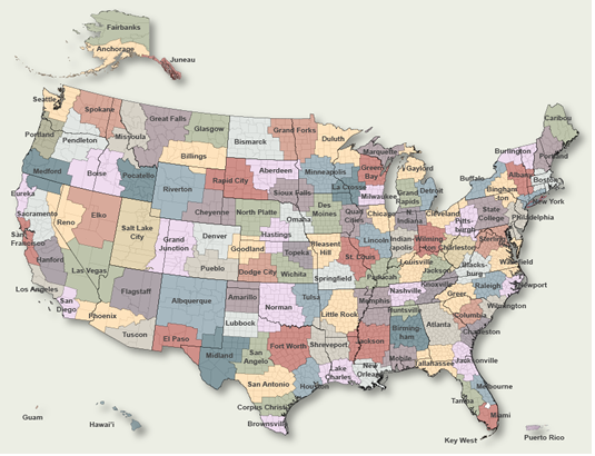
To Select Another NWS Office Click on Map or Choose from List
|
| Select Forecast Office: | Select Product: |
000 FLUS45 KBOU 261734 HWOBOU Hazardous Weather Outlook National Weather Service Denver/Boulder CO 1134 AM MDT Fri Apr 26 2024 COZ030>051-271745- Jackson County Below 9000 Feet- West Jackson and West Grand Counties Above 9000 Feet- Grand and Summit Counties Below 9000 Feet- South and East Jackson/Larimer/North and Northeast Grand/ Northwest Boulder Counties Above 9000 Feet- South and Southeast Grand/West Central and Southwest Boulder/ Gilpin/Clear Creek/Summit/North and West Park Counties Above 9000 Feet-Larimer and Boulder Counties Between 6000 and 9000 Feet- Jefferson and West Douglas Counties Above 6000 Feet/Gilpin/Clear Creek/Northeast Park Counties Below 9000 Feet- Central and Southeast Park County- Larimer County Below 6000 Feet/Northwest Weld County- Boulder And Jefferson Counties Below 6000 Feet/West Broomfield County- North Douglas County Below 6000 Feet/Denver/West Adams and Arapahoe Counties/East Broomfield County- Elbert/Central and East Douglas Counties Above 6000 Feet- Northeast Weld County-Central and South Weld County-Morgan County- Central and East Adams and Arapahoe Counties- North and Northeast Elbert County Below 6000 Feet/North Lincoln County- Southeast Elbert County Below 6000 Feet/South Lincoln County- Logan County-Washington County-Sedgwick County-Phillips County- 1134 AM MDT Fri Apr 26 2024 This hazardous weather outlook is for northeast and north central Colorado. .DAY ONE...Today and Tonight Moderate rain develops in the urban corridor and foothills this evening, with moderate snow in the mountains leading to deteriorating conditions overnight. .DAYS TWO THROUGH SEVEN...Saturday through Thursday A strong spring storm system will move across Colorado Saturday bringing widespread rain and mountain snow. The snow level is expected to fall to 7000 to 8000 feet. Travel into the higher foothills and mountains will likely be very difficult with 1 to 3 feet of snow expected, with the heavier amounts expected to be in the northern mountains. .SPOTTER INFORMATION STATEMENT... Spotter activation will not be needed today or tonight. $$ |
Previous Hazardous Weather Outlooks may be found at
NWS Denver/Boulder, CO (BOU) Office Hazardous Weather Outlooks.
(Click 'Previous Version' there to view past versions successively.
Some may differ only in time posted.)
Products Courtesy of NOAA-NWS
NWS Information Parsing Script by Ken True at Saratoga Weather - WFO and Products Scripts by SE Lincoln Weather.
Mapping by Curly at Michiana Weather and by Tom at My Mishawaka Weather.