As we often experience, high winds in Colorado can cause conditions to deteriorate rapidly. They present a very real danger to life and property, especially when coupled with other winter conditions like snow.
Why does it seem like we get so much wind in the winter? What causes this? How can you prepare and protect yourself and your property?
In this third in a series on winter weather preparedness from the National Weather Service, ThorntonWeather.com helps you understand why we receive so much wind and how to prepare for it.
PUBLIC INFORMATION STATEMENT
NATIONAL WEATHER SERVICE BOULDER CO
ISSUED BY NATIONAL WEATHER SERVICE PUEBLO CO
600 AM MDT WED OCT 19 2022
…WIDESPREAD HIGH WINDS VISIT COLORADO DURING THE WINTER…
This week through October 22nd is Winter Weather Preparedness Week in Colorado.
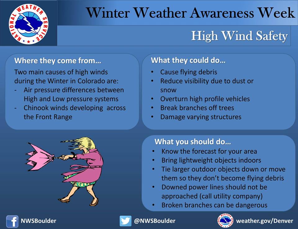
The two main causes of high winds in Colorado during the cold season are the air pressure difference between strong low pressure and cold high pressure systems, and Chinook winds developing across the Front Range and other eastern mountain ranges.
A strong, cold high pressure system moving from the north and setting up west of the Rockies can generate a damaging wind down the leeward slopes of the mountains, known as a bora. These episodes feature widespread high winds from the west or northwest into the adjacent plains at speeds which can exceed 100 mph. Much more rare are those episodes when low pressure is across the Rockies, and strong, cold high pressure is across the great plains. The result is damaging winds from the east across the western slopes of mountain ranges and adjacent valleys.
Winter Weather Education Series
| Intro | Winter Weather Preparedness Week |
| Part 1 | Winter travel safety |
| Part 2 | Watches…warnings…and advisories |
| Part 3 | High winds |
| Part 4 | Wind chill temperatures and hypothermia |
| Part 5 | Avalanche safety |
| Review | Winter Weather Preparedness Week review |
Mid and upper level winds over Colorado are much stronger in the winter than in the warm season, because of the huge difference in temperature from north to south across North America. West winds, under certain conditions, can bring warm, dry chinook winds plowing down the slopes of the eastern mountains. These winds can exceed 100 mph in extreme cases, bringing the potential for widespread damage. Winds of 60 to near 100 mph will occur in and near the foothills in areas such as Fort Collins, Boulder, Denver, Colorado Springs, Canon City, Westcliffe, Walsenburg and Trinidad areas. The areas around Boulder and Westcliffe are especially prone to these extreme wind episodes.
Dangers from high winds include flying debris, reduced visibility due to dust, damaged or destroyed structures, downed power lines, and overturned vehicles. The national weather service will issue a high wind watch when there is around a 50 percent chance for high winds to develop during the next day or two. When the threat becomes more certain in a specific area, a high wind warning will be issued. Cold strong winds can also bring dangerously low wind chill values, prompting a wind chill advisory or wind chill warning.
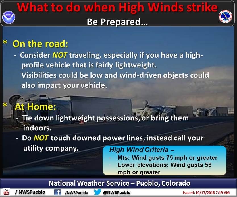
If high winds are forecast for your area, you should bring lightweight objects indoors, or tie them down outdoors, or move them so they do not become dangerous missiles. Any downed power lines should not be approached. Instead call the utility company. Stay clear from buildings under construction during high winds, as they can easily collapse. Traveling on north – south roads near the mountains along the Front Range during a high wind episode can also be dangerous. If you drive a lightweight or high profile vehicle, you may want to wait until the high winds die down.
The National Weather Service office in Boulder issues High Wind Warnings to highlight particularly strong wind episodes. A High Wind Warning is issued for the following conditions:
- In the mountains – Sustained winds of 50 mph or more, or gusts of at least 75 mph
- Lower elevations – Sustained winds of 40 mph or more, or gusts of at least 58 mph