Tag Archives: winter weather

Looking back at an unforgettable holiday – Denver’s Christmas Eve Blizzard of 1982

Cars are buried under the heavy snow in Denver. Scroll down for a photo slideshow with more images. (Denver Public Library Digital Collection)

As Christmas approaches everyone reflects on the past and for longtime Denver residents that oftentimes means remembering one of the most significant winter storms in the Mile High City’s history – the Christmas Eve Blizzard of 1982.  This major winter storm has become the one by which all others are compared not only due to its record-setting impact but also due to its timing being near Christmas.

As Christmas 1982 approached, forecasters were predicting a white Christmas several days beforehand but most were expecting a moderate snowfall of 6 inches.  Two days before Christmas Eve though, the picture began to change.  On the 22nd a Pacific cold front came ashore in California bringing severe rain, high surf and even hurricane force winds.  As it moved east over higher terrain, it dumped 2 feet of snow in the Wasatch Mountains near Salt Lake City.

At about that same time, jet stream winds were forming a trough of low pressure over the southeastern plains of Colorado.  The counterclockwise motion of the trough began to pull moist air into the state.  Further east Kansas and Oklahoma experienced severe thunderstorms and even tornadoes.  The winds set the stage for strong upslope conditions along the Front Range.

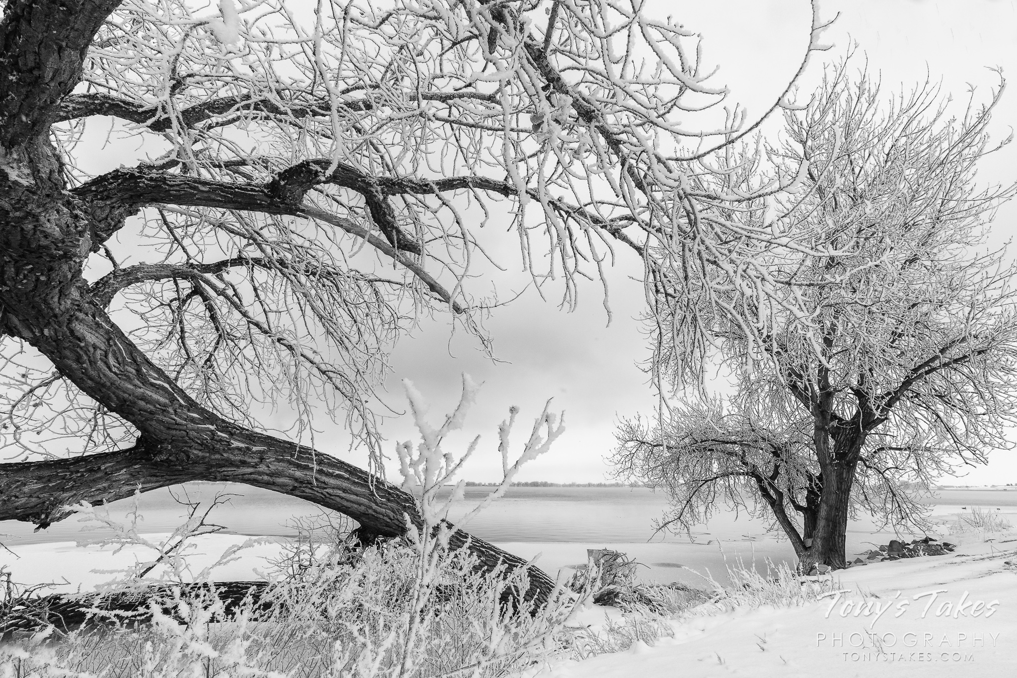
  • Scroll down to the view photo slideshow from this famous snowstorm
  • Do you remember the Christmas Eve Blizzard of ’82?  Leave a comment below with your memories
  • If you have photos of the event email them to info@thorntonweather.com or share them with us on our Facebook page and we will add them to the slideshow

Rain changed to snow on the plains and shortly before midnight on the 23rd, a full blown blizzard had developed.  Denver woke to snow on the ground the morning of Christmas Eve but the storm was just getting started.  Snowfall rates of 2 – 3 inches per hour were the norm during the day and winds screamed at 50mph causing wind chill temperatures to plummet to as low as -35 degrees.  As conditions continued to deteriorate throughout the day, the gravity of the situation began to be realized. Continue reading Looking back at an unforgettable holiday – Denver’s Christmas Eve Blizzard of 1982

Winter Weather Preparedness Week recap

Winter Weather Preparedness Week concludes. Are you ready for winter?

As we have talked about this week, winter weather can be dangerous and downright deadly.  However, being prepared helps to ensure that you and your family remain safe when the snow starts to fly or other winter weather conditions occur.

It is very easy to ignore the dangers of weather – no matter the season – and find yourself saying, “I wish I would have….” Now is the time to think about how you can prepare for these conditions, before it is too late and you find yourself wishing you had.

In this sixth and final message in a series on Winter Weather Preparedness from the National Weather Service, ThorntonWeather.com reviews the topics we covered this week and directs you to the previous articles and other resources to help you get ready.

PUBLIC INFORMATION STATEMENT
NATIONAL WEATHER SERVICE BOULDER CO
600 AM MDT SAT OCT 22 2022

Enjoy the great outdoors in Colorado this winter season, but watch the weather.

The National Weather Service issues a variety of winter weather, outlooks, watches, warnings, and advisories, covered earlier during this Winter Weather Preparedness Week.  Safety tips were also passed along.

Continue reading Winter Weather Preparedness Week recap

Avalanche safety – Be prepared or die

Avalanches claim lives every year in Colorado. Before you head to the mountains, be sure you are prepared! (Wikimedia Commons)

As snow starts to fall, many Coloradoans and out of state visitors will take advantage of it and head to the mountains for a variety of outdoor activities.  Whether skiing, snowshoeing, or hiking, anyone who spends time outdoors in the high country needs to be aware of the danger avalanches present.  On average six people die in Colorado every year from avalanches and being prepared is an essential survival skill.

In this fifth in a series on Winter Weather Preparedness from the National Weather Service, ThorntonWeather.com helps you understand avalanches, where they occur, how to protect yourself and where to go for more information.  If you are headed to the high country, be sure to check out our Avalanche Information & Forecast page.

PUBLIC INFORMATION STATEMENT
NATIONAL WEATHER SERVICE DENVER CO
600 AM MDT FRI OCT 21 2022

Avalanches – Are you prepared?

Thousands of avalanches occur each winter in the mountains of Colorado. With the enormous popularity of winter sports in Colorado, this poses a risk to skiers, snowboarders, snowmobilers, and people traveling in the backcountry. On average 6 people die in Avalanches in the state of Colorado every year. Anyone who travels into the high country in the winter should be prepared for avalanches And know how to avoid them.

The most important thing to know is how to get information on current avalanche conditions. Check the Colorado Avalanche Information Center website at http://avalanche.state.co.us/ for the current avalanche forecast and the National Weather Service website http://www.weather.gov for the current weather forecast in your area. Knowing the current and future conditions will help you make good decisions in the backcountry.

A little information about avalanche safety can go a long way. Most avalanches occur during or just after snowstorms on a slopes between 30 to 45 degrees. A significant snowfall may result in an unstable snowpack. By waiting at least 36 hours after a big snow or wind storm before you go into the mountains the Snow may become more stable and less likely to avalanche. If you stay in valleys away from avalanche chutes, in stands of dense trees, or on gentle slopes you can decrease the risk of being caught in an avalanche.

If you are a skier or snowboarder at a commercial ski area the risk from avalanches is lower than in the backcountry. Ski patrols work to reduce the chance of an avalanche on open slopes. Respect the rules of the ski area, stay on open slopes, and do not stray out of bounds or into closed areas. The avalanche risk is higher outside of the ski area boundaries.

If you want to enjoy the great outdoors in areas prone to avalanches…You can reduce the danger by following a few simple rules:

  • Check the current avalanche forecast to get information on current and forecast avalanche conditions. Also check the latest weather forecast to see if conditions are likely to change while you are in the backcountry.
  • Never travel alone. Always have one or more companions. Even small avalanches can be fatal. If you are alone and get trapped, you may not be found until spring.
  • If crossing a slope that may be prone to avalanches, do it one person at a time. You want to minimize the impact on your party if an avalanche is accidentally released.
  • In avalanche country, all members of your party should carry avalanche rescue equipment including an avalanche beacon, shovel and probe pole. This increases your chances of a successful rescue and finding your friends alive.

Avalanche conditions in Colorado are monitored and forecasted by the Colorado Avalanche Information Center, CAIC. You can get more information on avalanches, avalanche forecasts, avalanchesafety and request a safety class from CAIC. Go to their website…Http://www.colorado.gov/avalanche or call the center at 303-499-9650.

Winter Weather Preparedness Week continues through Saturday. Now is the time to get prepared for winter so you can safely enjoy the outdoors and travel safely when the snow flies.

Avalanche Safety Tips

Life threatening winter weather – Wind chill, frostbite and hypothermia

Wind chill is a life threatening weather danger that is often ignored or underestimated. (AP Photo)
Wind chill is a life threatening weather danger that is often ignored or underestimated.

Winter weather can not only be trying on the mind and soul, it also presents very real dangers to the human body.  Extreme wind chills can be deadly and bring on the outset of frostbite and hypothermia.  Here in Colorado, all residents should be aware of these hazards and be prepared to deal with them.

In this fourth in a series on Winter Weather Preparedness from the National Weather Service, ThorntonWeather.com helps you understand wind chill and how to protect yourself from frostbite and hypothermia.

PUBLIC INFORMATION STATEMENT
NATIONAL WEATHER SERVICE DENVER/BOULDER CO
600 AM MDT THU OCT 20 2022

Extreme wind chill – Potentially life-threatening and often overlooked

Extremely cold air comes every winter in at least part of the country and affects millions of people across the United States. The arctic air, combined with brisk winds, can lead to dangerously cold wind chill values. The Wind Chill Index helps you determine when dangerous conditions develop that could lead to frostbite or hypothermia. It takes into account heat loss from the human body to its surroundings during cold and windy weather. The calculation utilizes wind speed in miles per hour and temperature in degrees Fahrenheit. For example, a temperature of minus 5 degrees occurring with a 20 mph wind gives a wind chill near minus 30 degrees. This means that your body will lose heat at the same rate as it would if the air temperature were minus 30 degrees with no wind. Wind Chill values near minus 25 degrees mean that frostbite is possible within 15 minutes.

  • How does the wind affect wind chill?  See the chart below.

Frostbite is the freezing of skin and the body tissue just beneath it. It first affects exposed body tissue where blood circulation may be limited such as your fingers, toes, nose and ears. To minimize frostbite, make sure all body parts are well covered. When frostbite starts, feeling is lost in the affected area and the frozen tissue will take on a white or pale appearance. If you suspect you are experiencing frostbite, hold the frostbitten area closely against warm skin to return blood flow and warmth to the affected area.

Hypothermia is a dangerously low body temperature and is the most common winter weather killer. When you hear of a hiker, climber, hunter or a stranded traveler perishing from cold weather exposure, hypothermia was the cause. Most people are surprised to learn that hypothermia deaths can occur with temperatures between 30 and 50 degrees. If you or your clothing are wet, then hypothermia becomes even more likely.

Warning signs of hypothermia include uncontrollable shivering, memory loss, disorientation, slurred speech and drowsiness. Immediate medical attention should be given to victims suspected of suffering from hypothermia. If no help is available, the victim should be warmed slowly with warm liquids along with dry clothing and blankets.

The National Weather Service will issue wind chill advisories and warnings when a deadly combination of wind and cold air threaten. A Wind Chill Warning will be issued for the following wind chill temperatures:

  • Mountains…minus 35 degrees Fahrenheit or colder.
  • Lower Elevations…minus 25 degrees Fahrenheit or colder.

When cold weather threatens, follow these tips for survival:

  • Stay dry, wet clothing results in much faster heat loss from your body. Wear waterproof insulated boots.
  • Stay covered, wear mittens or gloves and wear a hat. At least half of your body heat is lost if your head is not covered.
  • Dress layered, trapped air between loose fitting clothing helps to insulate.
  • Stay informed, have a portable NOAA weather radio nearby to keep you up-to-date with the latest forecasts and warnings. Use wind chill temperatures to guide you in dressing properly for the outdoors. On very cold days, minimize your exposure to the outdoors if possible.

Winter Weather - Extreme Cold Safety

Winter Weather - Signs of Hypothermia

Wind Chill Chart

High winds a major threat in Colorado during the winter

Winter winds can not only make it miserable to be outside, they can also be dangerous.

As we often experience, high winds in Colorado can cause conditions to deteriorate rapidly.  They present a very real danger to life and property, especially when coupled with other winter conditions like snow.

Why does it seem like we get so much wind in the winter?  What causes this?  How can you prepare and protect yourself and your property?

In this third in a series on winter weather preparedness from the National Weather Service, ThorntonWeather.com helps you understand why we receive so much wind and how to prepare for it.

PUBLIC INFORMATION STATEMENT
NATIONAL WEATHER SERVICE BOULDER CO
ISSUED BY NATIONAL WEATHER SERVICE PUEBLO CO
600 AM MDT WED OCT 19 2022

…WIDESPREAD HIGH WINDS VISIT COLORADO DURING THE WINTER…

This week through October 22nd is Winter Weather Preparedness Week in Colorado.

The two main causes of high winds in Colorado during the cold season are the air pressure difference between strong low pressure and cold high pressure systems, and Chinook winds developing across the Front Range and other eastern mountain ranges.

Continue reading High winds a major threat in Colorado during the winter

Winter weather – What does that weather warning mean?

You have seen and heard the warnings but do you know what they really mean?

We all are familiar with the crawls on the TV screen or the announcements on the radio for winter weather advisories such as Winter Storm Watch, Blizzard Warning, Freeze Warning and more. But, how many of us really know what those mean? There is very specific criteria the National Weather Service follows in issuing these watches and warnings and there are important differences between all of them.

In this second in a series on Winter Weather Preparedness from the National Weather Service, ThorntonWeather.com helps you understand what all of these mean so you can be better prepared.

PUBLIC INFORMATION STATEMENT
NATIONAL WEATHER SERVICE BOULDER CO
600 AM TUE OCT 18 2022

From the National Weather Service:

What does that warning mean?

When a warning is issued during the winter season, will you know what it means, and will you know how to respond? During this Colorado Winter Weather Preparedness Week, please become familiar with our list of potentially life-saving winter weather products.

OUTLOOKS

A Hazardous Weather Outlook is issued daily by the National Weather Service office in Boulder Colorado. The outlook provides information on potentially hazardous weather out to 7 days into the future. Also, the Weather Story, a graphic of expected hazardous weather, is posted daily on National Weather Service web sites.

WATCHES AND WARNINGS

A Winter Storm Watch is issued when hazardous winter storm conditions are possible within the next 3 to 4 days, but the timing, intensity, or occurrence may still be uncertain. In contrast, a Winter Storm Warning is issued for potentially life-threatening winter storm conditions, such as heavy snowfall or a combination of snowfall and blowing snow, which are likely to occur within the next 1 to 2 days. Impacts such as timing of winter weather on rush hour are also considered when issuing Watches and Warnings.

Winter Storm
Plains: 6″ in 12 hours, 8″ in 24 hrs
Mountains: 8″ in 12 hours, 12″ in 24 hours
And Impacts

Winter Weather Advisory
Plains: 3-6″ in 12 hours, 4-8″ in 24 hours
Mountains: 4-8″ in 12 hours, 6-12″ in 24 hours
And Impacts

Blizzard
Sustained wind or frequent gusts 35 mph or greater, AND
Considerable falling/blowing snow with visibility less than 1/4 mile, for at least 3 hours

ADVISORIES

Advisories for winter weather are issued for potentially hazardous conditions which are considered more of a nuisance than a life-threatening situation. However, if caution is not taken the advisory events could become life-threatening. Impacts such as timing of winter weather on rush hour are also considered when issuing Advisories.

Winter Weather Preparedness Week in Colorado will continue through Saturday.

Winter weather watches and advisories.

Video captures chain reaction multi-car crash on I-25 near Colorado Springs

A screen capture shows the moment of impact during one of a series of accidents on I-25 Saturday, January 4, 2014.
A screen capture shows the moment of impact during one of a series of accidents on I-25 Saturday, January 4, 2014. (YouTube / coach tone)

As temperatures dropped and the snow fell Saturday across Colorado, roads became ice-coated and driving conditions worsened. Video captured near Colorado Springs captured a harrowing multi-car pileup on Interstate 25 that highlighted the dangerous road conditions.

Posted by a user Anthony Salazar to KOAA-5 television’s Facebook page, the video is taken from an overpass in the Colorado Springs area on Saturday, January 4.

Showing I-25 southbound, some drivers are shown exercising appropriate caution on the icy roads and proceeding slowly. Calamity ensues when others are less aware of the conditions.

Read the rest of this story and check out the amazing video on Examiner.com

Recent snows put Denver snowfall far ahead of last year and above average

ThorntonWeather.com Snow Report
Recent snows have put Denver ahead of the game on snow totals while the mountains remain drier than normal.

While none of the snowstorms seen so far this year in Denver have been major ones, they have delivered the much needed snow that was missed last year.  December’s snowfall totals will finish well above average and have helped put the city’s seasonal snowfall totals above normal to date .

December’s snowfall total for the month stands at 16.5 inches (20.1 inches in Thornton).  This is nearly double the 1981 – 2010 historical average for the month of 8.5 inches.

  • Stay up to date with Thornton’s weather: ‘Like’ us on Facebook, follow us on Twitter and add us to your Google+ circles

Leading up to Christmas, one storm slammed southeastern Colorado with blizzard conditions.  A second storm took a more northern track delivering a shot of snow to northern Colorado (see image below).  The snow cover ensured a white Christmas and NASA satellite imagery showed the Centennial State blanketed in white for the holiday.

For the season to date, the Mile High City has recorded 29.5 inches of snow (versus 34.6 inches in Thornton).  This puts us ahead of the pace of the average of 22.5 inches that we normally see through the end of December.

This stands in stark contrast to last season when Denver saw a paltry 22.8 inches of snow over the entire season and Thornton recorded 21.3 inches.  For comparison, in an average season we see 53.8 inches.

Not all is well in Colorado however with the snow.  While the plains are seeing above normal totals, the mountains are lagging.

Some ski areas like Cooper Mountain near Leadville have yet to even open for the season.  Others have had enough snow to allow skiers on their slopes but have runs that they have not yet been able to open due to the lack of snow. Get the latest ski area snow reports here.

Snowpack across the state is below average in seven of the eight major basins with only the Upper Rio Grande reporting above normal (101%).  The South Platte basin which includes the Colorado Front Range mountains stands at only 85% of normal and Western Slope basins are seeing as little as 65% of normal.

Snowfall totals from Denver's December 21 - 22, 2011 snowstorm.

Updated NOAA outlook for winter indicates chance for increased precipitation for northern Colorado

The National Oceanic and Atmospheric Administration’s Climate Prediction Center (CPC) released updated outlooks for winter 2011 – 2012 indicating it could be a snowy one for the northern half of Colorado.

The original outlooks from the agency released previously offered a drier picture, primarily based on the influences of La Niña in the Pacific.  Given however that the current event is relatively mild, its effects are limited, particularly this far inland.

For the meteorological winter from December 2011 to February 2012, NOAA places virtually all of Colorado in an area that has equal chance of well above, well below, or near-normal temperatures.  However, the northern half of the state, including Denver, is given a 33% chance of experiencing above normal precipitation.

NOAA said:

The winter outlook for this winter favors above average temperatures across much of the South, from New Mexico across the Southeast to the Atlantic coast… and also favors below average temperatures across much of the Northern plain, the Northern Rockies, the Pacific Northwest, and a good part of the West as well as the southern half of Alaska.

With regards to precipitation, we see those areas most likely to experience below-average precipitation across the South– in particular Florida and Texas– with a better than even chance of being wetter than average across much of the North– particularly from the Ohio valley and the Northern Rockies and the Pacific Northwest.

Last year, Denver experienced second least snowiest snow season on record as the city only recorded 22.8 inches (21.2 inches in Thornton).  This season the picture is much improved with 22.2 inches having been recorded so far – nearly as much as all of last season.

NOAA's updated Winter 2011 - 2012 outlook. Click the image for a larger view. (NOAA)

On the net: