Navigation
- Home
- News & Blog
- Forecasts
- NWS 5 Day Forecast
- Today's Weather Story
- 48 Hour Point Forecast
- WXSIM Forecast
- Forecast Discussion
- Mountain Area Forecast
- Avalanche Info & Forecast
- Colorado City Forecasts
- National Weather Outlook
- U.S. Cities Forecasts
- Long Range Climate Fcsts
- Advisories & Warnings
- Forecasts By Email
- Air Quality Forecast
- WeatherNation TV
- Live Conditions
- Weather Webcams
- Radar & Maps
- Lightning
- Severe Weather
- Winter Weather
- Almanac
- Thornton Weather Data
- Astronomy & Space
- National Weather Service
- Weather Extremes
- Trends & Statistics
- Climatology & Records
- Regional Temp & Precip
- River Heights
- Earthquake Activity
- Wildland Fire Activity
- Today in History
- Weather Education
- Area Information
- About Us
- Weather Links
- Search Site
- Donate
Active Alerts
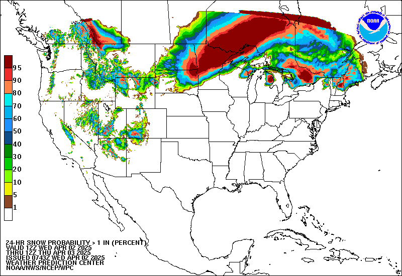
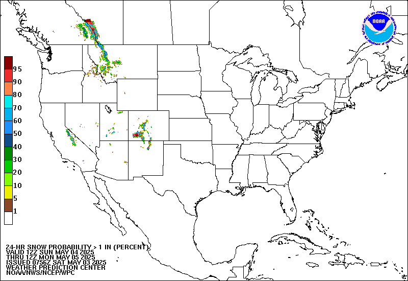
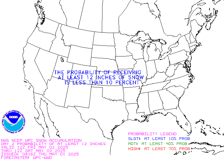
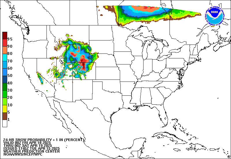
Snow Probability Forecasts |
Winter Weather Briefing | ||||||||||||||||||||
The following charts depict the probability of snowfall reaching or exceeding 1, 4, 8 and 12 inches.
|
|||||||||||||||||||||
DiscussionPROBABILISTIC HEAVY SNOW AND ICING DISCUSSION NWS HYDROMETEOROLOGICAL PREDICTION CENTER CAMP SPRINGS MD 300 PM EDT TUE MAY 15 2012 VALID 00Z WED MAY 16 2012 - 00Z SAT MAY 19 2012 ...DAYS 1 THROUGH 3... THE PROBABILITY OF SIGNIFICANT SNOWFALL AND/OR ICING IS LESS THAN 10 PERCENT. THIS WILL BE THE LAST PROBABILISTIC HEAVY SNOW AND ICING DISCUSSION OF THE 2011-12 WINTER SEASON...ALONG WITH THE SUITE OF SNOWFALL AND FREEZING RAIN PROBABILITY FORECASTS. HPC WILL RESUME ISSUING WINTER WEATHER PRODUCTS ON SEPTEMBER 15, 2012. HURLEY $$ Images and data courtesy the Hydrometeorological Prediction Center (HPC) |
|||||||||||||||||||||


