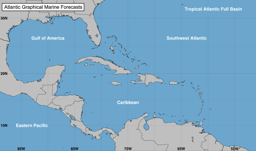
Active tropical cyclones in the Atlantic, Caribbean, and the Gulf of Mexico
Atlantic Tropical Weather Outlook
000
ABNT20 KNHC 280513
TWOAT
Tropical Weather Outlook
NWS National Hurricane Center Miami FL
200 AM EDT Thu Sep 28 2023
For the North Atlantic...Caribbean Sea and the Gulf of Mexico:
Active Systems:
The National Hurricane Center is issuing advisories on Tropical
Storm Philippe, located several hundred miles east of the northern
Leeward Islands.
Central Tropical Atlantic (AL91):
Showers and thunderstorms have changed little in organization in
association with an area of low pressure located roughly halfway
between the Cabo Verde Islands and the Lesser Antilles.
Environmental conditions are forecast to be conducive for
development, as long as this system remains far enough removed from
Tropical Storm Philippe to its west. A tropical depression or storm
is expected to form in the next day or so while the system moves
northwestward across the central tropical Atlantic. Additional
information on this system, including gale warnings, can be found in
High Seas Forecasts issued by the National Weather Service.
* Formation chance through 48 hours...high...90 percent.
* Formation chance through 7 days...high...90 percent.
&&
High Seas Forecasts issued by the National Weather Service
can be found under AWIPS header NFDHSFAT1, WMO header FZNT01
KWBC, and online at ocean.weather.gov/shtml/NFDHSFAT1.php
$$
Forecaster Bucci
Tropical Storm Tropical
-
Summary for Tropical Storm Philippe (AT2/AL172023)
...DISORGANIZED PHILIPPE MOVING SLOWLY... ...INTERESTS IN THE NORTHERN LEEWARD ISLANDS, VIRGIN ISLANDS, AND PUERTO RICO SHOULD MONITOR ITS PROGRESS...
As of 11:00 PM AST Wed Sep 27
the center of Philippe was located near 18.2, -54.5
with movement NW at 8 mph.
The minimum central pressure was 1002 mb
with maximum sustained winds of about 50 mph.
Tropical Storm Philippe
-
Tropical Storm Philippe Public Advisory Number 19
-
Tropical Storm Philippe Forecast Advisory Number 19
Issued at 0300 UTC THU SEP 28 2023
000
WTNT22 KNHC 280234
TCMAT2
TROPICAL STORM PHILIPPE FORECAST/ADVISORY NUMBER 19
NWS NATIONAL HURRICANE CENTER MIAMI FL AL172023
0300 UTC THU SEP 28 2023
NOTICE... LAND-BASED TROPICAL CYCLONE WATCHES AND WARNINGS ARE NO
LONGER INCLUDED IN THE TROPICAL CYCLONE FORECAST/ADVISORY...(TCM).
CURRENT LAND-BASED COASTAL WATCHES AND WARNINGS CAN BE FOUND IN THE
MOST RECENTLY ISSUED TROPICAL CYCLONE PUBLIC ADVISORY...(TCP).
TROPICAL STORM CENTER LOCATED NEAR 18.2N 54.5W AT 28/0300Z
POSITION ACCURATE WITHIN 30 NM
PRESENT MOVEMENT TOWARD THE NORTHWEST OR 305 DEGREES AT 7 KT
ESTIMATED MINIMUM CENTRAL PRESSURE 1002 MB
MAX SUSTAINED WINDS 45 KT WITH GUSTS TO 55 KT.
34 KT.......150NE 130SE 0SW 0NW.
12 FT SEAS..300NE 180SE 120SW 330NW.
WINDS AND SEAS VARY GREATLY IN EACH QUADRANT. RADII IN NAUTICAL
MILES ARE THE LARGEST RADII EXPECTED ANYWHERE IN THAT QUADRANT.
REPEAT...CENTER LOCATED NEAR 18.2N 54.5W AT 28/0300Z
AT 28/0000Z CENTER WAS LOCATED NEAR 18.0N 54.2W
FORECAST VALID 28/1200Z 18.7N 55.5W
MAX WIND 45 KT...GUSTS 55 KT.
34 KT...120NE 110SE 0SW 0NW.
FORECAST VALID 29/0000Z 19.0N 56.6W
MAX WIND 40 KT...GUSTS 50 KT.
34 KT...100NE 90SE 0SW 20NW.
FORECAST VALID 29/1200Z 19.0N 57.6W
MAX WIND 40 KT...GUSTS 50 KT.
34 KT... 90NE 80SE 0SW 20NW.
FORECAST VALID 30/0000Z 19.0N 58.6W
MAX WIND 40 KT...GUSTS 50 KT.
34 KT... 60NE 50SE 0SW 10NW.
FORECAST VALID 30/1200Z 18.7N 59.4W
MAX WIND 35 KT...GUSTS 45 KT.
34 KT... 60NE 50SE 0SW 0NW.
FORECAST VALID 01/0000Z 18.5N 60.3W
MAX WIND 35 KT...GUSTS 45 KT.
34 KT... 60NE 50SE 0SW 0NW.
EXTENDED OUTLOOK. NOTE...ERRORS FOR TRACK HAVE AVERAGED NEAR 125 NM
ON DAY 4 AND 175 NM ON DAY 5...AND FOR INTENSITY NEAR 15 KT EACH DAY
OUTLOOK VALID 02/0000Z 18.5N 62.1W...POST-TROP/REMNT LOW
MAX WIND 30 KT...GUSTS 40 KT.
OUTLOOK VALID 03/0000Z 18.5N 63.5W...POST-TROP/REMNT LOW
MAX WIND 30 KT...GUSTS 40 KT.
REQUEST FOR 3 HOURLY SHIP REPORTS WITHIN 300 MILES OF 18.2N 54.5W
NEXT ADVISORY AT 28/0900Z
$$
FORECASTER BROWN
-
Tropical Storm Philippe Forecast Discussion Number 19
Issued at 1100 PM AST Wed Sep 27 2023
000
WTNT42 KNHC 280235
TCDAT2
Tropical Storm Philippe Discussion Number 19
NWS National Hurricane Center Miami FL AL172023
1100 PM AST Wed Sep 27 2023
Deep convection has persisted around the eastern portion of
Philippe's circulation this evening, however there is not much
evidence of curved bands. The low-level center may have reformed or
become slightly better defined just to the west of the main
convective mass since the previous advisory. There has been no
recent microwave imagery to gain a better look at the cyclone's
structure and scatterometer appears likely to miss the center this
evening. The latest subjective Dvorak intensity estimates were T3.0
(45 kt) and T2.5 (35 kt) from TAFB and SAB, respectively. The
initial intensity is held at 45 kt for this advisory, in deference
to the earlier scatterometer data and latest TAFB estimate.
The track forecast for Philippe remains quite complicated, and it is
very dependent on the future intensity and vertical depth of the
cyclone. The current disorganized structure of Philippe and its
present environment of moderate southwesterly shear is likely to
inhibit strengthening over the next couple of days. The main
question is whether Philippe weakens and becomes more vertically
shallow or if it maintains some vertical coherence during that time.
If it becomes vertically shallow, Philippe is likely to move
generally westward or west-southwestward within the low-level
steering flow. If it remains more vertically deep, the cyclone is
likely to move little as it remains to the southeast of a mid-level
ridge. Another complicating factor is a disturbance (AL91) to
Philippe's southeast. The latest GFS run moves that system close
enough to Philippe that binary interaction occurs between the two
systems. However this run appears to have initialized Philippe
stronger than it actually is, which may have led to the solution
where Philippe remains the dominate system. Meanwhile, the
ECMWF weakens Philippe and keeps more separation between the two
systems, taking a weaker Philippe westward or west-southwestward.
The NHC forecast currently favors the latter scenario, but there is
an unusually large amount of uncertainty in the track and intensity
forecast. In general, the guidance is a bit slower this cycle and
the NHC forecast has been adjusted accordingly. The new track
forecast is not as slow as the consensus aids, but is a blend
of the previous official forecast and the latest consensus models.
It would not be surprising if additional adjustments to the track
forecast are required in subsequent advisories.
As mentioned above, moderate southwesterly shear and a slightly
drier airmass ahead of Philippe are likely to inhibit significant
convective organization of the cyclone at least during the next day
or two. That is likely to cause some gradual weakening, and the NHC
intensity forecast follows that thinking and calls for the system to
weaken during that time. However, there is still a lot of
uncertainty as to whether Philippe weakens and becomes a remnant low
later in the period, or moves little and remains a tropical cyclone.
The latest forecast maintains continuity from the previous few
advisories and calls for Philippe to become a remnant low, but this
is a low confidence forecast.
FORECAST POSITIONS AND MAX WINDS
INIT 28/0300Z 18.2N 54.5W 45 KT 50 MPH
12H 28/1200Z 18.7N 55.5W 45 KT 50 MPH
24H 29/0000Z 19.0N 56.6W 40 KT 45 MPH
36H 29/1200Z 19.0N 57.6W 40 KT 45 MPH
48H 30/0000Z 19.0N 58.6W 40 KT 45 MPH
60H 30/1200Z 18.7N 59.4W 35 KT 40 MPH
72H 01/0000Z 18.5N 60.3W 35 KT 40 MPH
96H 02/0000Z 18.5N 62.1W 30 KT 35 MPH...POST-TROP/REMNT LOW
120H 03/0000Z 18.5N 63.5W 30 KT 35 MPH...POST-TROP/REMNT LOW
$$
Forecaster Brown
-
Tropical Storm Philippe Wind Speed Probabilities Number 19
Issued at 0300 UTC THU SEP 28 2023
000
FONT12 KNHC 280235
PWSAT2
TROPICAL STORM PHILIPPE WIND SPEED PROBABILITIES NUMBER 19
NWS NATIONAL HURRICANE CENTER MIAMI FL AL172023
0300 UTC THU SEP 28 2023
AT 0300Z THE CENTER OF TROPICAL STORM PHILIPPE WAS LOCATED NEAR
LATITUDE 18.2 NORTH...LONGITUDE 54.5 WEST WITH MAXIMUM SUSTAINED
WINDS NEAR 45 KTS...50 MPH...85 KM/H.
Z INDICATES COORDINATED UNIVERSAL TIME (GREENWICH)
ATLANTIC STANDARD TIME (AST)...SUBTRACT 4 HOURS FROM Z TIME
EASTERN DAYLIGHT TIME (EDT)...SUBTRACT 4 HOURS FROM Z TIME
CENTRAL DAYLIGHT TIME (CDT)...SUBTRACT 5 HOURS FROM Z TIME
WIND SPEED PROBABILITY TABLE FOR SPECIFIC LOCATIONS
CHANCES OF SUSTAINED (1-MINUTE AVERAGE) WIND SPEEDS OF AT LEAST
...34 KT (39 MPH... 63 KM/H)...
...50 KT (58 MPH... 93 KM/H)...
...64 KT (74 MPH...119 KM/H)...
FOR LOCATIONS AND TIME PERIODS DURING THE NEXT 5 DAYS
PROBABILITIES FOR LOCATIONS ARE GIVEN AS OP(CP) WHERE
OP IS THE PROBABILITY OF THE EVENT BEGINNING DURING
AN INDIVIDUAL TIME PERIOD (ONSET PROBABILITY)
(CP) IS THE PROBABILITY OF THE EVENT OCCURRING BETWEEN
00Z THU AND THE FORECAST HOUR (CUMULATIVE PROBABILITY)
PROBABILITIES ARE GIVEN IN PERCENT
X INDICATES PROBABILITIES LESS THAN 1 PERCENT
PROBABILITIES FOR 34 KT AND 50 KT ARE SHOWN AT A GIVEN LOCATION WHEN
THE 5-DAY CUMULATIVE PROBABILITY IS AT LEAST 3 PERCENT.
PROBABILITIES FOR 34...50...64 KT SHOWN WHEN THE 5-DAY
64-KT CUMULATIVE PROBABILITY IS AT LEAST 1 PERCENT.
- - - - WIND SPEED PROBABILITIES FOR SELECTED LOCATIONS - - - -
FROM FROM FROM FROM FROM FROM FROM
TIME 00Z THU 12Z THU 00Z FRI 12Z FRI 00Z SAT 00Z SUN 00Z MON
PERIODS TO TO TO TO TO TO TO
12Z THU 00Z FRI 12Z FRI 00Z SAT 00Z SUN 00Z MON 00Z TUE
FORECAST HOUR (12) (24) (36) (48) (72) (96) (120)
- - - - - - - - - - - - - - - - - - - - - - - - - - - - - - - - - -
LOCATION KT
PONCE PR 34 X X( X) X( X) X( X) X( X) 1( 1) 2( 3)
VIEQUES PR 34 X X( X) X( X) X( X) X( X) 2( 2) 2( 4)
SAINT THOMAS 34 X X( X) X( X) X( X) 1( 1) 2( 3) 2( 5)
SAINT JOHN 34 X X( X) X( X) X( X) 1( 1) 2( 3) 3( 6)
SAINT CROIX 34 X X( X) X( X) X( X) X( X) 2( 2) 4( 6)
SAINT MAARTEN 34 X X( X) X( X) X( X) 2( 2) 4( 6) 3( 9)
SABA 34 X X( X) X( X) X( X) 2( 2) 3( 5) 2( 7)
ST EUSTATIUS 34 X X( X) X( X) X( X) 2( 2) 4( 6) 2( 8)
ST KITTS-NEVIS 34 X X( X) X( X) X( X) 2( 2) 4( 6) 1( 7)
BARBUDA 34 X X( X) X( X) 1( 1) 3( 4) 4( 8) 2(10)
ANTIGUA 34 X X( X) X( X) X( X) 1( 1) 2( 3) X( 3)
GUADELOUPE 34 X X( X) X( X) X( X) 2( 2) 2( 4) 2( 6)
AVES 34 X X( X) X( X) X( X) 1( 1) 1( 2) 1( 3)
DOMINICA 34 X X( X) X( X) X( X) 1( 1) 1( 2) 1( 3)
$$
FORECASTER BROWN
-
Tropical Storm Philippe Graphics

5-Day Uncertainty Track last updated Thu, 28 Sep 2023 02:36:29 GMT
Wind Speed Probabilities last updated Thu, 28 Sep 2023 03:23:00 GMT
|
Active tropical cyclones in the Eastern North Pacific
Eastern North Pacific Tropical Weather Outlook
000
ABPZ20 KNHC 280514
TWOEP
Tropical Weather Outlook
NWS National Hurricane Center Miami FL
1100 PM PDT Wed Sep 27 2023
For the eastern North Pacific...east of 140 degrees west longitude:
Southwestern East Pacific:
A tropical wave continues to produce an area of disorganized showers
and thunderstorms well southwest of the southern tip of the Baja
California peninsula. Some development of this system remains
possible over the next day or two while it moves generally westward
at about 15 mph. By late Friday, upper-level winds are forecast to
become unfavorable for further development before the system moves
into the Central Pacific basin.
* Formation chance through 48 hours...low...30 percent.
* Formation chance through 7 days...low...30 percent.
$$
Forecaster Bucci
There are no tropical cyclones at this time.
No tropical cyclones as of Thu, 28 Sep 2023 08:44:11 GMT
|