
National Weather Service Weather Story |
Thornton Weather Forecast 48 Hour Graphical Forecast |
| WEATHER STORY Louisville Weather Forecast Office |
|
|||
 |
|||
|
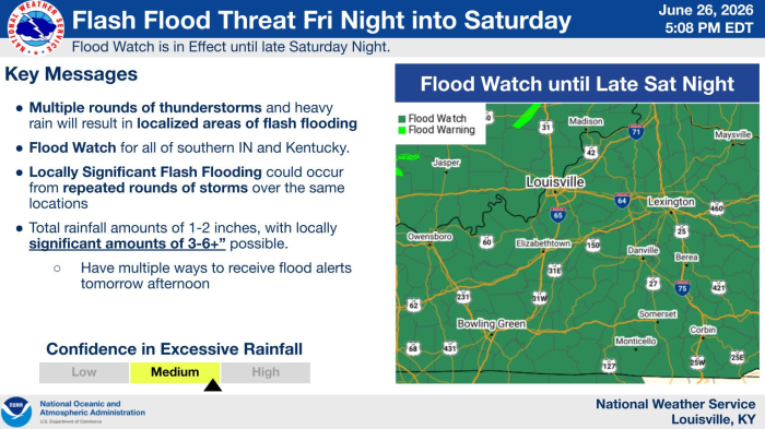
Multiple rounds of storms will continue this evening through the overnight. A lull in activity will occur overnight before multiple rounds of storms return again later Saturday morning into the evening. These storms may travel over the same areas, especially over southern KY where the highest flash flood threat is located. Rainfall amounts of 1-2" areawide, though significant amounts of 3-6" inches or more is possible in localized areas across south/central KY. Due to this threat, a Flood Watch is in effect for all areas at least through Saturday morning, with central/southern KY remaining in a Flood Watch until Saturday night.
|
Select a Different Office Below

Data Courtesy of Louisville Weather Forecast Office