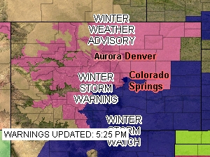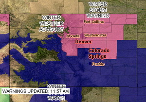
The old Stapleton International Airport site and Denver International Airport are separated by 12 miles. Is it accurate to compare weather between the two locations?
These announcements are common and we all take notice when we hear them and they make for great water cooler chat topics but are these claims accurate?
In 1995 Denver finally opened its new airport, Denver International Airport, out on the plains east of the city. This new facility, 12 miles as the crow flies northeast of the old Stapleton International Airport, moved the airport from an urban environment to a rural one and more than 19 miles from the center of Denver. Following that move, the National Weather Service (NWS) began taking some of its official measurements at the glistening new airport. In doing so, some say Denver’s climate records have forever been altered and as such any weather record should have an asterisk attached to it.
Denver officially set a new record high temperature for March 2nd.
Updated, 5:30pm: Denver’s official high temperature today reached 74 degrees at 3:08pm, beating the old record of 72 degrees by two.
Original post, 2:39pm: Denver has officially broken the high temperature record for today, March 2nd. At 1:52pm the thermometer at Denver International Airport reached 73 degrees, besting the old record of 72 degrees set way back in 1901. Here in Thornton we were a touch warmer reaching a high of 74.1 degrees.
This afternoon there is a chance the temperature could go a degree or two higher thus further increasing the record.
Is this really a record? Since moving Denver’s official weather recording station to DIA, many weather enthusiasts believe our weather and climate records are being unduly altered. Examiner.com just launched an investigative feature into this problem today – check out part 1 of our series on Examiner.com: Do Denver weather and climate records have an asterisk attached?
March 1 to March 7 - This week in Denver weather history
Looking at this week in Denver weather history, it is easy to see why March is known as Denver’s snowiest month. There are numerous instances of major winter storms dumping snow on the city that was measured not in inches – but feet!
From the National Weather Service:
28-1
IN 1875…6 INCHES OF SNOW FELL FROM 3:15 PM ON THE 28TH TO 1:00 AM ON THE 1ST. PRECIPITATION FOR THE TWO DAYS WAS 0.50 INCH.
29-1
IN 1896…SNOWFALL TOTALED 5.5 INCHES IN THE CITY. NORTHEAST WINDS GUSTED TO 24 MPH.
IN 1948…SNOWFALL TOTALED 5.9 INCHES IN DOWNTOWN DENVER. NORTH WINDS WERE SUSTAINED TO 15 MPH.
1
IN 1904…WEST WINDS WERE SUSTAINED TO 42 MPH WITH GUSTS AS HIGH AS 58 MPH. THE CHINOOK WINDS WARMED THE TEMPERATURE TO A HIGH OF 67 DEGREES.
IN 1906…SNOWFALL WAS HEAVY AND TOTALED 7.5 INCHES OVER DOWNTOWN DENVER. NORTHEAST WINDS WERE SUSTAINED TO 37 MPH.
IN 1940…SNOWFALL WAS HEAVY AND TOTALED 7.7 INCHES IN DOWNTOWN DENVER.
IN 1943…6.0 INCHES OF SNOW FELL OVER DOWNTOWN DENVER. NORTH WINDS WERE SUSTAINED TO 19 MPH.
Want to be an official storm spotter or maybe just want to learn more about severe weather? Here’s your chance!
We have written before about the great opportunity the National Weather Service provides by giving storm spotter training during the start of the severe weather season. That time is now here and training sessions start in the coming week and new sessions have been added since we last reported on the topic.
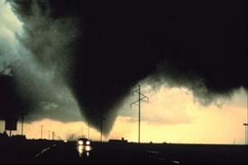
The storm spotter program is a nationwide program with more than 280,000 trained spotters. These volunteers report weather hazards to their local National Weather Service office providing vital information when severe strikes. Data from spotters include severe wind, rain, snow measurements, thunderstorms and hail and of course tornadoes.
Storm spotters are part of the ranks of citizens who form the Nation’s first line of defense against severe weather. There can be no finer reward than to know that their efforts have given communities the precious gift of time–seconds and minutes that can help save lives.
By completing one of these training classes you can become an official storm spotter. When severe weather strikes, you can report it by calling a special toll free number or submit your report via the National Weather Service’s website.
These are great sessions for anyone wanting to learn more about the severe weather we experience in Colorado, whether you want to be an official spotter or not. All training is free. Topics include:
Denver and Thornton's March 2009 climatological preview
March in Denver typically means frequent and rapid weather changes. The days grow longer and we start enjoying more sunshine and sometimes summer-like weather. However, on occasion arctic air masses can still force their way south into Colorado dropping temperatures quickly and markedly.
These changes are due to Marches “in between” status – elements during the month have much in common with winter and spring. In addition to arctic fronts, Pacific storms frequently move across Colorado from the west and warm moist air streams up from the Gulf of Mexico northeastward into the state. When these cold fronts collide with the warmer air masses the result can be some crazy weather.
The entire eastern half of Colorado is under a Red Flag Warning through Friday evening.
The National Weather Service has updated the Red Flag Warning and it will now go into effect at 9:00am today and run through 9:00pm. Further, the warning now covers the entire eastern half of the state of Colorado and in fact extends to the south and east into parts of Nebraska, Kansas, Oklahoma, Texas and New Mexico. This of course covers the entire Denver metro area and the Front Range.
The extension and widening of the warning should serve to really drive home how dry things are and how serious the fire conditions are. Please be sure to take appropriate precautions as we certainly would like to avoid any wildfires.
RED FLAG WARNING
NATIONAL WEATHER SERVICE DENVER CO
456 AM MST FRI FEB 6 2009
…Dry and windy conditions across the plains and lower foothills today…
Very dry air will combine with strong winds to produce increased fire danger over the foothills and plains of northeast Colorado today. Winds will gust as high as 40 mph on the plains this afternoon with gusts to 50 mph in the foothills. Minimum humidities will range from 10 to 15 percent. Conditions will improve on the plains around sunset…with warm and breezy conditions lingering in and near the foothills through the early evening hours.
…Red Flag Warning now in effect from 9 am this morning to 9 pm mst this evening for gusty winds and low humidities…
The Red Flag Warning is now in effect from 9 am this morning to 9 pm mst this evening. A Red Flag Warning is now in effect for all of the plains and foothills areas of eastern Colorado… Including fire weather zones 235…236…and 238 through 251.
West winds of 20 to 35 mph will become widespread in and near the southern Front Range foothills this morning…and spread across the plains by afternoon. Gusts as high as 50 mph are possible in the foothills. Relative humidities will drop into the 8 to 15 percent range. The combination of the gusty winds…low humidities and dry fuels will create very high fire danger. The gusty winds will decrease and the relative humidities will increase this evening.
A Red Flag Warning means that critical fire weather conditions are either occurring or imminent. Please advise the appropriate officials and fire crews in the field of this Red Flag Warning.
The Denver weather has been nice but we are extremely dry and in need of some moisture.
This week we have had some extraordinarily nice weather and it has been great. The mountains are certainly having a great year for snow with all of the major basins exceeding 100% of average for snowpack. However, here along the Front Range and the plains, we are bone dry and well below normal for snowfall.
As of today, Denver has received only half of its normal amount of snow for this point in the snow season which runs from July through June. By the first of February, we normally should have received 33.3 inches. To date for the 2008 – 2009 season we have received a mere 16.9 inches of snow as measured at Denver International Airport. Closer to the central part of the city, Stapleton has been even drier with only 13.1 inches of the white stuff to date.
For a complete look at how bleak the moisture has been along the Front Range, check out the details in our Examiner.com story.
A Red Flag Warning is in effect for Denver and the Front Range Thursday from 11:00am to 6:00pm.
While we have all enjoyed the record January warmth of recent days but that does come at a price. The warm temperatures, dry wind and very low humidity have dried much of the area out to a dangerous state.
Today we have one more warm day before we return to more seasonable weather. With temperatures climbing into the 60’s, humidity as low as 5 percent and a west wind that will pick up later today, the fire danger is very real. As we saw a couple weeks ago with the Olde Stage Road Fire, it doesn’t take much beyond a spark to set off a fire that can spread very quickly with as dry as it is.
The potentially dangerous conditions have caused the National Weather Service to issue a Red Flag Warning that will be in effect from 11:00am today through 6:00pm this evening.
Red Flag Warning
National Weather Service, Denver
544 am MST THU JAN 22 2009
……Red Flag Warning today from 1100 to 1800 MST…for Front Range foothill zones 215 and 216 below 8000 feet…and for the I-25 urban corridor zones 238..239..240 and 241 in northeast Colorado…
One more day of unseasonably warm and very dry conditions will be accompanied by periods of gusty Chinook winds resulting in critical wildland fire conditions in and near the front range foothills in northern Colorado. Minimum relative humidities will range from 5 to 15 percent with maximum temperatures in the 60 to 70 degree range. This is as much as 25 degrees above average for the date. Furthermore west winds in and near the foothills are expected to increase later the morning…with gusts this afternoon to 40 mph in the foothills and to 30 mph on the nearby plains.
Fuels are also quite dry in the area with no precipitation in the area for some time. These critical wildland fire conditions are expected to improve this evening with dry downslope winds subsiding…and a shift to a more humid east wind overnight with a weak cold front backing into northeast Colorado.
…Red Flag Warning in effect from 11 am this morning to 6 pm MST this afternoon…
The National Weather Service in Denver has issued a Red Flag Warning…which is in effect from 11 am this morning to 6 pm MST this afternoon.
Unseasonably warm temperatures…gusty west winds and very low relative humidities will combine with very dry fuels to produce critical wildland fire conditions in and near the Front Range foothills late this morning through this afternoon. Foothill areas below 8000 feet and lower elevations west of I-25 are more likely to see these conditions develop.
Get more local news and weather information on Examiner.com.
A Red Flag Warning means that critical fire weather conditions are either occurring or imminent. Please advise the appropriate officials and fire crews in the field of this Red Flag Warning.
Denver officially broke the record high temperature for January 21st, reaching 71 degrees.
It’s official. As reported earlier this morning on our Examiner.com pages, we had a decent shot at breaking the all time record high temperature for this date and we have done it. At 1:28pm today the temperature at Denver International Airport reached 71 degrees, breaking the old record of 70 degrees set in 1950. Here in Thoronton we didn’t get quite that warm, “only” reaching a high of 69 degrees.
Thursday we will be a bit cooler and “only” reach 65 degrees – still 20 degrees above normal though. Enjoy the next 36 hours or so though as Friday bring change – see our Examiner.com morning forecast here for details.
Get more local news and weather information on Examiner.com.
Editor’s comment – This is a great way to ‘give back’ to the community and help those who truly need it. From the City of Thornton:
Winter is coming: Snowbusters needed Snowbuster volunteers help dig out neighbors in need
THORNTON, CO…Winter is on the way, and while the snow isn’t here yet, Snowbuster volunteers are needed now. Snowbusters is a snow removal program that helps fixed-income seniors and disabled residents who can’t remove snow from their sidewalks. Snowbuster volunteers are paired-up with a neighbor in their area, and when it snows, the Snowbuster goes into action clearing their neighbor’s sidewalk. “These Snowbuster volunteers make a valuable difference in the lives of those in need,” says Thornton Arts and Volunteer Specialist Heather Kailey. “Their work is really appreciated.”
After each storm, Snowbuster volunteers:
have 36 hours to shovel their partner’s sidewalks
have 48 hours to clear the snow If more than eight inches fall
don’t have to worry about driveways, they are not included in this volunteer service
“Snow removal not only provides safe sidewalks for residents, but also for delivery persons and Meals on Wheels staff,” says Kailey. “It’s just a great service for those in need, and it really doesn’t take that much effort from the Snowbuster volunteer.”