Category Archives: Thornton Weather

Sunday storm brings funnel cloud and hail to Thornton

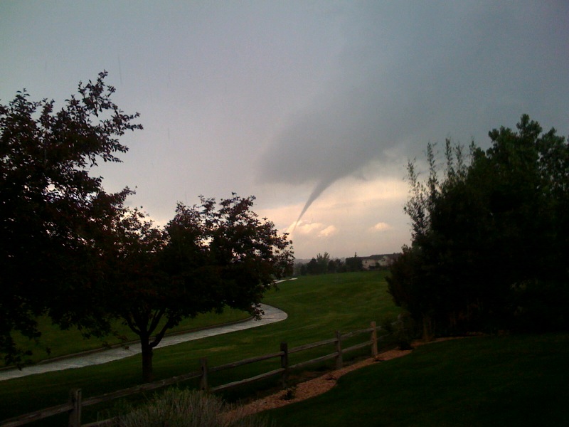
A funnel cloud near Thornton on Sunday, June 7, 2009.  Image courtesy John Wagner, Warrior Legacy Foundation.  Click for larger image.
A funnel cloud near Thornton on Sunday, June 7, 2009. Image courtesy John Wagner, Warrior Legacy Foundation. View our slideshow below for more images.

For a brief period of time this afternoon, Thornton and western Adams County were under a Tornado Warning as a funnel cloud was spotted passing.  Thankfully the storm quickly weakened and the threat diminished.  The image at the right is courtesy John Wagner of the Warrior Legacy Foundation.  This was from approximately 136th & Washington looking northwest. 

Do you have images of the severe weather to share?  Email them to info@thorntonweather.com

View images from ThorntonWeather.com visitors in our slideshow below.  Also check out two videos of the twister below!

Please stay aware of the latest severe weather in Thornton.  As of this writing a Severe Thunderstorm Warning remains in effect and conditions could rapidly deteriorate again. 

[nggallery id=4]

28 years ago today – Thornton is struck by a tornado

Damage along Washington was extensive from the tornado that struck Thornton on June 3, 1981. (City of Thornton archives)

It was 28 years ago today that the worst tornado to ever strike the Denver metro area hit Thornton.  June 3, 1981 is a day that will forever be remembered by longtime residents of the north metro area. 

Last year the Northglenn-Thornton Sentinel did a story about it which you can read by clicking here.  Also, below is the entry from the National Weather Service’s history calendar – it is very interesting and serves as a good reminder that severe weather can strike anywhere.

In 1981…severe thunderstorms produced tornadoes over metro Denver.  The first tornado touched down at the intersection of Alameda Ave. And Sheridan Blvd.  The twister moved north along Sheridan Blvd….damaging businesses…apartment buildings…homes…and vehicles.  Over ten homes were unroofed.  The roof of one landed in the middle of a neighborhood park.  At least 10 mobile homes were wrecked.

The tornado curved to the northeast into northwest Denver… Hopping up and down in several places.  Very strong winds outside the actual funnel caused 20 to 30 thousand dollars in damage in downtown Denver.  The third floor of one old building was demolished.  No major injuries were reported from the tornado…although several people were hurt slightly in traffic accidents on Sheridan Blvd. in the confusion caused by the storm.  Damage in Lakewood alone was estimated at 200 thousand dollars. 

At the same time… The worst tornado to ever hit metro Denver struck Thornton. Coming from the same thunderstorm that spawned the Denver twister…the Thornton tornado tore a swath through the heart of the city.  87 homes were destroyed…110 others damaged at least moderately.  In all…600 homes in a 100 block area sustained some damage.  The twister also hit shopping centers…several restaurants…and other buildings. Seven of the 42 injured were considered serious.  The storm was strong enough to snap lamp posts in half and drive a 6- inch slab of wood 2 feet into the ground.  Damage was estimated at up to 50 million dollars. 

The same storm that struck Thornton produced another damaging tornado that touched down in the northwest section of Fort Lupton.  This twister damaged 16 homes and numerous cars and campers. Two children were slightly injured when the car they were in was knocked about and its windows shattered by the storm.  The twister also damaged two commercial buildings.  Damage was very spotty…and observers said the storm hopped up and down at least 3 times.  Dollar damage was estimated at 500 thousand dollars. 

The thunderstorm complex that produced 3 damaging tornadoes also dropped large hail which damaged many cars over northwest Denver.  One to 2 inches of rain fell in less than an hour…flooding a mobile home park with 3 to 4 feet of water on the northwest edge of Denver.  The high water damaged about half of the 392 homes in the park.  Local flooding was also reported in other areas across metro Denver.  A tornado was also sighted near Franktown…but caused no damage.  A thunderstorm wind gust to 52 mph was recorded at Stapleton International Airport.

A Preview of Thornton’s June Weather – The Severe Weather Month

Denver is historically Thornton's true severe weather month.

June is historically Denver’s severe weather month and severe thunderstorms, tornadoes and hail are notorious visitors to Denver and across eastern Colorado during the month.  In fact, over 40 percent of the tornadoes that occur in Colorado are observed in June and these are typically the most destructive of the year.  Severe thunderstorms have also caused major property damage across the Front Range during the month.

In just the last 25 years or so, there have been some particularly notable storms in June.  Tornadoes have struck the metro area including one that longtime Thornton residents will recall on June 3, 1981.  53 residents were injured, 25 homes were destroyed and 239 other structures were damaged.  Others tornadoes in the metro area include southeast Denver and Aurora on June 8, 1986 and east Denver on June 13, 1984.  Severe thunderstorms occurring on June 13, 1984 dumped large hail making it one of the worst and the second costliest storm in Denver history.  More recently, on June 20, 2001, a major hail storm moved across Denver International Airport dropping hailstones as big as two inches in diameter. Damage was extensive on and near the airport.

For complete details on what we can expect in June, click here to view our June weather preview.

Monday weather quieter but a funnel cloud is spotted over Thornton

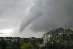
This funnel cloud, one of many across the metro area Sunday, was spotted over Highlands Ranch.  Image courtesy Tracee Hendershott.
This funnel cloud, one of many across the metro area Sunday, was spotted over Highlands Ranch. Image courtesy Tracee Hendershott.

Thus far the weather today has been much quieter than it was yesterday when thunderstorms brought severe weather to most of the metro area.  Southern Thornton has seen a good bit of rain but areas farther north have had very little. 

Earlier today, local law enforcement did report a funnel cloud over 104th and Colorado Blvd from a thunderstorm that was moving through the area.  Reported at 12:47pm, the funnel moved to the east at 15 mph and quickly disappated.  Unlike yesterday when many funnel clouds – and three tornadoes – were reported, this is the only such report thus far today. 

Do you have pictures of this weekend’s severe weather?  Send them to info@thorntonweather.com and we will show them on our site!

Saturday storms bring heavy rain, funnel cloud

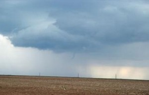
This funnel cloud was over north central Aurora Saturday afternoon.  Photo was taken from the Bennett area.
This funnel cloud was over north central Aurora Saturday afternoon. Photo was taken from the Bennett area.

Saturday afternoon’s thunderstorms brought some pretty interesting weather to Denver and the Front Range.  Our wettest and cloudiest month seems to be intent on finishing out right on par with what we would expect this time of year. 

Thunderstorms and showers moved across the metro area in the late afternoon Saturday producing thunder, lightning and rain across much of the area.  Some stations on the Rocky Mountain Weather Network reported quite heavy rain, particularly those on the west side of town.  Some of the rain totals along the Front Range since yesterday:

In yesterday’s forecast we warned of the possibility of landspouts which are small, short-lived tornadoes.  None were observed however a funnel cloud was reported over north central Aurora about three miles south of DIA at 4:50pm.  The funnel lasted about two minutes and never touched down and did not cause any damage.

Denver officially breaks high temperature record for this date

Denver set a temperature record for today, May 19.

It’s official.  At 1:24pm today the temperature at Denver International Airport reached 90 degrees setting a new record high temperature for May 19.  This breaks the previous record high for this date of 89 degrees set in 2006. 

Wtih some cloud cover moving in and a chance for thunderstorms in the forecast, it appears that is as high as the mercury will climb today. 

But is it truly a record?

One does have to wonder though, is it truly fair to call this a record?  When the National Weather Service moved Denver’s official monitoring station from Stapleton to Denver International Airport, some say the city’s climate records were forever altered.  For more information and analysis of the controversy, check out this story:  Do Denver weather and climate records have an asterisk attached?

Winter-like storm brings more than 3 inches of precipitation to Thornton

As we begin to dry out from an incredibly wet April storm, we can take a look at some of the numbers from the three day event.  Being on the warmer east side of the Denver area, Thornton did not receive a tremendous amount of snow as temperatures here simply remained too warm.  What we did get though was rain – and LOTS of it. 

ThorntonWeather.com measured 3.06 inches of precipitation – the most we have recorded for a single weather event since we went operational in October 2006.  Friday was the wettest of the three days with 1.86 inches recorded – not a single day record for ThorntonWeather.com but still a great amount for our arid climate.  The steady and more or less constant rain brought much needed moisture and helps to make up for what has been a dry snow season thus far. 

Denver did officially set a record for Friday when 1.16 inches of precipitation was recorded at Denver International Airport – the most ever on April 17th.  The old record was 1.00 inch set in 1920. 

While we remain well behind normal on snow for the season, for the calendar year thus far, the storm put Denver ahead of the curve on precipitation.  Normally by this date we would have had 3.36 inches of precipitation.  Since January 1 Denver has now recorded 3.61 inches, 0.25 inch above normal, so that is definitely good news. 

As we mentioned, Thornton did not receive a lot of snow from this event.  We recorded 3.1 inches total as the rain / snow mix we saw at many times resulted in what snow did fall being compacted by rain immediately thereafter.  Other areas of the Front Range however, those primarily west and south, were a touch colder and received a great deal of snow.  A quick look at a few of the snow totals from the event:

  • Pinecliffe – 52 inches
  • Rollinsville – 51 inches
  • Nederland – 37 inches
  • Blackhawk – 36 inches
  • Evergreen – 29 inches
  • Cherry Creek Dam – 15.3 inches
  • Parker – 14 inches
  • Highlands Ranch – 13.4 inches
  • Boulder – 10 inches
  • Broomfield – 9.3 inches
  • Arvada – 8.8 inches
  • Denver, Stapleton – 3.3 inches
  • ThorntonWeather.com – 3.1 inches
  • Denver International Airport – 2.6 inches (Denver’s official site)

All of that moisture and a coming week of temperatures in the 70’s are sure to truly start greening up the landscape.  It won’t be long now for sure and you will be mowing the lawn!

A Preview of Denver’s April Weather – Something for Everyone

Do April showers bring May flowers?  Find out in our April 2009 weather preview!
Do April showers bring May flowers? Find out in our April 2009 weather preview!

April marks a transition between winter and summer for most of the country but for Denver it is especially true as we can see a stunning variety of weather. The proverbial April showers are certainly a possibility for Denver. Snow? Tornadoes? Thunderstorms? You bet – all can happen! For good measure throw in a chance for hail and even dust storms and April gives every type of weather condition you could like – or hate.

The good news is that sunshine and warmer temperatures are usually in abundance as the normal highs during the month move up from 57 degrees on the first to 65 degrees on the 30th. It is not unusual to have a number of days well into the 70’s and the low 80’s. We also see the normal lows move above freezing from 30 degrees at the start of the month to 39 degrees by the end. Temperature extremes can hit both ends of the spectrum with a record low of 2 degrees below zero on April 2, 1975 and a record high of 90 degrees on April 30, 1992.

Get all the details here in our complete April 2009 preview.

Denver blizzard moves out as the digging out begins

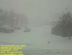
Thornton begins digging out from the March Blizzard of 2009.
Thornton begins digging out from the March Blizzard of 2009. This image is from our webcam as the storm really began in earnest just before noon.

The sun is already beginning to shine in the wake of Denver’s biggest snowstorm of the 2008 – 2009 winter season.  The storm was also Denver’s biggest since December 2007 when a series of storms dumped more than 30 inches on the city.  While the snow brings much-needed moisture to the parched Front Range, it was a stark contrast to the 70 degree temperatures of just a few days ago. 

Here is Thornton we received 11.4 inches of snow from the storm which increases our season total to 38.1 inches.  While yesterday’s snow helps, that is still barely half of what we average in a season so much more is needed if we want to make up lost ground.

Cold and wind were also part of the story.  Thornton’s high temperature yesterday was 35 degrees but that occurred before 11:00am.  Once the storm arrived, the mercury plummetted 15 degrees and we saw temperatures in the mid-teens.  Winds are what made the storm a blizzard and we had plenty of that with gusts to 33 mph.  The cold temperatures and wind coupled to give us wind chills in the low single digits and Thornton actually recorded a maximum wind chill of 1.3 degrees below zero.

If you haven’t seen it yet, check out these two Thornton weather stories from the blizzard:

For a complete recap on Denver’s March Blizzard of 2009, see our story on Examiner.com.

For all the details, read the rest of this story on our Denver Weather Examiner page. Examiner.com - Get inside Denver weather