Category Archives: Thornton Weather

Another chance at storm spotter training in the north area

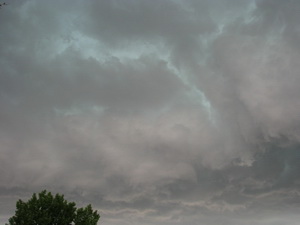
Do these clouds have the potential to bring a tornado?  Learn more at National Weather Service storm spotter training.
Do these clouds have the potential to bring a tornado? Learn more at National Weather Service storm spotter training.

We have written before about the great opportunity the National Weather Service provides by giving storm spotter training during the start of the severe weather season.  Normally these sessions are held in the spring but in response to the very active severe weather of early June, and the increased interest in severe thunderstorms, the National Weather Service in Boulder has added to additional spotter training session next week. 

  • When:  Saturday, July 11
  • Time: 10:00am
  • Where: Broomfield, CO.
  • Exact location: Rocky Mountain Metropolitan Airport, Terminal Building, 11755 Airport Way (formerly Jefferson County Airport)
  • For more information: robert.glancy@noaa.gov

The storm spotter program is a nationwide program with more than 280,000 trained spotters.  These volunteers report weather hazards to their local National Weather Service office providing vital information when severe strikes.  Data from spotters include severe wind, rain, snow measurements, thunderstorms and hail and of course tornadoes. 

Don’t think tornadoes can hit Thornton?  Click here for a look back at the June 3, 1981 twister that hit the city!

Storm spotters are part of the ranks of citizens who form the Nation’s first line of defense against severe weather. There can be no finer reward than to know that their efforts have given communities the precious gift of time–seconds and minutes that can help save lives.

By completing one of these training classes you can become an official storm spotter.  When severe weather strikes, you can report it by calling a special toll free number or submit your report via the National Weather Service’s website. 

Taking the training though doesn’t obligate you to being a storm spotter.  These are great sessions for anyone wanting to learn more about the severe weather we experience in Colorado, whether you want to be an official spotter or not.  All training is free.  Topics include:

  • Basics of thunderstorm development
  • Fundamentals of storm structure
  • Identifying potential severe weather features
  • Information to report
  • How to report information
  • Basic severe weather safety

To learn more about the program, see here:  http://www.crh.noaa.gov/bou/awebphp/spotter.php
Thornton and Denver close out a wet and cool June

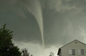
This funnel cloud was seen on Tuesday from the Thornton Civic Center (looking north) on June 10th.  Image courtesy Lisa Wilson, the City of Thornton.
This funnel cloud was seen on Tuesday from the Thornton Civic Center (looking north) on June 10th. Image courtesy Lisa Wilson, the City of Thornton.

June 2009 went down in the history books as one of the more unusual June’s on record.  Residents are all of course well aware of the string of severe storms but the Mile High City also were unusually cool and certainly very wet. 

In terms of precipitation, a whopping 4.86 inches of rain fell at the official measuring site at Denver International Airport during the month – the second wettest June since recordkeeping began here in 1872.  We missed out on breaking the record by only a tenth of an inch as the all-time wettest was back in 1882 when 4.96 inches fell in the rain bucket.  Nevertheless, we easily exceed the normal rainfall total for the month which is 1.56 inches.  In fact, we beat that in one day on June 23rd when 1.64 inches fell at DIA.  Here in Thornton we didn’t measure near as much precipitation having recording 3.44 inches for the month.  This is more in line with what areas closer to the actual metro area recorded than what was recorded at DIA.  See below for details on the controversy about Denver’s climate records. 

Temperature wise, we were very cool as well, never breaking the 90 degree mark during the month.  Two days, the 29th and 30th, came close with 89 degrees being recorded as the high temperatures on those days.  This was the first time since 2003 no 90 degree days were recorded in June.  Before that, you would have to go way back to 1972 to find another June when that happened.  The average temperature for June 2009 was 64.4 degrees, 3.2 degrees below the normal of 67.6.  That may be cool but it was nowhere near the record low average for June which is 60.6 set in 1967.  Thornton was just a touch warmer than the official stats from DIA as we recorded 90.0 degrees on the 29th.  Similarly, Thornton’s average temperature was just a bit cooler at 63.2 degrees. 

Then of course there were the storms.  Tornadoes, funnel clouds and hail will probably be the most memorable events of the month, especially the twister that struck the Southlands Shopping Center in Aurora.  In all, DIA recorded 18 days with thunderstorms – eight more than normal.  15 days had precipitation versus the normal of nine.  All those storms also took a toll on what is normally a sunny month.  On average Denver has 70 percent of possible sunshine during the month.  This year we only recorded sunshine 51 percent of the time. 

All that rain we have received in the last two months, especially in June, helps to make one other statistic a bit more tolerable.  Colorado’s snow season runs from July 1 to June 30 each year and for the 2008 – 2009 snow season, we recorded a meager 38.1 inches of the white stuff.  That is a whopping 29 inches below the normal of 67.1 inches.   Thornton fared a bit better on the snowfall front but not by a lot having recorded 48.5 inches for the season.

There is always a ‘but’… 

As always, we would like to remind everyone that all official Denver weather statistics are now taken out at Denver International Airport.  As we outlined a few months ago, moving the official monitoring station 13 miles away has made quite a difference in Denver’s climate records.  Evidence suggests that temperatures and precipitation as measured at DIA differ greatly from what would have been recorded at the old site at Stapleton or near downtown Denver. 

The National Weather Service has finally acknowledged this and has setup a measuring station at the Denver Museum of Nature and Science (click here to view current conditions from it on the Weather Underground).  However, they maintain that Denver’s official statistics will continue to be recorded at DIA and as a result, Denver’s climate records will forever have an asterisk next to them.  If you compare June’s statistics from this new station to the ‘official’ ones at DIA, you will notice that much of what we discuss above, including the temperature and precipitation, would be much different were the statistics being kept by the new station closer to where people actually live.

Denver climate summary for the month of June 2009 – From the National Weather Service

CLIMATE NORMAL PERIOD 1971 TO 2000
CLIMATE RECORD PERIOD 1872 TO 2009
WEATHER         OBSERVED          NORMAL  DEPART  LAST YEAR'S
                 VALUE   DATE(S)  VALUE   FROM    VALUE  DATE(S)
                                          NORMAL
................................................................
TEMPERATURE (F)
RECORD
 HIGH             104   06/26/1994
 LOW               30   06/02/1951
HIGHEST            89   06/30       104     -15       95  06/26
                        06/29
LOWEST             41   06/08        30      11       37  06/12
AVG. MAXIMUM     77.7              82.1    -4.4     83.9
AVG. MINIMUM     51.1              53.0    -1.9     50.9
MEAN             64.4              67.6    -3.2     67.4
DAYS MAX >= 90      0               6.3    -6.3       10
DAYS MAX <= 32      0               0.0     0.0        0
DAYS MIN <= 32      0               0.0     0.0        0
DAYS MIN <= 0       0               0.0     0.0        0
PRECIPITATION (INCHES)
RECORD
 MAXIMUM         4.96   1882
 MINIMUM            T   1890
TOTALS           4.86              1.56    3.30     0.73
DAILY AVG.       0.16              0.05    0.11     0.02
DAYS >= .01        15               8.7     6.3        4
DAYS >= .10         9                MM      MM        2
DAYS >= .50         4                MM      MM        1
DAYS >= 1.00        1                MM      MM        0
GREATEST
 24 HR. TOTAL    1.64R  06/23 TO 06/23              0.70     06/04 TO 06/05       

SNOWFALL (INCHES)
RECORDS
 TOTAL            0.4   1919
TOTALS            0.0                T
DEGREE_DAYS
HEATING TOTAL      78                60      18       64
 SINCE 7/1       5616              6128    -512     6056
COOLING TOTAL      68               136     -68      144
 SINCE 1/1         94               161     -67      172
FREEZE DATES
RECORD
 EARLIEST     09/08/1962
 LATEST       06/02/1951
EARLIEST                        10/07
LATEST                          05/05
.................................................................
WIND (MPH)
AVERAGE WIND SPEED              8.4
RESULTANT WIND SPEED/DIRECTION   2/147
HIGHEST WIND SPEED/DIRECTION    53/260    DATE  06/26
HIGHEST GUST SPEED/DIRECTION    68/270    DATE  06/26
SKY COVER
POSSIBLE SUNSHINE (PERCENT)   51
NUMBER OF DAYS FAIR            3
NUMBER OF DAYS PC             22
NUMBER OF DAYS CLOUDY          5
AVERAGE RH (PERCENT)     65
WEATHER CONDITIONS. NUMBER OF DAYS WITH
THUNDERSTORM             18     MIXED PRECIP               1
HEAVY RAIN                7     RAIN                      10
LIGHT RAIN               17     FREEZING RAIN              0
LT FREEZING RAIN          0     HAIL                       3
HEAVY SNOW                0     SNOW                       0
LIGHT SNOW                0     SLEET                      0
FOG                      14     FOG W/VIS <= 1/4 MILE      6
HAZE                     10                                           

-  INDICATES NEGATIVE NUMBERS.
R  INDICATES RECORD WAS SET OR TIED.
MM INDICATES DATA IS MISSING.
T  INDICATES TRACE AMOUNT.

A Preview of Thornton’s July Weather – A Stormy Month

Change is of course the one constant in Denver’s weather but come July, things actually get pretty consistent. The standard formula for a day in July is a sunning morning, clouds developing in the late morning and early afternoon. Come mid-afternoon, thunderstorms are rolling off of the foothills and into the metro area and the eastern plains. These storms do occasionally reach severe status containing hail, gusty winds and heavy downpours of rain.
In fact, the worst hail storm on record in Denver history hit western sections of the city on July 11th, 1990. Baseball and softball sized hail from this ferocious storm caused millions of dollars worth of property damage.

July is the most stormy month of the year in fact with thunderstorms occurring on average 11 days per month – or once every three days. These slow moving storms are one of the reasons July is Denver’s second rainiest month with an average of 2.16 inches of rain (second only to May). However, these storms are also often very localized and cause widely varying precipitation amounts across the metro area. It is not unusual for one area of down to be deluged while others remain entirely dry. With these severe storms, flash flooding remains a possibility.

View the complete July 2009 preview along with a look back at July 2008 here.

June 2009 is now the 2nd wettest Denver June

From the National Weather Service: June 2009 has moved into the second wettest June since Denver weather records began in 1872.  So far for June 2009, through June 26th, the Denver International Airport (DIA) has measured 4.86 inches of liquid (and there are still 4 more days left in June).  The 4.86 inches of water is 3.52 inches above normal through the 26th.  Last year, June 2008 had only measured 0.73 inch again through the same June time frame.

The wettest June on record for Denver was in June 1882 when 4.96 inches of moisture was collected in the rain bucket.

For the 2009 year so far, 10.38 inches of water has been measured at DIA which is a very impressive 2.51 inches above the normal through June 26th.   Last year in June, only 3.04 inches had been recorded through the same time frame.

Note:  The average Denver annual precipitation is 15.81 inches.

As always, we have to ask, do Denver weather and climate records have an asterisk attached?  Read our Examiner.com investigation to see why maybe they should.

Northglenn-Thornton Sentinel talks tornado sirens

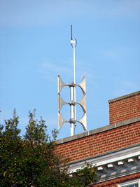
Something you will not see in Thornton - Tornado sirens.
Something you will not see in Thornton - tornado sirens.

In yesterday’s Northglenn-Thornton Sentinel, the paper wrote about tornado sirens and warning systems in the north metro area – or rather the lack thereof.  Appropriately titled “Sound of silence”, the article points out that Thornton is not alone in their lack of any sort of severe weather warning system. 

Westminster, Northglenn, Federal Heights and Adams County leave citizens to fend for themselves as well.  Brighton and Commerce City have siren systems to protect residents of their cities.

Emergency managers cited a number of reasons including the ever-present cost consideration and the fact that severe weather season in Colorado is relatively shortlived.  It is the opinion of ThorntonWeather.com that these thoughts are all extremely shortsighted and cities are risking their citizens’ lives. 

One of the more interesting sections of the article reflects that:

Mike Reddy, captain of emergency management for the Westminster Fire Department, said Mother Nature often provides enough warning for those people who are caught outside during severe weather.

“To me it’s like lightning. If you are out playing golf and there is lightning, it’s best to go inside where it’s safe,” Reddy said. “Tornado sirens are a very expensive investment that it turns out are used three weeks out of the year.

With all the media coverage and alternative approaches, there are more effective ways for people to be notified.”

Reddy added that the information he gets from dispatch about severe weather can be found on the local news channel or Internet.

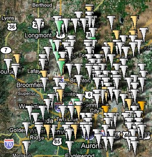
Do tornadoes strike in the Denver area?  177 have been recorded in the metro area alone since 1950. They have occurred as early as April 10th and as late as October 14th.
Do tornadoes strike in the Denver area? 177 have been recorded in the metro area alone since 1950. They have occurred as early as April 10th and as late as October 14th. Map courtesy TornadoPaths.org.

Captain Reddy may wish to familiarize himself with the history of tornadoes in Colorado.  Since 1950, tornadoes have been recorded as early as April 10th and as late as October 14th – in the Denver metro area alone.  Further, through yesterday, 177 twisters have been recorded in the metro area during that same time frame so despite what some may say, they are not rare. 

If a warning system saved your life or the lives of your family, wouldn’t it be worth it?

We recently wrote an article on Examiner.com detailing the current state of emergency warning system across the metro area.  While we had similar results in our talks with various cities that the Sentinel did, we also found that many communities are taking advantage of lower-cost, high tech solutions that incorporate notifying residents of emergencies using email and text messaging.  These types of systems have the added benefit of having multiple uses and can be used to notify residents about other significant events including Amber Alerts, wildfires, chemical spills, civil disasters and terrorist attacks.

We recognize that siren systems are expensive and limited in their reach.  However, we applaud those communities that are taking steps using other methods and implore Thornton and other north metro area municipalities to do the same. 

What do you think?  Should north metro communities invest in emergency alert systems to protect their citizens?  Leave a comment below with your thoughts!

For more information:

Severe weather strikes Thornton again

Ominous clouds tinged by green appeared over Thornton on Sunday.
Ominous clouds tinged by green appeared over Thornton on Sunday. More images of the severe weather are posted below.

What had been a relatively quiet Sunday was shattered by severe storms moving across the Denver metro area and Thornton on Sunday.  A deluge of rain coupled with hail and funnel clouds sent Thornton residents scrambling for cover and caused a rain delay for the Colorado Rockies when a funnel cloud was spotted near Coors Field.  Hail up to 1 1/2 inches fell in parts of Thornton. 

  • New photos added – Funnel cloud near Coors Field.  See below.

A Tornado Warning was issued for a large swath of the metro area including Thornton.  The warning has since expired but a  Tornado Watch remains in effect for Thornton until 9:00pm Sunday evening so residents should remain aware.

[nggallery id=6]

Northglenn-Thornton Sentinel covers the recent severe weather

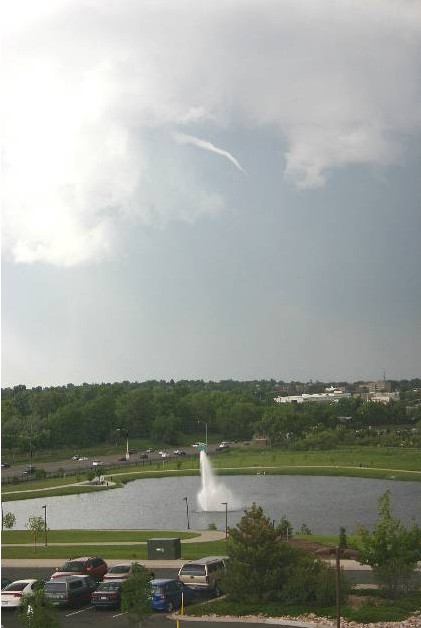
This funnel cloud was seen on Tuesday from the Thornton Civic Center (looking north).  Image courtesy Lisa Wilson, the City of Thornton.
This funnel cloud was seen on Tuesday, June 9, from the Thornton Civic Center (looking north). Image courtesy Lisa Wilson, the City of Thornton.

MetroNorth Newspapers in the Northglenn-Thornton Sentinel covered the recent bout of severe weather in the most recent edition of Thornton’s hometown newspaper. In part, the article says:

As a former producer for 9News, Todd Barnes has chased a few tornadoes in his time. On Sunday, however, the storm found him.

Barnes, communications manager for the City of Thornton, was shopping at Costco in the Larkridge development near 162nd Avenue and Interstate 25 when he witnessed the funnel cloud form. The tornado touched down at 1:17 p.m. one mile north of Broomfield, near the northwestern edge of Thornton.

“There’s nothing like watching a tornado touch down,” Barnes said Monday. “It’s incredible.”

Another funnel cloud was spotted over the city at about 4:30 p.m. Tuesday. It appeared only briefly, high in the sky at a nearly 90-degree angle, before disappearing, according to witnesses. A tornado did touch down outside Firestone shortly after 5 p.m., but no serious damage was reported.

Click here for the complete story on MetroNorth’s website or click here to view a PDF.

Related stories from ThorntonWeather.com:

Do you subscribe to the Sentinel? Why not? There is no other source of truly local news available to Thornton and Northglenn residents and MetroNorth News and the Sentinel do an outstanding job of providing the depth of news and information area residents really need. If you haven’t read the Sentinel, pick up a copy and check it out. They do have a website but it isn’t particularly noteworthy and doesn’t have the same information you get in the print version. Subscriptions for the paper are very inexpensive and I would highly recommend it to everyone who lives in the area. Check it out and support Thornton’s hometown newspaper!

City of Thornton addresses residents’ concerns about tornadoes

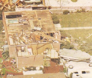
On June 3, 1981 a tornado struck Thornton in what is the worst twister to have struck the Denver metro area. Despite this, Thornton does not have any sort of emergency alert system to warn citizens of tornadoes or other civil disasters.  Image courtesy the City of Thornton archives.
On June 3, 1981 a tornado struck Thornton in what is the worst twister to have struck the Denver metro area. Despite this, Thornton does not have any sort of emergency alert system to warn citizens of tornadoes or other civil disasters. Image courtesy the City of Thornton archives.

As we have discussed before, the City of Thornton is lacking any type of system to alert citizens of severe weather like we have seen recently. In the last week, parts of Thornton have been under Tornado Warnings as funnel clouds circled in the sky and citizens are understandably concerned.

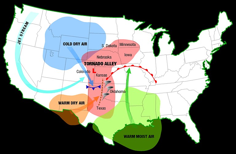
We at ThorntonWeather.com continually remind people that the Denver metro area is at the far western edge of Tornado Alley and funnel clouds, tornadoes, hail and other types of severe weather are not unusual at all. It was 28 years ago last Wednesday in fact that the costliest tornado to ever hit the Denver metro area struck Thornton. Accounts vary but 53 people were injured, at least 25 homes were destroyed and hundreds more damaged.

The danger is real – tornadoes can and do strike in the Thornton area. In some ways it is surprising that the city did not implement some sort of system in the wake of the tornado in 1981. Many municipalities in the metro area do have warning sirens including Denver, Aurora, Englewood, Commerce City and Brighton.

Thornton Mayor Erik Hansen has told ThorntonWeather.com that the city will look at ways to inform citizens when severe weather is imminent. This may take the form of utilizing the reverse 911 system or as we suggested to him, a possible new text alert system that would deliver alerts to citizen’s mobile phones. It is our firm belief that some sort of system to be used not only for severe weather but for other civil disasters is a wise and prudent investment for the city to take.

The Denver area is at the western edge of Tornado Alley and as we have seen historically and in recent days, the danger is real.  Click image for larger view.  Image courtesy NOAA.
The Denver area is at the western edge of Tornado Alley and as we have seen historically and in recent days, the danger is real. Click image for larger view. Image courtesy NOAA.

This week the city posted some tornado safety tips on its website that are worth reviewing. You may also wish to review our Severe Weather 101 series which provides more in depth information on the entire array of spring and summer severe weather (links below).

We will continue our conversations with the city about how they can improve communication with Thornton residents about severe weather and keep you updated as appropriate. If you are so inclined, contact your city council representatives and let them know you want to see Thornton implement an emergency alert system.

ThorntonWeather.com Severe Weather 101 Series

Severe weather returns as funnel clouds spotted over Thornton, tornado near Firestone

This funnel cloud was seen on Tuesday from the Thornton Civic Center (looking north).  Image courtesy the City of Thornton.
This funnel cloud was seen on Tuesday from the Thornton Civic Center (looking north). Image courtesy the City of Thornton.

Severe weather has returned to the Denver metro area and the Front Range Tuesday afternoon.  At approximately 4:50pm and for nearly one half hour afterwards trained spotters reported numerous funnel clouds over the Northglenn, Thornton, and Broomfield areas.  No tornadoes touched down however.

At 5:11pm local law enforcement reported a tornado four miles northwest of Firestone moving at 20mph.  This area remains under a Tornado Warning until 5:00pm. 

If you are in an area under a Tornado Warning, do not try to outrun the storm or chase it in your vehicle.  Immediately seek shelter in a building.  If no structure is available, seek shelter in a ditch or low spot.  If in your home or other building go to an interior hallway or ideally the basement.

[nggallery id=5]

Tornado in Aurora rated an EF1

The tornado that struck Aurora, Colorado has been rated an EF1 with 100 mph winds by the National Weather Service.  Image courtesy Sean Strachan. Follow the link below to go to Examiner.com for more images.
The tornado that struck Aurora, Colorado has been rated an EF1 with 100 mph winds by the National Weather Service. Image courtesy Sean Strachan. Follow the link below to go to Examiner.com for more images.

The tornado that touched down in the Denver suburb of Aurora and caused damage to a local mall and apartment complex has been rated an EF1 by the National Weather Service.  After two days of evaluations, the service said that the twister most likely had winds of 100 mph, placing it in the middle of that rating.

The four other twisters that struck the area will be rated later this week.  Because they were short lived and struck in open areas, they mostly likely will be rated as EF0 twisters with winds from 65 mph to 85 mph. 

The other tornadoes were reported in the area of 144th and I-25, one was reported five miles south of Bennett, one five miles south of Deer Trail and one three miles north of Byers.

For all the details including photos of the damage and video, check out the complete story on Examiner.com. Examiner.com - Get inside Denver weather