Category Archives: Colorado Weather

Record streak official. Heat Advisory and possible record temps to come.

Denver\'s Record Breaking Heat Wave ContinuesIt is official – we have broken Denver’s 107 year old record of consecutive days with over 90 degree temperatures.  Thursday marked day 19 in the streak, moving past the old record of 18 days set way back in 1901 and 1874. 

At the current time, it looks like the 90+ degree heat will continue until Wednesday at the earliestso the streak could number around 24 days or so by the time it is done.  Thornton’s forecast calls for 101 degrees Friday, 100 Saturday and 98 on Sunday so the weekend will be a hot one for sure.  This gives us the potential to break Denver’s all-time record for August 1st and 2nd of 100 degrees (set in 1938 and 1878 respectively).  Thankfully it doesn’t look like we will break the overall all-time Denver temperature record of 105 so you can consider that a bit of a silver lining.  🙂  Continue reading Record streak official. Heat Advisory and possible record temps to come.

August Preview – Summer coming to an end

August 2008 Weather PreviewAs summer vacations wind down and families prepare to send kids back to school in August, Colorado weather also starts to settle down.  The chances for severe weather decrease markedly during August and by the end of the month daytime temperatures are dropping quite a bit as well.  For more information on what to expect in August, click here to view our August 2008 Preview.

Editor’s note:  Somehow we forgot to post the July 2008 preview last month and we apologize for our error.  Should you wish to read it, it is posted here.

12 days and counting – the 90 degree streak continues

The 90 degree streak continues.As of today, Thursday, we are at 12 consecutive days with 90 plus degrees.  Unfortunately there doesn’t appear to be an end in sight although some coming days may drop just below the 90 degree mark.

Friday we can expect 91 degrees, Saturday 93, and Sunday 94.  Monday is currently looking to be around 90 so maybe the streak will end then – keep your fingers crossed! Continue reading 12 days and counting – the 90 degree streak continues

What are those zones?

National Weather ServiceRecently we were asked what are the “zones” that the National Weather Service uses and what is their purpose. This is a very good question.

The National Weather Service in Boulder breaks down Colorado (and other states) into various zones for use when issuing forecasts, watches, warnings, etc. If you look at the text of these, you will see something like this:

SHORT TERM FORECAST
NATIONAL WEATHER SERVICE DENVER CO
1125 AM MDT MON JUL 07 2008

COZ040-041-043-045-071930-

Notice the part in bold. That tells you which zones are affected by the warning – in this case, the CO of course means Colorado.  The “Z” part tells you zones 40, 41, 43 and 45 are affected. So what zone do you live in? In general, if you are in the Denver metro area, you are in either zone 39 or zone 40. You can click here for a PDF map of all Colorado zones.

Area King Soopers Offers Discounted Weather Radio

All Hazards NOAA Weather RadioWe recently wrote about systems which provide severe weather alerts to the general public.  In writing that, we extolled the virtues of having a “weather radio” – a specialty radio that allows you to listen to and monitor the NOAA Weather Radio All Hazards (NWR) system.

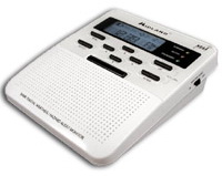
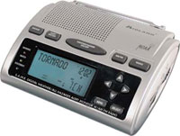
Midland WR-100 Weather RadioWe just read on KMGH channel 7’s website that all Front Range area King Soopers are offering a very good deal on a Midland WR-100 radio.  These are similar to the WR-300 model we discussed previously – just with fewer bells and whistles.  The WR-100 retails for $49.99 but through September at area King Soopers stores you can buy one for $29.99. 

You can find more information on channel 7’s website including a list of area King Soopers stores and even a video that walks you through how to set the radio up.  This is a great deal and we would encourage everyone to take advantage of it. 

Windsor Tornado Officially Rated as EF3

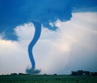
The National Weather Service has completed their tornado assessment of the Windsor tornado and determined the twister was rated an EF3 on the Enhanced Fujita scale.  See below for details and here for a map of the path the twister took

PUBLIC INFORMATION STATEMENT…UPDATED…
NATIONAL WEATHER SERVICE DENVER CO
430 PM MDT FRI JUN 6 2008

..WELD COUNTY TORNADO OF MAY 22 2008 RATED AN EF3 TORNADO…

On Thursday May 22 2008 a wide and powerful tornado swept north northwestward for 34 miles from northeast of platteville in Weld County at 1126 AM MDT to 7 miles east northeast of Fort Collins in Larimer County at 1216pm MDT.   The National Weather Service tornado damage assessments conducted on Friday May 23rd and Saturday May 24th documented large areas of damage.  On the enhanced Fujita scale there were pockets of EF3 damage especially near the Missile Silo Park Campground west of Greeley and to homes and businesses in eastern Windsor.  Wind estimates in the heavily damaged areas were as high as 130 to 150 mph. 

The tornado was as wide as one mile at times along its path.  There was one fatality and 15 to 20 injuries.   Damage estimates are not finalized, but preliminary numbers from FEMA are 850 homes damage, with nearly 300 homes signficantly damged or destroyed.  Privately insured damages total 174 million dollars…and the Poudre Valley Rural Electric Association reported one million dollars of damage to electric transmission facilities.  

One question frequently asked is how unusual was this event.  Certainly it was not unusual in time of year (May and June are the peak tornado months in Colorado).  It was not unusual in location (more tornadoes are reported in Weld County than any other county).  It was slightly earlier in the day than normal, as we usually see tornadoes in the mid afternoon to early evening.  The track was longer than most, the tornado was moving fastern than most,  and a track moving north northwest is very unsusual.  Since 1950 there have been a total of 20 tornadoes of f3 and higher within Colorado.  This was the second f3 tornado reported in weld county since 1950.   On May 15, 1952 an F3 tornado injured 5 people within the county. 

For reference…the Enhanced Fujita Scale classifies tornadoes into the following categories:

EF0…wind speeds 65 to 85 MPH.

EF1…wind speeds 86 to 110 mph.  

EF2…wind speeds 111 to 135 mph.

EF3…wind speeds 136 to 165 mph. 

EF4…wind speeds 166 to 200 mph. 

EF5…wind speeds greater than 200 mph.

Colorado Weather – Rain, Thunderstorms and Snow – All Today!

One thing that is consistent about Colorado weather is how inconsistent it can be!  Yesterday evening we saw some metro area thunderstorms with some rain and a pretty good lightning show.  Further east on the plains, four tornadoes were reported but all were in open areas.  Today the state will see it all. 


Current Advisories / WarningsFlood watches / warnings are in effect for a good part of the western slope.  Also out west there are actually snow advisories issued for the Gore and Elk Mountain Ranges and a few other spots as the snow level will drop to around 9,000 feet.  Much of the eastern third of the state is under thunderstorm watches until around noon and those could very well be extended.  Severe storms out there are a real possibility. 

Click here to see what advisories / warnings are currently issued for the state

This morning in the metro area we woke up to overcast skies and light rain in many areas.  Showers will continue on and off throughout the day and a thunderstorm or two are a possibility.  Temperature wise we will be about 20 degrees below the normal of 79 and that is a pretty dramatic difference from recent days.  Expect temps around the metro area to reach around 60 today. 

There is good news though.  The rain and cool weather will move out of the Front Range after midnight tonight and we will see a quick warm up and a beautiful weekend.  Look for 77 degrees on Friday and 85 degrees on Saturday and Sunday. 

If you didn’t read our June weather preview, you may find it interesting to know that snow has actually been recorded in Denver as late as June 11th (1947).  It is pretty unlikely anything like that will happen this year but if you don’t like the rain, just remember that it could be snow! 

Tornado Watch Issued for Metro Area – Northeast Colorado

Tornado Watch issued for Denver.The National Weather Service has issued a Tornado Watch for much of northeastern Colorado including the Denver Metro area.  Counties under the watch include Adams, Arapahoe, Denver, Douglas, Elbert, Kit Carson, Lincoln Logan, Morgan, Phillips, Sedgwick, Washington, Weld and Yuma.  This watch is in effect until 8:00pm tonight. 

Tornado Watches are issued when weather conditions are favorable for the development of severe thunderstorms that are capable of producing tornadoes. A tornado watch therefore implies that it is also a severe thunderstorm watch.

As we all saw two weeks ago in Weld County, conditions can quickly deteriorate and the weather can present a very real danger to life and property.  Now would be a good time to run through tornado emergency procedures in your mind. 

Please remember, should the tornado threat increase:  Get in, get down and cover up!  A well built structure with a basement is ideal shelter but if that is not available, an interior bathroom or closet is next best.  Modular and mobile homes are NEVER a good option nor are vehicles.  If you are in a vehicle and a tornado is near, abandon it immediately and seek shelter in a low lying area such as a ditch. 

For these and other tornado safety tips, please see our Severe Weather 101 – Tornadoes

How do you know when something bad is coming?

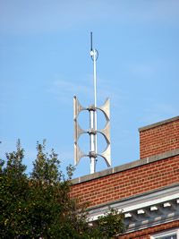
Emergency Alert Sirens - Not in Thornton!I was recently asked how prevelant tornado sirens are in the metro area and thought that would be a good discussion to have.  Tornado and alert sirens do exist in some municipalities in the Denver metro area but not all. Boulder has a system (primarily due to flood dangers) as does the city of Denver itself. Many of the other suburbs however do not.  Unfortunately, Thornton does not which to me is somewhat odd as in 1981 Thornton was struck by one of the few tornadoes to have hit the metro area so you would think that would have caused them to consider building a system back then.  If you are reading this and live in another municipality, give them a call to find out if one is available in your area.
The sirens definitely do provide a service to the community.  However, USA Today just had an article discussing these types of systems and pointing out that they were expensive to maintain and of limited effectiveness.  Some municipalities have depended on reverse 911 systems to alert residents but it is my opinion that these to are limited because they rely on someone being home to answer the phone.  What if you are in an area park and a tornado is coming? People today are very mobile and a solution that takes that into account and can warn people wherever they are would be ideal.

The city of Dacono recently deployed a system that I think Thornton should give some thought to.  You can read more about it here but in essence residents can sign up to receive alerts on their home phone, cellular phone and email.  Within a matter of seconds, thousands of subscribers can be notified of everything from weather events to disaster updates to AMBER alerts for much less than the cost of a siren system.  ThorntonWeather.com is going to be discussing the idea of this type of system with Thornton City Council members in coming weeks so be sure to check back to see what we learn.

NOAA All Hazards Weathe RadioIn the meantime, probably the best way to ensure you are warned about approaching dangers is to purchase what is commonly known as a “weather radio.” These radios are relatively inexpensive (around $40.00) and allow you to listen to and monitor the NOAA Weather Radio All Hazards (NWR) system. NWR broadcasts official Weather Service warnings, watches, and forecasts as well as other hazard information like earthquakes, avalanches, chemical spills, and even AMBER alerts. These broadcasts continually run 24 hours a day, 7 days a week and provide a great way to stay up to date with developing weather conditions.  One of these radios is actually what broadcasts our weather radio system here on ThorntonWeather.com.

Some of the nicer units even use what is called SAME – Specific Alert Message Encoding – which I would highly recommend. In essence you program in a code for the area in which you live and the radio will automatically turn on and sound an alert when something of note is in your area. These weather radios are very popular in rural areas in Tornado Alley but as we saw last week in Windsor, they definitely can be useful here along the Front Range as well. More information about the system can be found on the National Weather Service’s website and you can find these at many electronics retailers, particularly those on the Internet like Amazon or NewEgg.

Midland WR-300 Weather RadioWhich weather radio do we use?  We are hesitant to recommend specific products but our radio of choice at the current time is the Midland WR-300.  This radio has the important SAME coding feature, a text display to show you what sort of alert is occurring, battery backup and more.  We have been pleased with the two we have.  NewEgg carries this model for $47.99.

Regional Weather Now at Rocky Mountain Weather Network

We are excited to announce a new regional weather website – the Rocky Mountain Weather Network (RMWN) – that you will find at www.rockymountainweather.net.

One of the prominent members of the personal weather station (PWS) community, Ken True of SaratogaWX, recently hatched the idea of a series of regional weather networks, all being fed data from weather stations in the areas they serve. Tony of ThorntonWeather.com has agreed to manage the regional network for the Rocky Mountain area encompassing Colorado, New Mexico and Wyoming.

These networks are to provide an overview of weather conditions across the region and will provide links to the stations within. The main page of the site displays a “mesomap” with a rotating display of current weather conditions across the three states. At the current time, 18 stations are online with RMWN and more are joining daily.

The Rocky Mountain Weather Network will not only serve as an online repository for current weather conditions in the area, but we are also hoping to see it grow into an online community . To this end, online discussion forums have been created on the RMWN website that anyone can participate in. These will be frequented not only by weather station owners / operators but also by the public and anyone just generally interested in the weather. The community will be a great way for anyone interested in the weather to congregate online and discuss their common interests.

So please check out the Rocky Mountain Weather Network at www.rockymountainweather.net and be sure to stop by the discussion forums for some weather talk!

Rocky Mountain Weather Network