A significant magnitude 5.1 earthquake struck La Habra, California Friday breaking water mains, knocking items from shelves and rattling Los Angeles area residents.Occurring at 9:09 p.m., the US Geological Survey reported the quake was centered 4…

Read the rest of this story on Examiner.com
Before and after: NASA satellite imagery shows effects of Washington state landslide
As many as two dozen people were killed on Saturday, March 22, 2014 when a massive landslide swept down a rain-soaked hill near Oso, Washington. NASA satellite imagery taken before and after the event shows the extent of the event.
Using the ‘sliders’ on the image below you can compare how the area looks normally (left) versus how it looked after the landslide (right).
[wpw_ba_viewer width=”600″ height=”auto” anim_speed=”600″ start_percent=”0.5″ disable_intro=”false”]
[wpw_ba_img src=”http://lh6.googleusercontent.com/-I2mSOZBkFnQ/UzMQFKXi74I/AAAAAAAAB0s/tcA9N10o6cY/s600/wa-before.jpg” data_second=”http://lh5.googleusercontent.com/-VXmVfoDsFqQ/UzMQFPSNLNI/AAAAAAAAB0w/kIX2gla6sTA/s600/wa-after.jpg” title=”Satellite imagery comparison of the area near Oso, Washington before and after the March 22, 2014 landslide. (NASA EO)” data_info=”Satellite imagery comparison of the area near Oso, Washington before and after the March 22, 2014 landslide. (NASA EO)”]
[/wpw_ba_viewer]
From NASA:
On March 22, 2014, a rainfall-triggered landslide near Oso, Washington sent muddy debris spilling across the North Fork of the Stillaguamish River. The debris engulfed numerous homes, resulting in the deaths of at least 14 people. As of March 25, authorities reported that 176 people were still missing.
The slide left an earthen dam that blocked the river, causing a barrier lake to form. The Operational Land Imager (OLI) on Landsat 8 acquired this image of landslide debris and the barrier lake on March 23, 2014. An image of the same area acquired on January 18, 2014, is shown for comparison.
As water backed up, it raised fears of a potential flash flood. On March 23, water began to flow around the north side of the dam. However, as of the afternoon of March 25, a flash flooding watch issued by the National Weather Service remained in effect for parts of Snohomish county.
According to Durham University geologist Dave Petley, the landslide was a reactivation of an earlier landslide that caused problems in 1988 and 2006.
Video: Dust devil strikes during controlled burn at Rocky Mountain Arsenal
 Performing prescribed burns is an important way to clear brush and renew wildland and are often done without any excitement. Mother Nature had other plans last week however as whirling winds propelled a fire beyond its containment lines at the Rocky Mountain Arsenal National Wildlife Refuge.
The amazing video of the event on March 14 was taken by a firefighter from South Metro Fire and showcases how quickly weather conditions can change and how even when well-planned, fires can quickly get out of control.
- Story republished with permission from the Denver Weather Examiner
The fire is seen burning through the grasslands of the refuge when swirling wind develops – a common phenomenon caused by the heat quickly rising from the fire. Soon the fire begins to rage and tumbleweeds and burning debris are sent flying in a circular path.
Thomas Rogers, the man behind the camera, said on YouTube the fire burned an additional acre as crews backed off to gain the upper hand.
Refuge Manager David Lucas said on Facebook, “What we saw and how we reacted is exactly what we want out of our fire crews — well planned with plenty of on-site resources to manage contingencies, safety first, and well trained folks who got after it quickly.”
Satellite imagery provides bird’s eye view of Earth at the change of seasons
Satellite imagery provides bird’s eye view of Earth at the change of seasons.
Pretty neat imagery and explanation from NASA:
Enjoy the Equinox!
Every year, there are two equinoxes. One is in March; the other is in September. In 2014, the March equinox falls on March 20, 2014. On the equinoxes, the sun shines directly on the equator and the length of day and night is nearly equal. Seasons are opposite on either side of the equator, so the March equinox is called the spring (or vernal) equinox in the northern hemisphere. But in the southern hemisphere, it’s known as the fall (autumnal) equinox. What do equinoxes look like from space? The Spinning Enhanced Visible and Infrared Imager (SEVIRI) on EUMETSAT’s Meteosat-9 captured these four views of Earth from geosynchronous orbit. The images show how sunlight fell on the Earth on December 21, 2010 (upper left), and March 20 (upper right), June 21 (lower left), and September 20, 2011 (lower right). Each image was taken at 6:12 a.m. local time. Notice how on March 20 and September 20, the terminator — the divide between day and night — is a straight north-south line, and the Sun is said to sit directly above the equator. Equinox means “equal night” in Latin, capturing the idea that daytime and nighttime are equal lengths everywhere on the planet.
Read more about the equinoxes and solstices at
http://
See a video of the equinoxes and solstices from space at
http://www.youtube.com/
Read more about the March Equinox from Date and Time at
http://

Announcing Tony’s Takes Photography

I have always been a shutterbug ever since my parents gave me my first SLR one Christmas when I was in high school. It wasn’t until recent years however that I began to hone the craft and now I have launched Tony’s Takes Photography.
Certainly I have no illusion of becoming a professional photographer or having the skills of one. This is purely a hobby for me. However I think I do a pretty passable job and decided I would like to share my images. Up until now that has been confined to this website and on social media with friends and family.
Over at Tony’s Takes (www.tonystakes.com) I will be sharing the images I capture. These will usually be focused on the subjects which interest me most – extreme weather, landscapes and wildlife. Certainly some of these photos will make their way here as always but that will be the primary spot where I post them.
Don’t worry though. Weather is still a passion of mine andThorntonWeather.com will be staying around as always and remaining your one and only spot for truly local Thornton weather news and information!
You can find Tony’s Takes Photography at any of the links below and I would truly appreciate you spreading on the work:

Video: Los Angeles news anchors scramble under desk during earthquake
 A magnitude 4.4 earthquake struck the Los Angeles area Monday morning in the pre-dawn hours. While a relatively minor quake, it was strong enough to rattling residents and send morning TV news anchors under their desks.
According to the US Geological Survey (USGS) the quake was centered 6 miles west of Beverly Hills and at a depth of 5.3 miles. Occurring at 6:25 a.m. local time, a light aftershock of magnitude 2.7 was recorded at 7:23 a.m.
Residents stretching from Mission Viejo to the south and Oxnard to the north reported feeling the initial temblor. Beyond waking residents that were still sleeping and grabbing the attention of those already awake, initial reports indicate no significant damage.
Television stations were in the middle of their morning broadcasts when the quake hit.
KTLA news anchors Chris Schauble and Megan Henderson reacted quickly announcing that they were feeling the quake. The two acted appropriately and dived under their anchor desks for the short duration of the quake.
Video from the station shows the overhead lights shaking and Henderson noting that dust or ceiling material was falling down.
Photo: A snow-covered landscape at sunrise
We headed out this morning looking for bald eagles at Cherry Creek State Park. Certainly saw LOTS of them but also enjoyed a beautiful morning with the snow-covered trees and blue skies.
If you like this image, be sure to check out our photography website at Tony’s Takes. There is also an accompanying, Facebook page, Google+ page and Twitter feed. Check them all out!

Spring forward: Daylight Saving Time begins this weekend

The biannual ritual of changing our clocks to adjust for Daylight Savings Time occurs this Saturday night providing yet another signal of the changing of seasons.
The United States will ‘spring forward’ one hour at 2:00am Sunday morning, March 9, as we begin Daylight Savings Time.
The ritual of changing our clocks twice a year can be met with some resistance as some people struggle to adjust their body’s internal clock. The start of Daylight Savings Time can be particularly problematic given the one hour less sleep people receive on the night of the change.
However, longer days as we head into the milder months are a very real benefit and for many worth the inconvenience of a lost hour of sleep. The time change definitely has big effects on how much daylight we enjoy during our normal waking hours.
On Saturday, prior to the change, sunset will occur at 6:00pm but on Sunday the sun won’t disappear over the horizon until 7:01pm. This affords folks more time in the evening to get started on those spring-time chores and allows us to get outside and enjoy the warming weather.
The spring equinox is also on the horizon. Spring officially begins at 10:57am on March 20.
This year Daylight Savings Time will come to an end on November 2.
Some of the recent history of Daylight Savings Time (from Wikipedia):
Daylight saving time in the United States was first observed in 1918. Most areas of the United States currently observe daylight saving time, with the exceptions being the states of Arizona and Hawaii along with the territories of Puerto Rico, American Samoa, Guam, and the Northern Mariana Islands.
From 1987 to 2006, daylight saving time in the United States began on the first Sunday of April and ended on the last Sunday of October. The time was adjusted at 2:00 AM (0200) local time (as it still is done now).
Since 2007, daylight saving time starts on the second Sunday of March and ends on the first Sunday of November, with all time changes taking place at 2:00 AM (0200) local time. In 2011, daylight saving time began on March 13 and will end on November 6.
Daylight Saving Time Schedule
| Year | DST Begins 2 a.m. (Second Sunday in March) |
DST Ends 2 a.m. (First Sunday in November) |
|---|---|---|
| 2014 | 9 March 2014 | 2 November 2014 |
| 2015 | 8 March 2015 | 1 November 2015 |
| 2016 | 13 March 2016 | 6 November 2016 |
| 2017 | 12 March 2017 | 5 November 2017 |
| 2018 | 11 March 2018 | 4 November 2018 |
| 2019 | 10 March 2019 | 3 November 2019 |
Videos: Time lapse of Thornton’s quick, wet snow coming and going
Late winter in Colorado can bring a wide variety of conditions, oftentimes within a very short time span. This was fully evident yesterday and last night as we went from a high of a daytime 62 degrees to receiving a healthy dose of snow before midnight.
Thornton received a total of 2.9 inches of heavy, wet snow from about 9:00 p.m. on March 4 through 1:00 a.m. on March 5. A healthy 0.45 inches liquid precipitation was recorded from the snow.
The time lapse video below captures the event from its start through sunrise. Below that is a satellite imagery time lapse from 7:00 a.m. to noon to show just how fast that snow disappeared.
Time lapse video captures mountain wave clouds, sunset
Watching clouds in real time can be fascinating however it is when they are sped up via time lapse that we can oftentimes truly see the subtle motions that we otherwise miss. A time lapse video released by some local storm chasers provide a stunning visual of wave clouds near Boulder.
Posted to YouTube today by Basehunters Chasing, the video showcases scenes captured over a couple of days along the Front Range.
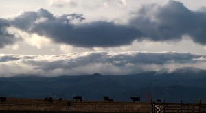
Rolling mountain wave clouds serve as a backdrop to cows in a field. Watching closely, snow can be seen falling on the highest mountain peaks. Zoomed in views of a wave cloud follow showing the amazing motion.
Lastly a sunset is seen with the clouds starting pastel orange, then turning brilliant bright orange before fading away.
The video is set to a very soothing flute-type instrumental. Check it out below.