All posts by Thornton Weather

ThorntonWeather.com is your local source for live Thornton, Colorado weather conditions and news!

Near perfect viewing of the Perseid meteor shower Wednesday & Thursday night

Stargazers have an extraordinary opportunity to see the Perseid meteor shower Wednesday and Thursday nights.

An extraordinary opportunity to view the annual Perseid meteor shower awaits those who stay up late or get up very early the next two days.  The night sky tonight and tomorrow will be lit up with the fiery fragments of Comet Swift-Tuttle thanks in part to moonless nights. 

For the 2010 show, the moon will not be up during the pre-dawn hours allowing a very dark sky to show off the meteors as they enter the Earth’s atmosphere. At its peak, observers this year may see as many as 100 Perseids per hour.

This is a great opportunity to see an extraordinary light show in the heavens. 

We have written a complete story on the Denver Weather Examiner including details on where and when to look .  Head over there to learn more!

CSU hurricane forecasters warn the worst of hurricane season is yet to come

Comparison of updated 2010 Atlantic hurricane season forecasts.

Despite what seems like a slow start to the Atlantic hurricane season, forecasters are warning that the worst is yet to come. In updates to their annual predictions released last week, Colorado State University (CSU) forecasters and the National Oceanic and Atmospheric Administration (NOAA) are sticking to their earlier forecasts of an above normal level of activity for 2010.

On Wednesday the professional team of Dr. Philip J. Klotzbach and Dr. William M. Gray at CSU said they were sticking with their original prediction of 18 named storms, 10 hurricanes and 5 major hurricanes (Category 3 or higher). The pair warns, “We anticipate a well above-average probability of United States and Caribbean major hurricane landfall.”

NOAA updated their annual forecast Thursday saying, “The Atlantic Basin remains on track for an active hurricane season” and that there was a “90% chance of an above normal season.” Warmer than average water temperatures in the Atlantic and Caribbean and low wind shear are expected to help storm generation. The agency did slightly lower its forecast to 14 – 20 named storms, 8 – 12 hurricanes and 4 – 6 major hurricanes.

Only three named storms so far in 2010

Hurricane Alex became a tropical storm on June 26th and a hurricane on the 29th. The storm became a Category 2 hurricane before making landfall in northeastern Mexico.

Tropical Storm Bonnie formed on July 22nd followed by Tropical Storm Colin on July 30th. Colin only survived for 12 hours initially then reconstituted itself late last week only to fall apart as it passed over Bermuda.

The worst is yet to come

Hurricanes can occur at any time of year but the peak period is from August to October. (NOAA)

Experts reminded the public that August and September are historically the most active months with the peak occurring during the second week of September. Dr. Gerry Bell of NOAA’s Climate Prediction Center said, “All indications are for considerable activity during the next several months.”

Keeping the public safe and aware is one of the primary purposes of the forecasts and despite the slow start to the season, they warn coastal residents not to be complacent. NOAA Administrator Jane Lubchenco said, “August heralds the start of the most active phase of the Atlantic hurricane season and with the meteorological factors in place, now is the time for everyone living in hurricane prone areas to be prepared.”

Related stories:

Fires across Russia spotted by NASA satellites

Satellite imagery released by NASA clearly shows the extent of the smoke plume from wildfires burning in western Russia. (NASA) Click the image to view a slideshow of the wildfires as seen from space.

More than 600 wildfires burning across Russia have clouded the skies and claimed the lives of at least 50 people. NASA has trained its satellites on the nation capturing imagery of the blazes as they continue to burn.

Seven regions of Russia are under state of emergency as officials struggle to gain an upper hand against the fires. All told, estimates are that more than 484,000 acres (196,000 hectares) have been scorched with no end in sight.

President Dmitry Medvedev fired several military officials today for their inability to slow the fires. Thousands of people have lost their homes as the flames continue unabated. A naval base in Kolomna was destroyed last week and a nuclear research facility in Sarov is now threatened.

The choking smoke over places like Moscow has added to the misery of what has been an unusually hot summer. The plumes of smoke are so extensive they can easily be captured by NASA satellites orbiting 22,300 miles above the surface of the Earth.

The imagery below was captured by NASA’s Terra satellite yesterday. In the top image, the plumes of smoke from the fires in western Russia stretch more than 1,800 miles (3,000 km). The lower image shows a closer view of the fires burning southeast of Moscow.

Satellite image showing the extent of the smoke plume from fires burning in Russia (NASA)
NASA satellite image of wildfires burning near Moscow, Russia. (NASA)

Satellite image of smoke from wildfires burning southeast of Moscow (NASA)
Satellite imagery of smoke from fires in western Russia. (NASA)

From NASA:

Intense fires continued to rage in western Russia on August 4, 2010. Burning in dry peat bogs and forests, the fires produced a dense plume of smoke that reached across hundreds of kilometers. The Moderate Resolution Imaging Spectroradiometer (MODIS) captured this view of the fires and smoke in three consecutive overpasses on NASA’s Terra satellite. The smooth gray-brown smoke hangs over the Russian landscape, completely obscuring the ground in places. The top image provides a close view of the fires immediately southeast of Moscow, while the lower image shows the full extent of the smoke plume.

The fires along the southern edge of the smoke plume near the city of Razan, top image, are among the most intense. Outlined in red, a line of intense fires is generating a wall of smoke. The easternmost fire in the image is extreme enough that it produced a pyrocumulus cloud, a dense towering cloud formed when intense heat from a fire pushes air high into the atmosphere.

The lower image shows the full extent of the smoke plume, spanning about 3,000 kilometers (1,860 miles) from east to west. If the smoke were in the United States, it would extend approximately from San Francisco to Chicago. The MODIS sensor acquired the right section of the image starting at 5:55 UTC (10:55 a.m. local time, 8:55 a.m. in Moscow). The center section is from the overpass starting at 7:35 UTC (11:35 local time, 10:35 in Moscow), and the westernmost section was taken at 9:10 UTC (12:10 p.m. local time in Moscow).

Early analyses of data from the Multi-angle Imaging Spectroradiometer (MISR), another instrument on the Terra satellite, indicates that smoke from previous days has at times reached 12 kilometers (six miles) above Earth’s surface into the stratosphere. At such heights, smoke is able to travel long distances to affect air quality far away. This may be one reason that the smoke covers such a large area. The pyrocumulus cloud and the detection of smoke in the stratosphere are good indicators that the fires are large and extremely intense.

According to news reports, 520 fires were burning in western Russia on August 4. MODIS detected far fewer. It is likely that the remaining fires were hidden from the satellite’s view by the thick smoke and scattered clouds. High temperatures and severe drought dried vegetation throughout central Russia, creating hazardous fire conditions in July.

As of August 4, 48 people had died in the fires and more than 2,000 had lost their homes throughout central Russia, said news reports. The dense smoke also created hazardous air quality over a broad region. Visibility in Moscow dropped to 20 meters (0.01 miles) on August 4, and health officials warned that everyone, including healthy people, needed to take preventative measures such as staying indoors or wearing a mask outdoors, reported the Wall Street Journal. In the image, Moscow is hidden under a pall of smoke. Close to the fires, smoke poses a health risk because it contains small particles (soot) and hazardous gases that can irritate the eyes and respiratory system. Smoke also contains chemicals that lead to ozone production farther away from the fires.

The large image provides the full scene shown in the lower image at the sensor’s highest resolution (as shown in the top image). The MODIS Rapid Response Team provides the scene in additional resolutions.

References

  1. BBC News. (2010, August 4). Medvedev cuts holiday as Russian wildfires kill 48. Accessed August 4, 2010.
  2. Iosebashvili, I. (2010, August 4). Death toll rises as Russian fires rage. Wall Street Journal. Accessed August 4, 2010.

NASA image courtesy Jeff Schmaltz, MODIS Rapid Response Team at NASA GSFC. Caption by Holli Riebeek with information courtesy Mike Fromm, Naval Research Laboratory.

August 8 to August 14 – This week in Denver weather history

August 8 to August 14 - This week in Denver weather history

Monsoon season in Colorado typically brings short-lived but heavy rains.  These can result in flash flooding and we see that in our look back at this week in Denver weather history.  Also notable are the number of lightning deaths and injuries as well as hail events and even a swarm of grasshoppers!

In 1874…swarms of grasshoppers invaded the city.  Millions of them were seen cruising through the air.  The insects were apparently picked up by a thunderstorm gust front and carried into the city.  The grasshoppers had ravaged crops in surrounding counties for the last month.
 
In 1878…the highest temperature ever recorded in Denver…105 degrees…occurred at 3:20 pm.  This temperature was equaled on July 20th in 2005.
 
In 1969…the temperature reached 100 degrees at Stapleton International Airport.
 
In 1976…in Thornton…a 13 year old boy riding a bicycle was struck and killed by lightning.
 
In 2000…lightning struck three homes in central Arapahoe County east of Denver.  Damage was estimated at 47 thousand dollars.
 
In 2003…hail to 1 inch in diameter pelted Denver.  Hail to 7/8 inch was measured in Boulder.
 
In 2008…heavy rain also caused flash flooding over south Denver and its nearby suburbs. Heavy rain…from 2.5 to 4 inches…fell in less than 90 minutes.  Firefighters rescued 20 people as the water quickly rose along creeks…flooded roadways…and stranded motorists.  Three people had to be rescued along Cherry Creek when the bike path flooded.  In Evergreen…a man suffered minor injuries when he was struck by lightning.  It entered his finger…traveled down his body… And exited his foot.

Continue reading August 8 to August 14 – This week in Denver weather history

NASA satellites capture images of deadly flooding in Pakistan

Flooding in Pakistan is easily seen in this satellite image released by NASA.  See larger images below and click here to view images from on the ground in Pakistan. (NASA)
Flooding in Pakistan is easily seen in this satellite image released by NASA. See larger images below. (NASA)

While Colorado has witnessed some pretty good rain showers in recent days due to the monsoon season, it is nothing compared to what Pakistan is experiencing.  Seemingly endless monsoonal rains have flooded hundreds of thousands of acres in Pakistan that were easily spotted by NASA satellites.

The floods, said to be the worst in the nation since 1929, have claimed more than 1,500 lives and affected 3.2 million people. Entire villages have been submerged by the water that continues to rise across large swaths of the nation.

By comparison, Colorado’s worst natural disaster was the Big Thompson Flood which killed 143 people in 1976.  This occurred during our own monsoon season but pales in comparison to what is happening in Pakistan. 

The images taken by NASA on July 31st show the Indus River in northwestern Pakistan clearly overflowing. The difference between the image taken this year versus one taken on August 1, 2009 provide a stark contrast that demonstrates how much worse this season is.

Flooding in Pakistan – Image captured July 31, 2010 (NASA)
Satellite image of flooding in Pakistan along the Indus River. (NASA)

Pakistan – Image captured August 1, 2009 (NASA)
Satellite image of flooding in Pakistan along the Indus River. (NASA)

More on the Pakistan flooding: Floods ravage Pakistan killing 1,500 and affecting millions

Slideshow: Death and devastation as monsoon rains flood Pakistan

Russians caught in raging wildfire – Amazing video

This screenshot from a YouTube video shows flames coming dangerously close to volunteers that went to help those in need as wildfires burn across western Russian. (YouTube)  Watch the video below.
This screenshot from a YouTube video shows flames coming dangerously close to volunteers that went to help those in need as wildfires burn across western Russian. (YouTube) Watch the video below.

Wildfires have been sweeping across European Russia in recent days prompting the government to declare a state of emergency. A recently released video shows how the fast moving blazes can turn a relatively calm situation into a desperate flight – and flight – for life in the face of advancing flames.

The video, released on YouTube, shows volunteers that went to the village of Tamboles to assist residents finding themselves instead in need of help.

The translated caption for the video explains that the vehicle’s occupants passed along the same road a half hour before and there was no hint of the fire. When they went to return, they were surrounded by flames as trees and brush burned around them and they were confronted with walls of flame.

Listening to the audio in the video one does not have to speak Russian to understand the desperateness of the situation they are in. Amazingly enough, the vehicle and its occupants survived their fiery journey.

Solar flare headed to Earth; Expected to light up the sky in some parts of the nation

This X-ray photo of the Sun was taken by NASA's Solar Dynamics Observatory (SDO) on Sunday morning, August 1st.  The dark area near the top right edge is a filament of plasma being ejected, part of the coronal mass ejection (CME).  The bright region on the left half is an unrelated flare. (NASA)  Watch video of the ejection at the link below.
This X-ray photo of the Sun was taken by NASA's Solar Dynamics Observatory (SDO) on Sunday morning, August 1st. The dark area near the top right edge is a filament of plasma being ejected, part of the coronal mass ejection (CME). The bright region on the left half is an unrelated flare. (NASA) Watch video of the ejection at the link below.

A large solar flare on Sunday is expected to strike the Earth tonight treating sky watchers in the northern United States to a display of aurorae. The increased activity is being monitored by NOAA’s Space Weather Prediction Center (SWPC) in Boulder.

The ejection of charged particles from the sun follows a period of relative calm in terms of solar activity. What is being termed a “solar tsunami” – a wall of charged ion particles – is expected to trigger a geomagnetic storm visible in the northern latitudes.

The aurorae, normally only visible at extreme northern latitudes, are expected to put on a show for areas as far south as the northern contiguous United States the nights of August 3rd and 4th. 

Unfortunately for those in Colorado, the phenomena won’t be strong enough to reach the state. But, those in Oregon, Montana, North Dakota and other states further north should be able to witness the event.

You can get the rest of this story including seeing some amazing video of the eruption on the Denver Weather Examiner.
There's more to this story on Examiner.com!

August 1 to August 7 – This week in Denver weather history
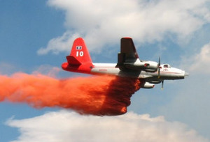
August 1 to August 7 - This week in Denver weather history

August isn’t normally associated with severe weather but our look back at the history books show it certainly can and does happen.  We see many occurrences of dangerous lightning and of particular note is the flood events – a byproduct of the monsoon season the first of August brings.

18-2 

In 1987…a streak of 16 consecutive days of 90 degrees ranked 4th on the list of hot streaks.  The record of 24 consecutive days was established in the summer of 2008.

1

In 1888…heavy rain in the mountains and foothills caused flooding on clear creek in Golden.  The high waters also washed away portions of the railroad tracks in the canyon between Idaho Springs and Golden.
 
In 1901…the temperature reached a high of 100 degrees in the city.
 
In 1902…the high temperature climbed to 100 degrees in downtown Denver.
 
In 1914…a thunderstorm produced 1.00 inch of rainfall in just 21 minutes and north winds sustained at 43 mph with gusts to 50 mph.  Rainfall totaled 1.17 inches.
 
In 1938…the temperature climbed to a high of 100 degrees in downtown Denver…which is the record maximum for the date.  The temperature was also recorded on this date in previous years.
 
In 1976…flight operations at Stapleton International Airport were suspended for 90 minutes when the airport tower radar was knocked out and water reached a foot deep on some taxi ramps after 1.50 inches of rain fell in one hour.  Heavy rain also caused minor flooding in east Denver and Aurora where lightning damaged the roof of a home and injured the owner.  One young man was swept down a flooded ditch…but was rescued by firemen.  A number of rafts were floated in flooded streets.  Thunderstorm rainfall totaled 1.71 inches at Stapleton International Airport.
 
In 1978…a tornado damaged a house and broke a power pole 5 miles northwest of Parker.  A microburst wind gust to 52 mph briefly reduced visibility to 1 mile in blowing dust at Stapleton International Airport.
 
In 1985…heavy thunderstorms roared through the southern and western sections of metro Denver…producing large hail and heavy rain.  Lightning hit a recreational vehicle trailer causing it to burn.  There was a lot of street flooding over western suburbs where rainfall totaled over 2 inches in some areas.  One inch diameter hail was reported in Littleton and near Evergreen.  Hail piled 4 to 6 inches deep at Tinytown in the foothills southwest of Denver.
 
In 1990…a small rope-like tornado was spotted in open country 15 miles southeast of centennial airport. No damage was reported from the twister.
 
In 1992…pilots reported a funnel cloud near the construction site of the new Denver International Airport.  A few minutes later…a tornado was reported near Bennett.  The tornado remained on the ground for about 18 minutes and was visible from the national weather service office at Stapleton International Airport.  Thunderstorm wind gusts to 70 mph were reported near Bennett and Watkins with a wind gust to 60 mph at Brighton.  Two men were injured when struck by lightning.  A young man sustained serious injuries when struck by lightning while jet skiing on Cheery Creek Reservoir.  A man received only minor injuries when struck by lightning while golfing in Westminster.
 
In 1994…heavy thunderstorm rains in the foothills west of Denver caused the closure of the Virginia Canyon Road north of Idaho Springs by rocks and debris.
 
In 2001…a 34 year old man on the South Platte River bike path in Denver received minor injuries when lightning struck a nearby tree.  Lightning…coupled with strong thunderstorm winds…knocked out electrical power to about 10 thousand homes and businesses in Golden.
 
In 2006…strong thunderstorms hit southern metro Denver. A severe thunderstorm wind gust estimated to 71 mph knocked down a tree in Aurora near Cherry Creek. Lightning sparked a fire in a home near Lone Tree and struck a transformer at an RTD light rail station at Interstate 25 and Yosemite street.  Heavy thunderstorm rainfall forced the closure of Arapahoe road between Holly and Quebec streets due to high water.  Flooding was also reported near park meadows mall and greenwood village.  Heavy rainfall also caused flooding in Highlands Ranch…Lone Tree…and Parker.  Water up to 6 inches deep was reportedly running over the roads.

Continue reading August 1 to August 7 – This week in Denver weather history
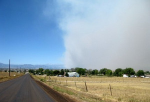
34 years ago today – the Big Thompson Flood remembered

The Big Thompson Flood in 1976 claimed the lives of 143 Coloradoans in what is Colorado's deadliest natural disaster.

July 31, 1976 started like most other summer days in Colorado. It was 1976 and the nation was celebrating its bicentennial and Colorado was celebrating its centennial. What should have been a quiet summer day quickly turned disastrous as the Big Thompson Flood killed more than 100 people in Colorado’s deadliest natural disaster.

In terms of weather, the day started out much like one would expect but by late afternoon storm clouds loomed over the mountains. Mountain thunderstorms are an almost daily occurrence in Colorado but the storm that struck in the early evening that day was unlike any other.

With light winds aloft, the storm stalled over the upper portion of the Big Thompson basin where it sat dumping tremendous amounts of rain – nearly 8 inches in one hour and 12 inches over four hours. The rain came so fast that the water didn’t have time to be absorbed into the ground.

I’m stuck, I’m right in the middle of it, I can’t get out…about a half mile east of Drake on the highway. Get the cars out of the low area down below…
~ Radio transmission by Sergeant Willis Hugh Purdy, Colorado State Patrol. Purdy was never heard from again.

In the mid-sections of the canyon and lower, there was little indication of what was to come. The flash flood that resulted from the rain further up rushed down the canyon creating a wall of water that was 20 feet high in places. The flood scoured the canyon of everything – cars, homes, buildings and people.

The following day the Rocky Mountain News ran with the headline “Scores dead, hundreds hurt in Big Thompson flash flood.” A subheading said, “U.S. 34 west of Loveland is no more.”

When the flood was over, 143 people had lost their lives, more than in any other natural disaster in state history. 418 homes, 52 businesses and 400 cars were destroyed at a cost of over $40 million.

More coverage:

This story was originally published on the Denver Weather Examiner.  Be sure to visit Examiner.com for all the latest Denver and Colorado weather news and information.

A look at Denver and Thornton’s August weather

Denver and Thornton's August weather preview and history.

As summer vacations wind down and families prepare to send their kids back to school in August, Colorado weather also starts to settle down. The chances for severe weather decrease markedly during August and by the end of the month daytime temperatures are dropping quite a bit as well.

At the start of the month Denver usually averages around 88 degrees for a high temperature. By the end of August that drops to 82 degrees. Similarly, nighttime lows drop from 60 to 53 from the start to the end of the month.

Generally clear skies can be expected between midnight and noon but the afternoon often brings showers and thunderstorms. These storms typically develop over the foothills then bring precipitation to the Denver metro area.

Get all the details including complete statistics and a look back at August 2009 in our August weather preview here.