The fall colors on the Colorado Front Range are a bit of a mixed bag this year but are about as good as they will get right now. Two days after work this week I took my drone out to a couple spots to capture the scenery along the South Platte River. Sit back, make it full screen, and enjoy the view.
Tag Archives: Video
Video: Impressive dust storm charges south across Mexico
Absolutely insane satellite imagery from CSU’s Cooperative Institute for Research in the Atmosphere (CIRA) of a dust storm as it moves south across northern Mexico this past Saturday.
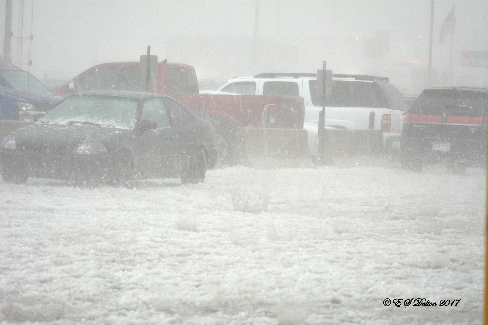
Video: Time lapse of February 27, 2024 snow squall
Well, that was fun! Things happened fast and a Snow Squall Warning was issued for an hour or so. In that time Thornton received a fast-hitting 2.3 inches of wet snow. We welcome the precipitation and it was certainly fun to see.
The video below shows four hours in 10 seconds – from partly sunny skies to driving snow and then back again.
Video: Lightning crawls across the Thornton skies in the early morning
Quite the impressive storm cell this morning. While we only got a light shot of rain, the light and sound show was very cool. This video from Jessica Fey gives a sample.
Time lapse video: Thornton’s January 28, 2019 snowstorm
Well, that was fun, eh? Well, probably not for those stuck in traffic when the snowstorm hit this morning.
The storm over-performed big time, far exceeding forecasts. Upslope flow pushed the system against the mountains and kept it in place over the Front Range.
Our east webcam captures it all in a time lapse.
Snow begins at about 3:00am and continued through much of the morning. By the end of the day though, blue skies returned and the snow was melting. We recorded 4.2 inches here but know many spots, particularly to the west, got more.
Video: Remembering Denver’s record-setting May 8, 2017 hailstorm
The weather forecast for May 8, 2017 was relatively typical for this time of year with pleasant temperatures and a sunny morning. We also wrote about the usual chance for PM thunderstorms but cautioned they could be potent saying, “Strong winds, large hail and possibly an isolated tornado will be possible.”
Little did we know just how potent they would be.
The thunderstorms that rolled through the Denver metro area that day brought monstrous hail, destroying windows, roofs, siding and vehicles.
As expected, the worst of the storms stayed south of Thornton but the areas that were hit from Golden to just north of downtown Denver were devastated. The tally to date is $2.3 billion in damage.
Fox 31 did a special on the storm last year and it makes for an interesting look back – and a reminder of the power of Mother Nature.
Video: Thornton’s surprising pre-Christmas snow
We were expecting snow but not quite as much as received. The storm that hit yesterday evening delivered a respectable 3.5 inches to Thornton as snow bands were quite strong and aided by upslope. Temperatures early this morning dipped well into the single digits, our coldest readings since January 7.
The time lapse video below captures four hours of the event as it started and then began to taper off.
Watch: Drone Footage Shows California Fire Devastation Aftermath
|
Time lapse video captures lenticular clouds along the Front Range
Thornton resident Shannon Dizmang put his camera to good use and captured a stunning time lapse video of some lenticular clouds that developed this afternoon.
Also known by their scientific name of altocumulus standing lenticularis, these clouds are not entirely unusual in Colorado on the Front Range during the winter. Strong jet winds force moist air to be pushed up by the rugged terrain of the adjacent Rocky Mountains. This creates a wave-like pattern of air flow that condenses at high altitudes (usually around 20,000 feet).
Time lapse video: Thornton’s first snowstorm of 2017
Mother Nature seems intent on starting out 2017 the way she ended 2016 – cold. A deep trough coupled with successive, reinforcing cold fronts sent Thornton’s mercury plunging and delivered a healthy shot of snow over the last couple of days.
Below is a time lapse video from our east webcam covering the majority of the event. It begins at 6:00am on Wednesday, January 4 when we were only seeing flurries. From there you see the varying intensities of snow over the next 24 hours or so and end with some hints of blue sky but the afternoon of the 5th. In all, the video covers 36 hours in about 83 second.
Thornton ended with 7.1 inches of snow over the two-day period, our biggest snowfall of the season thus far.