All posts by Thornton Weather

ThorntonWeather.com is your local source for live Thornton, Colorado weather conditions and news!

A snowy and slick commute for Thursday

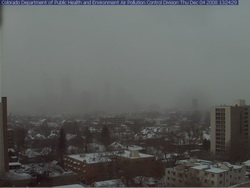
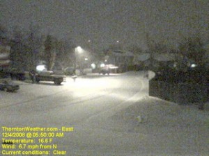
The scene at ThorntonWeather.com at 5:50am today.  Click the image for a current weather webcam view.
The scene at ThorntonWeather.com at 5:50am today. Click the image for a current weather webcam view.

The snow arrived overnight and as of 5:00am ThorntonWeather.com had measured 1.3” and it was still coming down pretty good.  Due to the extreme cold – 17 degrees and a windchill of 5 degrees as of this writing – the roads are quite slick.  This morning we found residential streets to be the worst of course but main arterials like 120th Ave were not in too good of shape either.  Please allow plenty of time to get the kids to school and yourselves to work, allow plenty of distance between you and other cars and just take your time. 

A surge of cold air from the north is expected to intensify the snowfall in the coming hours and a bit of upslope will keep the flakes falling for most of the day.  Accumulations though won’t be all that great – look for 2 to 4 inches overall.  Snow will taper off this evening from the north to the south and completely end in the metro area around midnight.

Friday and this weekend are shaping up great but that could be short lived.  We are watching a cold front coming from Montana that could bring more cold and snow toward the first part of next week.

Snow finally comes to the Front Range

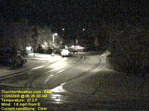
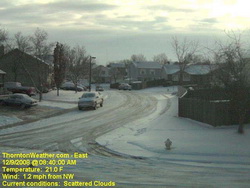
An early morning image from the ThorntonWeather.com east webcam.  Click for larger view.
An early morning image from the ThorntonWeather.com east webcam. Click for larger view.

With only two days to go in the month, things were pretty bleak and we were dangerously close to joining the “top 10” for the least snowiest Novembers in Denver.  That changed in pretty short order last night.  Forecasters were expecting about an inch of snow but the local storm reports indicate most areas exceeded that handily. 

Here in Thornton we started with a touch of rain in the evening which changed to snow as time went on and the temperature dropped.  In the end we recorded 4.1″ of the white stuff, most of which fell between 10:00pm and midnight. 

The National Weather Service in Denver is officially showing 2.4″ of snow at the old Stapleton International Airport site.  At Denver International Airport they recorded 1.6″. 

Some of the other snow reports that have come in (Updated @ 11:15am):

  • Arvada – 2.4″
  • Brighton – 1.5″
  • Conifer – 2.5″
  • Denver (north) – 1.5″
  • Denver (Stapleton) – 3.2″
  • Denver (DIA) – 1.7″
  • Elizabeth – 3.2″
  • Evergreen – 3.2″
  • Erie – 4.5″
  • Highlands Ranch – 3.0″
  • Henderson – 3.0″
  • Highlands Ranch – 4.5″
  • Lakewood – 3.8″
  • Lone Tree – 3.2″
  • Parker – 1.8″
  • Thornton – 4.1″
  • Westminster – 2.2″

For other totals, please see our local storm reports page.

2008 Atlantic hurricane season sets record

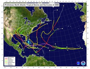
This image shows the tracks of hurricanes that occurred during the 2008 season.  Click for larger image.
This image shows the tracks of hurricanes that occurred during the 2008 season. Click for larger image.

Sunday, November 30th marks the close of the hurricane season and the National Oceanic and Atmospheric Administration says it was one for the record books.  The season marks one of the more active in the last 64 years overall and resulted in a record number of consecutive storms striking the United States.

According to Gerry Bell, Ph.D, the lead seasonal forecaster at NOAA, “This year’s hurricane season continues the current active hurricane era and is the tenth season to produce above-normal activity in the past 14 years.”  It is important to note however that comprehensive record keeping of hurricanes has only been occurring for the last 64 years so there is not a great deal of data to draw upon.

In all, a total of 16 named storms formed this season, eight of which were hurricanes.  Five of those were major hurricanes of category 3 strength or higher.  An average hurricane season has 11 named storms, six hurricanes and two major hurricanes.  In May at the start of the 2008 season, NOAA forecasters predicted 12 to 16 named storms and then in August upped their predictions to 14 to 18 named storms.  This represents the first time in recent years forecasters had accurately bracketed the number of storms.  In 2007 NOAA predicted 10 hurricanes and only six formed. The year prior, 2006, nine hurricanes were forecasted by NOAA but only five formed.  In 2005, the year Hurricane Katrina devastated New Orleans in the worst U.S. natural disaster, the forecasts underestimated storm activity.

2008 ties as the fourth most active season in terms of named storms (16) and major hurricanes (5).  It also tied as fifth most active in terms of hurricanes overall (8) since 1944. 

From NOAA, most notably:

For the first time on record, six consecutive tropical cyclones (Dolly, Edouard, Fay, Gustav, Hanna and Ike) made landfall on the U.S. mainland and a record three major hurricanes (Gustav, Ike and Paloma) struck Cuba. This is also the first Atlantic season to have a major hurricane (Category 3) form in five consecutive months (July: Bertha, August: Gustav, September: Ike, October: Omar, November: Paloma).

Bell attributes the active season to ongoing increased activity since 1995, lingering La Nina effects and warmer tropical Atlantic Ocean effects.

Here is a fascinating video from NOAA using satellite imagery of the entire hurricane season:

Green skies – Storm Chasers episode 7 sneak peek

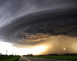
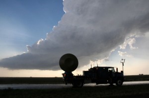
The Doppler On Wheels (DOW) surveys storm clouds looking for tornadoes.

Our friendly little bird from the Discovery Channel continues to offer us – and you – sneak peeks of coming episodes of Storm Chasers.  The episode guide for this coming Sunday’s episode says:

HAIL TO THE BEAST – Nov. 30 at 9 p.m. ET/PT
Reed and Josh’s teams struggle to find the perfect storm in Nebraska. Reed’s girlfriend Jene gets lost in a deadly hailstorm while the DOW fleet mistakenly drives into an oncoming tornado.

The sneak peek the Discovery Channel has offered us this week is aptly titled, “Green Skies.”  As anyone who has been around severe weather knows, green skies mean hail – and tornadoes.  We see this is Denver occasionally but in this clip, the TornadoVideos.net team finds themselves separated from each other while under a sky completely filled with green clouds.  It is a rather eerie – and scary – effect.

For more information:  The Discovery Channel – Storm Chasers

December weather preview – What to expect

December weather preview - what can we expect in Denver?

December brings with it the official start to winter and at the same time we find ourselves hoping we get moisture in the near future. As of this writing, the mountain snowpack in all basins are well below normal, with some as low as 27% of normal. Here in town our our annual snowfall is well below normal as well. In Colorado the snow season starts on July 1st and between that date and November 30th, Denver averages 16.9 inches of snow. Thus far, ThorntonWeather.com has measured a meager 0.2 inch and the official total for Denver taken at the site of the old Stapleton International Aiport stands at 0.8 inch!

So what can we expect in the coming month?  Click here to read our December 2008 climate and weather preview to find out!

Remote control hurricane hunters set to deploy

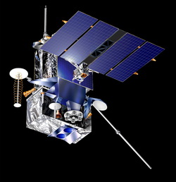
NASA uses unmanned UAVs as hurricane hunters.

Anyone who has followed the wars in Iraq or Afghanistan has heard about the use of Unmanned Aerial Vehicles (UAV).  These are essentially remote control airplanes capable of performing a number of tasks from surveillance to actually carrying weapons. 

NASA and NOAA have over the last year been experimenting with a small UAV from Aerosonde, an Australian manufacturer.  NOAA currently uses manned hurricane hunter aircraft (WP-3D Orion and Gulfstream IVs) to take measurements from inside and immediately surrounding hurricanes.  This data is essential to not only predicting hurricane paths and guaging the storms’ strength but also to learning more about them. 

These new UAVs offer many advantages over the traditional, manned hurricane hunter aircraft.  For one, they can fly at much lower altitudes into the storms without endangering human lives.  Further, they can be called into service on much shorter notice than a manned crew and remain on station around a storm for longer periods of time.  In November of 2007 NOAA sent an Aerosonde UAV into Hurricane Noel and the unit was airborne for over 17 hours and collected more than seven hours worth of data. 

The technology has many applications within NOAA’s mission of monitoring our globe.  In addition to hurricane hunting, UAVs can be used to monitor ice flows, wildfires, severe weather, animal life and much more.  The program is really just getting started and funding is minimal in comparison to the military equivalent but the applications are very promising.  Maybe a tornado hunter is next!

Here’s a video from Aerosonde discussing the potential applications.

November 23 to 29 – This week in Denver weather history

November 23 to 29 - This week in Denver weather history.

PUBLIC INFORMATION STATEMENT
NATIONAL WEATHER SERVICE DENVER CO
645 PM MST SAT NOV 22 2008

…THIS WEEK IN METRO DENVER WEATHER HISTORY…

21-23

IN 1918…POST-FRONTAL SNOWFALL TOTALED 5.9 INCHES IN DOWNTOWN
DENVER. MOST OF THE SNOW…5.3 INCHES…FELL ON THE 22ND.
NORTH WINDS WERE SUSTAINED TO 20 MPH ON THE 21ST.
IN 1931…A MAJOR STORM DUMPED A TOTAL OF 13.2 INCHES OF
SNOWFALL OVER DOWNTOWN DENVER. MOST OF THE SNOW…11.4
INCHES…FELL ON THE 21ST. A VERY COLD AIR MASS SETTLED
OVER THE CITY AFTER THE HEAVY SNOW ON THE 21ST. AFTER A
LOW TEMPERATURE OF ZERO…THE TEMPERATURE CLIMBED TO A HIGH
OF ONLY 5 DEGREES ON THE 22ND…A RECORD LOW MAXIMUM FOR THE
DATE.

21-25

IN 1952…SNOWFALL OF 6.2 INCHES WAS MEASURED AT STAPLETON
AIRPORT WHERE NORTHEAST WINDS GUSTED TO 17 MPH ON THE
21ST.

Continue reading November 23 to 29 – This week in Denver weather history

ThorntonWeather.com sneak peek – Storm Chasers episode 4 preview

Now that is heavy metal!  The TIV 2 is a machine designed specifically for driving into a tornado.  Image courtesy Discovery Channel.
Now that is heavy metal! The TIV 2 is a machine designed specifically for driving into a tornado. Image courtesy Discovery Channel.

The 2008 tornado season was historical for its ferocity.  Record breaking numbers of twisters struck Tornado Alley with a frequency not seen in years.  In June, north central and western Kansas were ground zero for tornado outbreaks that went on for days. 

ThorntonWeather.com continues to be granted special access to the Discovery Channel’s Storm Chasers (Sunday’s @ 8:00pm MST) footage.  In this coming Sunday’s episode, the crew finds itself right in the thick of things.  The episode guide says:

No Place Like Kansas – Nov. 23 at 10 p.m. ET/PT
With the DOW and all the chase vehicles up and running again, the team finds themselves hunting in the same territory as the rival TVN crew. Tornadoes are forming all over western Kansas on what looks like the biggest day of the season.

This week’s sneak peak – A funnel cloud begins to form in the skies over Quinter, Kansas as the the Storm Chasers scramble to approach it.

How about earthquakes and wildland fires?

ThorntonWeather.com now features earthquake activity reports and wildland fire maps.

Thanks to the wonderful community that surrounds weather station operators, we are pleased to announce two new features added to our site.

Our new Earthquake Activity page displays earthquake data directly from the United States Geological Survey (USGS).  A report at the top highlights activity within 500 miles of Denver and a map displays activity nationwide. 

Also new is our Wildland Fire Activity page that shows an integrated Google Map of all recent major wildland fires in the continental United States.  You can click on any incident to get more details.  Below the map is the latest wildland fire news from FireHouse.com.  In light of the recent fires in California, this is a timely addition.  Special thanks to one of our regular visitors, David Canfield, for this suggestion. 

Both items are now available under the Almanac menu item on the left. 

Do you have an idea of something you would like to see added or improved on ThorntonWeather.com?  Don’t be shy!  Let us know!  Click here to contact us.

NOAA says October hottest on record – Oops – Maybe not

In this GISS image, incorrect data shows much of Russia under a heat wave in October.

Scientists at NOAA and NASA’s Goddard Institute for Space Studies (GISS) announced last week that October global temperatures were the hottest on record.  Naturally this caused quite a bit of hubbub and had the global warming alarmists in quite an uproar.  As we wrote about previously, the year has been cooler than normal in North America but this new data showed that Asia experienced record high temperatures last month.  Word of the “hottest October on record” quickly spread of course. 

In a bit of an embarrassment for NOAA and GISS, their claims were short lived when two blogger meteorologists went through the data and found a number of anomalies.  They discovered at least 10 Russian stations that oddly enough reported the exact same temperatures as September.  Well, since October is almost always cooler than September in the northern hemisphere they did some checking and found that GISS had used the incorrect data and it influenced the calculations significantly. 

Al Gore's infamous "hockey stick" graph that was used in An Inconvenient Truth was quickly debunked, as were many other "facts" used in the movie.
Al Gore's infamous "hockey stick" graph that was used in An Inconvenient Truth was quickly debunked as were a number of other "facts" used in the movie.

This isn’t the first time “anomalies” with data used to measure the earth’s temperature have been discovered and have caused incorrect calculations.  In other curious happenings, measuring stations have “disappeared” from data only to reappear later, stations have been found to be sitting next to heaters and gas wells and more.  Then of course there was Al Gore’s infamous “hockey stick” graph which was debunked soon after he began showing it.  Perhaps in the most grievous error just last year, NOAA had to revise their published figures for U.S. surface temperatures, to show that the hottest decade of the 20th century was not the 1990s, as they had claimed, but the 1930s.

When GISS and NOAA recalculated October’s temperatures it dropped the month to the 2nd warmest on record and that is significant.  However, these types of problems serve only to fuel doubt in the minds of climate change skeptics and highlight the need for more careful analysis and a level-headed approach to studying the subject – from both sides of the discussion. 

For more information:  NOAA – National Oceanic and Atmospheric Administration