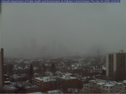
If you can, get out of work early today as the roads are sure to be a mess during rush hour. Snow has been falling across the Front Range all day and snow totals for the metro area are in the 2 to 4 inch range. Probably just as notable is the bitter cold we are seeing – at 1:00pm DIA was showing 17 degrees and a wind chill of only 2 degrees. Denver’s high temperature today will most likely be 22 degrees but that was reached at 1:00am! The wind will continue to keep the wind chills down around zero so bundle up if you head out.
The snow will continue through 11:00pm although accumulations will be pretty light. The north, west and southern suburbs could see up to 6 inches of snow while the central metro area will end up with around 2 to 4 inches. Areas of Larimer and Weld Counties including Fort Collins and Greeley will see between 5 to 10 inches of snow.
A Winter Weather Advisory is in effect for the I-25 corridor north of Longmont as well as most of the central and northern mountains areas. The extreme eastern portions of the state are under an advisory as well. In the mountains, eastbound I-70 has chain restrictions in place at the Eisenhower Tunnel, Loveland Pass and at Vail.
Tonight we will dip into the single digits but Friday brings us back into the 40’s and the weekend looks great.

Whoohoo! Bring it on! I want a blizzard! 🙂 Sadly it doesn’t look like this storm is the one though.