This screen capture shows a car being carried away by a flash flood in Toowoomba, Australia. Click the image to watch the amazing video on Examiner.com.
The death toll from the relentless flooding in Queensland, Australia continues to climb as four people were killed in a flash flood. The rising waters have inundated an area covering hundreds of thousands of square miles and now threaten the city of Brisbane.
The most recent fatalities, two adults and two children, occurred near the city of Toowoomba when flash floods swept their vehicle from the road. A wall of water as high as 26 feet (eight meters) raged through the area in the wake of a rainstorm.
Cars, furniture and people were tossed around by the rushing waters and search and rescue operations continue as fears of additional deaths weigh heavily. The waters hit with enough intensity to move houses from their foundations and landslides covered highways.
Premier Anna Bligh told a press conference, “Mother Nature has unleashed something shocking on Toowoomba.”
Snow now covers nearly three quarters of the lower 48 states and 47 of the 48 have at least some snow. (NOAA)
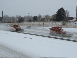
For much of the lower 48 states of the United States the 2010 to 2011 winter season has been a rough one. Blizzards and snowstorms have stretched into the Deep South and this morning data shows that nearly three quarters of the nation is covered in snow.
The latest analysis from NOAA’s National Operational Hydrologic Remote Sensing Center shows 69.4% of the lower 48 states covered in snow as of this morning. This is a significant increase over the 33.1% cover seen in December and bests the previous snow season’s highest number.
Perhaps most interesting is that 47 of the lower 48 states and 49 of all 50 states including Hawaii have at least some snow with the only exception being Florida. Even the Deep South reaching nearly to the Gulf of Mexico is covered in a blanket of white today after ice and snow pummeled the region yesterday. Early this morning only five of the 48 did not have some sort of a winter weather warning or advisory in effect.
January 9 to January 15 - This week in Denver weather history
Winds along the Front Range this time of year can be a blessing and a curse all at once. Chinook’s can warm temperatures well above what they normally would but they can also cause a great deal of damage when they are at their hardest. We see these contrasts in our look back at this week in Denver weather history.
From the National Weather Service
7-10
In 1962…a major winter storm dumped 13.5 inches of snow on metro Denver. A foot of the snow fell on the 8th when northeast winds gusted to 30 mph. The storm was followed by an intense blast of very cold arctic air. Minimum temperature readings of 24 degrees below zero occurred on both the 9th and 10th. The temperature never reached above zero on the 9th when a maximum reading of 1 degree below zero was recorded. Temperatures were below zero for 37 consecutive hours.
8-9
In 1891…heavy dry snowfall totaled 9.7 inches over downtown Denver. Most of the snow…6.5 inches…occurred on the 8th when north winds were sustained to 12 mph with gusts to 20 mph.
In 1939…heavy snowfall totaled 6.7 inches in downtown Denver. The snowfall was the heaviest overnight…particularly during the early morning hours. The moist snow adhered to the north side of the instrument shelter and other objects to a depth of 2 inches. Snow accumulated on fences and trees to several inches. This was the greatest snowfall of the month that year. The greatest depth on the ground was 6.5 inches. North to northwest winds were sustained to 24 mph on the 8th and to 27 mph on the 9th.
8-10
In 1983…winds of 70 to 90 mph howled through Boulder. A wind gust to 100 mph was recorded on Fritz Peak near Rollinsville. A tree blown down by the wind damaged a house in eastern Boulder County. The strong winds developed behind a cold front late on the 8th and continued through the 10th. At Stapleton International Airport…west to northwest winds gusted to 49 mph on the 8th…to 45 mph on the 9th…and to 48 mph on the 10th.
Not since the 1888 to 1889 snow season has Denver seen less snow this far into the snow season than this year.
Amid record-setting snowfall in northern Europe this winter and blizzards on the U.S. East Coast, one place that normally sees its fair share of snow has been left high and dry. The Mile High City is facing a snow drought of near record proportions having thus far experienced its worst snow season in 122 years.
Denver’s snow season is from July through June and through the end of December Denver has recorded a mere 4.8 inches of snow. The majority of that (3.3 inches) was received from a pre-New Year’s storm on December 30th. Here in Thornton we have fared a mere 0.1 inch more snow for a total of 4.9 inches.
On average the city sees 25.6 inches from July through December and the pitiful show so far gives the 2010 to 2011 season a 20.8 inch snow deficit to date. Only one other time in the 128 years that snow records have been kept in Denver has so little snow been recorded to this point in the season.
One has to look back to the 1888 to 1889 season to find a more dismal snow season. It was that season 122 years ago that 3.8 inches of snow had been recorded by the end of December. The next worst season up to December was two seasons later when 5.5 inches was recorded.
2010 was a relatively uneventful year for weather in Thornton.
Many years in Colorado are marked by significant weather events. The Christmas Blizzards of 2006, the severe thunderstorms that dominated June of 2009 or reaching even further back the Thornton Tornado of 1981. The same can’t entirely be said about 2010 as we experienced a relatively quiet year without any truly major events.
In terms of temperatures the year was slightly warmer than the historical average of 50.1 degrees. In 2010 Denver officially recorded an annual average of 51.2 degrees at Denver International Airport. Thornton was actually spot on Denver’s historical average at 50.1 degrees.
Denver temperatures ranged from a high of 102 degrees on July 17th down to -16 on January 7th. The July high was a record for the date but the January low didn’t fall far enough to set a record. Thornton’s high temperature for the year was 101.6 degrees and our low was -9.7 degrees – both occurring on the same dates as Denver’s.
The average high temperature for the year was 65.3 degrees – 1.1 degrees above normal. The average low was 37.0 degrees, 1.2 degrees above normal. Thornton’s average highs and lows were very close to Denver’s at 65.7 degrees and 36.8 degrees respectively.
DIA reported 47 days with temperatures at or above 90 degrees – 16 above normal. Thornton stayed cooler recording only 38 days. Low temperatures dipped below freezing on 158 days in Denver (2 above normal) while Thornton had one more with 159 days.
Snowfall
The first half of the 2010 to 2011 snowfall season was dismal as Denver recorded a mere 4.8 inches and Thornton recorded 4.9 inches. This is the second lowest total on record for the period with the only year with less snow being 1888 when 3.8 inches was recorded.
2010 Year in Review - A month by month narrative from the National Weather Service.
While Denver’s weather in 2010 was generally pretty quiet that isn’t to say there wasn’t something to talk about. Below is a month by month narrative from the National Weather Service for each month of the year.
JANUARY…ONLY A TOTAL OF 0.07 INCH OF LIQUID EQUIVALENT WAS COLLECTED DURING JANUARY 2010 WHICH CAME FROM MELTED SNOWFALL. THIS IS 0.44 INCH BELOW THE NORMAL OF 0.51 INCH. IT ALSO TIED 1961 AS THE 6TH DRIEST JANUARY SINCE DENVER RECORDS KEEPING BEGAN IN 1872. ONLY 2 DAYS RECORDED MEASURABLE MOISTURE WITH THE 6TH COLLECTING THE MOST IN A 24 HOUR PERIOD WITH ONLY 0.05 INCH. IN THE SNOWFALL DEPARTMENT WHERE MEASUREMENTS ARE TAKEN NEAR THE DENVER INTERNATIONAL AIRPORT (DIA)… ONLY 2.6 INCHES OF THE WHITE STUFF WAS RECORDED. THIS AGAIN WAS BELOW THE JANUARY NORMAL OF 7.7 INCHES. FOR THE SEASON…THE GOOD NEWS IS THAT THE JULY THROUGH JANUARY’S SEASONAL TOTAL WAS 40.2 INCHES WHICH IS 6.9 INCHES ABOVE THE NORM OF 33.3 INCHES FOR THAT PERIOD OF TIME. 40.2 INCHES IS FAR BETTER THAN THE 2008-09 SEASONAL TOTAL THROUGH JANUARY OF A MERE 16.9 INCHES. THERE WERE NO PRECIPITATION RECORDS SET OR TIED DURING THE MONTH.
JANUARY 2010 TEMPERATURE STATISTICS TURNED OUT TO BE A NON-HEADLINE. THE MONTH FINISHED WITH AN AVERAGE TEMPERATURE OF 30.4 DEGREES WHICH IS 1.2 DEGREES ABOVE THE 29.2 NORMAL. TEMPERATURES RANGED FROM A HIGH OF 58 DEGREES DOWN TO A LOW OF A NON-RECORD -16 DEGREES. IN FACT… THERE WERE NO TEMPERATURE RECORDS SET OR TIED DURING JANUARY 2010. ALL 31 DAYS HAD LOW TEMPERATURES AT OR BELOW FREEZING AND 3 DAYS HAD MINIMUM TEMPERATURES BELOW ZERO. TWO DAYS HAD HIGH MERCURY READINGS AT OR BELOW FREEZING. JANUARY 2009 SEEMED LIKE A COOL MONTH AS THERE WERE ONLY 7 READINGS THAT REACHED INTO THE FIFTIES. OBVIOUSLY THE REST OF THE MONTH ONLY SAW READINGS IN THE 40S OR BELOW.
THREE DAYS HAD DENSE FOG (VISIBILITY OF 1/4 MILE OR LESS) RECORDED AT DIA. LIGHT FOG WAS OBSERVED ON 8 DAYS. THE PEAK WIND DURING THE MONTH WAS A FAIRLY LIGHT GUST OF 35 MPH FROM A NORTHWESTERLY DIRECTION (310 DEGREES).
FEBRUARY…IT WAS A COOL FEBRUARY WITH THE MONTH FINISHING WITH A 29.1 DEGREE AVERAGE TEMPERATURE WHICH WAS 4.1 DEGREES BELOW THE NORMAL OF 33.2 DEGREES. EVEN THOUGH IT WAS 4.1 DEGREES BELOW NORMAL…IT WAS STILL 3.9 DEGREES BELOW THE 10TH COLDEST FEBRUARY WHICH WAS 25.2 DEGREES ESTABLISHED IN 1905. THE COLDEST FEBRUARY OCCURRED IN 1954 WITH A VERY FRIGID 17.6 DEGREE AVERAGE. THE FEBRUARY AVERAGE OF 29.1 DEGREES WAS COLDER THAN THE JANUARY 2010 30.4 DEGREE AVERAGE. TEMPERATURES DURING FEBRUARY RANGED FROM A HIGH OF 52 DEGREES ON THE 27TH DOWN TO A LOW OF -1 DEGREE ON THE 9TH. ONLY 3 DAYS DURING THE MONTH REGISTERED HIGHS IN THE 50S. ALL 28 DAYS REGISTERED OVERNIGHT LOW TEMPERATURES AT OR BELOW FREEZING WITH 8 DAYS WHEN THE HIGH TEMPERATURE DID NOT REACH ABOVE 32 DEGREES. ONLY 1 LOW TEMPERATURE DIPPED BELOW ZERO.
PRECIPITATION WAS ALSO BELOW NORMAL. THE MONTH FINISHED WITH ONLY 0.30 INCH OF LIQUID WHICH WAS MEASURED FROM WATER EQUIVALENT OF SNOW. THIS EQUATED TO 0.19 INCH BELOW THE NORMAL OF 0.49 INCH. NINE DAYS RECORDED MEASURABLE MOISTURE BUT THERE WAS NO DAYS THAT ACCUMULATED .10 INCH OR MORE. THE MAXIMUM 24 HOUR LIQUID MEASUREMENT WAS 0.10 INCH BUT THAT COVERED 2 DAYS…THE 7TH AND 8TH. IN THE SNOWFALL DEPARTMENT…5.8 INCHES OF SNOWFALL WAS MEASURED AT THE AIRPORT. THIS WAS ONLY 0.5 INCH BELOW THE NORM OF 6.3 INCHES. THE 24 HOUR SNOWFALL MAXIMUM WAS 1.7 INCHES ON THE 20TH AND 21ST. THERE WERE NO PRECIPITATION OR SNOWFALL RECORDS SET OR TIED DURING THE MONTH. THE DRIEST FEBRUARY WAS 0.01 INCH COLLECTED IN 1970 AND THE WETTEST FEBRUARY WAS 2.01 INCHES IN 1934. THE MOST FEBRUARY SNOW OCCURRED IN 1912 WITH 22.1 INCHES WHILE THE LEAST AMOUNT OF FEBRUARY SNOWFALL WAS A TRACE WHICH OCCURRED JUST LAST YEAR…2009.
THE AVERAGE FEBRUARY WIND SPEED WAS 7.6 MILES PER HOUR WHILE THE PEAK GUST DURING THE MONTH WAS ONLY 35 MPH FROM A SOUTHWESTERLY DIRECTION (210 DEGREES).
Thornton wraps up December with another drier and warmer than normal month.
Much to our dismay we closed out December the same way we did the month prior – warmer and drier than average. Snowfall continues to elude us this season as we have recorded a mere 4.8 inches thus far which is 20.8 inches below normal.
For the month of December the story was the precipitation, or rather the lack thereof. A mere 0.22 inch was officially recorded at Denver International Airport and Thornton was only slightly better at 0.28 inch. This is far below the normal of 0.63 inch for Denver.
The majority of that precipitation was during the last two days of the month when a very cold and quick snowstorm moved through Colorado. Were it not for that Denver would have wrapped up the month as the 2nd driest December on record. Instead the little bit of precipitation that was recorded dropped it out of ‘top 10 driest’ consideration.
The snow that did fall on the 30th and 31st did not amount to a lot – officially 3.3 inches at DIA. Thornton was only slightly better with 3.8 inches. This is again far below the historical average of 8.7 inches for December.
Flooding in Stanthorpe, Queensland, Australia. Rising waters prompted one government officials to call it 'a disaster of biblical proportions.' (Flickr / Michael Jefferies) Click the image for more photos of the Australian flooding on Examiner.com.
Residents of Australia’s state of Queensland are facing an extraordinary deluge following record-setting rain. In recent weeks an unusually heavy rainy season coupled with Tropical Storm Tasha has affected an area of land bigger than France and Germany combined.
Queensland’s state treasurer Andrew Fraser told media last week, “It is a disaster of biblical proportions.”
NASA satellite measurements of the rainfall indicated from 10 to 16 inches of rain fell within a week. Many rivers have overrun their banks including the Fitzroy River which is sending water into the city of Rockhampton.
Disaster declarations have been made for an area encompassing 366,000 square miles and 41 of Queensland’s 73 municipalities. An estimated 200,000 residents are affected by the floods and tens of thousands have been evacuated.
Government officials said 22 towns were either entirely flooded or isolated by flood waters. At least 10 deaths have been attributed to the flooding and rivers have yet to crest.
The housing areas of Fort Leonard Wood were devastated by a New Year's Eve tornado. View more images in the slideshow below. (4th Maneuver Enhancement Brigade)
An unusual New Year’s Eve tornado outbreak brought on twisters across Arkansas and Missouri causing widespread destruction. Seven lives have been reported lost and one tornado struck Fort Leonard Wood, a U.S. Army base in northwestern Missouri.
Strong thunderstorms spawned the tornado outbreak that included 44 tornado reports although the actual number of twisters is likely much lower once duplicates are removed. Three fatalities were recorded in Arkansas, four in Missouri.
Preliminary damage assessments from the National Weather Service indicate the two most significant tornadoes were EF-3 twisters packing winds as high as 150 mph.
Slideshow: Fort Leonard Wood Army base devastated by New Year's Eve tornado
At the Army post in Pulaski County, images show extensive damage to structures at the base, many of which were part of the base housing and training areas. Officials said that only four minor injuries were sustained at the base.
View images of the destruction at Fort Leonard Wood in the slideshow to the right. For more on this story, visit the Natural Disasters Examiner and these stories:
Like any other month in Denver January can yield a wide variety of conditions. The month is pretty consistently our coldest but by the end of the month we do start to see temperatures slowly start to climb. Big time snow can and does happen but more often than not the month is quite dry – in fact it is our second driest month of the year.
The real story in January is oftentimes the wind. Warm but potentially damaging Chinook winds appear with greater frequency and can be a blessing and a curse. Conversely, cold Bora winds bring dangerous wind chills during the month.