May 17 – May 23 – This week in Denver weather history

May 17 - May 23 - This week in Denver weather history

As we move further into the severe weather season, we begin to see that transition in our look back at Denver weather history.  There are many more mentions of lightning, wildfires, tornadoes, hail and other season weather conditions.

14-18

In 1996…a period of unusually warm weather resulted in 4 record maximum temperatures in 5 days.  The record high temperatures were 87 degrees on the 14th…89 degrees on the 15th…and 93 degrees on both the 16th and 18th.  The temperature climbed to only 81 degrees on the 17th which was not a record.

16-17

In 1981…a heavy rain storm dumped 1 to 2 1/2 inches of rain across metro Denver.  Rainfall totaled 1.27 inches at Stapleton International Airport where north winds gusted to 38 mph on 17th.
 
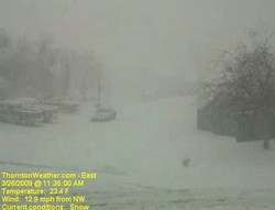
In 1983…a very strong late spring storm dumped heavy snow over the Front Range.  Strong winds with the storm produced blizzard conditions at times.  Sustained winds were 20 to 40 mph with a peak gust to 55 mph at Stapleton International Airport.  The foothills received 1 to 2 feet of snow with 4 to 12 inches along the foothills.  Howling winds whipped the snow into drifts several feet deep…closing schools and highways.  Stapleton International Airport was forced to reduce flight operations…closing 2 of 4 runways and stranding hundreds of travelers.  Most of the damage and inconvenience caused by the storm was in power outages… Which occurred when wind and heavy wet snow caused hundreds of power poles to snap and topple.  About 20 square miles of Denver were blacked out.  Precipitation from the storm totaled 1 to 3 inches.  At Stapleton International Airport… Snowfall totaled 7.1 inches with a maximum snow depth on the ground of only 2 inches due to melting.  The high temperature of 40 degrees on the 17th was a record low maximum for the date.  Due to the heavy moisture content of the storm…widespread street flooding occurred on the 18th when much of the snow melted under the warm May sun and temperatures climbed to a high of 57 degrees.
 
In 1995…significant moisture and upslope flow caused flooding across metro Denver.  Moderate to heavy rains… Which began on the evening of the 16th…developed in the foothills and spread eastward over metro Denver throughout the night.  The heavy rains brought many creeks and small streams to bankfull or slightly over.  Locations along the foothills received between 3 and 4 inches of rainfall from the storm.  Boulder received 3.60 inches of rainfall for the 24-hour period…causing minor street flooding near small streams.  To the northwest of Boulder…a bridge which crossed Fourmile Creek was washed out.  Numerous rock and mudslides occurred in foothills canyons…closing portions of U.S. Highways 6 and 40 and State Highway 119 for a few hours at a time.  Rocks were piled 6 feet deep on a stretch of State Highway 119 along with Boulders as large as cars on U.S. Highway 6.  A parking lot near a creek in Golden caved in leaving a hole the size of an 18-wheeler.  Rushing water washed out a 50-foot stretch of a road in Westminster. Rainfall totaled 1.75 inches at Denver International Airport…but only 1.42 inches at the site of the former Stapleton International Airport.

Continue reading May 17 – May 23 – This week in Denver weather history

Tornadoes wreak havoc, kill three in Missouri

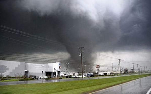
A tornado tears through Adair County Wednesday evening. This photograph was taken by Dr. Curtis Roof from Highway 6, facing west. The tornado traveled on a northeastern path, damaging several homes along the way. (Dr. Curtis Roof/Kirksville Daily Express)

The quiet rural area of Kirksville, Missouri was ripped apart Wednesday evening by four tornadoes that destroyed and damaged homes and claimed the lives of three people.  The first of the series of tornadoes was reported at 5:49pm local time near this town 120 miles northeast of Kansas City.

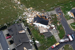
Adair County bore the brunt of the line of severe storms as they moved northeast across the nation’s midsection.  Two twisters were reported near Novinger, one near Troy Mills and the most damaging one in Kirksville.  The Kirksville tornado destroyed at least one house and damaged 30 – 40 others as well as a car dealership. 

Two victims were killed in Adair County according to the Missouri State Highway Patrol.  No details on the circumstances or their names have been released other than to say they were tornado related.  One woman was killed in neighboring Sullivan County when a tornado struck her mobile home.

Get complete details on the twisters and see some incredible images of the destruction on Examiner.com.

VORTEX2 stormchasers on the hunt today

VORTEX2 scientists are on the chase for tornadoes today in west Texas.

Since officially kicking off on Sunday, the weather has been less than cooperative for the VORTEX2 tornado field study teams.  From their starting point in Oklahoma, there simply has not been severe weather worthy of them chasing.  That is changing right at this moment as the team is on the road and headed to western Texas.

VORTEX2 (Verification of Origin of Rotation in Tornadoes EXperiment2) is nothing short of the most ambitious field study of tornadoes ever launched.  Comprising a team of more than 80 scientists utilizing 40 vehicles, 10 mobile radar units and an Unmanned Aerial Vehicle (UAV) from the United States, Canada, Australia and Finland, the study hopes to answer many of the questions about twisters that we do not have answers to. 

How do tornadoes form? What exactly causes the wind to spin into a concentrated funnel? How can we tell exactly when a tornado will form and when it will die, or how long it will last? Why do some thunderstorms produce tornadoes and others do not? What is the structure of tornadoes? What is the relationship of tornadic winds to damage?

New Red Cross tornado safety guidelines spark controversy

Should you ride out a tornado in your vehicle?  The  Red Cross has issued new guidelines that conflict with those from the National Weather Service.  This photo is of a Ford Ranger pickup truck that was blown one-quarter mile and found underneath tree debris after the March 28, 2009 tornado near Corydon, KY.  (NWS)
Should you ride out a tornado in your vehicle? The Red Cross has issued new guidelines that conflict with those from the National Weather Service. This photo is of a Ford Ranger pickup truck that was blown one-quarter mile and found underneath tree debris after the March 28, 2009 tornado near Corydon, KY. (NWS)

The American Red Cross has updated its tornado safety guidelines, modifying longstanding recommendations putting them in conflict with those provided by NOAA and the National Weather Service. The new guidelines no longer recommend evacuating a car if a tornado is about to strike and finding a low-lying ditch to hide in. Instead, the Red Cross is now recommending remaining in the vehicle.

Until now, all tornado safety guidelines were consistent in saying that remaining in a car during a tornado, just like a mobile home, is one of the worst possible places to be. The vehicle stands a great chance of being picked up and thrown and destroyed with its occupants trapped inside.

The National Weather Service, and the Red Cross until now, believes that lying flat in a ditch provides a greater chance of survival. Your body provides a smaller target for winds and by being in a ditch, debris and winds have a better chance of passing over you.

The new guidelines from the Red Cross say:

  • If you are caught outdoors, seek shelter in a basement, shelter, or sturdy building. If you cannot get to shelter, a recent study* suggests doing the following:
    • Get into a vehicle, buckle your seat belt, and try to drive at right angles to the storm movement and out of the path.
    • If strong winds and flying debris occur while you are driving, pull over and park, keeping seat belts on and the engine running. Put your head down below the windows, covering with your hands and a blanket if possible.

Compare this to the guidelines from the National Weather Service’s Storm Prediction Center:

Vehicles are extremely dangerous in a tornado. If the tornado is visible, far away, and the traffic is light, you may be able to drive out of its path by moving at right angles to the tornado. Otherwise, park the car as quickly and safely as possible — out of the traffic lanes. [It is safer to get the car out of mud later if necessary than to cause a crash.] Get out and seek shelter in a sturdy building. If in the open country, run to low ground away from any cars (which may roll over on you). Lie flat and face-down, protecting the back of your head with your arms.

Researchers for the Red Cross cited studies from historical tornado damage, injuries and deaths. Rick Bissell of the University of Maryland-Baltimore County was head of the committee that wrote the new recommendations and had posted to his blog, “We found no evidence to support the NWS suggestion that people should lie in a ditch during a tornado if they cannot find solid shelter.”

It should be noted that the “recent study” the commendations cite is actually an older one from 2002. Further, Mr. Bissell’s blog comments have since been removed from the website.

Now Americans are faced with two competing recommendations which could make the difference between life or death. Many believe the Red Cross’ issuing of these new recommendations without collaboration with the weather experts at the National Weather Service is irresponsible. However, there are no hard rules when dealing with Mother Nature and what works in one situation, may not work in a comparable one at a different time.

This vehicle was destroyed by a tornado - if you were in it, would you have survived?

It is my opinion that the traditional recommendations of the National Weather Service are the best choice. As we wrote in our Severe Weather 101 – Tornadoes and tornado safety article:

When driving in open country and you see a tornado, simply drive away from the path of the tornado – usually at a 90 degree angle to the path is best. While we all have seen video of people doing it, do not seek shelter beneath a highway underpass as these act like wind tunnels and actually serve to increase the wind speed and collect flying debris. In the extreme situation that you simply cannot get away from a tornado, abandon your vehicle immediately. Lie down in a ditch or culvert and cover your head. This isn’t a particularly good option, but it is safer than remaining in a vehicle.

If you are caught outside with no place to seek shelter, crawl into a ditch or culvert and cover your head. Getting as low as possible will decrease the odds of you being struck by flying debris. This is not ideal, but it is your best course of action.

Ideally you would of course escape the tornado by outrunning it as outlined above or seek shelter in a sturdy building – knock on doors if you have to.

Justin Berk, Baltimore Weather Examiner and professional meteorologist had this to say:

If you are that close to a tornado, pray! If the option to drive the other way is not available… it is luck of the draw. I used to tell my students to get out and curl down in a low ditch by the road with their heads covered – to protect from flying debris. Honestly, who is going to think of getting outside when it gets worse? The car may provide some protection from flying debris. Which in a tornado, could be another car. I can see the fault in getting out of your car, only to get hit by another. The myth of hiding under a highway overpass has been proven wrong. So, drive away or pray!

The weather and the spread of the swine flu – Will it help or hurt?

In the United States, the winter is generally considered ‘flu season’ and is when we see it most widespread.  With the threat of a potential swine flu epidemic, analysts are trying to determine if the weather will play any factor in the spread of the virus.

The flu is spread through contact with an infected person or pig, typically through coughing or sneezing.  In the winter, when most people in temperate regions like the United States are spending time indoors in closed environments and in close quarters with those that are infected, it is thought that the flu can be transmitted easier.  The water droplets containing the virus are slower to evaporate in cooler weather thus remaining airborne for longer periods of time and increasing chances of others becoming infected.

Outbreaks can and do occur in the tropics however research indicates they occur with less frequency in places that do not have the seasonality that other areas do.  Limited laboratory and health data from regions like Africa and Latin America have made it more difficult to track the spread of viruses and thus learn from it.

The World Meteorological Organization (WMO) said on Monday that it hoped drier and warmer weather would help stifle the effects of the swine flu.  The organization is asking health authorities to work with weather services to assess the role of weather and the climate in the outbreak as this is an aspect that is not fully known.  WMO spokeswoman Gaelle Sevenier said , “The transmission patterns of this particular influenza and its possible seasonality are as yet not adequately understood and are the subject of ongoing investigations.”

Get the rest of the details on this story and how that family summer vacation could help spread the virus on Examiner.com.

For all the details, read the rest of this story on our Denver Weather Examiner page. Examiner.com - Get inside Denver weather 

Climate change hearing on Capitol Hill highlights politics and hypocrisy

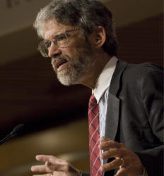
Former Vice President Al Gore, right, and former Virginia Sen. John Warner testify on Capitol Hill in Washington, Friday, April 24, 2009, before the House Energy and Environment subcommittee.  (AP Photo/Manuel Balce Ceneta)
Former Vice President Al Gore, right, and former Virginia Sen. John Warner testify on Capitol Hill in Washington, Friday, April 24, 2009, before the House Energy and Environment subcommittee.

As legislators in Washington D.C. debated a climate change bill that would levy new taxes on businesses and potentially cost consumers, political theatre was in full view Friday at the House of Representatives.  The House Energy and Commerce Committee held hearings all last week on the legislation, culminating with the appearance of former Vice President Al Gore and former Speaker of the House and potential 2012 presidential candidate Newt Gingrich.

Democrats who support the measure and the ‘cap and trade tax’ it would bring, brought forth the self-appointed head of the global warming movement Al Gore.  Mr. Gore of course was full of his usual dire predictions of the Earth’s pending doom from carbon dioxide accumulation in the atmosphere unless immediate action is taken.  He likened those who doubted the theory to those who don’t believe man landed on the moon saying, “There are people who still believe that the moon landing was staged on a movie lot in Arizona.”

Perhaps Mr. Gore wasn’t aware but even some of those that have been to the moon and walked on its surface don’t believe all the hype about global warming.  It was just recently that a real moonwalker announced his doubts about the theory as well.  Dr. Harrison Schmitt, an Apollo 17 astronaut, moonwalker, and PhD holding geologist said, “Contrary to categorical statements by many politicians and unfortunately some scientists, including some colleagues of mine, the science of climate change and its causes is not settled – at least not to this geologist.”

There is much more to this story – including battles between the committee and Newt Gingrich when he appeared.  Learn more about how politics have taken over the debate on manmade climate change in the full story on Examiner.com.

For all the details, read the rest of this story on our Denver Weather Examiner page. Examiner.com - Get inside Denver weather

Colorado Severe Weather Awareness Week highlights weather dangers in the state

Last year's Windsor tornado highlighted just how dangerous weather in Colorado can be.  Are you and your family prepared?
Last year's Windsor tornado highlighted just how dangerous weather in Colorado can be. Are you and your family prepared?

As is customary, the governor has declared this week Severe Weather Awareness Week.  This is an opportunity for the public to get reacquanted with the dangers severe weather presents in Colorado. 

Tornadoes, lightning, hail, severe wind and flooding are very real hazards that Coloradoans face every year during severe weather season.  It is important that you know what to do to protect you and your family. 

In conjunction with the National Weather Service, Examiner.com will be publishing our Severe Weather 101 series.  Each day this week a weather hazard will be discussed in depth and we will outline protective measures you can take to keep yourself and your family safe.  Please be sure to check back every day to read these important message.

From the National Weather Service

Thunderstorm hazards around the corner…are you prepared?

Severe thunderstorm season will be soon upon us.  Do you know how to stay safe around tornadoes, flash floods, lightning, hail, and damaging winds?  This is the week to learn.  This week, April 19th to 25th, is Colorado severe weather awareness week.   This is the time to learn more about severe weather in Colorado, develop severe weather preparedness plans, and test vital communications.

Can we learn lessons from the past severe weather events?  Just last year on may 22nd an EF3 tornado raced north through Weld and Larimer counties resulting in one fatality.  Several injuries and destroyed or heavily damaged hundreds of homes.  Two years ago, on March 28, 2007 the town of Holly was heavily damaged by another EF3 tornado that resulted in two fatalities.  Twelve years ago on July 28, 1997 a devastating flash flood occurred in Fort Collins resulting in 5 fatalities and millions of dollars in damage.

Each year for the past 20 years there have been an average of 50 tornadoes in Colorado, 3 people killed by lightning and another 15 injured by lightning.  

The National Weather Service offices which cover Colorado will issue a series of public information statements during the week covering the following topics:

  • Monday…Watches and warnings
  • Tuesday… Tornadoes and tornado safety
  • Wednesday…Flash floods and flash flood safety
  • Thursday…Downburst wind and hail
  • Friday…Lightning and lightning safety
  • Saturday…A review of the week

A time to test your warning reception and communications systems is planned.  Each national weather service office serving Colorado will send test tornado warnings on Tuesday April 21 between the hours of 8 am MDT and 11 am MDT.  These test warnings will be sent to the emergency alert system, the internet, NOAA weather radio and law enforcement communications systems. 

Safety information, watches, warnings, forecasts, past weather and much more information is available at your local National Weather Service web sites:

     www.weather.gov/denver      NWS Denver web site
     www.weather.gov/pueblo      NWS Pueblo web site
     www.weather.gov/goodland    NWS Goodland web site
     www.weather.gov/gjt         NWS Grand Junction web site


Largest in-field tornado study ever set to launch in May

The VORTEX2 tornado research project will be the largest in-field study of tornadoes ever.

The single largest and most ambitious field study to increase our understanding of tornadoes is set to kick off next month.  The Verification of Origin of Rotation in Tornadoes EXperiment2 (VORTEX2 or V2) will feature more than 50 scientists utilizing 40 vehicles, 10 mobile radar units and an Unmanned Aerial Vehicle (UAV).

The study which will run from May 10 to June 13 will become the largest mobile in-field laboratory ever assembled to study tornadoes.  In a statement Louis Wicker, research meteorologist with NOAA’s National Severe Storms Laboratory and V2 co-principal investigator said, “Data collected from V2 will help researchers understand how tornadoes form and how the large-scale environment of thunderstorms is related to tornado formation.”

The VORTEX2 tornado research project will be the largest in-field study of tornadoes ever.

Operations will be controlled at the National Weather Center in Norman, Oklahoma while the mobile units chase tornadoes across Tornado Alley and the central Great Plains.  The target area for the study ranges from southern South Dakota through Nebraska, Kansas, Oklahoma and the Texas Panhandle.  Eastern Colorado, home of many tornadoes, is included in the study.

This unprecedented gathering of scientists and technology hold incredible promise for the research that will be gathered.  The original VORTEX program which happened from 1994 to 1995 documented the entire life cycle of a tornado from start to finish, the first time that had ever been done.   That research greatly enhanced our understanding of twisters and led to much improved tornado warnings that help to save lives today.

VORTEX2 seeks to build on that research and the research that has taken place since.  According to the project website it will seek to answer such important questions as:  How do tornadoes form? What exactly causes the wind to spin into a concentrated funnel? How can we tell exactly when a tornado will form and when it will die, or how long it will last? Why do some thunderstorms produce tornadoes and others do not? What is the structure of tornadoes? What is the relationship of tornadic winds to damage?

An important finding from the original VORTEX experiment was that the factors responsible for causing tornadoes happen on smaller time and space scales than scientists had thought.  New advances will allow for a more detailed sampling of a storm’s wind, temperature and moisture environment and lead to a better understanding of why tornadoes form – and how they can be more accurately predicted.
– Stephan Nelson, NSF program director for physical and dynamic meteorology.

VORTEX2 features scientists and students from the United States, Canada and Australia in collaboration with government agencies, private industry and educational institutions.  Many luminaries within the storm chasing and severe weather research community will participate including Dr. Josh Wurman of the Discovery Channel’s Storm Chasers TV show.  Some of the notable participating organizations include Center for Severe Weather Research, Rasmussen Systems, NOAA National Severe Storms Laboratory, OU/NOAA Cooperative Institute for Mesoscale Meteorological Studies, NSF-sponsored National Centers for Atmospheric Research, Penn State University, University of Oklahoma, Texas Tech University, Lyndon State College, University of Colorado, Purdue University, North Carolina State University, University of Illinois, University of Massachusetts, University of Nebraska, Environment Canada, and the Australian Bureau of Meteorology.

For more information:

[nggallery id=3]

Winter-like storm brings more than 3 inches of precipitation to Thornton

As we begin to dry out from an incredibly wet April storm, we can take a look at some of the numbers from the three day event.  Being on the warmer east side of the Denver area, Thornton did not receive a tremendous amount of snow as temperatures here simply remained too warm.  What we did get though was rain – and LOTS of it. 

ThorntonWeather.com measured 3.06 inches of precipitation – the most we have recorded for a single weather event since we went operational in October 2006.  Friday was the wettest of the three days with 1.86 inches recorded – not a single day record for ThorntonWeather.com but still a great amount for our arid climate.  The steady and more or less constant rain brought much needed moisture and helps to make up for what has been a dry snow season thus far. 

Denver did officially set a record for Friday when 1.16 inches of precipitation was recorded at Denver International Airport – the most ever on April 17th.  The old record was 1.00 inch set in 1920. 

While we remain well behind normal on snow for the season, for the calendar year thus far, the storm put Denver ahead of the curve on precipitation.  Normally by this date we would have had 3.36 inches of precipitation.  Since January 1 Denver has now recorded 3.61 inches, 0.25 inch above normal, so that is definitely good news. 

As we mentioned, Thornton did not receive a lot of snow from this event.  We recorded 3.1 inches total as the rain / snow mix we saw at many times resulted in what snow did fall being compacted by rain immediately thereafter.  Other areas of the Front Range however, those primarily west and south, were a touch colder and received a great deal of snow.  A quick look at a few of the snow totals from the event:

  • Pinecliffe – 52 inches
  • Rollinsville – 51 inches
  • Nederland – 37 inches
  • Blackhawk – 36 inches
  • Evergreen – 29 inches
  • Cherry Creek Dam – 15.3 inches
  • Parker – 14 inches
  • Highlands Ranch – 13.4 inches
  • Boulder – 10 inches
  • Broomfield – 9.3 inches
  • Arvada – 8.8 inches
  • Denver, Stapleton – 3.3 inches
  • ThorntonWeather.com – 3.1 inches
  • Denver International Airport – 2.6 inches (Denver’s official site)

All of that moisture and a coming week of temperatures in the 70’s are sure to truly start greening up the landscape.  It won’t be long now for sure and you will be mowing the lawn!

Weather, natural disasters & climate news and information.