28 years ago today – Thornton is struck by a tornado

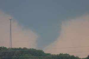
Damage along Washington was extensive from the tornado that struck Thornton on June 3, 1981. (City of Thornton archives)

It was 28 years ago today that the worst tornado to ever strike the Denver metro area hit Thornton.  June 3, 1981 is a day that will forever be remembered by longtime residents of the north metro area. 

Last year the Northglenn-Thornton Sentinel did a story about it which you can read by clicking here.  Also, below is the entry from the National Weather Service’s history calendar – it is very interesting and serves as a good reminder that severe weather can strike anywhere.

In 1981…severe thunderstorms produced tornadoes over metro Denver.  The first tornado touched down at the intersection of Alameda Ave. And Sheridan Blvd.  The twister moved north along Sheridan Blvd….damaging businesses…apartment buildings…homes…and vehicles.  Over ten homes were unroofed.  The roof of one landed in the middle of a neighborhood park.  At least 10 mobile homes were wrecked.

The tornado curved to the northeast into northwest Denver… Hopping up and down in several places.  Very strong winds outside the actual funnel caused 20 to 30 thousand dollars in damage in downtown Denver.  The third floor of one old building was demolished.  No major injuries were reported from the tornado…although several people were hurt slightly in traffic accidents on Sheridan Blvd. in the confusion caused by the storm.  Damage in Lakewood alone was estimated at 200 thousand dollars. 

At the same time… The worst tornado to ever hit metro Denver struck Thornton. Coming from the same thunderstorm that spawned the Denver twister…the Thornton tornado tore a swath through the heart of the city.  87 homes were destroyed…110 others damaged at least moderately.  In all…600 homes in a 100 block area sustained some damage.  The twister also hit shopping centers…several restaurants…and other buildings. Seven of the 42 injured were considered serious.  The storm was strong enough to snap lamp posts in half and drive a 6- inch slab of wood 2 feet into the ground.  Damage was estimated at up to 50 million dollars. 

The same storm that struck Thornton produced another damaging tornado that touched down in the northwest section of Fort Lupton.  This twister damaged 16 homes and numerous cars and campers. Two children were slightly injured when the car they were in was knocked about and its windows shattered by the storm.  The twister also damaged two commercial buildings.  Damage was very spotty…and observers said the storm hopped up and down at least 3 times.  Dollar damage was estimated at 500 thousand dollars. 

The thunderstorm complex that produced 3 damaging tornadoes also dropped large hail which damaged many cars over northwest Denver.  One to 2 inches of rain fell in less than an hour…flooding a mobile home park with 3 to 4 feet of water on the northwest edge of Denver.  The high water damaged about half of the 392 homes in the park.  Local flooding was also reported in other areas across metro Denver.  A tornado was also sighted near Franktown…but caused no damage.  A thunderstorm wind gust to 52 mph was recorded at Stapleton International Airport.

Reports: Lightning may have brought down Air France flight

Air France Flight 447 is missing over the Atlantic this morning and presumed lost.  (AP Photo)
Air France Flight 447 is missing over the Atlantic this morning and presumed lost. (AP Photo)

An Air France jet en route from Rio de Janeiro to Paris carrying 228 people appears to have been lost over the Atlantic Ocean.  The plane which disappeared approximately 190 miles northeast of the Brazilian city of Natal may have been brought down by severe weather the plane was flying through at the time it lost contact with air traffic controller.

Air France Flight 447 is reported to have hit strong turbulence and possibly lightning as the result of a thunderstorm.  Air France says the plane, an Airbus A330, left Rio de Janeiro at 7:00pm local time and approximately four hours late the plan sent an automated signal indicating electrical problems.  The airline said the plane “crossed through a thunderous zone with strong turbulence.”  The automated message was received 14 minutes later at 0214GMT (10:14 pm  EDT Sunday) “signaling electrical circuit malfunction.”

Francois Brousse, head of communications at Air France, “The plane might have been struck by lightning. It’s a possibility.”

For the complete story and the latest images from the tragedy, please visit our Denver Weather Examiner pages. Examiner.com - Get inside Denver weather

Is global warming responsible for a slow tornado season?

Is global warming responsible for fewer tornadoes in 2009?  Stu Ostro of the Weather Channel thinks so.  Image courtesy NSSL.
Is global warming responsible for fewer tornadoes in 2009? Stu Ostro of the Weather Channel thinks so. Image courtesy NSSL.

Stormchasers across Tornado Alley have been frustrated this spring by what seems to be a lack of tornadoes and severe weather.  Indeed, VORTEX2, the largest tornado field study ever, has been running for more than two weeks now and has not seen one twister.  Last week, Weather Channel Senior Meteorologist Stu Ostro speculated that global warming was the cause.

In a segment with on-air meteorologist Stephanie Abrams, Ostro explained that the jet stream lingering over Canada and a continual ridge of high pressure were suppressing severe weather.  Without the collision of low and high pressure (among other factors), tornadoes and supercell thunderstorms have a hard time forming.

Ostro continued his explanation saying that atmospheric pressure in the Northern Hemisphere’s mid-latitudes between 30 and 60 degrees has increased steadily since 1970.  He then overlaid a chart showing this increase with that of a chart that shows global average temperatures having increased over the same period.  As he says in his blog entry, “That parallels remarkably well the trend of globally-averaged temperatures, which has also shown a significant rise since the mid 1970s.”

For the rest of the story story – and a response from Stu Ostro – check out the complete story on the Denver Weather Examiner’s pages. Examiner.com - Get inside Denver weather

A Preview of Thornton’s June Weather – The Severe Weather Month

Denver is historically Thornton's true severe weather month.

June is historically Denver’s severe weather month and severe thunderstorms, tornadoes and hail are notorious visitors to Denver and across eastern Colorado during the month.  In fact, over 40 percent of the tornadoes that occur in Colorado are observed in June and these are typically the most destructive of the year.  Severe thunderstorms have also caused major property damage across the Front Range during the month.

In just the last 25 years or so, there have been some particularly notable storms in June.  Tornadoes have struck the metro area including one that longtime Thornton residents will recall on June 3, 1981.  53 residents were injured, 25 homes were destroyed and 239 other structures were damaged.  Others tornadoes in the metro area include southeast Denver and Aurora on June 8, 1986 and east Denver on June 13, 1984.  Severe thunderstorms occurring on June 13, 1984 dumped large hail making it one of the worst and the second costliest storm in Denver history.  More recently, on June 20, 2001, a major hail storm moved across Denver International Airport dropping hailstones as big as two inches in diameter. Damage was extensive on and near the airport.

For complete details on what we can expect in June, click here to view our June weather preview.

Monday weather quieter but a funnel cloud is spotted over Thornton

This funnel cloud, one of many across the metro area Sunday, was spotted over Highlands Ranch.  Image courtesy Tracee Hendershott.
This funnel cloud, one of many across the metro area Sunday, was spotted over Highlands Ranch. Image courtesy Tracee Hendershott.

Thus far the weather today has been much quieter than it was yesterday when thunderstorms brought severe weather to most of the metro area.  Southern Thornton has seen a good bit of rain but areas farther north have had very little. 

Earlier today, local law enforcement did report a funnel cloud over 104th and Colorado Blvd from a thunderstorm that was moving through the area.  Reported at 12:47pm, the funnel moved to the east at 15 mph and quickly disappated.  Unlike yesterday when many funnel clouds – and three tornadoes – were reported, this is the only such report thus far today. 

Do you have pictures of this weekend’s severe weather?  Send them to info@thorntonweather.com and we will show them on our site!

Saturday storms bring heavy rain, funnel cloud

This funnel cloud was over north central Aurora Saturday afternoon.  Photo was taken from the Bennett area.
This funnel cloud was over north central Aurora Saturday afternoon. Photo was taken from the Bennett area.

Saturday afternoon’s thunderstorms brought some pretty interesting weather to Denver and the Front Range.  Our wettest and cloudiest month seems to be intent on finishing out right on par with what we would expect this time of year. 

Thunderstorms and showers moved across the metro area in the late afternoon Saturday producing thunder, lightning and rain across much of the area.  Some stations on the Rocky Mountain Weather Network reported quite heavy rain, particularly those on the west side of town.  Some of the rain totals along the Front Range since yesterday:

In yesterday’s forecast we warned of the possibility of landspouts which are small, short-lived tornadoes.  None were observed however a funnel cloud was reported over north central Aurora about three miles south of DIA at 4:50pm.  The funnel lasted about two minutes and never touched down and did not cause any damage.

Windsor marks one year anniversary of EF3 tornado

The town of Windsor, Colorado was forever changed when an EF3 tornado ripped through it one year ago today.

May 22, 2008 was like most any spring day along the Colorado Front Range.  The morning started out a bit warmer than usual and it was more humid but there was nothing to indicate the havoc that was soon to be visited upon Windsor, Colorado.

As the morning wore on, high above the plains the jet stream was moving at 120 mph and temperatures were warming quickly.  From Denver looking north huge clouds began to build miles into the sky – an ominous sign of what was to come.  A supercell thunderstorm, one more like what you expect to see in Oklahoma, was forming quickly.

At 11:30am the warnings were going out from the National Weather Service.  This was not your typical thunderstorm.  Soon a Gilcrest police officer radioed, “We have a tornado on the ground!”

Three tornadoes touched down that morning in northern Colorado but one stands out.  The supercell that was near Windsor was growing in size and the twister that developed was massive – ¾ of a mile wide.  Rated by the National Weather Service as an EF3 on the Enhanced Fujita Scale with winds in excess of 136 mph, what was described as a “big, black monster” would tear a path 35 miles long.

For the rest of this story including video and a photo slideshow, please visit Examiner.com.

Rare tornado touches down in Mesa County

A tornado touched down in Mesa County on Tuesday - only the ninth twister since 1950 in the county.  (File photo)
A tornado touched down in Mesa County on Tuesday - only the ninth twister since 1950 in the county. (File photo)

Mesa County, Colorado reported a rare tornado on Tuesday afternoon.  The National Weather Service in Grand Junction reports that the twister touched down in an open area around 3:25pm yesterday near Mount Garfield (map). 

The Associated Press reported that Meteorologist Jeff Colton said a National Weather Service employee was in the area and saw it happen. No damage or injuries were reported.

This was only the ninth tornado recorded in Mesa County since 1950 and the first since August 2, 2005. 

For more information:  Click here to view a history of tornadoes in Mesa County.

Denver officially breaks high temperature record for this date

Denver set a temperature record for today, May 19.

It’s official.  At 1:24pm today the temperature at Denver International Airport reached 90 degrees setting a new record high temperature for May 19.  This breaks the previous record high for this date of 89 degrees set in 2006. 

Wtih some cloud cover moving in and a chance for thunderstorms in the forecast, it appears that is as high as the mercury will climb today. 

But is it truly a record?

One does have to wonder though, is it truly fair to call this a record?  When the National Weather Service moved Denver’s official monitoring station from Stapleton to Denver International Airport, some say the city’s climate records were forever altered.  For more information and analysis of the controversy, check out this story:  Do Denver weather and climate records have an asterisk attached?

Mother Nature doesn’t cooperate with VORTEX2 stormchasers

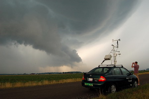
Last Tuesday the VORTEX2 teams chased a system that generated hail, wind and lightning but no tornadoes. Image courtesy VORTEX2 / NSSL.

The scientists and researchers taking part in VORTEX2, the largest ever tornado field study, have been confounded by Mother Nature in their search for twisters.  The Verification of Origin of Rotation in Tornadoes EXperiment2 (VORTEX2) and its accompanying 80 scientists and 40 vehicles have yet to track a tornado since the project launched just over a week ago.

The team has tracked severe weather systems from northwestern Texas to Oklahoma and while they have seen severe thunderstorms that produced significant rainfall and winds, twisters have eluded them thus far.  While this is undoubtedly frustrating for the team, it has given them time to practice the coordination and deployment of the researchers. 

Last Tuesday the team was on their first chase day in west Texas and was able to deploy their mobile radar units and mobile mesonet vehicles.  That storm yielded little more than wind and hail but it provided a valuable opportunity to view their plan in action and highlight areas where improvement is needed. 

Weather, natural disasters & climate news and information.