Without a doubt the Mile High City – and much of the nation – has had an unusually warm summer. Records have tumbled regularly over the past couple of months and yet another is on the brink as we approach a record number of 90 degree days. Read the rest of this story on Examiner.com to find out how close to the record we are.
August 12 to August 18 – This Week in Denver Weather History

Denver’s weather calms considerably in August as compared to many other months but the history books show plenty of notable events in our past. Lightning, flooding rain and even a tornado highlight this week in Denver weather history.
8-13
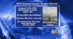
In 1875…clouds of grasshoppers were seen flying through the air on the prevailing winds during each day.
12
In 1876…the temperature climbed to a high of 100 degrees in downtown Denver.
In 1941…excessive thunderstorm rainfall flooded streets and delayed traffic for a few hours in some sections of the city. The basements of a considerable number of homes and commercial buildings were flooded. The total value of the damage was unknown. Only 0.94 inch of thunderstorm rainfall was recorded downtown.
In 1969…a man and a 9-year old boy were injured…when lightning struck a tree near where they were standing. Both were revived after treatment…but the boy later died of respiratory failure due to electrical shock.
In 1984…heavy thunderstorm rains drenched southern metro Denver. Rural roads in Douglas County received minor washouts. Hail…as large as 3/4 inch in diameter…was reported in southeast Aurora with one inch diameter hail reported near Parker. Rainfall totaled 1.00 inch at Stapleton International Airport.
12-13 in 1975…heavy rains caused flash flooding along the foothills from Denver north. Thunderstorm rainfall totaled 1.56 inches at Stapleton International Airport.
In 2004…a brief cool spell resulted in two daily temperature records. The low temperature of 49 degrees was a record minimum for the 12th…as was the low temperature of 48 degrees on the 13th.
13
In 1959…thunderstorm winds gusted to 53 mph at Stapleton Airport.
In 1983…thunderstorms dumped torrential rain in Northglenn… Thornton…and Broomfield. Northglenn was drenched with 1.72 inches in 30 minutes. Street flooding was widespread. Hail…as large as 3/4 inch in diameter…was reported 7 miles northeast of Boulder along with heavy rain which caused some street flooding.
In 2000…lightning sparked 3 small grass fires near Golden. The fires were quickly contained. Hail as large as 3/4 inch in diameter fell in Castle Rock.
Continue reading August 12 to August 18 – This Week in Denver Weather History
Forecasters increase chances for hurricane activity during second half of season
The 2012 Atlantic hurricane season has been a relatively active one although not particularly notable. NOAA forecasters have updated their outlook for the season though and are cautioning that hurricane activity may soon increase in the basin. Read the rest of this story on Examiner.com

NOAA’s most accurate climate network contradicts agency’s own claims of ‘hottest month ever’
To listen to the United States’ primary agency responsible for monitoring the climate, one would think the end is near as global temperatures continue to rise at an alarming rate. However, the National Oceanic and Atmospheric Administration’s (NOAA) own monitoring network specifically designed to monitor global warming contradicts these claims. Read the rest of this story on Examiner.com to find out why we should be skeptical when we hear claims of record-setting heat.

NOAA: July 2012 goes into record books as hottest month ever for United States
Sweltering, unseasonably warm temperatures gripped much of the contiguous United States last month breaking many records. In the final analysis of the month, NOAA announced that July was the hottest month ever recorded in the U.S. How hot was it? Read the rest of this story on Examiner.com

Smoke from northwestern United States wildfires blankets neighboring Colorado
The Mile High City found itself in a bit of a haze yesterday that continues into today as smoke from wildfires to Colorado’s northwest moves into the state. Dozens of fires are burning across the region and while none have been as devastating as those seen in recent months, their effects are being felt far and wide. Read the rest of this story and view satellite imagery of the smoke plume on Examiner.com.
NASA’s Curiosity rover makes perfect landing; image captures amazing decent

Landing on Mars has proven over the years to be an extremely difficult task with few space probes seeing success. NASA’s Curiosity rover beat the odds completing its 352 million mile journey with a perfect landing early Monday morning.
The probe was launched on November 26 and as it neared its touchdown on the Red Planet, NASA had been discussing the “7 minutes of terror” involved in inserting the probe into the Martian atmosphere and successfully landing. The craft used an amazing array of equipment to land including a sky crane and a supersonic parachute.
The image above was taken by the Mars Reconnaissance Orbiter in a perfectly choreographed event designed to capture just an image. The photo shows Curiosity dangling under its massive parachute as it descends to the surface.
For more on NASA’s Curiosity rover mission click here.
From NASA:
Curiosity Spotted on Parachute by Orbiter
NASA’s Curiosity rover and its parachute were spotted by NASA’s Mars Reconnaissance Orbiter as Curiosity descended to the surface on Aug. 5 PDT (Aug. 6 EDT). The High-Resolution Imaging Science Experiment (HiRISE) camera captured this image of Curiosity while the orbiter was listening to transmissions from the rover. Curiosity and its parachute are in the center of the white box; the inset image is a cutout of the rover stretched to avoid saturation. The rover is descending toward the etched plains just north of the sand dunes that fringe “Mt. Sharp.” From the perspective of the orbiter, the parachute and Curiosity are flying at an angle relative to the surface, so the landing site does not appear directly below the rover.
The parachute appears fully inflated and performing perfectly. Details in the parachute, such as the band gap at the edges and the central hole, are clearly seen. The cords connecting the parachute to the back shell cannot be seen, although they were seen in the image of NASA’s Phoenix lander descending, perhaps due to the difference in lighting angles. The bright spot on the back shell containing Curiosity might be a specular reflection off of a shiny area. Curiosity was released from the back shell sometime after this image was acquired.
This view is one product from an observation made by HiRISE targeted to the expected location of Curiosity about one minute prior to landing. It was captured in HiRISE CCD RED1, near the eastern edge of the swath width (there is a RED0 at the very edge). This means that the rover was a bit further east or downrange than predicted.
The image scale is 13.2 inches (33.6 centimeters) per pixel .
HiRISE is one of six instruments on NASA’s Mars Reconnaissance Orbiter. The University of Arizona, Tucson, operates the orbiter’s HiRISE camera, which was built by Ball Aerospace & Technologies Corp., Boulder, Colo. NASA’s Jet Propulsion Laboratory, a division of the California Institute of Technology in Pasadena, manages the Mars Reconnaissance Orbiter Project for NASA’s Science Mission Directorate, Washington. Lockheed Martin Space Systems, Denver, built the spacecraft.
Credit: NASA/JPL-Caltech/Univ. of Arizona
August 5 to August 11 – This Week in Denver Weather History

As we enter August the weather typical is a bit calmer as the atmosphere settles down. However our look back at this week in Denver weather history shows that Mother Nature can still visit plenty of excitement on us.
From the National Weather Service:
5
In 1881…the low temperature cooled to only 76 degrees…the record high minimum temperature for the month.
In 1889…southwest winds were sustained to 42 mph.
In 1918…hail pelted the city…but was light and caused no damage. Precipitation totaled 0.25 inch. Northwest winds were sustained to 31 mph.
In 1964…lightning struck two boys in Denver while playing ball. One was treated and released from the hospital…but the other boy suffered second degree electrical shock and cardiac arrest and was hospitalized in critical condition for several days.
In 1969…two tornadoes touched down briefly in an open field southeast of Buckley Field in Aurora. No damage was reported.
In 1970…heavy rain in the Indian Hills area in the foothills west of Denver caused flash flooding…which washed out roads and damaged other property. Hail accumulated to a 3 inch depth with stones up to golf ball size; however…most of the damage was from flooding.
In 1982…2.38 inches of rain fell in an hour in Arvada… Causing minor flooding on Ralston Creek. In Westminster… 1 1/2 inches of rain fell…causing damage to streets and culverts. In addition…lightning caused some minor power outages across metro Denver.
In 1983…very heavy thunderstorms hit the southern portion of metro Denver. Heavy rainfall…as much as 2.89 inches in 38 minutes…caused widespread street flooding in southeast Denver. Two feet of water covered a section of I-25. Hail up to golf ball size accompanied the storm in Littleton and Englewood…along with 60 mph winds.
In 1984…a heavy thunderstorm drenched Littleton with up to 2.35 inches of rain in an hour…along with small hail that piled up to 2 inches deep. Flood waters were up to 4 feet deep in parts of town with many basements flooded. There were some power outages caused by lightning.
In 1990…a thunderstorm dumped 1.25 inches of rain in 12 minutes near tower and smoky hill roads in southeast Aurora. Minor street flooding was reported in the area.
In 1992…a pilot reported two funnel clouds near Cheery Creek Reservoir. Both dissipated quickly. Dime size hail fell near Franktown.
In 1994…one inch diameter hail fell near Strasburg. No damage was reported.
In 1999…a dog kennel east of Denver International Airport… Was flooded when a small dam…upstream in Elbert County… Was breached. The floodwaters…up to 4 feet deep…washed away some 6-foot fences and other small buildings. Ten of the 70 dogs boarded at the kennel drowned.
In 2002…a mail carrier was struck by lightning as he inserted a key into a multi-unit mailbox in Bailey. The shock knocked the man back against the mail truck. He suffered minor injuries. Lightning struck a residence in Commerce City. The resulting fire destroyed the roof of a detached garage and damaged much of its contents. Hail as large as 1 3/4 inches in diameter pelted pine. One inch diameter hail fell in Arvada and southwest Denver. Heavy rain triggered a mudslide along U.S. Highway 285 near Bailey. Both lanes of traffic had to be closed until debris could be removed from the highway. Several residences in the Bailey and Glenisle areas were also flooded.
In 2004…heavy thunderstorm rainfall caused localized flash flooding in Virginia canyon near Idaho Springs. Sections of the Virginia Canyon Road had to be closed due to the floodwaters.
In 2008…a severe thunderstorm produced large hail…up to 1 1/4 inches in diameter…northeast of Parker. Several automobiles were damaged.
Continue reading August 5 to August 11 – This Week in Denver Weather History
July 2012 Thornton weather recap: Month goes into books as hottest recorded

For the second month in a row, Thornton saw extraordinarily warm temperatures in July. The month not only was the warmest July ever recorded by ThorntonWeather.com, it was the warmest month recorded since we began operation.
The average temperature for July 2012 was an astonishing 75.5 degrees. This was 1.8 degrees above Thornton’s average for July over the past six years, a significant increase.
Temperatures ranged from a high of 98.7 degrees on July 1 down to a low of 56.6 degrees on July 11.
In all we recorded 23 days with high temperatures at or above 90 degrees. We did however manage to escape the month without breaking the century mark.
In terms of precipitation Thornton didn’t fare too poorly. We recorded 1.92 inches of precipitation in our rain bucket. This was only 0.03” below the six year average of 1.95 inches.
For comparison, Denver saw an official average monthly temperature of 78.9 degrees as measured at Denver International Airport. Further, they only recorded 0.48 inch of precipitation. For more details on Denver’s July 2012 weather, please visit this story on Examiner.com.
More on ThorntonWeather.com:
July 2012 Graphs
July 2012 enters history books as hottest month in recorded Denver history
July in usually the warmest month of the year in Denver so hot temperatures are not entirely unusual. However July 2012 exceeded all previous marks not only going into the history books as the hottest July ever but also…