Thornton’s February weather preview: Month usually brings warmer temps, dry conditions

Thornton and Denver, Colorado February Weather Preview.February in Colorado typically brings to an end an extended period when average temperatures are at their lowest.  Winter begins to loosen its grip and temperatures get warmer but precipitation is not a particularly common event during the month.

Thanks to some late January snows, Denver’s seasonal snowfall has started to rebound but still remains below normal.  February is only our sixth snowiest month so it may not provide much help on the precipitation month.

Temperatures however do usually see a nice rebound during the month.  Average high temperatures climb from an average of 44 degrees at the start to 50 degrees by the end of February.

For the complete February preview including a look at historical averages and extremes as well as a look at what long range forecasts are predicting, click here. 

January 2014 in pictures: Monthly photo slideshow

January 3, 2014 - Stunning wave cloud sunset as seen from Brighton.  View more images in the slideshow below. (Brandi Donahue)
January 3, 2014 – Stunning wave cloud sunset as seen from Brighton. View more images in the slideshow below. (Brandi Donahue)

While typically a cold month, January is oftentimes lacking in terms of weather drama.  Living in Colorado however provides plenty of opportunity to capture a wide variety of weather-related imagery as we see in our January 2014 slideshow.

  • Slideshow updated January 31, 2014

In this, our first monthly photo slideshow, we feature photos that not only we have taken but also those taken by ThorntonWeather.com fans.

Throughout the month we will gather the images sent to us via email or shared with us via our various social media outlets and post them in the slideshow below.

With us only being one week into the month, great photos of sunsets, wildlife, pets and wintry conditions have emerged.  We love them all!

To learn more about getting your photos added to our monthly slideshow, click here. 

Click the play button below and sit back and enjoy the images.

January 2014 becomes 11th snowiest January on record

Record snowfall.
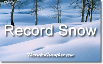
Thanks to a snowy start and a similarly snowy finish, the month of January 2014 climbed onto the list of top 10 January snow measurements in the Mile High City.

Officially the month ended with 14.3 inches of snowfall as measured at Denver International Airport.  It was just enough to bump January 1991 from the number 10 spot (14.1 inches).

Here in Thornton we received just a bit less as we saw 13.4 inches of the white stuff.

January is only our fourth snowiest month with an average of 7.0 inches (based on 1981 to 2010 normals).  The snowiest January on record occurred in 1992 when 24.3 inches of snow fell.

Looking at the 2013 / 2014 snow season, January helped make up some lost ground from the previous dry months.

The seasonal total now stands at 22.4 inches, 5.4 inches below the long term average of 27.8 inches we normally receive by the end of January.  Thornton’s seasonal total is a bit better but still below normal at 24.2 inches.

Click here to view Thornton’s seasonal snow summary.

TOP TEN SNOWIEST JANUARYS:

24.3 INCHES 1992
22.2 INCHES 1949
20.5 INCHES 1883
19.2 INCHES 1948
17.4 INCHES 1959
17.2 INCHES 1962
17.0 INCHES 1891 AND 1987
15.9 INCHES 2007
15.7 INCHES 1951
14.3 INCHES 2014

Live social feed: Thornton’s late January snowstorm

ThorntonWeather.com on Facebook, Google+ and TwitterThe stage is set for Thornton to receive its most significant snowfall of the season thus far.  Up in the high country snowfall will be measured in feet.

Here at lower elevations current forecasts are calling for 5 to 10 inches between Thursday and Friday afternoon.  Many variables are in play that could affect the total that is eventually realized but this is certainly our best shot at a heavy snow thus far in the snow season.

We will be monitoring monitoring the storm very closely and posting regularly to our Facebook page and Twitter feed.  You can follow along in real time below.  We are also on Google+ here.

For comprehensive look at the storm, please monitor our Winter Weather Briefing page.


Winter Storm Watch issued, Thornton may receive biggest snow of the season

In a very brief period of time the forecast for the next 48 hours has changed considerably.  The latest data indicates Thornton and the Colorado Front Range may be receiving a healthy dose of snow starting Thursday afternoon and lasting into Friday.

Abundant moisture streaming in from the Pacific coupled with a series of cold fronts stands to bring a wintry blast to the area.  While the arrival is still a good ways out and much could change between now and when it gets here, the potential for a significant snow event exists.

The National Weather Service has issued a Winter Storm Watch for the Denver metro area and western plains.  In effect from 3:00 p.m. Thursday through 3:00 p.m. Friday, the watch cautions that heavy snow will be possible.

Total forecast amounts are in the 3 to 6 inch range for the Denver area and 5 to 10 inches in the foothills.  Bands of heavier snowfall are possible and could serve to drive those totals up.  The Weather Prediction Center is giving at least a 40% chance of snowfall greater than or equal to 4 inches in our area.

The arrival later in the day Thursday should help to mitigate impacts to tomorrow’s commute home.  However if this pans out as forecast, Friday morning’s drive to work may be a rough one.

With those forecast snowfall amounts comes the caveat that there is the possibility for less snowfall than mentioned above.  A strong jet is overhead and while we expect upslope winds to help create a sustained snow event, should downslope flow prevail amounts will decrease.

Be sure to monitor our Winter Weather Briefing Page for all the latest with the coming storm.  Also, if you haven’t already, be sure to ‘like’ us on Facebook, follow us on Twitter and add us to your Google+ circles.

Weather may be the ultimate wildcard in deciding outcome of Super Bowl XLVIII

A crew member works to remove snow from MetLife Stadium, which will host Superbowl XLVIII next month, on January 22, 2014 in East Rutherford, New Jersey.
A crew member works to remove snow from MetLife Stadium, which will host Superbowl XLVIII next month, on January 22, 2014 in East Rutherford, New Jersey. (Getty Images)

Mother Nature and the potential she has to impact Super Bowl XLVIII is a hot topic as the game draws nearer. No matter what happens in the contest between the Denver Broncos and Seattle Seahawks, it is almost certain the game will be the coldest NFL championship ever played and possibly the snowiest.

With the game still more than eight days away, weather forecasts are less than certain about what conditions will be on game day. However a look at historical statistics from the National Weather Service for the New Jersey / New York area provide some clues.

Using 1981 to 2010 climate averages, the normal high temperature for February 2 as measured at Newark is 40 degrees. The average low is a chilly 25 degrees.

The coldest kickoff temperature in Super Bowl history occurred on January 16, 1972. Played at Tulane Stadium in New Orleans, the temperatures at the start of that game was a chilly 39 degrees on the field.

Given that, it is pretty certain this will be the coldest Super Bowl in history.  It could also be the first to have snow fall on the field and freezing rain and wind are other hazards the teams may have to contend with.

Read more about the potential for weather to impact the game on Examiner.com

Yet another reason the Weather Channel shouldn’t name winter storms

The Weather Channel's naming of storms has never been a good idea.  Now we see another reason why when a letter appears to be missing from this storm's name. Click for a larger view.
The Weather Channel’s naming of storms has never been a good idea. Now we see another reason why when a letter appears to be missing from this storm’s name. Click for a larger view.

Last year the Weather Channel unilaterally decided to start naming winter storms, a decision met with ridicule and concern from weather professionals.  Now, with a storm TWC calls ‘Janus’, we very graphically can see another reason why the naming of these storms may not be a good idea.

The list the Weather Channel created for winter storms during the 2013 – 2014 season range contains everything from Latin words and Roman governors to mythological figures.

The channel is calling the current storm pounding the Northeast ‘Janus.’  Janus comes from Roman mythology and was considered the god of beginnings and transitions.

Setting aside the fact the naming of winter storms is ridiculous and only serves to confuse people in potentially dangerous situation, the display of the name during broadcasts has brought further ridicule.

Many graphics showing the word ‘Janus’ on TWC were partially obscured by their on air personalities and even their own imagery.  The end result has been the appearance of the name without the ‘J’.

See the screenshot top right and below.

Related stories from Examiner.com:

The Weather Channel's naming of storms has never been a good idea.  Now we see another reason why when a letter appears to be missing from this storm's name.
The Weather Channel’s naming of storms has never been a good idea. Now we see another reason why when a letter appears to be missing from this storm’s name.

Historical Super Bowl temperatures, conditions and weather extremes

People walk in New York’s Times Square as snow falls during the rush hour January 21, 2014. Snow on the field is a possibility for the first time in Super Bowl history.
People walk in New York’s Times Square as snow falls during the rush hour January 21, 2014. Snow on the field is a possibility for the first time in Super Bowl history. (Getty Images)

Super Bowl XLVIII will be the first NFL championship game played outdoors at a cold-weather location. Looking back at the history of previous sites for the event, much milder weather than what will likely be seen at MetLife Stadium in New Jersey this year has been the rule.

Over the past 47 Super Bowl’s, the average on-field temperature at kickoff has been 66.5 degrees. The contests that have been played at northern latitudes have previously been in domed stadiums helping to keep that average up. That is a luxury the Denver Broncos and Seattle Seahawks won’t enjoy.

It is highly likely that this year’s Super Bowl between the Denver Broncos and Seattle Seahawks will be the coldest on record and possibly the first to have snow fall on the field.

How would that compare to weather extremes experienced during other NFL championship games?  Find out in the story on Examiner.com

NASA satellite captures image of Australian wildfires

Satellite imagery of wildfires is something we are certainly used to seeing here in Colorado, particularly the last couple of years.  Summertime in Australia brings wildfire danger as well and a NASA satellite captured smoke billowing from a blaze down under.

Much of Australia has been gripped by record-setting heat in recent weeks thus leading to the increased fire danger.  The image from NASA’s Aqua satellite shows one of the blazes burning.

From NASA:

“In January 2014, an intense heat wave and strong winds fueled an outbreak of hundreds of bushfires in South Australia. The Moderate Resolution Imaging Spectroradiometer (MODIS) on NASA’s Aqua satellite acquired this image of grass and shrub fires raging in Yumbarra Conservation Park on January 16, 2014. Red outlines indicate hot spots where MODIS detected unusually warm surface temperatures associated with fire. Northerly winds blew large plumes of smoke out over the Great Australian Bight. Members of the aboriginal community of Koonibba were preparing to evacuate as a large fire headed in the direction of the town, according to the Australian Broadcasting Company.”

NASA satellite image of wildfires and their smoke in Australia. (NASA)

Weather, natural disasters & climate news and information.