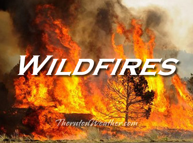
Colorado has been extremely fortunate this summer with no truly notable wildfires. Other locations across the western U.S. have not been near as lucky. Highlighting this are videos taken by a northern California man as he fled the fast moving Valley Fire.
A YouTube user posted three videos yesterday showing a harrowing escape down roads in the Anderson Springs and Middletown areas. As he drives, flames burn, oftentimes reaching 10 or more feet into the air, lap the roadway and embers and debris blow across the road.
Japan’s largest active volcano, Mount Aso, erupted Monday, prompting the Japan Meteorological Agency (JMA) to raise its five-scale volcanic alert level to three from two, warning people not to approach the area. The eruption shot plumes of smoke 2,000 meters (6,560 feet) into the air. Mount Aso, located on the southern Japanese island of Kyushu, erupted… Continue reading Japan’s Mount Aso Erupts, Tourists Evacuated→
A fast-moving wildfire left a path of devastation northwest of Sacramento, Calif., destroying homes and forcing and forcing residents to run for their lives. On Sunday morning, Gov. Jerry Brown declared a state of emergency in Lake and Napa counties, noting that he fire forced large evacuations and damage to state infrastructure. The order mobilizes various… Continue reading California wildfire spreads; governor declares emergency→
Following on a drier and slightly warmer than normal August, the month of September arrives and one can’t help but wonder if an early fall lies in wait. The month can bring our first snow of the season but more often than not, it is one of the most pleasant along the Colorado Front Range.
As temperatures start to drop, September usually reminds us that summer is at an end and fall is now here. Sunshine is predominant though as the month actually has the highest percentage of sun out of any month. Sunny days and clear, cool nights are the standard weather pattern for the month.
The month can bring extremes however. We will of course forever remember last year’s devastating floods brought on by record-setting rain. Longtime residents might remember September 1971 which brought over 17 inches of snowfall.
High pressure was the dominant feature across much of Colorado during the month of August 2015. This helped keep temperatures quite warm and while there were occasional storms, they failed to deliver much in the way of precipitation.
We started out the month very warm and dry. This was interrupted on the 9th when a series of disturbances finally brought some measurable precipitation. Dry weather returned for a few days but then a strong cold front moved bring much cooler temperatures from the 17th to the 19th. The break was short-lived and warmer mercury readings and drier conditions dominated the balance of the month.
Thornton’s average temperature for the month came in at 71.8 degrees, not far off Denver’s long term average for August of 72.5 degrees. Out at DIA where the Mile High City’s official readings are taken, it was much warmer with an average of 74.0 degrees.
Temperatures in Thornton ranged from a high of 98.1 degrees on the 15th down to a low of 45.3 degrees on the morning of the 19th. Denver’s maximum reading of 98 degrees came on the 15th as well and its lowest reading of 43 degrees came on the 23rd.
We saw 18 days with high temperature readings above the 90 degree mark. Denver saw one more than that.
Two daily high temperature records were tied in Denver during the month, those coming on the 18th and 26th with readings of 98 and 97 degrees respectively. Additionally, two mornings in a row fell to record lows. The record low temperature for the 18th (47 degrees) was tied and the following day a new record low of 47 degrees was set.
In terms of precipitation, a paltry 0.87 inches fell in Thornton’s rain bucket. Out at the airport, Denver recorded 1.18 inches. Both were well below Denver’s long term average of 1.69 inches for August.
Thornton, Colorado’s August 2015 temperatur?e summary. (ThorntonW?eather.com?)Thornton, Colorado’s August 2015 precipitat?ion summary. (ThorntonW?eather.com?)
From the National Weather Service:
CLIMATE REPORT
NATIONAL WEATHER SERVICE BOULDER, CO
244 AM MDT TUE SEP 1 2015

...................................

...THE DENVER CO CLIMATE SUMMARY FOR THE MONTH OF AUGUST 2015...

CLIMATE NORMAL PERIOD 1981 TO 2010
CLIMATE RECORD PERIOD 1872 TO 2015

WEATHER         OBSERVED          NORMAL  DEPART  LAST YEAR`S
                 VALUE   DATE(S)  VALUE   FROM    VALUE  DATE(S)
                                          NORMAL
................................................................
TEMPERATURE (F)
RECORD
 HIGH             105   08/08/1878
 LOW               40   08/26/1910
                        08/25/1910
                        08/24/1910
HIGHEST            98   08/15       105      -7       91  08/19
                                                          08/17
LOWEST             43   08/23        40       3       52  08/31
                                                          08/30
                                                          08/25
AVG. MAXIMUM     89.8              87.2     2.6     83.8
AVG. MINIMUM     58.3              57.9     0.4     57.4
MEAN             74.0              72.5     1.5     70.6
DAYS MAX >= 90     19              11.5     7.5        4
DAYS MAX <= 32      0               0.0     0.0        0
DAYS MIN <= 32      0               0.0     0.0        0
DAYS MIN <= 0       0               0.0     0.0        0

PRECIPITATION (INCHES)
RECORD
 MAXIMUM         5.85   1979
 MINIMUM         0.02   1924
TOTALS           1.18              1.69   -0.51     2.73
DAILY AVG.       0.04              0.05   -0.01     0.09
DAYS >= .01         9               8.6     0.4       13
DAYS >= .10         4               4.3    -0.3        5
DAYS >= .50         1               1.2    -0.2        3
DAYS >= 1.00        0               0.3    -0.3        0
GREATEST
 24 HR. TOTAL    0.68   08/11 TO 08/11           08/25 TO 08/26
                        08/10 TO 08/11                    08/31 TO 08/31
                        08/11 TO 08/11                    08/31 TO 08/31
 STORM TOTAL       MM                                 MM
 (MM/DD(HH))            MM                    08/26(00) TO 08/26(00)
                                                 08/31(00) TO 08/31(00)1
                                                 08/31(00) TO 08/31(00)1

SNOWFALL (INCHES)
RECORDS
 TOTAL             MM   MM
TOTALS            0.0               0.0

DEGREE_DAYS
HEATING TOTAL      13                10       3        2
 SINCE 7/1         18                16       2        7
COOLING TOTAL     304               244      60      182
 SINCE 1/1        713               688      25      613

FREEZE DATES
RECORD
 EARLIEST     09/08/1962
 LATEST       06/08/2007
EARLIEST                        10/07
LATEST                          05/05
..................................................

WIND (MPH)
AVERAGE WIND SPEED              9.6
RESULTANT WIND SPEED/DIRECTION   3/189
HIGHEST WIND SPEED/DIRECTION    38/260    DATE  08/31
HIGHEST GUST SPEED/DIRECTION    47/340    DATE  08/09

SKY COVER
POSSIBLE SUNSHINE (PERCENT)   MM
AVERAGE SKY COVER           0.50
NUMBER OF DAYS FAIR            6
NUMBER OF DAYS PC             23
NUMBER OF DAYS CLOUDY          2

AVERAGE RH (PERCENT)     45

WEATHER CONDITIONS. NUMBER OF DAYS WITH
THUNDERSTORM             15     MIXED PRECIP               0
HEAVY RAIN                1     RAIN                       4
LIGHT RAIN               12     FREEZING RAIN              0
LT FREEZING RAIN          0     HAIL                       5
HEAVY SNOW                0     SNOW                       0
LIGHT SNOW                0     SLEET                      0
FOG                       4     FOG W/VIS <= 1/4 MILE      0
HAZE                      8

-  INDICATES NEGATIVE NUMBERS.
R  INDICATES RECORD WAS SET OR TIED.
MM INDICATES DATA IS MISSING.
T  INDICATES TRACE AMOUNT.
A gorgeous Thornton, Colorado sunset as captured by LE Worley. Scroll down for more images in our slideshow.
As the calendar turns to August, the summertime heat begins to fade and that makes it easier to get out and enjoy all of the outdoor activities Colorado has to offer. From a walk in a park to afternoon thunderstorms to an abundance of wildlife, photo opportunities abound as is seen in our slideshow.
Our monsoon season typically arrives about now and that means better chances for moisture. However with limited instability, the intensity of storms are more sedate. That doesn’t mean however that the weather is any less photographic.
Slideshow updated August 30, 2015
By the end of the month some of our seasonal feathered friends will be looking to leave the state giving our last chance to see them till spring. Larger mammals are gearing up for the rut (mating season) and that can make for some intense scenes.
Showcasing images captured by ThorntonWeather.com readers as well as some of our own, our monthly slideshow covers the entire gamut of weather and nature related imagery. Sunsets, sunrises, wildlife and of course every type of weather condition are vividly depicted.
To learn more about how to send your photo to us for inclusion in the slideshow, see below the slideshow.
[flickr_set id=”72157656784854999″]
What is missing in the slideshow above? Your photo!
Our monthly photo slideshow is going to feature images that we have taken but more importantly images that you have captured. The photos can be of anything even remotely weather-related.
Landscapes, current conditions, wildlife, pets, kids. Whimsical, newsy, artsy. Taken at the zoo, some other area attraction, a local park, a national park or your backyard. You name it, we want to see and share it!
Images can be taken in Thornton, Denver or anywhere across the extraordinary Centennial State. We’ll even take some from out of state if we can tie it to Colorado somehow.
We’ll keep the criteria very open to interpretation with just about any image eligible to be shown in our slideshows.
What do you win for having your image in our slideshow? We are just a ‘mom and pop’ outfit and make no money from our site so we really don’t have the means to provide prizes. However you will have our undying gratitude and the satisfaction that your images are shared on the most popular website in Thornton.
To share you images with us and get them included in the slideshow just email them to us or share them with ThorntonWeather.com on any of the various social media outlets. Links are provided below.
As measured at Denver International Airport, the Mile High City’s high temperature reached 97 degrees at 2:33pm. This ties the record for the date set in 1985 and 1936.
Today, here in Thornton we were just a bit cooler topping out at 95 degrees.
The event makes it the fourth temperature record set or tied in Denver this month.
On August 15 Denver tied the record high for the date (98 degrees). This was followed by record lows on August 18 and 19 (47 degrees on both days).
Stay up to date with Thornton’s weather: Be sure to ‘like’ us on Facebook, follow us on Twitter and add us to your Google+ circles.
Within days of the U.S. Environmental Protection Agency’s accidental release of 3 million gallons of mining wastewater into the Animas River in Colorado, portions of the Internet frothed over with conspiracy theories that the EPA spill may not have been an accident. Now, that line of thinking has found its way to the Utah legislature. And… Continue reading EPA Spill Conspiracy Theories Gain Traction in Utah Legislature→
The U.S. government is at it again, hyping meaningless records in a parameter that does not exist in order to frighten us about something that doesn’t matter. NASA and the National Oceanic and Atmospheric Administration (NOAA) announced this week that according to their calculations, July 2015 was the hottest month since instrumental records began in 1880.… Continue reading Global warming: Deceptive temperature record claims→
Typhoon Goni made landfall in the southwestern Kumamoto prefecture on the Japanese island of Kyushu Tuesday. The typhoon damaged buildings and cars, and flooded streets before barreling toward the Sea of Japan. While no deaths were recorded, at least 26 people were injured, Japan’s fire and disaster management agency said, according to the Associated Press (AP).… Continue reading Typhoon Goni Makes Landfall In Japan, Injures At Least 26→
Weather, natural disasters & climate news and information.

 Colorado has been extremely fortunate this summer with no truly notable wildfires. Other locations across the western U.S. have not been near as lucky. Highlighting this are videos taken by a northern California man as he fled the fast moving Valley Fire.
 Following on a drier and slightly warmer than normal August, the month of September arrives and one can’t help but wonder if an early fall lies in wait. The month can bring our first snow of the season but more often than not, it is one of the most pleasant along the Colorado Front Range.


 As measured at Denver International Airport, the Mile High City’s high temperature reached 97 degrees at 2:33pm. This ties the record for the date set in 1985 and 1936.