Denver topped out at 102 degrees on June 24 setting a record for the date.
As officially measured at Denver International Airport, the mercury in Denver today topped out at 102 degrees at 3:35pm. This easily breaks the old record for June 24th of 100 degrees set in 2007.
Here in Thornton we fell just shy of the 100 degree mark today as we topped out at 99.3 degrees at 3:55pm. This follows on 102.2 degrees on Saturday and 100.2 degrees on Friday.
This makes it the third day in a row with Denver seeing 100 degrees or warmer temperatures. Only four other times since recordkeeping began in 1878 have there been three or more 100 degree days in a row in the Mile High City.
Denver has recorded 100 degrees or warmer only 73 times including today. Weather forecasts currently call for 100+ degree temperatures for at least the first part of the week giving a chance that the current streak will continue.
Stay up to date with Thornton’s weather: ‘Like’ us on Facebook, follow us on Twitter and add us to your Google+ circles
High temperature records fall once again in Denver
Saturday brought another extraordinarily hot day across northeastern Colorado.
In Denver the mercury climbed to 104° at 4:57pm. This broke the record high temperature for June 23rd of 102° set back in 1954.
This also ties the mark for the warmest temperature ever recorded in Denver during the month of June. The only other time 104° was also recorded was on June 26, 1994.
Here in Thornton we reached 102.2° at 4:09pm. This is the highest temperature recorded by ThorntonWeather.com since we came online in October 2006. Our previous highest temperature was 101.6° on July 17, 2010.
The heat wave continues the record-setting heat we have seen this month in the Mile High City. High temperature records have been set on June 4, June 17, June 18, June 22 and now June 23.
Denver set a high temperature record of 100° on Monday, June 18, 2012.
A record-setting day in the Mile High City. At 2:57pm today the temperature at DIA climbed to 100 degrees thus breaking the record high for the date. The old record was 99 degrees last set in 1990.
Also, the date will go down in history as having had the record high minimum as the mercury dipped to only 69 degrees at 5:38am. That handily beat the previous record of 66 degrees set in 1940.
Here in Thornton we weren’t quite as warm. Our high temperature topped out at 97.5 degrees at 4:23pm. On the other end, our morning low was considerably cooler as we dropped to 60.3 degrees at 6:08am.
The National Weather Service also points out some interesting information about today’s heat:
“Although official records are not recorded for an average daily temperature…a few interesting statistics have been found for today’s excessive warmth. Today’s average daily temperature was a very warm 84.5 degrees. When we look at the average daily temperatures for this date in history…today was by far the warmest for June 18th. The old warmest average daily high temperature for June 18th was 81.5 degrees set back in 1936.”
“The average daily temperature of 84.5 degrees also ties with June 24th, 1954 as the 2nd warmest daily average ever for the month of June in Denver.
“The warmest daily average temperature for the month of June is 85.5 degrees and it occurred on June 27th, 1990.”
Denver set a high temperature record of 98° on Sunday, June 17, 2012.
A record breaking Sunday in Denver as the mercury topped out at 98 degrees at 4:25pm. This breaks the high temperature record for the date of 97 degrees set in 2007.
Here in Thornton we were slightly cooler with the high reaching 97.1 degrees at 3:20pm.
More record-setting heat is forecast for Monday as the mercury is expected to soar to 100 degrees. The record for June 18 is 99 degrees set in 1990 and could very well tumble. Get the latest forecast here: http://www.thorntonweather.com/forecast.php
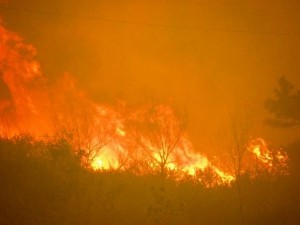
The High Park Fire rages in the mountains west of Fort Collins, Colorado. The dry conditions have prompted the state to ban all open burning and personal use of fireworks. Click the image for a slideshow of the blaze. (US Forest Service)
Colorado Gov. John Hickenlooper today issued an executive order banning all open burning and the use of personal fireworks across the state. As the High Park Fire shows, conditions are tinder dry and while lightning was the cause of that blaze, man is often to blame for wildfires as well.
“We can’t completely eliminate the threat of wildfire because there’s no way to control Mother Nature,” Hickenlooper said in a statement. “But we can take steps to reduce the risks of more wildfires starting. This ban is a necessary step to help protect people, property and the beautiful state we live in.”
The ban will put a damper on 4th of July fireworks festivities but is a necessary step to protect life and property. For campers, there will be limitations in unimproved locations but fires in permanent pits within developed campgrounds will still be allowed as long as the local authority allows it.
The High Park Fire now ranks as the third largest blaze in Colorado history. In 96 short hours the blaze grew to encompass an area more than 72 square miles and is now only 10% contained and still growing.
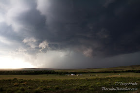
A massive storm churns near Simla, Colorado on Thursday, July 7, 2012. See more photos in the slideshow below.
Mother Nature brought severe weather to northeastern Colorado again yesterday but for the second day in a row Thornton missed out on the action. Since the storms wouldn’t come to us, ThorntonWeather.com went to the storms.
Thornton seems to be in a bit of a ‘storm drought’ of late with most thunderstorms passing us by and yielding little more than a few rain drops. Elsewhere along the Colorado Front Range the story has been much different over the last two days.
The setup was near perfect thanks to the formation of a Denver cyclone with moist air pulling in from the south meeting dry air from the north.
ThorntonWeather.com took off in mid-afternoon and headed east to Bennett, then on to Byers and east on Highway 36. The initial storm cell that was beginning to take shape broke in to three and decisions had to be made on which one to follow.
The southernmost cell seemed to hold the most promise so we headed south, through Limon and tracked the storm near Simla.
The storm would drop tennis ball size hail and push out wind gusts measured at 80mph. As many as four tornadoes were reported to have been caused by the storm, a number which will be confirmed and finalized later today.
In Elbert County, emergency agencies are conducting damage assessments from at least one of the twisters that tore through the central part of the county. Extensive damage to as many as seven homes west of Simla was seen. One person received minor injuries.
Denver set a high temperature record of 94° on Tuesday, June 4.
As officially measured at Denver International Airport, the Mile High City hit a high temperature of 94° at 2:25pm. This broke the old record high temperature for the date of 93° set in 2010, 1990 and 1977.
The problem? No other reliable station in the metro area came anywhere near that high of a temperature reading.
For comparison, Rocky Mountain Regional Airport saw 91°, Centennial 88°, Boulder 91°, Denver City Park 90°, Stapleton 90° and here in Thornton we recorded 91°.
The mercury climbed to 88 degrees at 3:03pm today. This sets a new record for the date, breaking the old record of 87 degrees set in 2000. Here in Thornton we matched Denver’s official temperature with 88 degrees as well.
ThorntonWeather.com believes so firmly that every house should have a weather radio, we are giving one away for Severe Weather Awareness Week.
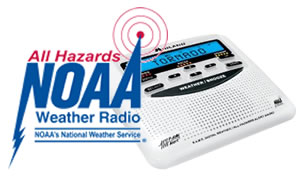
As the nation’s midsection digs out from an extraordinary day of severe weather and tornadoes, Colorado’s Severe Weather Awareness Week kicks off. To raise awareness of the dangerous weather Thornton residents face each year, ThorntonWeather.com is going to give away a NOAA All Hazards Weather Radio *.
We have long said that every resident should own a weather radio. These devices tap directly into the National Weather Service and sound an alarm when severe weather is approaching. Life saving information and instructions are then broadcast giving you the precious moments that you may have to take action before disaster strikes.
To help raise awareness of severe weather and these devices, we are giving away a Midland WR-120B weather radio. The radio has all of the essential features including SAME alert programming, a siren and voice alert, battery backup and it is trilingual.
It is our goal that even if you don’t win the radio, you will take action and purchase a weather radio on your own. To learn more about these important devices and why you should own one, click here.
So how do you win? It is easy!
All you have to do is share our Facebook page or Google+ page with all of your friends telling them how great a resource ThorntonWeather.com is and ask them to ‘like’ us or add us to their ‘circles.’
Simply follow the links below and click ‘Share’ if on Facebook or ‘Share this post’ on Google+. Be sure to do this from the postings linked below so that we can see that you shared it and in doing so you are automatically entered.
We will then randomly pick a winner on Monday, April 23 after Severe Weather Awareness Week is over.
* Contest is open to residents of the Denver / Boulder metropolitan area (verified by shipping address). Weather radio will be shipped directly to the winning contestant from Amazon.com. Allow up to 2 weeks for delivery after the contest ends.
The City of Thornton's new Emergency Management T-Alerts will inform residents of a wide variety of weather and civil emergencies.
Sitting at the western edge of tornado alley, the Denver metro area is home to severe weather of all forms. In an effort to keep residents aware of the dangers Mother Nature brings every year, the City of Thornton is set to roll out an email alert system.
Seeking to correct that lapse, Thornton’s Office of Emergency Management presented a significant enhancement to the city’s T-Alert system to city council at a planning session last night.
Emergency Manager Gene Putman explained that with the proliferation of email on mobile devices like cellular phones, the system will allow the city to send out warnings to residents in a matter of seconds. The system was tested during the February snowstorms and was a resounding success.
Dispatches can be sent out by the city’s emergency management personnel or in an urgent situation, the new 911 center. Spanish translations to the messages will also be included in the emails.
Putman said, “Within 30 seconds of a warning being issued by the National Weather Service we can have that critical information out to residents.”
Uses for the emergency management service will include obvious items such as tornado watches and warnings and severe hail or flooding. Also thrown into the mix will be important announcements about major snow events, hazardous material spills and other types of civil alerts.
Jack Ethredge, City Manager, is no stranger to disasters having served as Emergency Manager along the Gulf Coast during two hurricanes. He told council the system gives the city an “important, broader way to communicate.”
While the new system will help to keep residents safe, officials also remind residents that they must take responsibility for their own safety as well and stay aware of developing weather. Local news media should be monitored and residents should own a NOAA All Hazards Radio.
Note: In addition to the city’s alert system, you can subscribe to ThorntonWeather.com’s alert system. We believe the two systems will complement each other. Our system provides all watches and warnings from the National Weather Service while the city’s will maintain a focus on the major events.
Thornton also continues to improve and refine its disaster preparedness as a city government.
Emergency management personnel are receiving important training on disaster response and new emergency procedures are being developed all city employees.
When disaster strikes, the speed and accuracy of a response is essential and Emergency Investigation Area Teams have been created to aid on this front. Each team will be comprised of personnel from key city departments. These teams will be responsible for one of six Emergency Investigation Areas and when needed, will be deployed to document a situation and provide direction.
Weather, natural disasters & climate news and information.