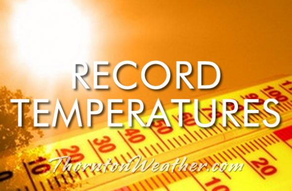
We knew it was going to be warm and windy today and boy was it! Downslope winds kept things warm in the early morning hours and it went up a good ways from there.
At 1:38pm the temperature at Denver International Airport where the Mile High City’s official measurements are taken reached 80 degrees.
This easily bested the record high temperature for this date (71 degrees in 1951). More notably that also is the warmest temperature reading ever in February in Denver. The old warmest February reading of 77 degrees was recorded on February 4, 1890 and February 28, 2006.
Here in Thornton, we were a touch warmer than Denver with a high of 80.5 degrees at 1:22pm.
As for the wind, it kicked into high gear at around 2:00am. Our top gust of 48.3 mph occurred at 8:15am.
Only a select few have the privilege of viewing our planet from space so those of us more grounded live vicariously through the images they send back. Astronaut Shane Kimbrough gave us a look at a lit up Front Range from Colorado Springs to Cheyenne in an image he tweeted out.
All the major population centers are clearly visible. The nighttime lights of Colorado Springs, Denver, Boulder, Fort Collins, Cheyenne and even Fort Morgan out on the plains are all visible. The Denver / Boulder office of the National Weather Service tweeted out a copy of the image labeled with the cities to provide some context.
Amazing view of the Urban Corridor from Astronaut Shane Kimbrough as the International Space Station passed overhead! City names overlayed. pic.twitter.com/Fdb2Qh5uqm
The month of December brought colder and wetter than normal conditions to Thornton and in January we continued that trend with more of the same and our first month of the season with above average snowfall.
January started out warmer than normal but on the third that changed with a system that sent temperatures plummeting for five days. From the 3rd to the 7th the mercury failed to even climb above freezing and we saw three overnight lows dip to zero or below. The period also brought 7.4 inches over a three day period from the 3rd to the 5th.
Once that system moved out, we returned to warmer and dry conditions for four days then saw light snow on the 11th and 12th followed by colder temperatures through the 16th. The 16th also brought our last measurable snow for the month.
The last half of the month was relatively uneventful and the final three days saw highs climb over the 60 degree mark.
Thornton saw an average temperature in January of 29.5 degrees. This is a good ways below the long term Denver average for the month of 30.7 degrees. Out at DIA where Denver’s official measurements are kept, it was slightly warmer with an average of 30.0 degrees.
Temperatures in our part of town ranged from a high of 66 degrees on January 31 down to a low of 9.4 degrees below zero on the morning of the 6th. Denver saw its warmest reading of 63 degrees on the 30th and its coldest of 7 below zero on the morning of the 6th.
In terms of precipitation, the Mile High City averages 0.41 inches in January. Both Thornton and Denver came in wetter than that with 0.77 inches and 0.54 inches of liquid precipitation at those locations respectively.
Thornton welcomed a respectable 10.0 inches of snowfall during the month. Out at the airport, their total lagged ours with a reading of 6.3 inches. On average Denver receives 7.0 inches during the month.
Thornton, Colorado’s January 2017 temperature summary.Thornton, Colorado’s January 2017 precipitation summary.
From the National Weather Service:
...THE DENVER CO CLIMATE SUMMARY FOR THE MONTH OF JANUARY 2017...

CLIMATE NORMAL PERIOD 1981 TO 2010
CLIMATE RECORD PERIOD 1872 TO 2017

WEATHER         OBSERVED          NORMAL  DEPART  LAST YEAR`S
                 VALUE   DATE(S)  VALUE   FROM    VALUE  DATE(S)
                                          NORMAL
................................................................
TEMPERATURE (F)
RECORD
 HIGH              76   01/27/1888
 LOW              -29   01/09/1875
HIGHEST            63   01/30        76     -13       65  01/30
LOWEST             -7   01/06       -29      22        5  01/10
AVG. MAXIMUM     42.3              44.0    -1.7     43.5
AVG. MINIMUM     17.7              17.4     0.3     20.1
MEAN             30.0              30.7    -0.7     31.8
DAYS MAX >= 90      0               0.0     0.0        0
DAYS MAX <= 32      8               5.5     2.5        3
DAYS MIN <= 32     30              29.4     0.6       30
DAYS MIN <= 0       2               1.7     0.3        0

PRECIPITATION (INCHES)
RECORD
 MAXIMUM         2.35   1883
 MINIMUM         0.01   1933
                        1934
                        1952
TOTALS           0.54              0.41    0.13     0.50
DAILY AVG.       0.02              0.01    0.01     0.02
DAYS >= .01         3               4.1    -1.1        5
DAYS >= .10         3               0.9     2.1        3
DAYS >= .50         0               0.0     0.0        0
DAYS >= 1.00        0               0.0     0.0        0
GREATEST
 24 HR. TOTAL    0.34   01/04 TO 01/05
SNOWFALL (INCHES)
TOTALS            6.3               7.0
JANUARY RECORD SNOWFALL
                 24.3              1992

DEGREE_DAYS
HEATING TOTAL    1075              1063      12     1021
 SINCE 7/1       3117              3531    -414     3208
COOLING TOTAL       0                 0       0        0
 SINCE 1/1          0                 0       0        0

FREEZE DATES
RECORD
 EARLIEST     09/08/1962
 LATEST       06/08/2007
EARLIEST                        10/07
LATEST                          05/05
.........................................................

WIND (MPH)
AVERAGE WIND SPEED              9.0
RESULTANT WIND SPEED/DIRECTION   3/223
HIGHEST WIND SPEED/DIRECTION    37/280    DATE  01/10
HIGHEST GUST SPEED/DIRECTION    53/270    DATE  01/09

SKY COVER
POSSIBLE SUNSHINE (PERCENT)   MM
AVERAGE SKY COVER           0.60
NUMBER OF DAYS FAIR            5
NUMBER OF DAYS PC             20
NUMBER OF DAYS CLOUDY          6

AVERAGE RH (PERCENT)     59

WEATHER CONDITIONS. NUMBER OF DAYS WITH
THUNDERSTORM              0     MIXED PRECIP               0
HEAVY RAIN                0     RAIN                       0
LIGHT RAIN                0     FREEZING RAIN              0
LT FREEZING RAIN          0     HAIL                       0
HEAVY SNOW                1     SNOW                       2
LIGHT SNOW                9     SLEET                      0
FOG                      11     FOG W/VIS <= 1/4 MILE      2
HAZE                      7

-  INDICATES NEGATIVE NUMBERS.
R  INDICATES RECORD WAS SET OR TIED.
MM INDICATES DATA IS MISSING.
T  INDICATES TRACE AMOUNT.
February in Colorado typically brings to an end an extended period when average temperatures are at their lowest. Winter begins to loosen its grip and temperatures get warmer but precipitation is not a particularly common event during the month.
Thus far our snow season is extraordinarily well in terms of snowpack with all basins in Colorado having well above normal levels. At lower elevations however, the snow season has been pretty poor due to a slow start. February is only our sixth snowiest month so we may not see much snowfall for the balance of the month.
Temperatures however do usually see a nice rebound during the month. Average high temperatures climb from an average of 44 degrees at the start to 50 degrees by the end of February.
Geese walk across a frozen Barr Lake with the snow-capped Rocky Mountains in the background. (Shawn Jones)
As one of our coldest months, January can be a good month to hibernate inside and avoid the outdoors. But, like any month in Colorado, photo opportunities abound as our monthly slideshow demonstrates.
Snow is not normally dominant in the month but when it does fall, it can create a beautiful blanket of white. Throw in the amazing sunrises and sunsets we receive in the middle of winter as well as wildlife and a host of other subjects and the imagery can be quite beautiful and stunning.
Slideshow updated January 31, 2017
To learn more about how to send your photo to us for inclusion in the slideshow, see below the slideshow.
Showcasing images captured by ThorntonWeather.com readers as well as some of our own, our monthly slideshow covers the entire gamut of weather-related imagery.
Sunsets, sunrises, wildlife and of course every type of weather condition are vividly depicted in images captured from yours and our cameras.
[flickr_set id=”72157679397821116″]
What is missing in the slideshow above? Your photo!
Our monthly photo slideshow is going to feature images that we have taken but more importantly images that you have captured. The photos can be of anything even remotely weather-related.
Landscapes, current conditions, wildlife, pets, kids. Whimsical, newsy, artsy. Taken at the zoo, some other area attraction, a local park, a national park or your backyard. You name it, we want to see and share it!
Images can be taken in Thornton, Denver or anywhere across the extraordinary Centennial State. We’ll even take some from out of state if we can tie it to Colorado somehow.
We’ll keep the criteria very open to interpretation with just about any image eligible to be shown in our slideshows.
What do you win for having your image in our slideshow? We are just a ‘mom and pop’ outfit and make no money from our site so we really don’t have the means to provide prizes. However you will have our undying gratitude and the satisfaction that your images are shared on the most popular website in Thornton.
To share you images with us and get them included in the slideshow just email them to us or share them with ThorntonWeather.com on any of the various social media outlets. Links are provided below.
Thornton resident Shannon Dizmang put his camera to good use and captured a stunning time lapse video of some lenticular clouds that developed this afternoon.
Also known by their scientific name of altocumulus standing lenticularis, these clouds are not entirely unusual in Colorado on the Front Range during the winter. Strong jet winds force moist air to be pushed up by the rugged terrain of the adjacent Rocky Mountains. This creates a wave-like pattern of air flow that condenses at high altitudes (usually around 20,000 feet).
Another year in the books for us and as we look back on our overall weather for 2016, we see overall temperatures were warmer than normal while precipitation fell a good bit short of normal. The year did seem to lack any major drama in terms of severe weather or winter storms which is likely a good thing.
We started out with above normal temperatures for the first quarter of the year. March, as usual, was our snowiest month and also became our wettest month of the year. April followed with some snow and a good bit of rain to be our second wettest and May the third.
May also saw much cooler than normal temperatures with the biggest departure from normal. From there, drier conditions reigned through November with each month registering below normal precipitation.
October and November saw our biggest deviations from normal temperatures as high pressure dominated and we saw extraordinarily warm conditions. This changed in December as Arctic air infiltrated the region leading to well below normal temperatures.
Overall, Thornton’s annual temperature came in at 51.6 degrees. This was 1.1 degrees above Denver’s 30 year average (1981 to 2010) of 50.5 degrees. We saw readings ranging from a high of 100.4 degrees down to a low of 10.7 degrees below zero. Fifty days saw 90 degrees or higher while at the opposite end we saw 169 days with readings at or below freezing.
Out at DIA where the Mile High City’s official measurements are kept, it was warmer with an annual average of 52.3 degrees. For Denver, that ranks as the 14th warmest year in its 145 year temperature history.
In terms of precipitation, Denver averages 14.3 inches per calendar year. Both Thornton and Denver fell well short of that mark with 12.98 inches and 11.85 inches respectively. For Denver, that is the 37th driest year on record.
Thornton saw a very respectable 68.1 inches for the calendar year. At the airport Denver saw less with 61.6 inches. Both were well above the annual average of 53.8 inches.
Thornton, Colorado’s annual temperature summary for 2016.Thornton, Colorado’s annual precipitation summary.
From the National Weather Service:
CLIMATE REPORT
NATIONAL WEATHER SERVICE DENVER/BOULDER CO
1010 AM MST SUN JAN 1 2017

...................................

...THE DENVER CO CLIMATE SUMMARY FOR THE YEAR OF 2016...

CLIMATE NORMAL PERIOD 1981 TO 2010
CLIMATE RECORD PERIOD 1872 TO 2016

WEATHER         OBSERVED          NORMAL  DEPART  LAST YEAR`S
                 VALUE   DATE(S)  VALUE   FROM    VALUE  DATE(S)
                                          NORMAL
................................................................
TEMPERATURE (F)
RECORD
 HIGH             105   06/26/2012 06/25/2012
                        07/20/2005 08/08/1878
 LOW              -29   01/09/1875
HIGHEST           102   07/10/2016                   98  08/15
LOWEST            -15   12/17/2016                  -10  01/04
AVG. MAXIMUM     66.7              64.7     2.0     65.4
AVG. MINIMUM     38.0              36.3     1.7     38.6
MEAN             52.3              50.5     1.8     52.0
DAYS MAX >= 90     55              39.6    15.4       48
DAYS MAX <= 32     14              20.0    -6.0       29
DAYS MIN <= 32    138             156.9   -18.9      126
DAYS MIN <= 0 4 5.8 -1.8 7 PRECIPITATION (INCHES) RECORD MAXIMUM 23.31 1967 MINIMUM 7.29 2008 TOTALS 11.85 14.30 -2.45 18.31 DAILY AVG. 0.03 0.03 0.00 0.05 DAYS >= .01        71              79.7    -8.7      107
DAYS >= .10        32              34.9    -2.9       49
DAYS >= .50         5               7.6    -2.6       10
DAYS >= 1.00        2               2.3    -0.3        2
GREATEST
 24 HR. TOTAL    1.38   2016                5/26 TO 5/27
                 1.22   2016                4/15 TO 4/16
                 0.77   2016                3/23 TO 3/23
SNOWFALL RECORDS JANUARY THROUGH DECEMBER TOTALS
               MAXIMUM           MINIMUM
                115.9   1913       18.9    1887
                112.0   1959       21.5    1888
                 99.2   1929       21.8    1890
 24 HR TOTAL     23.6   12/24/1982 TO 12/24/1982

TOTALS           61.6              53.8     7.8     64.4
 LIQUID EQUIV    6.16              5.40    0.76     6.44
SINCE 7/1        11.4              22.5   -11.1     22.6
 LIQUID 7/1      1.14              2.20   -1.06     2.26
SNOWDEPTH AVG.      0                MM      MM        0
DAYS >= TRACE      37              33.3     3.7       51
DAYS >= 1.0        13              16.3    -3.3       25
GREATEST
 SNOW DEPTH        10   03/24                          9  02/23
 24 HR TOTAL     13.1   03/23
                 11.8   04/16
                  6.9   02/01

 STORM TOTAL     13.1   03/23

DEGREE_DAYS
HEATING TOTAL    5415              6059    -644     5479
 SINCE 7/1       2042              2468    -426     5575
COOLING TOTAL     878               769     109      877
 SINCE 1/1        878               769     109      877

FREEZE DATES
RECORD
 EARLIEST     09/08/1962
 LATEST       06/08/2007
EARLIEST                        10/07
LATEST                          05/05
..................................................

WIND (MPH)
AVERAGE WIND SPEED              10.0
RESULTANT WIND SPEED/DIRECTION   2/194
HIGHEST WIND SPEED/DIRECTION    54/340    DATE  07/24
HIGHEST GUST SPEED/DIRECTION    74/340    DATE  07/24

SKY COVER
POSSIBLE SUNSHINE (PERCENT)   MM
AVERAGE SKY COVER           0.50
NUMBER OF DAYS FAIR           94
NUMBER OF DAYS PC            210
NUMBER OF DAYS CLOUDY         62

AVERAGE RH (PERCENT)     50

WEATHER CONDITIONS. NUMBER OF DAYS WITH
THUNDERSTORM              0     MIXED PRECIP               0
HEAVY RAIN                3     RAIN                      13
LIGHT RAIN               72     FREEZING RAIN              0
LT FREEZING RAIN          0     HAIL                       4
HEAVY SNOW                5     SNOW                      17
LIGHT SNOW               39     SLEET                      0
FOG                      80     FOG W/VIS <= 1/4 MILE     26
HAZE                     33

-  INDICATES NEGATIVE NUMBERS.
R  INDICATES RECORD WAS SET OR TIED.
MM INDICATES DATA IS MISSING.
T  INDICATES TRACE AMOUNT.

..........2016 CLIMATE YEAR IN REVIEW...........

THE YEAR OF 2016 IN DENVER, THE FRONT RANGE AND NORTHERN COLORADO,
WAS A TRANSITION FROM STRONG EL NINO CONDITIONS OVER TO WEAK LA NINA
AND INTO THE CURRENT ENVIRONMENT WHICH IS ENSO NEUTRAL. AS EL NINO
CONDITIONS WEAKENED FROM MID-WINTER THROUGH LATE SPRING 2016,
TEMPERATURES CAME IN WARMER THAN AVERAGE FOR JANUARY THROUGH MARCH
ALONG WITH NEAR TO SLIGHTLY ABOVE NORMAL PRECIPITATION FOR THE THREE
MONTHS. DENVER`S WETTEST MONTH OF 2016 ARRIVED IN APRIL WITH 2.56
INCHES OF PRECIPITATION ALONG WITH 18.4 INCHES OF SNOW. TEMPERATURES
FOR THEN COOLED TO NEAR AVERAGE FOR APRIL AHEAD OF ABOVE AVERAGE
PRECIPITATION AND FURTHER COOLING INTO MAY. MAY WAS THE SECOND
WETTEST MONTH OF 2016 AND ALSO HAD THE COLDEST MONTHLY DEPARTURE
FROM AVERAGE FOR THE YEAR AT 2.7 DEGREES BELOW DENVER`S MONTHLY MAY
NORMAL.

WITH WATER TEMPERATURE CONDITIONS RAPIDLY CHANGING IN THE EQUATORIAL
PACIFIC REGION IN THE FIRST HALF OF 2016, NORTHERN COLORADO AND THE
HIGH PLAINS STATES TRANSITIONED INTO A DIFFERENT PATTERN AS WELL.
THE FIVE MONTHS OF JUNE THROUGH OCTOBER ALL REGISTERED PRECIPITATION
TOTALS BELOW THEIR MONTHLY AVERAGE. AUGUST RECEIVED A MERE 0.22
INCHES OF PRECIPITATION IN DENVER WHICH WAS 1.47 INCHES BELOW
AVERAGE AND WAS THE LOWEST PERCENTAGE OF NORMAL OF ALL MONTHS OF
2016 AT 13 PERCENT.

AS A LARGE AND STRONG RIDGE OF HIGH PRESSURE PERSISTED ACROSS THE
CENTRAL AND SOUTHERN ROCKIES FROM MID SUMMER INTO MID FALL,
TEMPERATURES REFLECTED THIS WITH OCTOBER AND NOVEMBER LANDING WELL
ABOVE THEIR MONTHLY AVERAGE TEMPERATURES. BOTH OCTOBER AND NOVEMBER
IN DENVER CAME IN WITH MONTHLY TEMPERATURE DEPARTURES OF 6.9 AND 6.8
DEGREES ABOVE AVERAGE RESPECTIVELY. PRECIPITATION ALSO HELD BELOW
NORMAL FOR THESE TWO MONTHS AS WELL WITH 0.26 INCHES IN OCTOBER AND
0.52 INCHES IN NOVEMBER. HOWEVER, WITH TWO MOIST AND WINTER-LIKE
PACIFIC DISTURBANCES IN MID NOVEMBER, THE DEPARTURE FROM NORMAL IN
NOVEMBER WAS ONLY -0.09 OR 85 PERCENT OF AVERAGE.

AS METEOROLOGISTS OBSERVED THE DEVELOPING NORTHERN HEMISPHERIC
PATTERN FROM LATE NOVEMBER INTO EARLY DECEMBER, IT WAS CLEAR THAT A
CHANGE FOR THE COLDER WAS COMING TO MUCH OF THE UNITED STATES,
INCLUDING DENVER. IN EARLY DECEMBER, WINDS ALOFT BROADLY EXTENDED
LONGITUDINALLY FROM THE ARCTIC REGION NORTH OF SIBERIA, ACROSS THE
NORTH POLE REGION AND INTO SOUTHERN CANADA. FRIGID ARCTIC AIR WAS
BROUGHT SOUTHWARD INTO CANADA AND ACROSS MUCH OF THE CENTRAL UNITED
STATES AS A RESULT. THIS WAS FOLLOWED BY ANOTHER PATTERN OF
PERSISTENT NORTHERLY WINDS ALOFT ACROSS NORTHERN LATITUDES WHICH
USHERED IN ANOTHER PERIOD OF COLD AND SNOWFALL AHEAD OF THE
CHRISTMAS HOLIDAY. THESE TWO SYSTEMS WERE ENOUGH TO BRING DECEMBER`S
AVERAGE MONTHLY TEMPERATURE DOWN TO -2.2 BELOW NORMAL ALONG WITH
ABOVE AVERAGE PRECIPITATION AND SNOWFALL.

WHEN 2016 ENDED, THE AVERAGE ANNUAL TEMPERATURE FOR DENVER FINALIZED
AT 52.3 DEGREES, WHICH IS 1.8 DEGREES ABOVE THE 1981-2010 ANNUAL
AVERAGE OF 50.5 DEGREES. THIS RANKS AS 14TH WARMEST IN DENVER`S 145
YEAR TEMPERATURE HISTORY. THE WARMEST YEAR IN DENVER`S WEATHER
HISTORY WAS IN 1934 WITH AN AVERAGE ANNUAL TEMPERATURE OF 54.8
DEGREES. THE COLDEST YEAR WAS 1912 WITH AN ANNUAL AVERAGE OF 47.6
DEGREES.

FOR THE PRECIPITATION CATEGORY, 2016 IN DENVER WAS ON THE DRY SIDE
OF THE 1981-2010 ANNUAL AVERAGE. THE YEAR ENDED WITH 11.85 INCHES OF
PRECIPITATION WHICH WAS 2.45 INCHES BELOW THE ANNUAL NORMAL OF 14.30
INCHES, OR 83 PERCENT OF NORMAL. THE ANNUAL TOTAL OF 11.85 INCHES
RANKS AS 37TH DRIEST IN DENVER`S 145 YEAR WEATHER HISTORY. THE
WETTEST YEAR IN DENVER`S WEATHER HISTORY WAS IN 1967 WHEN 23.31
INCHES OF PRECIPITATION FELL. DENVER`S DRIEST YEAR OCCURRED IN 2002
WHEN ONLY 7.48 INCHES OF PRECIPITATION WAS RECORDED.
Mother Nature seems intent on starting out 2017 the way she ended 2016 – cold. A deep trough coupled with successive, reinforcing cold fronts sent Thornton’s mercury plunging and delivered a healthy shot of snow over the last couple of days.
Below is a time lapse video from our east webcam covering the majority of the event. It begins at 6:00am on Wednesday, January 4 when we were only seeing flurries. From there you see the varying intensities of snow over the next 24 hours or so and end with some hints of blue sky but the afternoon of the 5th. In all, the video covers 36 hours in about 83 second.
Thornton ended with 7.1 inches of snow over the two-day period, our biggest snowfall of the season thus far.
For the three previous months we had seen warmer and drier than normal conditions. December finally brought an end to that streak with temperatures well below normal and precipitation almost doubt the average for the month.
The month was largely an unsettled one as a series of storm systems moved across the region. Two significant blasts of Arctic air sent the mercury plummeting. The first, from the 6th to the 8th, brought little snowfall but the second from the 16th to the 18th was quite generous. The balance of the month saw things warm up with 10 of the last 13 days seeing above normal mercury readings.
Overall, Thornton saw an average monthly temperature of 28.1 degrees. This was well below Denver’s 30 year average (1981 – 2000) for the month of December of 30.0 degrees. Out at DIA where the Mile High City’s official measurements are taken, the month averaged 27.8 degrees.
Temperatures ranged from a high of 65.7 degrees on the 30th down to a bone-chilling low of 10.7 degrees below zero on the morning of the 17th. Denver saw its warmest temperature of 65 degrees and coldest of 15 degrees below zero on the same dates.
That low reading in Denver on the 17th was also a record low for the date. Additionally, the airport saw a high temperature of only 3 degrees that day setting a new record low maximum for the 17th.
In all, Thornton saw five days where the high temperatures failed to climb above freezing and four days with temperatures below zero. Denver recorded six and four respectively.
In terms of precipitation, Denver averages 0.35 inches of liquid precipitation during December. Thornton easily bested the average with 0.64 inches for the month while Denver fared better with 0.78 inches.
Both Thornton and Denver saw above average levels of snowfall. The Mile High City averages 8.5 inches in December. In 2016, Thornton saw 8.9 inches while DIA recorded 9.7 inches.
Thornton, Colorado’s December 2016 temperature summary. (ThorntonWeather.com)Thornton, Colorado’s December 2016 precipitation summary. (ThorntonWeather.com)
From the National Weather Service:
CLIMATE REPORT
NATIONAL WEATHER SERVICE DENVER/BOULDER CO
718 AM MST SUN JAN 1 2017

...................................

...THE DENVER CO CLIMATE SUMMARY FOR THE MONTH OF DECEMBER 2016...

CLIMATE NORMAL PERIOD 1981 TO 2010
CLIMATE RECORD PERIOD 1872 TO 2016

WEATHER         OBSERVED          NORMAL  DEPART  LAST YEAR`S
                 VALUE   DATE(S)  VALUE   FROM    VALUE  DATE(S)
                                          NORMAL
................................................................
TEMPERATURE (F)
RECORD
 HIGH              79   12/05/1939
 LOW              -25   12/22/1990
                        12/24/1876
HIGHEST            65   12/30        43      22       69  12/09
LOWEST            -15   12/17        17     -28        0  12/28
                                                          12/17
AVG. MAXIMUM     42.7              42.8    -0.1     40.9
AVG. MINIMUM     12.9              17.1    -4.2     17.9
MEAN             27.8              30.0    -2.2     29.4
DAYS MAX >= 90      0               0.0     0.0        0
DAYS MAX <= 32      6               5.8     0.2       10
DAYS MIN <= 32     30              29.4     0.6       28
DAYS MIN <= 0 4 2.0 2.0 2 PRECIPITATION (INCHES) RECORD MAXIMUM 5.21 1913 MINIMUM 0.00 1881 TOTALS 0.78 0.35 0.43 0.71 DAILY AVG. 0.03 0.01 0.02 0.02 DAYS >= .01         6               4.1     1.9        5
DAYS >= .10         2               1.1     0.9        3
DAYS >= .50         0               0.1    -0.1        0
DAYS >= 1.00        0               0.0     0.0        0
GREATEST
 24 HR. TOTAL    0.63   12/16 TO 12/17

SNOWFALL (INCHES)
TOTALS            9.7   2016        8.5 NORMAL
RECORDS          57.4   1913
                    T   1905 1906 2002

DEGREE_DAYS
HEATING TOTAL    1146              1086      60     1097
 SINCE 7/1       2042              2468    -426     2187
COOLING TOTAL       0                 0       0        0
 SINCE 1/1        878               769     109      877

FREEZE DATES
RECORD
 EARLIEST     09/08/1962        10/07
 LATEST       06/08/2007        05/05
...............................................................

WIND (MPH)
AVERAGE WIND SPEED              9.2
RESULTANT WIND SPEED/DIRECTION   3/167
HIGHEST WIND SPEED/DIRECTION    37/260    DATE  12/05
HIGHEST GUST SPEED/DIRECTION    46/260    DATE  12/05

SKY COVER
POSSIBLE SUNSHINE (PERCENT)   MM
AVERAGE SKY COVER           0.50
NUMBER OF DAYS FAIR            7
NUMBER OF DAYS PC             18
NUMBER OF DAYS CLOUDY          6

AVERAGE RH (PERCENT)     57

WEATHER CONDITIONS. NUMBER OF DAYS WITH
THUNDERSTORM              0     MIXED PRECIP               0
HEAVY RAIN                0     RAIN                       0
LIGHT RAIN                1     FREEZING RAIN              0
LT FREEZING RAIN          0     HAIL                       0
HEAVY SNOW                2     SNOW                       3
LIGHT SNOW                7     SLEET                      0
FOG                      11     FOG W/VIS <= 1/4 MILE      3
HAZE                      6

-  INDICATES NEGATIVE NUMBERS.
R  INDICATES RECORD WAS SET OR TIED.
MM INDICATES DATA IS MISSING.
T  INDICATES TRACE AMOUNT.
As we begin the new year the winter chill begins to set in. While January can see its share of extremes, the month historically sees stable temperatures and is usually relatively dry.
January ranks as the second coldest month in Denver next to December with average temperatures remaining virtually the same from the start to the end of the month.
In terms of snowfall, the month only ranks as the fourth snowiest and it is not uncommon for it to be quite dry.
What does January 2017 hold for us? Follow the link to find out.
 We knew it was going to be warm and windy today and boy was it! Downslope winds kept things warm in the early morning hours and it went up a good ways from there.

 February in Colorado typically brings to an end an extended period when average temperatures are at their lowest. Winter begins to loosen its grip and temperatures get warmer but precipitation is not a particularly common event during the month.


 As we begin the new year the winter chill begins to set in. While January can see its share of extremes, the month historically sees stable temperatures and is usually relatively dry.