NOAA satellite image captures ‘biblical’ storm as it strikes Colorado

This image from the Suomi NPP satellite's VIIRS sensor from the evening of September 11, 2013, shows the storm system that has devastated towns in the foothills of the Rockies in central Colorado. Flash Flood Watches and Warnings are in effect throughout central Colorado, citing excessive runoff causing flash flooding of creeks and streams, roads and roadside culverts. The heavy rains could also trigger rock slides or debris flows in steep terrain. Major amounts of rain over the last several days have saturated soils in many foothill and Urban Corridor locations and additional rainfall in these locations today and tonight will only exacerbate an already serious situation. The High Park and Four Mile burn areas will be especially susceptible to the heavy rains. This image was taken around 2015Z on September 11, 2013. (NOAA)
This image from the Suomi NPP satellite’s VIIRS sensor from the evening of September 11, 2013, shows the storm system that has devastated towns in the foothills of the Rockies in central Colorado. Flash Flood Watches and Warnings are in effect throughout central Colorado, citing excessive runoff causing flash flooding of creeks and streams, roads and roadside culverts. The heavy rains could also trigger rock slides or debris flows in steep terrain. Major amounts of rain over the last several days have saturated soils in many foothill and Urban Corridor locations and additional rainfall in these locations today and tonight will only exacerbate an already serious situation. The High Park and Four Mile burn areas will be especially susceptible to the heavy rains. This image was taken around 2015Z on September 11, 2013. (NOAA)

* Click the image above for a larger view

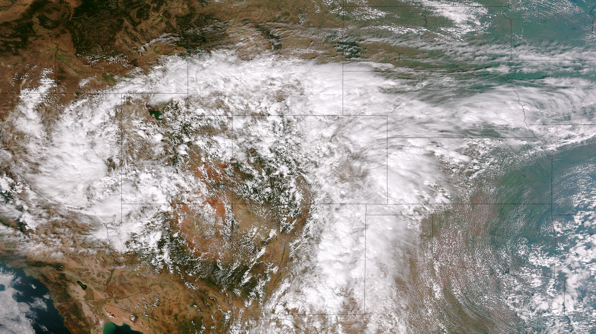
Five days of rain, one with absolutely torrential downpours, created dangerous and deadly flooding across much of the Colorado Front Range.  At one point the National Weather Service warned of ‘biblical rainfall amounts’ and it became hard to argue with that terminology.  The rainfall amounts were truly astounding.

Boulder, where some of the worst flooding was seen, recorded 9.08” on Thursday, September 12.  Estes Park, where the Big Thompson River flooded its banks, saw 3.9” over the 24 hour period.

Officially Denver only saw 1.1” on the date but that was as measured at Denver International Airport which only saw the edge of the storms.  At the previous historical location in Stapleton, 3.68” was measured.

Here in Thornton we seemed to be right in line for the storms and generated one of the higher totals in the metro area accumulating 4.76” on the date.  Since the rain started five days ago, we have received an amazing 7.66” (as of this writing).

  • Don’t miss a thing when it comes to our ever-changing weather! Be sure to ‘like’ us on Facebook, follow us on Twitter and add us to your Google+ circles.

2 thoughts on “NOAA satellite image captures ‘biblical’ storm as it strikes Colorado”

Leave a Reply

Your email address will not be published. Required fields are marked *