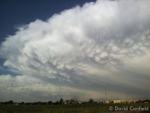
Impressive thunderstorms are a hallmark of Colorado’s June weather. (David Canfield)
The month of June typically sees springtime severe weather reach its height of activity in northeastern Colorado.
This affords the opportunity to capture extraordinary images of amazing weather phenomena from monstrous supercell thunderstorms to heavy rain, hail and even tornadoes.
Slideshow updated June 30, 2014
Showcasing images captured by ThorntonWeather.com readers as well as some of our own, our monthly slideshow covers the entire gamut of weather-related imagery.
Sunsets, sunrises, wildlife and of course every type of weather condition are vividly depicted. June brings some very dynamic weather and the photos are a great way to see the stunning variety.
To learn more about how to send your photo to us for inclusion in the slideshow, see below the slideshow.
Click the play button below and sit back and enjoy the images.
What is missing in the slideshow above? Your photo!
Our monthly photo slideshow is going to feature images that we have taken but more importantly images that you have captured. The photos can be of anything even remotely weather-related.
Landscapes, current conditions, wildlife, pets, kids. Whimsical, newsy, artsy. Taken at the zoo, some other area attraction, a local park, a national park or your backyard. You name it, we want to see and share it!
Images can be taken in Thornton, Denver or anywhere across the extraordinary Centennial State. We’ll even take some from out of state if we can tie it to Colorado somehow.
We’ll keep the criteria very open to interpretation with just about any image eligible to be shown in our slideshows.
What do you win for having your image in our slideshow? We are just a ‘mom and pop’ outfit and make no money from our site so we really don’t have the means to provide prizes. However you will have our undying gratitude and the satisfaction that your images are shared on the most popular website in Thornton.
To share you images with us and get them included in the slideshow just email them to us or share them with ThorntonWeather.com on any of the various social media outlets. Links are provided below.
Extreme weather can occur during in month in Colorado we well know. June however is when traditional spring severe weather arrives in the state oftentimes with hail, damaging wind and tornadoes.
Over 40 percent of the tornadoes that occur in Colorado happen during the month of June. Far more common are thunderstorms with hail and wind, each responsible for extensive damage each year.
While severe weather is common, so too are brilliantly sunny and mild days as we close out spring and enter summer. If you are looking for cold, it isn’t likely but it is possible as the Denver area has seen freezing temperatures and yes, even snow, during the month.
In writing the history of the weather for the area for June 2013 two words come to mind: hot and dry. While both conditions were certainly prevalent, we can at least be consoled by the fact that it could have been worse.
The month actually started cooler than normal with six of the first seven days recording below average temperatures. Soon though high pressure built over the area and temperatures began to climb with many days for the balance seeing above normal mercury readings.
June 2013 wrapped up with an average temperature in Thornton of 70.5 degrees. This was well above Denver’s historical average for the month of 67.4 degrees. Officially Denver’s average temperature last month was 71.1 degrees, warm enough to put it in a tie for the 10th warmest June in Denver history.
In all, Thornton recorded 10 days with mercury readings above 90 degrees. Denver saw 14.
The warmest temperature of the month in Thornton was 99.2 degrees on the 11th. That same day Denver hit 100 degrees, its high reading of the month.
Thornton’s coldest temperature came on the 6th when the temperature dropped to 41.6 degrees. Denver’s officially bested that with a low temperature for the month of 39 degrees on the 2nd.
Denver officially broke three temperature records during the month:
In terms of precipitation the month was certainly dry but not the worst we have seen. Thornton recorded a scant 0.49 inch in the rain bucket. Denver bested us slightly by recording 0.75 inches. Both measurements were far below the 1.98 inch historical average for June but certainly better than the driest June on record in 1890 when only a trace was recorded.
Thornton, Colorado June 2013 Temperatures.Thornton, Colorado June 2013 Precipitation.
CLIMATE REPORT
NATIONAL WEATHER SERVICE BOULDER, CO
210 AM MDT MON JUL 1 2013

...................................

...THE DENVER CO CLIMATE SUMMARY FOR THE MONTH OF JUNE 2013...

CLIMATE NORMAL PERIOD 1981 TO 2010
CLIMATE RECORD PERIOD 1872 TO 2013

WEATHER         OBSERVED          NORMAL  DEPART  LAST YEAR`S
                 VALUE   DATE(S)  VALUE   FROM    VALUE  DATE(S)
                                          NORMAL
................................................................
TEMPERATURE (F)
RECORD
 HIGH             105   06/26/2012
                        06/25/2012
                        54/01/2206
 LOW               30   06/02/1951
HIGHEST           100   06/11       104      -4      105  06/26
                                                          06/25
LOWEST             39   06/02        30       9       43  06/11
AVG. MAXIMUM     87.8              82.4     5.4     91.7
AVG. MINIMUM     54.3              52.3     2.0     58.4
MEAN             71.1              67.4     3.7     75.0
DAYS MAX >= 90     14               7.9     6.1       17
DAYS MAX <= 32      0               0.0     0.0        0
DAYS MIN <= 32      0               0.0     0.0        0
DAYS MIN <= 0       0               0.0     0.0        0

PRECIPITATION (INCHES)
RECORD
 MAXIMUM         4.96   1882
 MINIMUM            T   1890
TOTALS           0.75              1.98   -1.23     1.22
DAILY AVG.       0.03              0.07   -0.04     0.04
DAYS >= .01         4               8.4    -4.4        2
DAYS >= .10         2               4.6    -2.6        2
DAYS >= .50         1               1.4    -0.4        2
DAYS >= 1.00        0               0.3    -0.3        0
GREATEST
 24 HR. TOTAL    0.51   06/23 TO 06/23           06/06 TO 06/07
                        06/22 TO 06/23                    06/23 TO 06/23
                        06/23 TO 06/23                    06/23 TO 06/23
 STORM TOTAL       MM                                 MM
 (MM/DD(HH))            MM                    06/07(00) TO 06/07(00)
                                                 06/23(00) TO 06/23(00)3
                                                 06/23(00) TO 06/23(00)3

SNOWFALL (INCHES)
RECORDS
 TOTAL             MM   MM
TOTALS            0.0               0.0

DEGREE_DAYS
HEATING TOTAL      29                62     -33        6
 SINCE 7/1       6084              6058      26     5399
COOLING TOTAL     221               133      88      314
 SINCE 1/1        263               155     108      365

FREEZE DATES
RECORD
 EARLIEST     09/08/1962
 LATEST       06/08/2007
EARLIEST      03/01             10/07
LATEST        04/24             05/05
....................................................

WIND (MPH)
AVERAGE WIND SPEED              10.7
RESULTANT WIND SPEED/DIRECTION   2/156
HIGHEST WIND SPEED/DIRECTION    64/060    DATE  06/18
HIGHEST GUST SPEED/DIRECTION    97/040    DATE  06/18

SKY COVER
POSSIBLE SUNSHINE (PERCENT)   MM
AVERAGE SKY COVER           0.50
NUMBER OF DAYS FAIR            6
NUMBER OF DAYS PC             23
NUMBER OF DAYS CLOUDY          1

AVERAGE RH (PERCENT)     42

WEATHER CONDITIONS. NUMBER OF DAYS WITH
THUNDERSTORM              0     MIXED PRECIP               0
HEAVY RAIN                3     RAIN                       2
LIGHT RAIN                7     FREEZING RAIN              0
LT FREEZING RAIN          0     HAIL                       0
HEAVY SNOW                0     SNOW                       0
LIGHT SNOW                0     SLEET                      0
FOG                       4     FOG W/VIS <= 1/4 MILE      0
HAZE                      6

-  INDICATES NEGATIVE NUMBERS.
R  INDICATES RECORD WAS SET OR TIED.
MM INDICATES DATA IS MISSING.
T  INDICATES TRACE AMOUNT.
The National Oceanic and Atmospheric Administration (NOAA) released its climate summary for June 2012 showing the United States experienced an unusually warm month. Most notably the U.S. has recorded its warmest first half of the year on record and the warmest 12 month period on record. Climate change? Learn more about the warm weather across the nation on Examiner.com.
June 2012 will go into the record books as the hottest June since record-keeping began in Denver in 1872.
You didn’t need a thermometer to know that June 2012 was extraordinarily hot. What is normally one of the most pleasant months in Thornton turned into a scorcher with high temperature records seemingly falling daily.
The first half of the month was unseasonably warm but that was only a warm-up (pun intended) for what would come during the latter half of the month.
Officially for Denver nine daily high temperature records were tied or broken. The first record fell on June 4th and then the records on the 9th, 17th, 18th, 22nd, 23rd, 24th, 25th and 26th followed suit.
The temperature at Denver International Airport hit 100 degrees or higher six times during the month – the most ever recorded in June. Five of those 100 degree days were consecutive from the 22nd to the 26th and all of those dates set records. On 17 of the 30 days of the month the temperature reached 90 degrees or higher.
In the end Denver saw an average monthly temperature of 75.0 degrees. This was an astonishing 7.6 degrees above normal and puts June 2012 in the books as the hottest on record.
Thornton, while not quite as warm as DIA, still saw an extraordinarily hot month. We recorded 16 days of 90 degree or higher temperatures, one shy of Denver.
From the time ThorntonWeather.com was founded in October 2006 until the start of June 2012, we had only twice before recorded temperatures of 100 degrees or higher. We doubled that tally in June alone as on four days we reached 100 degrees or higher.
A look at temperature records set in Denver during the month of June. Click for a larger image. (National Weather Service)
Thornton recorded an average monthly temperature of 73.9 degrees. This was 6.7 degrees above the average of the previous five Junes.
In terms of precipitation, Denver officially recorded 1.22 inches of precipitation which was 0.76 inches below normal. All of that was recorded on the 6th and 7th when thunderstorms rolled through the airport area.
Here in Thornton we didn’t benefit from the thunderstorms nearly as well. A mere 0.11 inch of precipitation fell into our rain bucket, far below the 1.44 average of the past six years.
CLIMATE REPORT
NATIONAL WEATHER SERVICE BOULDER, CO
649 AM MDT SUN JUL 1 2012
…JUNE 2012…HOTTEST JUNE ON RECORD…
June 2012 was the hottest June in Denver since weather records began back in 1872. The month got off to a warm start with above normal temperatures during the first 9 days of the month. Record maximum temperatures were set and tied on the 4th and 9th respectively. An upper level trough of low pressure which moved across the northern and central Rockies brought cooler temperatures to the region… Resulting in below normal temperatures on the 10th and 11th. Upper level high pressure then reestablished over the region bringing another stretch of above normal temperatures from the 12th through the 19th. Record high temperatures were set both on the 17th and 18th. An upper level trough of low pressure and associated cold front brought some relief to Colorado on the 20th. The high temperature on the 20th was a pleasant 76 degrees…which was eight degrees below normal. Much above normal temperatures returned to Denver the final 10 days of the month as a strong upper ridge of high pressure built over the desert southwest and migrated into the central plains states. A stretch of 5 consecutive 100 degree days occurred from the 22nd through the 26th. This was only the third time in Denver weather history in which this has happened. The other occurrences were July 4th-8th 1989 and July 19th-23rd 2005. In addition…each of the 5 days set new record high temperatures. The 105 degree readings on the 25th and 26th established a new all time record maximum temperature for the month of June and tied Denver’s all time annual record high temperature.
Temperatures:
The average temperature for the month was 75.0 degrees which was 7.6 degrees above normal. This makes June of 2012 the hottest June on record. There were 17 days in which the maximum temperature exceeded 90 degrees. This ties 2002 for the second most 90 degree days in June. June of 2006 still holds the record with nineteen 90 degree days. There were also six days in which the temperature reached the century mark. This is a new record for 100 degree days in the month of June. The old record was 3 days back in June of 1990. The coldest temperature on the month was 43 degrees which occurred on the morning of the 11th. Below is list of temperature records tied or broken during the month.
JUNE 2012 TEMPERATURE RECORDS:

MONTHLY RECORDS:

JUNE 2012 WAS HOTTEST ON RECORD (AVERAGE TEMPERATURE WAS 75.0 DEGREES)
PREVIOUS RECORD WAS JUNE 1994 (AVERAGE TEMPERATURE OF 73.5 DEGREES)

JUNE 22ND-26TH 5 CONSECUTIVE DAYS MAX TEMPERATURE REACHED 100 DEGREES
OTHER OCCURRENCES (JULY 4TH-8TH 1989)  (JULY 19TH-23RD 2005)

JUNE 25TH AND 26TH SET ALL TIME JUNE RECORD HIGH TEMPERATURE 105 DEGREES
(PREVIOUS RECORD 104 DEGREES IN 1994)

DAILY RECORDS:

 DATE      TEMPERATURE  TYPE OF RECORD   OLD RECORD   YEAR(S) SET
JUNE 4TH   94 DEGREES  NEW RECORD MAX    93 DEGREES   1946, 1977
                                                      1990, 2010

JUNE 9TH   95 DEGREES  TIED RECORD MAX   95 DEGREES   1922, 2002
JUNE 17TH  98 DEGREES  NEW RECORD MAX    97 DEGREES   2007
JUNE 18TH 100 DEGREES  NEW RECORD MAX    99 DEGREES   1936, 1990
JUNE 22ND 102 DEGREES  NEW RECORD MAX    98 DEGREES   1874
JUNE 23RD 104 DEGREES  NEW RECORD MAX   102 DEGREES   1954
JUNE 24TH 102 DEGREES  NEW RECORD MAX   100 DEGREES   2007
JUNE 25TH 105 DEGREES  NEW RECORD MAX   100 DEGREES   1991
JUNE 26TH 105 DEGREES  NEW RECORD MAX   104 DEGREES   1994
JUNE 26TH  71 DEGREES  NEW RECORD HI MIN 68 DEGREES   1936 PREVIOUS YEARS

PRECIPITATION.

PRECIPITATION FOR THE MONTH WAS 1.22 INCHES...WHICH IS 0.76 INCHES
BELOW THE NORMAL 0F 1.98 INCHES. ALL OF THIS PRECIPITATION FELL ON
THE 6TH AND 7TH WHEN STRONG TO SEVERE THUNDERSTORMS MOVED ACROSS
PORTIONS OF THE DENVER METRO AREA. THERE WERE 8 THUNDERSTORMS
OBSERVED AT DENVER INTERNATIONAL AIRPORT DURING THE MONTH. THERE
WERE NO DAYS WITH DENSE FOG WITH A VISIBILITY AT OR BELOW 1/4 MILE
DURING THE MONTH. THE PEAK WIND OF 67 MPH FROM A WESTERLY DIRECTION
OCCURRED ON THE 26TH.
...................................

...THE DENVER CO CLIMATE SUMMARY FOR THE MONTH OF JUNE 2012...

CLIMATE NORMAL PERIOD 1981 TO 2010
CLIMATE RECORD PERIOD 1872 TO 2012

WEATHER         OBSERVED          NORMAL  DEPART  LAST YEAR'S
                 VALUE   DATE(S)  VALUE   FROM    VALUE  DATE(S)
                                          NORMAL
................................................................
TEMPERATURE (F)
RECORD
 HIGH             105   06/26/2012
                        06/25/2012
 LOW               30   06/02/1951
HIGHEST           105R  06/26       104       1       96  06/29
                        06/25                             06/28
LOWEST             43   06/11        30      13       45  06/10
AVG. MAXIMUM     91.7              82.4     9.3     83.3
AVG. MINIMUM     58.4              52.3     6.1     53.0
MEAN             75.0              67.4     7.6     68.2
DAYS MAX >= 90     17               7.9     9.1        7
DAYS MAX <= 32      0               0.0     0.0        0
DAYS MIN <= 32      0               0.0     0.0        0
DAYS MIN <= 0       0               0.0     0.0        0

PRECIPITATION (INCHES)
RECORD
 MAXIMUM         4.96   1882
 MINIMUM            T   1890
TOTALS           1.22              1.98   -0.76     2.43
DAILY AVG.       0.04              0.07   -0.03     0.08
DAYS >= .01         2               8.4    -6.4        8
DAYS >= .10         2               4.6    -2.6        4
DAYS >= .50         2               1.4     0.6        2
DAYS >= 1.00        0               0.3    -0.3        1
GREATEST
 24 HR. TOTAL    0.69   06/06 TO 06/07           06/19 TO 06/20
                                                          06/30 TO 06/30
                                                          06/30 TO 06/30
SNOWFALL (INCHES)
RECORDS
 TOTAL            0.4   1919
TOTALS            0.0

DEGREE_DAYS
HEATING TOTAL       6                62     -56       26
 SINCE 7/1       5399              6058    -659     5707
COOLING TOTAL     314               133     181      126
 SINCE 1/1        365               155     210      135

FREEZE DATES
RECORD
 EARLIEST     09/08/1962
 LATEST       06/08/2007
EARLIEST                        10/07
LATEST                          05/05
.................................................

WIND (MPH)
AVERAGE WIND SPEED              12.2
RESULTANT WIND SPEED/DIRECTION   5/169
HIGHEST WIND SPEED/DIRECTION    52/240    DATE  06/02
HIGHEST GUST SPEED/DIRECTION    67/250    DATE  06/02

SKY COVER
POSSIBLE SUNSHINE (PERCENT)   MM
AVERAGE SKY COVER           0.50
NUMBER OF DAYS FAIR            8
NUMBER OF DAYS PC             21
NUMBER OF DAYS CLOUDY          1

AVERAGE RH (PERCENT)     33

WEATHER CONDITIONS. NUMBER OF DAYS WITH
THUNDERSTORM              8     MIXED PRECIP               0
HEAVY RAIN                1     RAIN                       2
LIGHT RAIN                5     FREEZING RAIN              0
LT FREEZING RAIN          0     HAIL                       1
HEAVY SNOW                0     SNOW                       0
LIGHT SNOW                0     SLEET                      0
FOG                       1     FOG W/VIS <= 1/4 MILE      0
HAZE                      3

-  INDICATES NEGATIVE NUMBERS.
R  INDICATES RECORD WAS SET OR TIED.
MM INDICATES DATA IS MISSING.
T  INDICATES TRACE AMOUNT.
June 17 to June 23 - This Week in Denver Weather History
This year the weather in June has been most notable for its heat. That however is far less common than severe weather conditions with lightning, tornadoes and hail. All of these we see in our look back at this week in Denver weather history.
From the National Weather Service:
24
In 1873…there was a great deal of smoke from a fire in the mountains to the southwest of the city during the late afternoon.
In 1875…smoke from forest fires in the mountains to the southwest could plainly be seen from the city.
In 1958…a strong cold front produced a north wind gust to 55 mph at Stapleton Airport where blowing dust briefly reduced the visibility to 1 mile.
In 1982…one inch diameter hail pelted west Denver. A half inch of rain drenched the suburb of Englewood in 10 minutes. Hail piled up to 5 inches deep…snarling rush hour traffic and damaging some stores in a shopping center when the roof started leaking.
In 1988…lightning destroyed the chimney of a house near Evergreen. Another bolt demolished a radio transmitter in the area.
In 1989…golf ball size hail cut a swath 2 1/2 miles wide through open country 14 miles southwest of Bennett. The storm also dropped 1.75 inches of rain on the area. Hail to 3/4 inch in diameter damaged the car of a storm chaser just south of Bennett.
In 1996…a funnel cloud was sighted near Hudson where hail up to 1 3/4 inch diameter fell. Lightning struck a home in Littleton…which sparked a small fire on the roof. Thunderstorm wind gusts to 64 mph were recorded in Castle Rock.
In 2005…severe thunderstorms produced large hail across metro Denver. Hail as large as 1 inch in diameter fell near Castle Rock and Thornton. Hail to 3/4 inch was measured near Northglenn and Fort Lupton.
In 2006…severe thunderstorms raked metro Denver. Hail as large as 2 1/2 inches in diameter shattered automobile windshields in and near Boulder. Hail to 1 3/4 inches pounded areas in and near Lakewood and Morrison. Hail to 1 inch was measured in Wheat Ridge along with 7/8 inch hail in Arvada. Severe thunderstorm wind gusts estimated to 69 mph snapped power lines for a distance of one quarter mile near Castle Rock. Severe thunderstorm winds were measured to 60 mph in Sedalia. Hail as large as 1 inch in diameter fell near Evergreen and Castle Rock. Hail to 3/4 inch in diameter was reported in Louviers and near Conifer.
25
In 1873…forest fires produced a great deal of smoke in the mountains to the southwest of the city.
In 1958…an unusually cold day for summer set two temperature records for the date. Under cloudy skies with occasional drizzle…a record low maximum temperature of 55 degrees was established along with a record minimum temperature of 42 degrees.
In 1959…a waitress…working at a kitchen sink…was injured by a bolt of lightning…which struck the rear of a tavern in Denver. She was hospitalized.
In 1971…a tornado touched down briefly at a high school football field in Brighton…but caused no damage.
In 1981…3/4 inch hail pelted wheat ridge and hail to 1 1/4 inches fell in Louisville. A brief funnel cloud was sighted by national weather service personnel 4 miles east of Stapleton International Airport.
In 1982…a bolt of lightning struck a cabin in the foothills west of Denver. The resulting fire totally destroyed the cabin.
In 1987…golf ball size hail fell near Bennett.
In 1988…a tornado touched down 1 mile south of Watkins and was on the ground for 4 minutes. Another tornado was spotted just southeast of Barr Lake and was on the ground for 5 minutes. No damage was reported from either tornado. Lightning struck two rock climbers near Eldorado Springs. A 25-year-old man was killed…and a 21-year-old man suffered extensive injuries. Thunderstorm winds knocked over two elm trees near downtown Denver. One fell on a house destroying most of it. A nearby building was unroofed…and two cars were damaged. A truck that had been severely damaged by one of the Denver tornadoes 10 days before was hit again. Thunderstorm wind gusts to 51 mph were recorded at Stapleton International Airport.
In 1991…the temperature reached a high of 100 degrees… Setting a new record for the date.
In 1997…one inch diameter hail fell in Arvada and 1 1/2 inch hail in Boulder. Hail as large as 3/4 inches fell in Denver…Louisville…Westminster…and near Broomfield.
In 1999…thunderstorm winds gusted to 58 mph near Fort Lupton toppling an oil rig. A 37-year-old man was killed when he fell 55 feet from the derrick of the rig.
In 2001…four golfers and one construction worker received minor injuries from a nearby lightning strike on the Broadlands Golf Course in Broomfield.
In 2002…hail to 1 inch in diameter was measured in greenwood village.
In 2005…hail to 3/4 inch in diameter fell near Bennett and Roggen. A thunderstorm wind gust to 61 mph was recorded near Golden.
In 2009…lightning struck the Darlington prismatic electric fountain in City Park’s lake. The damage was estimated to be approximately $25000.
In 2010…wind gusts associated with a dry microburst downed several trees in the vicinity of 14th and federal…and near Bayaud St. and Clarkson St. in Denver. At Denver International Airport…a peak wind gust to 45 mph was observed from the southwest.
June 10 to June 16 - This Week in Denver Weather History
Just as we saw in the past week, we are entering the primetime of Colorado’s severe weather season. Our look back at Denver weather history for this week shows numerous damaging, dangerous and deadly weather events.
From the National Weather Service:
9-10
In 1864…high water from melting snow combined with heavy rains over the upper reaches of the South Platte River forced the river over its banks and caused flooding of low lying areas along the river in the city. The amount of rainfall in the mountains and in the city is unknown.
10
In 1943…a man was killed by lightning while using a surveying instrument at Buckley Field.
In 1969…hail stones 2 to 3 inches in diameter caused extensive damage to buildings and automobiles in an area from northeast of Boulder to Longmont. Two funnel clouds were reported near Castle Rock. A funnel cloud and 1 inch hail stones were reported 10 to 20 miles southeast of Stapleton International Airport. Hail stones to 1 3/4 inches fell 3 miles west of Littleton. Hail to 3/4 inch diameter fell over southeast Denver.
In 1988…thunderstorm winds clocked to 60 mph unroofed a porch and downed a fence at a home near Stapleton International Airport. A small tornado touched down briefly in northeast Aurora. Another small tornado touched down for 3 minutes in southeast Aurora. No damage was reported from either twister.
In 1989…a national weather service observer saw lightning strike 2 storage tanks at 40th and Havana…3/8 mile northeast of Stapleton International Airport. The strike temporarily knocked out some weather observing equipment at the national weather service.
In 1991…a tornado was sighted 2 miles south of Castle Rock. No damage was reported. The funnel cloud associated with the tornado was sighted for 5 minutes by National Weather Service observers at Stapleton International Airport.
In 1994…lightning struck a home in Denver…which started a fire in the attic and caused minor damage.
In 1997…lightning struck a security guard at the castle pines golf course near Castle Rock. He received only minor injuries.
In 1999…severe thunderstorms rolled off the foothills over metro Denver…producing large hail and damaging winds. Hail to 1 inch diameter fell near Evergreen with 1 3/4 inch hail measured west of Golden. Hail to 1 1/2 inches fell in Commerce City with one inch hail in Lakewood…wheat ridge… The city of Denver and at Denver International Airport where thunderstorm winds gusted to 58 mph. As the storms moved east…3/4 inch hail was reported in Aurora…and damaging thunderstorm winds developed between Bennett and Strasburg. Winds gusting as high as 69 mph blew half a metal roof from a shed in a Bennett lumberyard. A small barn was also leveled between Bennett and Strasburg. Winds also gusted to 58 mph near Manilla.
In 2000…a dry microburst produced a wind gust to 58 mph at Jefferson County Airport. Thunderstorm winds gusted to 55 mph at Denver International Airport.
In 2003…hail as large as 1 3/4 inches was measured at centennial airport and near Parker.
In 2005…hail to 7/8 inch in diameter was reported near Parker with 3/4 inch hail measured near Castle Rock.
In 2009…lightning struck an apartment complex…a veterinary hospital in Boulder and caused minor damage. Lightning also struck two oil tanks…one in Boulder and the other at Front Range airport north of Watkins. The oil tanks in both instances were set on fire and suffered extensive damage.
In 2010…a complex of severe thunderstorms hammered portions of eastern Arapahoe…eastern Douglas and western Elbert counties. The hail ranged from 1 inch to 3 inches in diameter. The largest hail was observed near Elizabeth. Areas in and around Aurora…Byers…Parker and Thornton were also impacted by large hail. One weak tornado touched down near prospect valley but did no damage. At Denver International Airport…a peak wind gust to 35 mph was observed from the northwest.
10-11
In 1882…heavy thunderstorm rains on the morning of the 10th caused a rapid rise in Dry Creek…which enters the South Platte River at Fairview in present day south Denver. This…combined with additional heavy rainfall on the 11th caused the South Platte River to overflow. Five people drowned and several houses were destroyed. Total losses in the city and suburbs was estimated at 75 thousand dollars. Total rainfall in central Denver was 2.21 inches over the 2 days.
June 3 to June 9 - This Week in Denver Weather History
Severe weather season in Colorado gets started in earnest in June and we see that in our look back at this week in Denver weather history. Probably the most notable event for Thornton residents was the infamous 1981 Thornton tornado.
From the National Weather Service:
1-4
In 1977…unusually warm weather for this early in June resulted in 3 maximum temperature records being equaled at the time: 88 degrees on the 1st…90 degrees on the 2nd… And 93 degrees on the 4th. Maximum of 91 degrees on the 3rd was not a record.
2-4
In 1989…heavy rain drenched metro Denver with the greatest amounts recorded on the 3rd. Total rainfall ranged from 1 1/2 to 3 inches. Roads were washed out in Boulder County… And flooded basements caused water damage to houses in the Gunbarrel section of Boulder. In suburban Denver…heavy rain caused minor flooding along Lena Gulch in Jefferson County where two mobile home parks were evacuated. Rainfall totaled 1.66 inches at Stapleton International Airport.
2-7
In 1921…heavy rainfall for nearly a week…on top of streams already swollen by mountain snowmelt…produced widespread flooding over the South Platte River basin…including the tributaries through the canyons to the west and southwest of Denver. Heavy rainfall over the 6-day period totaled 3.36 inches in Boulder…4.98 inches in Morrison…4.27 inches in Castle Rock…and 2.94 inches in the city of Denver. Rainfall amounts in the foothills were estimated between 3 and 6 inches. The narrow-gage tracks of the Colorado and southern railroad were destroyed in the Platte Canyon. From the mouth of the canyon through the city to near Brighton… The river spread from 1/2 to nearly 1 1/2 miles wide… Flooding farm and pasture land and destroying or damaging many bridges. In the city…many businesses along with as many as 500 homes were inundated…forcing their evacuation. Bridges were swept away. The high waters flooded the rail yards and stock yards in lower downtown…closing three adjacent packing houses. The heavy rains also caused flooding on Boulder creek in Boulder on the 6th.
3
In 1951…a trace of snow fell at Stapleton Airport.
In 1961…torrential rains fell 10 to 30 miles north of Denver…causing flooding in the town of Frederick. The rush of water broke through and over a retaining dike sending a 5-foot wall of water into the town…flooding homes and damaging sewer lines…roads…and streets. Golf ball size hail fell in derby…west Denver…and Lakewood…causing more than one million dollars in damage.
In 1981…severe thunderstorms produced tornadoes over metro Denver. The first tornado touched down at the intersection of Alameda Ave. and Sheridan Blvd. The twister moved north along Sheridan Blvd….damaging businesses…apartment buildings…homes…and vehicles. Over ten homes were unroofed. The roof of one landed in the middle of a neighborhood park. At least 10 mobile homes were wrecked. The tornado curved to the northeast into northwest Denver… Hopping up and down in several places. Very strong winds outside the actual funnel caused 20 to 30 thousand dollars in damage in downtown Denver. The third floor of one old building was demolished. No major injuries were reported from the tornado…although several people were hurt slightly in traffic accidents on Sheridan Blvd. In the confusion caused by the storm. Damage in Lakewood alone was estimated at 200 thousand dollars. At the same time… The worst tornado to ever hit metro Denver struck Thornton. Coming from the same thunderstorm that spawned the Denver twister…the Thornton tornado tore a swath through the heart of the city. 87 homes were destroyed…110 others damaged at least moderately. In all…600 homes in a 100 block area sustained some damage. The twister also hit shopping centers…several restaurants…and other buildings. Seven of the 42 injured were considered serious. The storm was strong enough to snap lamp posts in half and drive a 6- inch slab of wood 2 feet into the ground. Damage was estimated at up to 50 million dollars. The same storm that struck Thornton produced another damaging tornado that touched down in the northwest section of Fort Lupton. This twister damaged 16 homes and numerous cars and campers. Two children were slightly injured when the car they were in was knocked about and its windows shattered by the storm. The twister also damaged two commercial buildings. Damage was very spotty…and observers said the storm hopped up and down at least 3 times. Dollar damage was estimated at 500 thousand dollars. The thunderstorm complex that produced 3 damaging tornadoes also dropped large hail which damaged many cars over northwest Denver. One to 2 inches of rain fell in less than an hour…flooding a mobile home park with 3 to 4 feet of water on the northwest edge of Denver. The high water damaged about half of the 392 homes in the park. Local flooding was also reported in other areas across metro Denver. A tornado was also sighted near Franktown…but caused no damage. A thunderstorm wind gust to 52 mph was recorded at Stapleton International Airport.
In 1982…a cold air funnel cloud touched down briefly in southwest Denver. Two tornadoes were briefly spotted near Watkins. No damage was reported from these storms. A brief funnel cloud was sighted by national weather service observers at Stapleton International Airport where 1/4 inch hail fell.
In 1984…there were several sightings of tornadoes around Parker. No damage was reported.
In 1985…a tornado just southeast of Aurora was spotted by a national weather service employee. No damage was reported. Severe thunderstorms pummeled the metro area with hail. One inch to baseball size hail was reported in south Lakewood…one inch hail in Littleton…3/4 inch to 1 inch hail in Aurora…and golf ball size hail in south Denver.
In 1989…hail up to golf ball size fell over Arvada. A golf course had to be evacuated as the hail accumulated up to 3 inches deep in some places. One inch diameter hail fell in west Denver and Westminster.
In 1993…an early morning thunderstorm produced lightning… Which caused an attic fire at a residence in Niwot northeast of Boulder. Damage was estimated at 40 thousand dollars. No one was injured.
In 1994…hail to 1 1/2 inch diameter fell just northeast of Boulder. One inch diameter hail fell in Golden. Thunderstorm wind gusts to 70 mph were recorded in Erie.
In 1995…a tornado was sighted over open country near Strasburg. No damage was reported. A funnel cloud was sighted 11 miles east of Aurora where 3/4 inch hail fell.
In 2001…severe thunderstorms produced large hail over east and southeast metro Denver. Hail as large as 1 3/4 inches in diameter fell at centennial airport with 1 1/2 inch hail near Buckley Field…1 1/4 inch hail in Parker…1 inch hail near Elizabeth…7/8 inch hail at Cheery Creek Reservoir…and 3/4 inch hail 20 miles north of Kiowa in Elbert County.
In 2002…severe thunderstorms dumped large hail across metro Denver. Hail to 1 3/4 inches in diameter fell over southeast Denver and 4 miles north of Aurora. Hail to 1 1/4 inches pelted Parker. One inch hail was measured near Ft. Lupton…and 3/4 inch hail fell 9 miles southeast of Buckley Field…near Strasburg…and at the site of the former Stapleton International Airport.
In 2005…thunderstorms producing heavy rain and hail caused flash flooding over parts of southeast metro Denver. People became trapped in their vehicles by the high water… And numerous water rescues were required. The hardest hit areas included the vicinity of I-25 and Alameda Avenue…as well as the intersection of Yale Avenue and Quebec Street. Several basements were flooded along Eastman Place. Severe thunderstorms brought heavy rain and hail to eastern centennial and southeastern Aurora. Up to 3 feet of standing water was reported on east orchard road where several motorists were stranded in their vehicles and needed to be rescued. Hail to 3/4 inch in diameter fell in the area. Ten vehicles were stranded on Grand Avenue…and most had to be towed once the floodwaters receded. Water was reportedly chest deep at one location on Girard Avenue. Hail as large as 3/4 inch in diameter also was reported in Littleton…near Parker…and near Buckley Air Force Base. Hail to 7/8 inch was measured near Sheridan and Cheery Creek Reservoir.
May 27 to June 2 - This Week in Denver Weather History
A very eventful week in Denver weather history with everything from thunderstorms and tornadoes to yes, even snow.
From the National Weather Service:
20-27
In 2002…lightning sparked a wildfire near Deckers. Extremely dry conditions and very strong winds the following day allowed the fire…known as the Schoonover…to consume 3850 acres before it could be contained. Thirteen structures were destroyed…including 4 homes…resulting in 2.2 million dollars in damage.
26-31
In 1995…a cool period with light morning showers and moderate to heavy afternoon showers and thunderstorms pushed rivers already swollen from mountain snow melt over their banks causing minor flooding. Streams and rivers such as the South Platte and Boulder Creek flooded meadowlands…bike paths…roads near streams…and other low lying areas. No significant property damage was reported and crop damage was unknown. Rainfall totaled 1.79 inches at the site of the former Stapleton International Airport and only 1.51 inches at Denver International Airport.
27
In 1874…an apparent thunderstorm gust front reached the city at 6:40 pm. Strong southwest winds sustained to 48 mph for a few minutes produced large columns of dust in the city and on the prairie. There was no rain in the city.
In 1942…a duststorm swept into the city…but no damage was reported. West winds were sustained to 23 mph.
In 1953…a heavy hailstorm caused an estimated 100 thousand dollars damage across metro Denver. Larger than golf ball size hail fell in Westminster and north Denver. Only 1/8 inch hail was measured at Stapleton Airport.
In 1955…west-northwest winds at 35 mph with gusts as high as 58 mph briefly reduced the visibility to 1/2 mile in blowing dust at Stapleton Airport.
In 1981…lightning damaged power lines west of Lakewood and blew up a transformer at the Denver Federal Center. Hail 1 to 1 1/2 inches in diameter was reported in Lakewood and on I-25 south of Denver.
In 2001…hail as large as 3/4 inch in diameter was measured near Commerce City.
In 2003…hail to 3/4 inch in diameter fell near Central City.
In 2006…unusually warm weather for late May produced two temperature records. The high temperature of 93 degrees was a record maximum for the date. The low temperature of 59 degrees equaled the record high minimum temperature for the date. Both previous records occurred in 1895.
Thornton’s June 2011 weather was a relatively typical one with average temperatures but also with above normal precipitation. The month also signifies the official end of the 2010 to 2011 snow season which was absolutely dismal.
In terms of temperatures Denver saw an average temperature for the month of 68.2 degrees. This was just a bit above the normal of 67.6 degrees. Temperatures ranged from a high of 96 degrees on the 28th and 29th down to a low of 45 degrees on the 10th. DIA recorded seven days with 90 degrees or higher temperatures which is one above normal. No temperature records were set for the month.
Here in Thornton we came quite close to mirroring Denver’s official temperatures. Our average temperature was 68.1 degrees with the highest mercury reading of 96.4 degrees coming on the 29th. The lowest temperature in Thornton came on the 3rd at 45.4 degrees.
Precipitation for the month was above normal as DIA’s rain bucket recorded 2.43 inches. This was 0.87 inch above the normal of 1.56 inch and the second month in a row with above normal precipitation. In all, eight days had measurable precipitation and DIA reported thunderstorms on 10 days which is average.
One precipitation record was set during the month when 1.05 inches of rain was recorded on the 20th. This beat the old record for the date of 0.50 inch set in 1939.
We were quite a bit drier in Thornton as our precipitation for the month fell below the Denver normals. We recorded 1.14 inches for the month with the majority of that, 0.87 inch, falling on the 20th.
Denver’s snow season runs from July 1 to June 30 and with the end of the 2010 to 2011 season the numbers show just how poorly we faired in terms of snowfall. The Mile High City recorded a mere 22.8 inches of the white stuff at DIA. This is a whopping 38.9 inches below the normal of 61.5 inches. The season will go into the record books as the second least snowiest snow season since Denver began keeping records in 1882.
Here in Thornton we did not fare any better than Denver on the snowfall front. Our season wrapped up with a dismal 21.2 inches.
Denver, Colorado June 2011 Climate Summary
CLIMATE NORMAL PERIOD 1971 TO 2000
CLIMATE RECORD PERIOD 1872 TO 2011

WEATHER         OBSERVED          NORMAL  DEPART  LAST YEAR'S
                 VALUE   DATE(S)  VALUE   FROM    VALUE  DATE(S)
                                          NORMAL
................................................................
TEMPERATURE (F)
RECORD
 HIGH             104   06/26/1994
 LOW               30   06/02/1951
HIGHEST            96   06/29       104      -8       99  06/25
                        06/28
LOWEST             45   06/10        30      15       47  06/23
                                                          06/18
                                                          06/14
                                                          06/12
AVG. MAXIMUM     83.3              82.1     1.2     84.1
AVG. MINIMUM     53.0              53.0     0.0     53.6
MEAN             68.2              67.6     0.6     68.9
DAYS MAX >= 90      7               6.3     0.7       10
DAYS MAX <= 32      0               0.0     0.0        0
DAYS MIN <= 32      0               0.0     0.0        0
DAYS MIN <= 0       0               0.0     0.0        0

PRECIPITATION (INCHES)
RECORD
 MAXIMUM         4.96   1882
 MINIMUM            T   1890
TOTALS           2.43              1.56    0.87     1.60
DAILY AVG.       0.08              0.05    0.03     0.05
DAYS >= .01         8               8.7    -0.7        5
DAYS >= .10         4                MM      MM        3
DAYS >= .50         2                MM      MM        2
DAYS >= 1.00        1                MM      MM        0
GREATEST
 24 HR. TOTAL    1.55  06/19 TO 06/20      1.25  06/11 TO 06/12

SNOWFALL (INCHES)
RECORDS
 TOTAL            0.4  1919
TOTALS            0.0                T

DEGREE_DAYS
HEATING TOTAL      26                60     -34       38
 SINCE 7/1       5707              6128    -421     6441
COOLING TOTAL     126               136     -10      163
 SINCE 1/1        135               161     -26      179

FREEZE DATES
RECORD
 EARLIEST     09/08/1962
 LATEST       06/08/2007
EARLIEST                        10/07
LATEST                          05/05
.................................................

WIND (MPH)
AVERAGE WIND SPEED              10.4
RESULTANT WIND SPEED/DIRECTION   3/148
HIGHEST WIND SPEED/DIRECTION    48/190    DATE  06/29
HIGHEST GUST SPEED/DIRECTION    72/200    DATE  06/29

SKY COVER
POSSIBLE SUNSHINE (PERCENT)   MM
AVERAGE SKY COVER           0.50
NUMBER OF DAYS FAIR            7
NUMBER OF DAYS PC             21
NUMBER OF DAYS CLOUDY          2

AVERAGE RH (PERCENT)     45

WEATHER CONDITIONS. NUMBER OF DAYS WITH
THUNDERSTORM              0     MIXED PRECIP               0
HEAVY RAIN                3     RAIN                       2
LIGHT RAIN               10     FREEZING RAIN              0
LT FREEZING RAIN          0     HAIL                       1
HEAVY SNOW                0     SNOW                       0
LIGHT SNOW                0     SLEET                      0
FOG                       4     FOG W/VIS <= 1/4 MILE      0
HAZE                      6

-  INDICATES NEGATIVE NUMBERS.
R  INDICATES RECORD WAS SET OR TIED.
MM INDICATES DATA IS MISSING.
T  INDICATES TRACE AMOUNT.
Weather, natural disasters & climate news and information.
 Extreme weather can occur during in month in Colorado we well know. June however is when traditional spring severe weather arrives in the state oftentimes with hail, damaging wind and tornadoes.


 Thornton’s June 2011 weather was a relatively typical one with average temperatures but also with above normal precipitation. The month also signifies the official end of the 2010 to 2011 snow season which was absolutely dismal.