Tag Archives: December Weather

December 2009 goes into the books as seventh coldest on record

For the second time in the past three months, Denver has experienced monthly average temperatures in the ‘top 10 coldest’ category. In October, the Mile High City saw its second coldest October on record since record keeping began in 1882. Now Denver has just wrapped up its seventh coldest December in history.

Denver’s average December 2009 temperature was 24.1 degrees – a chilly 6.2 degrees below the normal average of 30.3 degrees. That puts the month into the books as the seventh coldest December on record (image right).  Thornton was just a touch colder having recorded an average temperature of 23.8 degrees.

Temperatures during the month ranged from a high temperature of 59 degrees on the 1st down to a low of -17 on the 9th. Overall, the majority of days during the month saw below normal temperatures.

In terms of snowfall, the month did finish above average but not in record setting territory. The National Weather Service recorded 11.1 inches of snowfall at the official monitoring station at Denver International Airport. This was 2.4 inches above the average of 8.7 inches for December.  In Thornton, we received a bit more snow than DIA.  15.3 inches was recorded at ThorntonWeather.com of which the single biggest even was the pre-Christmas storm which dumped 7.5 inches.

 The snow we did receive however was rather dry and as such we finished the month below normal for precipitation. DIA recorded 0.45 inch of precipitation which is 0.18 inch below normal.  Here again, because of the additional snowfall, Thornton fared a bit better with 0.5 inch of precipitation. 

CLIMATE REPORT
NATIONAL WEATHER SERVICE BOULDER, CO                                 
510 PM MST SAT JAN 2 2010

................................... 

...THE DENVER CO CLIMATE SUMMARY FOR THE MONTH OF DECEMBER 2009...

CLIMATE NORMAL PERIOD 1971 TO 2000
CLIMATE RECORD PERIOD 1872 TO 2009

WEATHER         OBSERVED          NORMAL  DEPART  LAST YEAR'S         
                 VALUE   DATE(S)  VALUE   FROM    VALUE  DATE(S)      
                                          NORMAL                      
................................................................
TEMPERATURE (F)
RECORD
 HIGH              79   12/05/1939                                    
 LOW              -25   12/22/1990                                    
                        12/24/1876                                    
HIGHEST            59   12/21        79     -20       69  12/02       
                        12/01                                         
LOWEST            -17   12/09       -25       8      -19  12/15       
AVG. MAXIMUM     36.4              44.1    -7.7     41.0              
AVG. MINIMUM     11.9              16.4    -4.5     12.3              
MEAN             24.1              30.3    -6.2     26.6              
DAYS MAX >= 90      0               0.0     0.0        0              
DAYS MAX <= 32     15               5.3     9.7       10              
DAYS MIN <= 32     31              29.2     1.8       30              
DAYS MIN <= 0       6               2.8     3.2        6              

PRECIPITATION (INCHES)
RECORD
 MAXIMUM         5.21   1913                                          
 MINIMUM         0.00   1881                                          
TOTALS           0.45              0.63   -0.18     0.24              
DAILY AVG.       0.01              0.02   -0.01     0.01              
DAYS >= .01         7               5.3     1.7        6              
DAYS >= .10         2                MM      MM        0              
DAYS >= .50         0                MM      MM        0              
DAYS >= 1.00        0                MM      MM        0              
GREATEST
 24 HR. TOTAL    0.20   12/22 TO 12/23        0.10  12/13 TO 12/14       

SNOWFALL (INCHES)
RECORDS
 TOTAL           57.4   1913  SNOWIEST DENVER MONTH SINCE 1881
TOTALS           11.1                8.7              7.1             

DEGREE_DAYS
HEATING TOTAL    1260              1078     182     1179              
 SINCE 7/1       2739              2486     253     2367              
COOLING TOTAL       0                 0       0        0              
 SINCE 1/1        533               696    -163      825              

FREEZE DATES
RECORD
 EARLIEST     09/08/1962                                              
 LATEST       06/08/2007                                              
EARLIEST                        10/07                                 
LATEST                          05/05                                 
.................................................................

WIND (MPH)
AVERAGE WIND SPEED              8.8
RESULTANT WIND SPEED/DIRECTION   3/217
HIGHEST WIND SPEED/DIRECTION    43/220    DATE  12/13
HIGHEST GUST SPEED/DIRECTION    49/220    DATE  12/13

SKY COVER
POSSIBLE SUNSHINE (PERCENT)   MM *SUNSHINE DATA N/A EFFECTIVE 10/1

NUMBER OF DAYS FAIR            4
NUMBER OF DAYS PC             21
NUMBER OF DAYS CLOUDY          6

AVERAGE RH (PERCENT)     61

WEATHER CONDITIONS. NUMBER OF DAYS WITH 
THUNDERSTORM              0     MIXED PRECIP               0
HEAVY RAIN                0     RAIN                       0
LIGHT RAIN                0     FREEZING RAIN              0
LT FREEZING RAIN          0     HAIL                       0
HEAVY SNOW                0     SNOW                       2
LIGHT SNOW               10     SLEET                      0
FOG                      11     FOG W/VIS <= 1/4 MILE      1
HAZE                      7                                           
                                                                    
-  INDICATES NEGATIVE NUMBERS.                                      
R  INDICATES RECORD WAS SET OR TIED.                                
MM INDICATES DATA IS MISSING.                                       
T  INDICATES TRACE AMOUNT.   

Dreaming of a white Christmas? The chances are slim

What are the odds of a white Denver Christmas?  Not very good.
What are the odds of a white Denver Christmas? Not very good.

As Christmas gets closer everyone always wonders if we are going to get the proverbial white Christmas. Unfortunately, if you look at Denver and Thornton weather history, the chances arent all that good but it also depends on what you define as a white Christmas. December just isnt that snowy of a month, ranking as only the fourth snowiest (behind March, November and April) so historically we have a bit of a disadvantage.

For a complete look at Denver’s Christmas weather statistics, click here.

Continuing snow sure to cause a rough afternoon commute

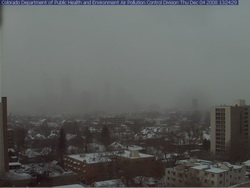
Where's Denver?  This webcam view from the Colorado Department of Public Health and Environment shows Denver obscured in the snowfall at 1:00pm Thursday.
Where's Denver? This webcam view from the Colorado Department of Public Health and Environment shows Denver obscured in the snowfall at 1:00pm Thursday.

If you can, get out of work early today as the roads are sure to be a mess during rush hour.  Snow has been falling across the Front Range all day and snow totals for the metro area are in the 2 to 4 inch range.  Probably just as notable is the bitter cold we are seeing – at 1:00pm DIA was showing 17 degrees and a wind chill of only 2 degrees.  Denver’s high temperature today will most likely be 22 degrees but that was reached at 1:00am!  The wind will continue to keep the wind chills down around zero so bundle up if you head out.

The snow will continue through 11:00pm although accumulations will be pretty light.  The north, west and southern suburbs could see up to 6 inches of snow while the central metro area will end up with around 2 to 4 inches.  Areas of Larimer and Weld Counties including Fort Collins and Greeley will see between 5 to 10 inches of snow. 

A Winter Weather Advisory is in effect for the I-25 corridor north of Longmont as well as most of the central and northern mountains areas.  The extreme eastern portions of the state are under an advisory as well.  In the mountains, eastbound I-70 has chain restrictions in place at the Eisenhower Tunnel, Loveland Pass and at Vail.

Tonight we will dip into the single digits but Friday brings us back into the 40’s and the weekend looks great.

A snowy and slick commute for Thursday

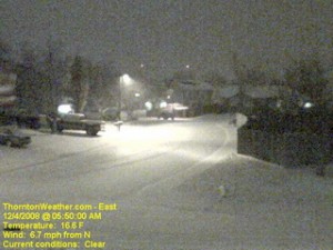
The scene at ThorntonWeather.com at 5:50am today.  Click the image for a current weather webcam view.
The scene at ThorntonWeather.com at 5:50am today. Click the image for a current weather webcam view.

The snow arrived overnight and as of 5:00am ThorntonWeather.com had measured 1.3” and it was still coming down pretty good.  Due to the extreme cold – 17 degrees and a windchill of 5 degrees as of this writing – the roads are quite slick.  This morning we found residential streets to be the worst of course but main arterials like 120th Ave were not in too good of shape either.  Please allow plenty of time to get the kids to school and yourselves to work, allow plenty of distance between you and other cars and just take your time. 

A surge of cold air from the north is expected to intensify the snowfall in the coming hours and a bit of upslope will keep the flakes falling for most of the day.  Accumulations though won’t be all that great – look for 2 to 4 inches overall.  Snow will taper off this evening from the north to the south and completely end in the metro area around midnight.

Friday and this weekend are shaping up great but that could be short lived.  We are watching a cold front coming from Montana that could bring more cold and snow toward the first part of next week.

December weather preview – What to expect

December weather preview - what can we expect in Denver?

December brings with it the official start to winter and at the same time we find ourselves hoping we get moisture in the near future. As of this writing, the mountain snowpack in all basins are well below normal, with some as low as 27% of normal. Here in town our our annual snowfall is well below normal as well. In Colorado the snow season starts on July 1st and between that date and November 30th, Denver averages 16.9 inches of snow. Thus far, ThorntonWeather.com has measured a meager 0.2 inch and the official total for Denver taken at the site of the old Stapleton International Aiport stands at 0.8 inch!

So what can we expect in the coming month?  Click here to read our December 2008 climate and weather preview to find out!