Category Archives: Thornton Weather

Time lapse video: Thornton’s March 23, 2016 blizzard

To say the storm that pounded the Colorado Front Range was a big one does not do it justice.  In less than 24 hours Thornton would see blizzard conditions and our second heaviest snowfall of the previous 10 years.

Light rain began in the early morning hours but that soon transitioned to snow.  The white stuff would continue to fall into the evening.  Strong winds helped whip the snow and create blizzard conditions grinding the Colorado Front Range to a halt.

Thornton would tally 20.1 inches of snow, one of the heftier totals from the area.

The video below begins at midnight and runs through 7:00pm.

Thornton’s March 2016 blizzard – Live social feed

ThorntonWeather.com on Facebook, Google+ and Twitter
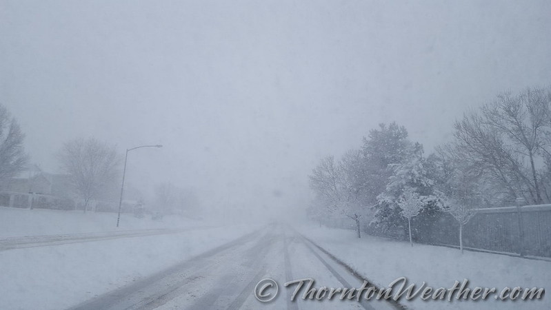
Just yesterday we saw temperatures in excess of 70 degrees.  Wednesday, March 23, will bring blizzard like conditions to Thornton.  That is springtime in Colorado!

The National Weather Service has issued a Blizzard Warning which will be in effect until 6:00pm.  Road conditions have deteriorated throughout the day and will continue to do so.  Power outages are occurring and most schools and government offices are closed as are many businesses.

Throughout the period we will of course be monitoring the system and posting regularly to our Facebook page and Twitter feed.  You can follow along in real time below.  We are also on Google+ here.

For comprehensive look at the storm, please monitor our Winter Weather Briefing page.


Time to spring forward: Daylight Saving Time begins

The United States begins Daylight Savings Time at 2:00am on Sunday, March 8, 2015.

The biannual ritual of changing our clocks to adjust for Daylight Savings Time occurs this Saturday night providing yet another signal of the changing of seasons.  The United States will ‘spring forward’ one hour at 2:00am Sunday morning as we begin Daylight Savings Time.

The ritual of changing our clocks twice a year can be met with some resistance as some people struggle to adjust their body’s internal clock.  The start of Daylight Savings Time can be particularly problematic given the one hour less sleep people receive on the night of the change.

However, longer days as we head into the milder months are a very real benefit and for many worth the inconvenience of a lost hour of sleep.  The time change definitely has big effects on how much daylight we enjoy during our normal waking hours.

On Saturday, prior to the change, sunset will occur at 6:04pm but on Sunday the sun won’t disappear over the horizon until 7:05pm.  This affords folks more time in the evening to get started on those spring-time chores and allows us to get outside and enjoy the warming weather.

The March Equinox is also on the horizon.  Spring officially begins at 10:30pm on March 19.

This year Daylight Savings Time will come to an end on November 6.

Some of the recent history of Daylight Savings Time (from Wikipedia):

Daylight saving time in the United States was first observed in 1918. Most areas of the United States currently observe daylight saving time, with the exceptions being the states of Arizona and Hawaii along with the territories of Puerto Rico, American Samoa, Guam, and the Northern Mariana Islands.

From 1987 to 2006, daylight saving time in the United States began on the first Sunday of April and ended on the last Sunday of October. The time was adjusted at 2:00 AM (0200) local time (as it still is done now).

Since 2007, daylight saving time starts on the second Sunday of March and ends on the first Sunday of November, with all time changes taking place at 2:00 AM (0200) local time. In 2011, daylight saving time began on March 13 and will end on November 6.

Daylight Savings Time Schedule

Year DST Begins 2 a.m.
(Second Sunday in March)
DST Ends 2 a.m.
(First Sunday in November)
2016 13 March 2016 6 November 2016
2017 12 March 2017 5 November 2017
2018 11 March 2018 4 November 2018
2019 10 March 2019 3 November 2019
2020 8 March 2020 1 November 2020
2021 14 March 2021 7 November 2021
2022 13 March 2022 6 November 2022

National Weather Service announces storm spotter training dates for 2016

On June 3, 1981 a tornado struck Thornton in what is the worst twister to have struck the Denver metro area. Are you ready should disaster strike again? Image courtesy the City of Thornton archives.

Severe weather is a fact of life in Colorado – from blizzards to tornadoes we can and do see it all.  Each year the weather is responsible for claiming lives in our state and across the nation and the threat is very real.  Storm spotter training allows you to learn how to protect yourself and your family while providing a public service.

Education is key to knowing how to protect you and your family.  Whether you want to be an official storm spotter or maybe just want to learn more about severe weather, storm spotter training can provide you an incredible opportunity to learn.

The National Weather Service Denver / Boulder office has announced a series of Skywarn storm spotter training dates for Colorado for the 2015 season.

The storm spotter program is a nationwide program with more than 280,000 trained spotters.  These volunteers report weather hazards to their local National Weather Service office providing vital information when severe strikes.  Data from spotters include severe wind, rain, snow measurements, thunderstorms and hail and of course tornadoes.

Storm spotters are part of the ranks of citizens who form the Nation’s first line of defense against severe weather. There can be no finer reward than to know that their efforts have given communities the precious gift of time–seconds and minutes that can help save lives.

By completing one of these training classes you can become an official storm spotter.  When severe weather strikes, you can report it by calling a special toll free number or submit your report via the National Weather Service’s website.

These are great sessions for anyone wanting to learn more about the severe weather we experience in Colorado, whether you want to be an official spotter or not.  All training is free.  Topics include:

  • Basics of thunderstorm development
  • Fundamentals of storm structure
  • Identifying potential severe weather features
  • Information to report
  • How to report information
  • Basic severe weather safety

To learn more about the program, see here: http://www.crh.noaa.gov/bou/awebphp/spotter.php

Below are the dates, times and locations announced thus far.  The embedded calendar should automatically update with new dates and changes but be sure to check the National Weather Service site for the latest.

February 2016 weather recap: Month offered wetter, warmer than normal conditions

The month of February was a bit of a mixed bag of weather conditions for Thornton.  While it started out cold and snowy, it finished quite warm.

Snow and cold were the main features for the month initially as we received our biggest snowfall of the season on the 1st and 2nd.  Thornton recorded a healthy 11.1 inches from the system while Denver officially saw 11.6 inches.

The white stuff and the cold with it did not last long however.  Cold did linger for a few days but an extended period from the 9th to the 20th saw dry conditions and warmer than normal temperatures.

  • February 2016 top shots: Monthly photo slideshow
  • A very brief interlude then arrived cooling things down and delivering light snow on the 23rd.  From there, the warm and dry conditions returned and closed out the month.

    Thornton saw an average monthly temperature of 38.5 degrees for the month.  Out at the airport where Denver’s official measurements are taken, the month averaged 37.8 degrees.  Both were well above the historical February average of 32.5 degrees.

    Temperatures in Thornton ranged from a high of 74.5 degrees on the 18th down to a low of 3.3 degrees on the morning of the 3rd.  Denver’s maximum reading for the month was 73 degrees and its lowest 1 degree, both occurring on the same day as Thornton’s.  The Mile High City’s reading on the 18th was a record high for the date.

    In terms of precipitation, Denver averages 0.37 inches during what is usually a relatively dry month.  Thornton saw 0.53 inches of liquid precip while DIA recorded 0.48 inches.  For both locations, the bulk of the moisture occurred with the snowstorm that started the month.

    Snowfall was well above normal for February 2016.  Thornton saw 11.9 inches and Denver 11.6 inches.  Average for February is 5.9 inches.

    Click here to view Thornton’s February 2016 climate report.

    Thornton, Colorado's February 2016 Temperature Summary. (ThorntonWeather.com)
    Thornton, Colorado’s February 2016 Temperature Summary. (ThorntonWeather.com)
    Thornton, Colorado's February 2016 Precipitation Summary. (ThorntonWeather.com)
    Thornton, Colorado’s February 2016 Precipitation Summary. (ThorntonWeather.com)

    From the National Weather Service:

    CLIMATE REPORT
    NATIONAL WEATHER SERVICE DENVER/BOULDER CO
    1035 AM MST TUE MAR 1 2016
    
    ...................................
    
    ...THE DENVER CO CLIMATE SUMMARY FOR THE MONTH OF FEBRUARY 2016...
    
    CLIMATE NORMAL PERIOD 1981 TO 2010
    CLIMATE RECORD PERIOD 1872 TO 2016
    
    WEATHER         OBSERVED          NORMAL  DEPART  LAST YEAR`S
                     VALUE   DATE(S)  VALUE   FROM    VALUE  DATE(S)
                                              NORMAL
    ................................................................
    TEMPERATURE (F)
    RECORD
     HIGH              77   02/28/2006
                            02/04/1890
     LOW              -25   02/01/1951
                            02/08/1936
    HIGHEST            73   02/18        68       5       74  02/07
    LOWEST              1   02/03         5       4       -6  02/27
    AVG. MAXIMUM     52.2              46.2     6.0     46.6
    AVG. MINIMUM     23.4              18.9     4.5     21.0
    MEAN             37.8              32.5     5.3     33.8
    DAYS MAX >= 90      0               0.0     0.0        0
    DAYS MAX <= 32      3               3.9    -0.9        7
    DAYS MIN <= 32     25              26.9    -1.9       24
    DAYS MIN <= 0       0               1.3    -1.3        2
    
    PRECIPITATION (INCHES)
    RECORD
     MAXIMUM         2.01   1934
     MINIMUM         0.01   1970
    TOTALS           0.48              0.37    0.11     1.25
    DAILY AVG.       0.02                MM      MM     0.04
    DAYS >= .01         2               5.3    -3.3       10
    DAYS >= .10         2               0.7     1.3        5
    DAYS >= .50         0               0.0     0.0        0
    DAYS >= 1.00        0               0.0     0.0        0
    GREATEST
     24 HR. TOTAL    0.45   02/01 TO 02/02                    02/15 TO 02/16
                                                              02/21 TO 02/21
    
    SNOWFALL (INCHES)
    RECORDS
     TOTAL           11.6               5.7
    RECORD FEBRUARY  22.4                            2015
    
    DEGREE_DAYS
    HEATING TOTAL     780               908    -128      864
     SINCE 7/1       3988              4468    -480     4113
    COOLING TOTAL       0                 0       0        0
     SINCE 1/1          0                 0       0        0
    
    FREEZE DATES
    RECORD
     EARLIEST     09/08/1962
     LATEST       06/08/2007
    EARLIEST                        10/07
    LATEST                          05/05
    ..................................................
    
    WIND (MPH)
    AVERAGE WIND SPEED              11.3
    RESULTANT WIND SPEED/DIRECTION   3/217
    HIGHEST WIND SPEED/DIRECTION    43/220    DATE  02/18
    HIGHEST GUST SPEED/DIRECTION    53/230    DATE  02/18
    
    SKY COVER
    POSSIBLE SUNSHINE (PERCENT)   MM
    AVERAGE SKY COVER           0.50
    NUMBER OF DAYS FAIR            8
    NUMBER OF DAYS PC             18
    NUMBER OF DAYS CLOUDY          3
    
    AVERAGE RH (PERCENT)     50
    
    WEATHER CONDITIONS. NUMBER OF DAYS WITH
    THUNDERSTORM              0     MIXED PRECIP               0
    HEAVY RAIN                0     RAIN                       0
    LIGHT RAIN                0     FREEZING RAIN              0
    LT FREEZING RAIN          0     HAIL                       0
    HEAVY SNOW                0     SNOW                       2
    LIGHT SNOW                3     SLEET                      0
    FOG                       4     FOG W/VIS <= 1/4 MILE      3
    HAZE                      2
    
    -  INDICATES NEGATIVE NUMBERS.
    R  INDICATES RECORD WAS SET OR TIED.
    MM INDICATES DATA IS MISSING.
    T  INDICATES TRACE AMOUNT.

    Thornton’s March preview: Our snowiest month also brings much warmer temps

    The month of February was quite generous in terms of snowfall at the start.  However things quickly transitioned to drier and warmer conditions that lasted most of the rest of the month.

    March usually offers healthy snowfall giving us an opportunity to add to those numbers.  While there is good snow potential in March, the month also typically brings much warmer temperatures.

    March is historically Denver’s snowiest month and brings about 20% of our annual snowfall.  Heavy, wet spring snow storms can oftentimes bring the entire month’s snowfall total in one monstrous snow.

    We also start the transition to spring and severe weather season and the month typically brings our first thunderstorms of the year.  Temperatures climb throughout the month and by the end our average daytime highs are near 60 degrees.

    For a complete look at what lies ahead in March 2016, click here.

    February 2016 top shots: Monthly photo slideshow

    February 2016 started with snow but the weather changed for the warmer allowing for a gorgeous day to welcome home the Super Bowl champion Denver Broncos. (Brandon Donahue)
    February 2016 started with snow but the weather changed for the warmer allowing for a gorgeous day to welcome home the Super Bowl champion Denver Broncos. (Brandon Donahue)

    February in Colorado typically brings to an end an extended period when average temperatures are at their lowest. Winter begins to loosen its grip and temperatures get warmer but precipitation is not a particularly common event during the month.

    The month started out a bang with our biggest snowfall of recent years.  That brought some great weather pics and was followed by unseasonably warm weather which allowed everyone to get outside and enjoy it.  The varying conditions afford a wide variety of photographic opportunities.

    • Slideshow updated February 29, 2016
    • To learn more about how to send your photo to us for inclusion in the slideshow, see below the slideshow.

    Showcasing images captured by ThorntonWeather.com readers as well as some of our own, our monthly slideshow covers the entire gamut of weather-related imagery.

    Sunsets, sunrises, wildlife and of course every type of weather condition are vividly depicted in images captured from yours and our cameras.

    [flickr_set id=”72157664509668855″]

    What is missing in the slideshow above?  Your photo!

    Our monthly photo slideshow is going to feature images that we have taken but more importantly images that you have captured.  The photos can be of anything even remotely weather-related.

    Landscapes, current conditions, wildlife, pets, kids.  Whimsical, newsy, artsy.  Taken at the zoo, some other area attraction, a local park, a national park or your backyard.  You name it, we want to see and share it!

    Images can be taken in Thornton, Denver or anywhere across the extraordinary Centennial State.  We’ll even take some from out of state if we can tie it to Colorado somehow.

    We’ll keep the criteria very open to interpretation with just about any image eligible to be shown in our slideshows.

    What do you win for having your image in our slideshow?  We are just a ‘mom and pop’ outfit and make no money from our site so we really don’t have the means to provide prizes.  However you will have our undying gratitude and the satisfaction that your images are shared on the most popular website in Thornton.

    To share you images with us and get them included in the slideshow just email them to us or share them with ThorntonWeather.com on any of the various social media outlets.  Links are provided below.

    So come on, get those camera’s rolling!

    Thornton’s February weather preview: Month usually brings warmer temps, drier conditions

    Thornton and Denver, Colorado February Weather Preview.February in Colorado typically brings to an end an extended period when average temperatures are at their lowest. Winter begins to loosen its grip and temperatures get warmer but precipitation is not a particularly common event during the month.

    Thus far our snow season is looking in pretty good shape with most basins in the high country reporting above normal snowpack.  At lower elevations, we are running above average as well.  That is a good thing as February is only our sixth snowiest month so we may not see much snowfall for the balance of the month.

    Temperatures however do usually see a nice rebound during the month. Average high temperatures climb from an average of 44 degrees at the start to 50 degrees by the end of February.

    For the complete February preview including a look at historical averages and extremes as well as a look at what long range forecasts are predicting, click here. 

    January 2016 weather recap: Average temperatures, just a bit drier than normal

    January 2016’s weather was notable for only one thing – its lack of anything notable.  All in all the month failed to produce anything particularly dramatic.  While it was just a bit dry, it wasn’t by much and temperatures came in right near normal.

    Only three periods of snowfall occurred during the month.  The heaviest of these was on the 7th and 8th but it only amounted to a few inches.  High and low temperatures failed to produce any extremes either.  We had a few mild days but also lacked extreme cold with no days dipping below zero.

    Thornton’s average temperature for the month came in at 30.5 degrees.  This was just slightly below Denver’s long term January average of 30.7 degrees.  Officially, the Mile High City’s average was warmer than ours at 31.8 degrees.

    Temperatures in Thornton ranged from a high of 68.5 degrees on the 30th down to a low of 1.1 degrees on the morning of the 1st.  Denver saw a maximum of 65 degrees on the 30th and a low of 5 degrees on the 10th.

    In terms of precipitation, we recorded 0.34 inches in Thornton.  Out at the airport, Denver was wetter with 0.50 being recorded by their bucket.  The January average for Denver is 0.41 inches.

    While we did see some snow during the month, no single storm was extraordinary and monthly totals came in below normal.  Average for Denver during the month is 7.0 inches.  Thornton saw 5.3 inches of the white stuff while Denver was just a bit behind at 4.6 inches.

    Click here to view Thornton’s January 2016 climate report.

    Thornton, Colorado's January 2016 temperature summary. (ThorntonWeather.com)
    Thornton, Colorado’s January 2016 temperature summary. (ThorntonWeather.com)
    Thornton, Colorado's January 2016 precipitation summary. (ThorntonWeather.com)
    Thornton, Colorado’s January 2016 precipitation summary. (ThorntonWeather.com)
    CLIMATE REPORT
    NATIONAL WEATHER SERVICE DENVER/BOULDER CO
    308 PM MST MON FEB 1 2016
    
    ...................................
    
    ...THE DENVER CO CLIMATE SUMMARY FOR THE MONTH OF JANUARY 2016...
    
    CLIMATE NORMAL PERIOD 1981 TO 2010
    CLIMATE RECORD PERIOD 1872 TO 2016
    
    WEATHER         OBSERVED          NORMAL  DEPART  LAST YEAR`S
                     VALUE   DATE(S)  VALUE   FROM    VALUE  DATE(S)
                                              NORMAL
    ................................................................
    TEMPERATURE (F)
    RECORD
     HIGH              76   01/27/1888
     LOW              -29   01/09/1875
    HIGHEST            65   01/30        76     -11       75  01/27
    LOWEST              5   01/10       -29      34      -10  01/04
    AVG. MAXIMUM     43.5              44.0    -0.5     46.7
    AVG. MINIMUM     20.1              17.4     2.7     21.0
    MEAN             31.8              30.7     1.1     33.9
    DAYS MAX >= 90      0               0.0     0.0        0
    DAYS MAX <= 32      3               5.5    -2.5        5
    DAYS MIN <= 32     30              29.4     0.6       27
    DAYS MIN <= 0       0               1.7    -1.7        3
    
    PRECIPITATION (INCHES)
    RECORD
     MAXIMUM         2.35   1883
     MINIMUM         0.01   1933
                            1934
                            1952
    
    TOTALS           0.50              0.41    0.09     0.38
    DAILY AVG.       0.02              0.01    0.01     0.01
    DAYS >= .01         5               4.1     0.9        5
    DAYS >= .10         3               0.9     2.1        1
    DAYS >= .50         0               0.0     0.0        0
    DAYS >= 1.00        0               0.0     0.0        0
    GREATEST
     24 HR. TOTAL    0.32   01/07 TO 01/08
    
    SNOWFALL (INCHES)
    TOTAL             4.6               7.0
    RECORD
    TOTAL            24.3              1992
    
    DEGREE_DAYS
    HEATING TOTAL    1021              1063     -42      958
     SINCE 7/1       3208              3531    -323     3249
    COOLING TOTAL       0                 0       0        0
     SINCE 1/1          0                 0       0        0
    
    FREEZE DATES
    RECORD
     EARLIEST     09/08/1962
     LATEST       06/08/2007
    EARLIEST                        10/07
    LATEST                          05/05
    ..................................................
    
    WIND (MPH)
    AVERAGE WIND SPEED              8.5
    RESULTANT WIND SPEED/DIRECTION   4/204
    HIGHEST WIND SPEED/DIRECTION    32/270    DATE  01/14
    HIGHEST GUST SPEED/DIRECTION    38/270    DATE  01/14
    
    SKY COVER
    POSSIBLE SUNSHINE (PERCENT)   MM
    AVERAGE SKY COVER           0.60
    NUMBER OF DAYS FAIR            6
    NUMBER OF DAYS PC             19
    NUMBER OF DAYS CLOUDY          6
    
    AVERAGE RH (PERCENT)     57
    
    WEATHER CONDITIONS. NUMBER OF DAYS WITH
    THUNDERSTORM              0     MIXED PRECIP               0
    HEAVY RAIN                0     RAIN                       0
    LIGHT RAIN                0     FREEZING RAIN              0
    LT FREEZING RAIN          0     HAIL                       0
    HEAVY SNOW                0     SNOW                       1
    LIGHT SNOW               10     SLEET                      0
    FOG                      10     FOG W/VIS <= 1/4 MILE      2
    HAZE                      5
    
    -  INDICATES NEGATIVE NUMBERS.
    R  INDICATES RECORD WAS SET OR TIED.
    MM INDICATES DATA IS MISSING.
    T  INDICATES TRACE AMOUNT.

    January 2016 top shots: Monthly photo slideshow

    January brings some amazing sunsets as seen in this image from Mary Lindow. Scroll down for a complete slideshow for the month. (Mary Lindow)
    January brings some amazing sunsets as seen in this image from Mary Lindow. Scroll down for a complete slideshow for the month. (Mary Lindow)

    As one of our coldest months, January can be a good month to hibernate inside and avoid the outdoors.  But, like any month in Colorado, photo opportunities abound as our monthly slideshow demonstrates.

    Snow is not normally dominant in the month but when it does fall, it can create a beautiful blanket of white.  Throw in the amazing sunrises and sunsets we receive in the middle of winter as well as wildlife and a host of other subjects and the imagery can be quite beautiful and stunning.

    • Slideshow updated February 1, 2016
    • To learn more about how to send your photo to us for inclusion in the slideshow, see below the slideshow.

    Showcasing images captured by ThorntonWeather.com readers as well as some of our own, our monthly slideshow covers the entire gamut of weather-related imagery.

    Sunsets, sunrises, wildlife and of course every type of weather condition are vividly depicted in images captured from yours and our cameras.

    [flickr_set id=”72157662914169580″]

    What is missing in the slideshow above?  Your photo!

    Our monthly photo slideshow is going to feature images that we have taken but more importantly images that you have captured.  The photos can be of anything even remotely weather-related.

    Landscapes, current conditions, wildlife, pets, kids.  Whimsical, newsy, artsy.  Taken at the zoo, some other area attraction, a local park, a national park or your backyard.  You name it, we want to see and share it!

    Images can be taken in Thornton, Denver or anywhere across the extraordinary Centennial State.  We’ll even take some from out of state if we can tie it to Colorado somehow.

    We’ll keep the criteria very open to interpretation with just about any image eligible to be shown in our slideshows.

    What do you win for having your image in our slideshow?  We are just a ‘mom and pop’ outfit and make no money from our site so we really don’t have the means to provide prizes.  However you will have our undying gratitude and the satisfaction that your images are shared on the most popular website in Thornton.

    To share you images with us and get them included in the slideshow just email them to us or share them with ThorntonWeather.com on any of the various social media outlets.  Links are provided below.

    So come on, get those camera’s rolling!