
Quite an eventful time we have had over the last 72 hours or so in terms of weather. Some of the more noteworthy items:
The streak ends. With cooler air finally moving into Colorado, Tuesday, August 5th marked the last day of our streak of 90 degree or higher temperatures. Wednesday the temperature reached 88 degrees at DIA thus breaking the heat wave and ending the streak at a record 24 days. The previous record of 18 days was last set 107 years ago in 1901! Click here to view the official statistics for the streak. Here at ThorntonWeather.com, our streak wasn’t quite as long. While the official streak dates back to July 12th, Thornton did have one day – July 17th – where the temperature “only” reached 88 degrees. If we start counting for Thornton on the 18th, that would put the Thornton streak at 17 days. But, let’s face it, “hot is hot” no matter how you look at it!
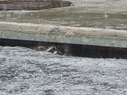
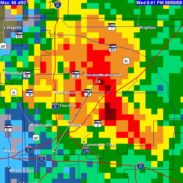
Record seting rainstorm on Wednesday, August 6th. As we discussed in our previous entry, severe weather moved across the Front Range bringing everything from thunder and lightning to funnel clouds and tornadoes to severe rain. Various watches / warnings were issued including Tornado Warnings, Flash Flood Warnings / Watches and more. Rain totals varied across the metro area with Thornton, particularly the northeast portions of the city, receiving the lion’s share. At ThorntonWeather.com, we measured a whopping 2.43″. The vast majority of that fell in a 70 minute time span from 6:00pm to 7:10pm. Rain rates were reading between 3″ and 7″ per hour during that timeframe! That is ThorntonWeather.com’s #1 rainiest day on record since going into service in October 2006; the previous record was 2.2″ set on April 24, 2007. Some street flooding was reported in Thornton but thankfully little real damage. At DIA they recorded 1.29″ of rain, breaking the old record for the date of 1.1″ set in 1929.
Cooler weather to prevail today. Significant moisture in the atmosphere and cooler temperatures should keep the excitement level down today – at least compared to yesterday. After noon there will be a chance for rain and those that do get rain can expect it to be heavy at times. As long as the temperatures stay down, we shouldn’t have the severity that we experienced yesterday though. Click here to view the latest forecast.
Be safe, use your head, pay attention! A bit of a report from the soapbox today. As we were looking at pictures of the storm on various news sites, we came across one submitted to 9News from a Thornton resident of children playing in the street in the rain. Now, that makes for a wonderfully fun picture and I am sure the kids had fun too but we do question how smart the parents were of these kids. At the time Thornton was getting hit with the storm, lightning was popping across the entire area and there was a Tornado Warning issued as funnel clouds had been spotted. Is outside playing in the street really where kids should be in a case like this? That fun would come to a quick end if lightning struck or worse yet, one of those funnel clouds developed into a tornado. Is that little bit of fun worth the risk of losing your child? THINK ABOUT IT! It may be worthwhile to review our Weather Education Series on Lightning and Tornadoes.
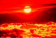 It is official – we have broken Denver’s 107 year old record of consecutive days with over 90 degree temperatures. Thursday marked day 19 in the streak, moving past the old record of 18 days set way back in 1901 and 1874.
  This is beginning to sound like a broken record – pun intended. 🙂 As for Tuesday our streak of consecutive 90 degree days hit 17, moving us into a tie for second place. Assuming today reaches 90 degrees or more – and it almost certainly will – we will then tie the record that has been set twice previously (in 1901 and 1874).
 As summer vacations wind down and families prepare to send kids back to school in August, Colorado weather also starts to settle down. The chances for severe weather decrease markedly during August and by the end of the month daytime temperatures are dropping quite a bit as well. For more information on what to expect in August,
 Recently we were asked what are the “zones” that the National Weather Service uses and what is their purpose. This is a very good question.