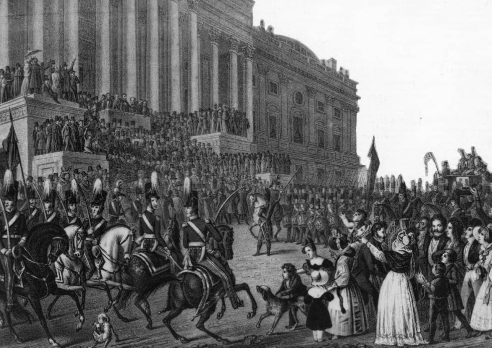
On a cold, wet and blustery day, the new President of the United States prepared to take office. He rode a horse to and from the Capitol that day and spoke on the steps of the building for nearly two hours – all without an overcoat or so much as a hat.
William Henry Harrison’s refusal to acknowledge the realities of the harsh weather on March 4, 1841 would be his demise. Our nation’s newest president would also have the shortest presidency, a mere 30 days, as he caught a chill that day which then turned to pneumonia and would claim his life.
Weather in the winter can be a wildcard to say the least and it has been a point of consternation for inauguration festivities. In President Harrison’s day, we inaugurated our new leader in March but since 1937 Inauguration Day has been held on January 20th, a day which puts it right in the potentially coldest part of winter.
‘Normal’ weather for January 20th in Washington D.C. actually isn’t all that bad. The city usually reaches a high temperature in the low 40’s. At noon, the appointed time for the inaugural address, the normal temperature is 37 degrees with partly cloudy skies and a 10 mph wind. According to the National Weather Service there is historically a 1 in 20 chance of snowfall on the date itself. Not too bad at all.
Like President Harrison, some other presidents weren’t very lucky when it came to the weather on inauguration day.
100 years ago President William Howard Taft famously said, “I knew it would be a cold day when I made president,” and he was absolutely right. On that March day ten inches of snow fell and wind downed trees and power poles as streets became clogged and trains stalled. President Taft’s ceremony was moved indoors due to poor weather and historians consider the day the worst inaugural weather ever.
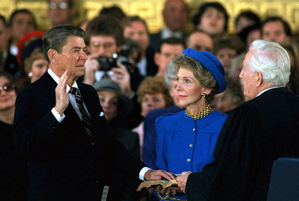
President Taft had it rough but his inauguration wasn’t the coldest. For his second inauguration President Ronald Reagan saw truly Arctic cold temperatures impact his ceremony. At noon in 1985 it was a mere 7 degrees and the wind chill dropped that to between -10 and -20 degrees. Like Taft, President Reagan’s inauguration was moved indoors.
In 1873 when Ulysses S. Grant prepared to take office for his second term, the temperature was a mere 16 degrees at noon. The wind was so bad it made his inaugural address inaudible to everyone including those on the platform with him.
In 1961 on the eve of John F. Kennedy’s inauguration, eight inches of snow fell causing the worst inaugural traffic jam as hundred of cars were stuck and thousands abandoned. The temperature only reached 22 degrees that day and the new president was forced to cancel dinner plans as travel was so difficult.
As for rain, that too can intrude on one of our nation’s most revered occasions. 1.77 inches of rain fell on January 20, 1937 – a record for the date that still stands today. President Franklin Delano Roosevelt rode in a convertible back to the White House after the inauguration which had a half-inch of water on the floor by the time he arrived.
How are things looking for Inauguration Day 2017 and President-elect Donald Trump’s swearing in? Rain looks to be a virtual certainty for much of the morning right through the swearing in at 12:00 noon EST / 10:00am MST. The actual volume of precipitation though does not look like it will be all that great. Temperatures will be topping out a bit warmer than normal for the date with an expected high of 48 degrees. Click here for the latest forecast for Washington DC from the National Weather Service.


