In a bit of a rarity for the Centennial State, Colorado experienced a 3.9 magnitude earthquake Sunday evening. According to the U.S. Geological Survey, the quake was centered nine miles east of Eads or 26 miles north of Lamar in the southeastern part of the state.
No damage was reported but the temblor was felt into western Kansas. Mary Breslin of Eads told the Denver Post she felt the shaking. “I really thought it was an explosion,” Breslin said. “It did not occur to me in the beginning that it was an earthquake.”
Originating at a depth of 6.2 miles, the quake occurred at 6:22pm along what state geologist Vince Matthews told the Associated Press might be part of a previously unmapped extension of the Cheraw Fault. See below for complete technical details on the quake.
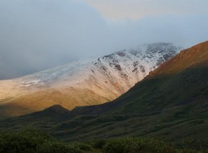
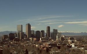
Denver has record setting cool temperatures and snow arrives in the Rocky Mountains. Image courtesy Victor Lewis.
While some parts of the nation experience record setting heat, on Thursday Denver had the opposite problem. The high temperature as measured at Denver International Airport reached a mere 64 degrees. This was two degrees below the previous record low maximum temperature of 66 degrees for this date set in 1925 and previous years. That is also an amazing 24 degrees below the normal temperature for this time of year!
Here in Thornton, we were even cooler than the official temperature on Thursday as the mercury climbed to a mere 61.3 degrees!
The unseasonably cold weather has also brought an unusual sight to the Colorado mountains in July – snow! Some northern parts of the Rocky Mountains in the state above 12,000 feet received a couple inches of snow.
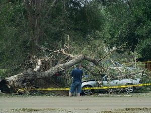
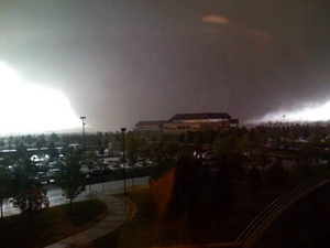
A man surveys damage to a vehicle struck by a fallen tree after last week's storms. The June 20th hail and wind storm has racked up costs of $350 million in insurance claims. Image courtesy Becki Mullen.
Last week’s hail and wind storm that brought destruction to the west Denver suburbs of Wheat Ridge and Arvada caused $350 million in insured damage according to the Rocky Mountain Insurance Information Association (RMIIA). The end result is a storm that now ranks as the second costliest in state history and adds to an already expensive summer storm season.
The July 20th storm has thus far resulted in 52,400 claims, 19,500 of which were for automobile damage and 32,900 were homeowner claims. RMIIA says that damage would have been much higher had the storm struck during daylight hours when more people and vehicles were on the road instead of in their homes and garages.
Massive trees were uprooted, power poles snapped, windows shattered, and automobiles dented beyond repair when the storm brought winds in excess of 60 mph and golf ball sized hail to the area. Two tornadoes also briefly touched down near Castle Rock and Englewood although they were not responsible for significant damage. 90,000 people lost power during the storm and Xcel Energy deployed more than 200 people into the field to restore electricity.
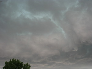
Do these clouds have the potential to bring a tornado? Learn more at National Weather Service storm spotter training.
We have written before about the great opportunity the National Weather Service provides by giving storm spotter training during the start of the severe weather season. Normally these sessions are held in the spring but in response to the very active severe weather of early June, and the increased interest in severe thunderstorms, the National Weather Service in Boulder has added to additional spotter training session next week.
When: Saturday, July 11
Time: 10:00am
Where: Broomfield, CO.
Exact location: Rocky Mountain Metropolitan Airport, Terminal Building, 11755 Airport Way (formerly Jefferson County Airport)
The storm spotter program is a nationwide program with more than 280,000 trained spotters. These volunteers report weather hazards to their local National Weather Service office providing vital information when severe strikes. Data from spotters include severe wind, rain, snow measurements, thunderstorms and hail and of course tornadoes.
Storm spotters are part of the ranks of citizens who form the Nation’s first line of defense against severe weather. There can be no finer reward than to know that their efforts have given communities the precious gift of time–seconds and minutes that can help save lives.
By completing one of these training classes you can become an official storm spotter. When severe weather strikes, you can report it by calling a special toll free number or submit your report via the National Weather Service’s website.
Taking the training though doesn’t obligate you to being a storm spotter. These are great sessions for anyone wanting to learn more about the severe weather we experience in Colorado, whether you want to be an official spotter or not. All training is free. Topics include:
The town of Windsor, Colorado was forever changed when an EF3 tornado ripped through it one year ago today.
May 22, 2008 was like most any spring day along the Colorado Front Range. The morning started out a bit warmer than usual and it was more humid but there was nothing to indicate the havoc that was soon to be visited upon Windsor, Colorado.
As the morning wore on, high above the plains the jet stream was moving at 120 mph and temperatures were warming quickly. From Denver looking north huge clouds began to build miles into the sky – an ominous sign of what was to come. A supercell thunderstorm, one more like what you expect to see in Oklahoma, was forming quickly.
At 11:30am the warnings were going out from the National Weather Service. This was not your typical thunderstorm. Soon a Gilcrest police officer radioed, “We have a tornado on the ground!”
Three tornadoes touched down that morning in northern Colorado but one stands out. The supercell that was near Windsor was growing in size and the twister that developed was massive – ¾ of a mile wide. Rated by the National Weather Service as an EF3 on the Enhanced Fujita Scale with winds in excess of 136 mph, what was described as a “big, black monster” would tear a path 35 miles long.
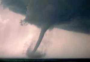
A tornado touched down in Mesa County on Tuesday - only the ninth twister since 1950 in the county. (File photo)
Mesa County, Colorado reported a rare tornado on Tuesday afternoon. The National Weather Service in Grand Junction reports that the twister touched down in an open area around 3:25pm yesterday near Mount Garfield (map).
The Associated Press reported that Meteorologist Jeff Colton said a National Weather Service employee was in the area and saw it happen. No damage or injuries were reported.
This was only the ninth tornado recorded in Mesa County since 1950 and the first since August 2, 2005.
In the United States, the winter is generally considered ‘flu season’ and is when we see it most widespread. With the threat of a potential swine flu epidemic, analysts are trying to determine if the weather will play any factor in the spread of the virus.
The flu is spread through contact with an infected person or pig, typically through coughing or sneezing. In the winter, when most people in temperate regions like the United States are spending time indoors in closed environments and in close quarters with those that are infected, it is thought that the flu can be transmitted easier. The water droplets containing the virus are slower to evaporate in cooler weather thus remaining airborne for longer periods of time and increasing chances of others becoming infected.
Outbreaks can and do occur in the tropics however research indicates they occur with less frequency in places that do not have the seasonality that other areas do. Limited laboratory and health data from regions like Africa and Latin America have made it more difficult to track the spread of viruses and thus learn from it.
The World Meteorological Organization (WMO) said on Monday that it hoped drier and warmer weather would help stifle the effects of the swine flu. The organization is asking health authorities to work with weather services to assess the role of weather and the climate in the outbreak as this is an aspect that is not fully known. WMO spokeswoman Gaelle Sevenier said , “The transmission patterns of this particular influenza and its possible seasonality are as yet not adequately understood and are the subject of ongoing investigations.”
Last year's Windsor tornado highlighted just how dangerous weather in Colorado can be. Are you and your family prepared?
As is customary, the governor has declared this week Severe Weather Awareness Week. This is an opportunity for the public to get reacquanted with the dangers severe weather presents in Colorado.
Tornadoes, lightning, hail, severe wind and flooding are very real hazards that Coloradoans face every year during severe weather season. It is important that you know what to do to protect you and your family.
In conjunction with the National Weather Service, Examiner.com will be publishing our Severe Weather 101 series. Each day this week a weather hazard will be discussed in depth and we will outline protective measures you can take to keep yourself and your family safe. Please be sure to check back every day to read these important message.
Thunderstorm hazards around the corner…are you prepared?
Severe thunderstorm season will be soon upon us. Do you know how to stay safe around tornadoes, flash floods, lightning, hail, and damaging winds? This is the week to learn. This week, April 19th to 25th, is Colorado severe weather awareness week. This is the time to learn more about severe weather in Colorado, develop severe weather preparedness plans, and test vital communications.
Can we learn lessons from the past severe weather events? Just last year on may 22nd an EF3 tornado raced north through Weld and Larimer counties resulting in one fatality. Several injuries and destroyed or heavily damaged hundreds of homes. Two years ago, on March 28, 2007 the town of Holly was heavily damaged by another EF3 tornado that resulted in two fatalities. Twelve years ago on July 28, 1997 a devastating flash flood occurred in Fort Collins resulting in 5 fatalities and millions of dollars in damage.
Each year for the past 20 years there have been an average of 50 tornadoes in Colorado, 3 people killed by lightning and another 15 injured by lightning.
The National Weather Service offices which cover Colorado will issue a series of public information statements during the week covering the following topics:
Monday…Watches and warnings
Tuesday… Tornadoes and tornado safety
Wednesday…Flash floods and flash flood safety
Thursday…Downburst wind and hail
Friday…Lightning and lightning safety
Saturday…A review of the week
A time to test your warning reception and communications systems is planned. Each national weather service office serving Colorado will send test tornado warnings on Tuesday April 21 between the hours of 8 am MDT and 11 am MDT. These test warnings will be sent to the emergency alert system, the internet, NOAA weather radio and law enforcement communications systems.
Safety information, watches, warnings, forecasts, past weather and much more information is available at your local National Weather Service web sites:
Sunny skies on Wednesday, March 4th helped Denver break a 137 year old high temperature record.
Denver officially broke the high temperature record on Wednesday, March 4th. At 12:40pm the temperature at Denver International Airport reached 76 degrees, breaking the old record of 74 degrees set in 1872.
This marks the 4th weather record we have broken in just the week. In addition to Wednesday’s mark, we have had:
March 3rd sets new record high minimum. Overnight temperatures got down to only 47 degrees, beating the old record of 44 set in 1925.
We are very dry right now and could really use some significant precipitation as snowfall totals are less than half of what they normally are by this time of year. Is there hope? We remember back to 2003 when we were in a similar dry condition and two major storms helped to turn things around. Click here to read about that on Examiner.com.
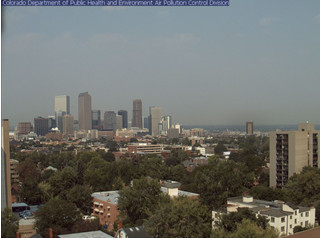
The old Stapleton International Airport site and Denver International Airport are separated by 12 miles. Is it accurate to compare weather between the two locations?
These announcements are common and we all take notice when we hear them and they make for great water cooler chat topics but are these claims accurate?
In 1995 Denver finally opened its new airport, Denver International Airport, out on the plains east of the city. This new facility, 12 miles as the crow flies northeast of the old Stapleton International Airport, moved the airport from an urban environment to a rural one and more than 19 miles from the center of Denver. Following that move, the National Weather Service (NWS) began taking some of its official measurements at the glistening new airport. In doing so, some say Denver’s climate records have forever been altered and as such any weather record should have an asterisk attached to it.