Category Archives: Colorado Weather

34 years ago today – the Big Thompson Flood remembered

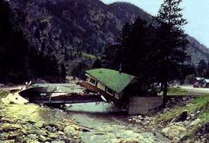
The Big Thompson Flood in 1976 claimed the lives of 143 Coloradoans in what is Colorado's deadliest natural disaster.

July 31, 1976 started like most other summer days in Colorado. It was 1976 and the nation was celebrating its bicentennial and Colorado was celebrating its centennial. What should have been a quiet summer day quickly turned disastrous as the Big Thompson Flood killed more than 100 people in Colorado’s deadliest natural disaster.

In terms of weather, the day started out much like one would expect but by late afternoon storm clouds loomed over the mountains. Mountain thunderstorms are an almost daily occurrence in Colorado but the storm that struck in the early evening that day was unlike any other.

With light winds aloft, the storm stalled over the upper portion of the Big Thompson basin where it sat dumping tremendous amounts of rain – nearly 8 inches in one hour and 12 inches over four hours. The rain came so fast that the water didn’t have time to be absorbed into the ground.

I’m stuck, I’m right in the middle of it, I can’t get out…about a half mile east of Drake on the highway. Get the cars out of the low area down below…
~ Radio transmission by Sergeant Willis Hugh Purdy, Colorado State Patrol. Purdy was never heard from again.

In the mid-sections of the canyon and lower, there was little indication of what was to come. The flash flood that resulted from the rain further up rushed down the canyon creating a wall of water that was 20 feet high in places. The flood scoured the canyon of everything – cars, homes, buildings and people.

The following day the Rocky Mountain News ran with the headline “Scores dead, hundreds hurt in Big Thompson flash flood.” A subheading said, “U.S. 34 west of Loveland is no more.”

When the flood was over, 143 people had lost their lives, more than in any other natural disaster in state history. 418 homes, 52 businesses and 400 cars were destroyed at a cost of over $40 million.

More coverage:

This story was originally published on the Denver Weather Examiner.  Be sure to visit Examiner.com for all the latest Denver and Colorado weather news and information.

NCAR scientists determine planes can punch holes in clouds

An example of a hole-punch cloud over Alabama. (Alan Sealls, WKRG-TV / NCAR)

Mysterious, almost UFO-looking, clouds have fascinated viewers from the ground for decades. Now, scientists at the National Center for Atmospheric Research (NCAR) in Boulder have determined that planes can ‘punch holes’ in clouds and perform the equivalent of cloud seeding.

Andrew Heymsfield, a scientist at NCAR, said that given the right conditions, planes climbing or descending can cause the atmospheric phenomena known as hole-punch, or canal clouds. When they do, they create unusual cloud formations and can cause rain and snow to develop.

Scientists have long speculated about the cause of the unusual ‘holes’ in the clouds and had attributed them to various aviation-related causes, none of which were conclusive.

The scientists at NCAR determined that water droplets at 5 degrees Fahrenheit (-15 degrees Celsius) are the key factor. When a plane flies through these droplets, the air behind it is cooled and the droplets freeze and fall toward the Earth.

There's more to this story on Examiner.com!Get the rest of this story including more photos and video explaining the phenomena at the Denver Weather Examiner!
Funnel cloud over two-mile-high Leadville raises eyebrows

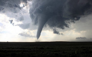
A 'cold air funnel' was spotted over Leadville, Colorado on Sunday morning. (NWS Pueblo)  See amazing video of the funnel cloud below.
A 'cold air funnel' was spotted over Leadville, Colorado on Sunday morning. (NWS Pueblo)

At an altitude nearly two miles high, one would not expect a funnel cloud to appear in the sky over a town like Leadville, Colorado. On Sunday however, Mother Nature treated visitors and residents to a rare ‘cold air funnel’ over the town high in Colorado’s Rocky Mountains.

At approximately 10:30 a.m. on Sunday, the funnel was spotted over Leadville where it continued to rotate for nearly 20 minutes, according to observers. The funnel never touched down, thus never becoming a tornado, but it serves as a reminder that twisters can occur just about anywhere on earth.

Funnel clouds and tornadoes typically need four conditions to form – Shear, Lift, Instability and Moisture (SLIM as famed storm chaser Roger Hill calls it). With a cold air funnel, those conditions also exist, although they aren’t associated with a supercell thunderstorm like is seen on the plains.

According to the National Weather Service’s Pueblo office, a cold low pressure system over northwestern Colorado provided the instability part of the equation. Strong upper level winds over the southwestern part of the state and slower winds over the northwest provided shear. The difference in lower and upper level temperatures and a passing thunderstorm provided the lift and moisture for the funnel.

One Denver-area television station is incorrectly reporting on its website that “Leadville was never in any danger because he says cold-air funnels do not turn into tornadoes.”

This is wholly inaccurate. While cold air funnels do not typically touch down, they can reach the ground and as the National Weather Service states, they “can bring damage in a small area.”

Slideshow – Amazing images captured by Storm Chase 2010

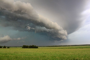
A shelf cloud moves across Nebraska farmland. (Tony Hake / ThorntonWeather.com)

Certainly the highlight of storm chasing is tornadoes and ThorntonWeather.com’s Storm Chase 2010 had plenty of those – five in one day in fact.  However, as great of satisfaction can be derived from simpler, less violent storms.  The images from a week of chasing on the Great Plains show the fury and the beauty of Mother Nature.

Storm chasing is as much an art as a science – there are no guarantees that tornadoes will appear as forecast. Other types of severe weather and the amazing structure they display can bu just as impressive.

Scud clouds hovering over a coal train in Nebraska, egg sized hail pummeling storm chaser vehicles, the sun setting on the Oklahoma plains and the now infamous Baca County, Colorado tornado ripping through ranchland all were highlights of Storm Chase 2010.

The images in the slideshow below represent some of the most stunning and beautiful images captured during the week.

Storm Chase 2010 wraps up – Chasers experience it all from sunsets to tornadoes

The Memorial Day tornado in Baca County, Colorado near Campo was the highlight of a week of storm chasing but it wasn’t the only exciting thing to happen. (Tony Hake / ThorntonWeather.com)

We have said before that storm chasing is as much an art as a science and it can very much be feast or famine.  Both extremes were seen over the course of a week of storm chasing on the Great Plains by ThorntonWeather.com.

We hope our site visitors were checking out the Storm Chase 2010 Examiner where we were documenting our chase across America’s heartland.  With stories, photos and video, the entire incredible week has been described in detail.

Two ‘busted’ storm chase days started out the week – one with a round trip from Denver to Nebraska and another one-way to Amarillo, Texas.  Those certainly fulfilled the ‘famine’ part of storm chasing. 

The third day however brought a ‘feast’ in the form of a bounty of five tornadoes in one day.  Chasing storms in southeastern Colorado, ThorntonWeather.com witnessed the entire gamut of severe weather from drenching rain and damaging hail to gale force winds and of course tornadoes. 

The first tornado of that day near Pritchett, Colorado allowed chasers to witness the complete tornado genesis.  As massive amounts of air were sucked into a storm cell and the clouds swirled menacingly above, a small funnel cloud soon grew into a powerful tornado. 

Two other tornadoes and an incredible hail storm on the virtually barren ranchland followed.  The main event was yet to come however. 

About eight miles south of Campo, Colorado, a massive supercell seemed poised to generate a tornado.  Chasers waited anxiously as the sky grew darker on the plains.  A funnel cloud formed and was cheered on as it grew closer to the ground. 

Before long the tornado was on the ground moving at a leisurely 10 mph – its slow pace allowing for plenty of time to capture amazing photos and video of the event.  The Baca County tornado would draw national media attention and will possibly go down as the most picturesque of all twisters during the 2010 tornado season.

While the Memorial Day tornadoes would be the last seen during the week, they were not the last extraordinary weather event witnessed by the storm chasers. 

Storm Chase 2010 intercepted a flying saucer over western Kansas at the end of a very long chase day. (Tony Hake / ThorntonWeather.com)

Two days after the southeastern Colorado tornadoes, chasers witnessed an extraordinary ‘mothership’ supercell near Goodland, Kansas.  The sight of the ‘flying saucer’ slowly moving across the Kansas wheat fields was extraordinary.

Central Nebraska proved to be the backdrop for another day of weather beauty.  Waiting patiently at a small town gas station, multiple super cells moved across the area and chasers were on the move.  From highways to dirt roads, the chasers saw the storms generate amazing shelf clouds and funnel clouds.

In the end, the group of storm chasers covered over 2,500 miles across five states.  They witnessed many funnel clouds and amazing storm structures and of course five tornadoes, two of which were at close range.  For many it was truly a once in a lifetime experience that allowed them to see Mother Nature’s fury up close and personal.   

Complete stories, photos and video from Storm Chase 2010:

Colorado researchers join VORTEX2 tornado project

This tornado in Goshen County, Wyoming in 2009 was intercepted by VORTEX2 teams and is considered the “most intensely examined tornado in history.” (NOAA)  Watch video of the twister and see more photos at the complete story on Examiner.com. (NOAA)
This tornado in Goshen County, Wyoming in 2009 was intercepted by VORTEX2 teams and is considered the “most intensely examined tornado in history.” (NOAA) Watch video of the twister and see more photos at the complete story on Examiner.com. (NOAA)

For the second year in a row, a team of over 100 scientists and dozens of vehicles will take to Tornado Alley in an attempt to study one of Mother Nature’s most destructive phenomena. Like last year, Colorado researchers will be helping with the project.

Among the Colorado-based participants are University of Colorado students and researchers. They join others from 11 other universities from across the nation including the University of Oklahoma, Penn State University, and the University of Massachusetts.

Perhaps most well known, Dr. Josh Wurman of the Center for Severe Weather Research (CSWR) in Boulder will be a key contributor. Watchers of the Discovery Channel’s Storm Chasers series know Wurman well as the operator of a Doppler On Wheels (DOW) radar truck and coordinator of the TV series’ storm chases.

Verification of the Origins of Rotation in Tornadoes Experiment 2 (VORTEX2) is simply the largest, most extensive in-field tornado study in history. Funded by the National Science Foundation (NSF) and the National Oceanic and Atmospheric Administration (NOAA), the VORTEX2 team will prowl the Great Plains hunting their elusive prey from May 1st to June 15th.

Once again, a veritable armada of scientific equipment will be deployed. Ten mobile radar units, dozens of vehicles, over 70 other instruments and even an Unmanned Aerial Vehicle (UAV) will cover thousands of miles on the Great Plains.

There's more to this story on Examiner.com!For the rest of this story including photos of all the equipment and amazing video of the tornado in Wyoming that the team intercepted last year, visit the Denver Weather Examiner.

Denver sets new record high temperature for March 30th

Denver set a new high temperature record for today, breaking a 131 year old record.

Following on last week’s wintry blast, residents of the Mile High City were anxious for spring-like weather and they received it today. Denver has officially set a new record high temperature for the date breaking a 131 year old record.

The National Weather Service reported that at 3:32pm the mercury reached 82 degrees at the official measuring station at Denver International Airport (DIA). This breaks the previous record of 81 degrees set in 1879. The service noted that Rutherford B. Hayes was our 19th president at the time.

Here at ThorntonWeather.com, we reached a high of 81.7 degrees at 4:01pm.

Denver’s newest National Weather Service station at Denver City Park recorded a high temperature today of 81 degrees. Many believe this station is the one that should be the official reporting station for the city as the station at DIA has been shown to be skewing Denver’s climate records.

Other area stations reported similarly warm temperatures. Longmont reached a high temperature of 83 degrees breaking its old record of 81 degrees set in 1986. On the Rocky Mountain Weather Network,  Arvada reached 84 degrees, north Denver 83 degrees, Littleton 81 degrees and Broomfield 83 degrees.

ThorntonWeather.com webcams capture time lapse video of snowstorm

March 24, 2010 - Early morning look as the snowstorm comes to an end.

Colorado was slammed with an early spring snowstorm on Tuesday, March 23, 2010 that left the Mile High City buried in a blanket of white. Widespread poweroutages were reported, the evening commute was a mess and residents worked to dig themselves out from the heavy, wet snow. 

Across the nation there are thousands of Personal Weather Stations (PWS) that are owned and operated by weather enthusiasts.  These stations provide valuable services to their communities and their data is oftentimes used by local news media and even the National Weather Service. 

You can find many of these stations on the Rocky Mountain Weather Network.

ThorntonWeather.com is proud to be one of these stations providing local weather to residents of the City of Thornton.  Our site has become extremely popular as we are the most comprehensive source for Thornton weather.

Our webcams followed the storm as it arrived in Thornton on Tuesday and below is a time lapse video from the east camera.  The day starts out relatively nice with temperatures in the 40’s but by late afternoon, the video shows conditions deteriorating rapidly.

Snowstorm slams Thornton wreaking havoc along the way

An image taken from ThorntonWeather.com's east camera at the height of the storm on Tuesday.

Update, 3:25pm: With many businesses and schools closed for the day, Thornton residents have spent the day digging out from a snowstorm that officially dumped 10 inches of snow in Denver. Areas to the west in the foothills and the south along the Palmer Divide had 18 inches or more while ThorntonWeather.com recorded 8.9 inches.  Click here to view the latest snowfall reports.

This latest snowfall puts Denver at 12.0 inches of snow for the month as measured at the official station at Denver International Airport. That is slightly above the March average of 11.7 inches. For the season, Denver has recorded 58.0 inches which is fast approaching the average of 61.7 inches.

As in the past, questions continue to dog the weather measurements at DIA however as they don’t reflect what most of the population of Denver actually sees. The accuracy of the measurements also is questionable as yesterday DIA recorded 0.61 inch of precipitation – far below what was likely received between the rain and snow melt.

Out at DIA, operations are slowly getting back to normal after scores of flights had been canceled due to the weather. At one point the FAA imposed a hold on arriving flights so the airport could catch up on departures. Many flights had been delayed while waiting for deicing and snow removal operations.

Xcel Energy continues to try to work to restore power to all of its customers after up to 36,000 lost electricity. The power company’s website still lists hundreds of outages affecting thousands of customers, including many in Thornton.

As always, stay tuned to ThorntonWeather.com for truly local weather for Thornton. 

You can also signup to receive the latest weather alerts and forecasts via email here.

Continue reading Snowstorm slams Thornton wreaking havoc along the way

Winter storm arrives in Colorado; Heavy snow expected in Thornton

Weather warnings in effect as of Friday morning. (NWS)

Update, 3:50pm: The snow keeps flying and the wind keeps blowing! Just about the time you think the snow is going to ease up Old Man Winter lets it fly yet again.

How cold and wet is it?  It is cold and wet enough to have frozen our anemometer (wind sensor).  So if you are wondering why we aren’t registering any wind, you know why!  🙂 

Snow continues to fall across much of the Front Range but it is heaviest in and near the foothills. A quick sampling of storm reports shows Thornton has recorded 4.5 inches, Arvada 6.0 inches and Boulder 9.4 inches. Click here for the complete listing of snowfall reports.

We are looking for the snow to gradually decrease from north to south. However, until it does this evening we will see periods of moderate to heavy snowfall. Total accumulations by the time the storm ends around midnight will range from a few inches out by DIA to 5 to 10 inches closer to town and 7 to 14 inches near the foothills.

The winds are picking up a bit this afternoon as well and that is creating blowing and drifting snow. Visibility may be limited on the roadways so please use caution. Most main roadways continue to be everything from wet to slushy but periods of heavy snow coupled with wind may cause conditions to deteriorate.

The Winter Storm Warning will continue to be in effect until midnight tonight.  Remember that a Winter Storm Warning means hazardous winter weather conditions are imminent or highly likely. Significant snow accumulations are occurring or expected. This will make travel very hazardous.

As always, stay tuned to ThorntonWeather.com for truly local weather for Thornton. 

You can also signup to receive the latest weather alerts and forecasts via email here.

Continue reading Winter storm arrives in Colorado; Heavy snow expected in Thornton