Category Archives: Climatology

Thornton’s November weather preview – Our second snowiest month

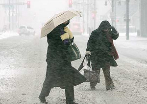
November is Denvers second snowiest month.  What else can we expect?
November is Denver's second snowiest month. What else can we expect?

Typically November is a quiet weather month with plenty of nice, fall days but it can also turn wet with plenty of snow and moisture.  Just like Forest Gump’s proverbial box of chocolates, you never quite know what you are going to get.

Looking into the weather history books, we see that November is actually Denver’s second snowiest month, second only to March (April is third).  Historically we average 10.7 inches of snow during the month.

In 1994, November was the snowiest month of that year with 16.9 inches – over 12 inches of which fell within a 12 hour period on the 13th and 14th.  In 1991 we saw 29.6 inches of snow (the 2nd snowiest November) and the following year in 1992 we had 20.1 inches of snow (the 8th snowiest November).  Those examples though pale in comparison to the snowiest November on record which was in 1946 when a whopping 42.6 inches of snow fell! 

It isn’t always that snowy though. November 2002 was at the time the 16th month in a row with below normal precipitation and the calendar year of 2002 marked the driest in Denver weather history. This pattern of below normal precipitation continued for 19 months through February 2003. Since 1882, one year (1949) recorded no snow, six more recorded only a trace of snow and four had less than one inch of snow.

For the rest of the November weather preview including complete historical statistics, averages and much more, click here.

Preview of Thornton’s October Weather – Fall is Here

What does October weather hold for Denver?

With the first full month of fall here, October usually brings one of the quietest weather months in the Denver area with plenty of mild, sunny days and clear, cool nights. The month actually has our second highest amount of sunshine with 72 percent with September having the most with 74 percent. Interestingly enough, the month following, November, is one of the lowest sunshine months with only 64 percent. Typically October brings our first real taste of winter with the first freeze on average coming on the 7th of the month and the first snow on the 15th of the month.

Average temperatures in October steadily drop throughout the month. On the first we average 72 degree highs but by the 31st that drops to 59 degrees. October also sees our average low temperatures start to reach below freezing as well. At the start of the month we will average 42 degrees as the low temperature but by the end of the month the mercury dips to 30 degrees. This truly begins the sign that winter is approaching.

Get all the details on Denver’s October weather in our complete preview here.

NOAA: Summer 2009 was 34th coolest on record; thousands of low temp records set

Highlighting the cooler summer, thousands of record low temperatures were experienced in July 2009. (NCDC)

The National Oceanic and Atmospheric Administration (NOAA) announced this week that the summer of 2009 was the 34th coolest since 1895. Covering the months from June to August for the contiguous United States, the average temperature was 0.4 degrees below the 20th century average.

Emphasizing the lower temperatures experienced in the United States over the summer, a closer look at the statistics provides some telling information.

Over the three month period, stations reporting to the National Climatic Data Center (NCDC) showed 2,254 daily record low temperatures and 1,296 low temperature records were tied according to preliminary data. Similarly, 4,051 daily record low maximums were recorded and 1,501 records were tied across the nation during the summer.

July in particular was notably cooler than normal and the single month by itself counted for roughly half of the records set across the three month summer. For the month, 2,212 record low maximum temperatures were recorded and 737 were tied. 1,225 new record low temperatures were recorded and 657 records were tied.

There's more to this story on the Denver Weather Examiner's site!For all the details on the United States’ summer weather including NOAA’s summary and a look back at the country’s August weather, go to Examiner.com.

August 2009 climate and weather preview posted

Thorntons August weather preview.
Thornton's August weather preview.

As summer vacations wind down and families prepare to send their kids back to school in August, Colorado weather also starts to settle down. The chances for severe weather decrease markedly during August and by the end of the month daytime temperatures are dropping quite a bit as well.

At the start of the month Denver usually averages around 88 degrees for a high temperature. By the end of August that drops to 82 degrees. Similarly, nighttime lows drop from 60 to 53 from the start to the end of the month. Generally clear skies can be expected between midnight and noon but the afternoon often brings showers and thunderstorms. These storms typically develop over the foothills then bring precipitation to the Denver metro area.

Despite that moisture, the chance for severe weather decreases considerably compared to the first two months of summer. Cooler air near the surface helps to create a stable atmosphere thus keeping thunderstorms from usually becoming too intense. After the middle of August, tornadoes and damaging hail are pretty rare. The slow movement of storms this time of year are more likely to produce potentially heavy rain.

Click here to read the complete preview including a look back at what was a record setting month last year.

A Preview of Thornton’s July Weather – A Stormy Month

Change is of course the one constant in Denver’s weather but come July, things actually get pretty consistent. The standard formula for a day in July is a sunning morning, clouds developing in the late morning and early afternoon. Come mid-afternoon, thunderstorms are rolling off of the foothills and into the metro area and the eastern plains. These storms do occasionally reach severe status containing hail, gusty winds and heavy downpours of rain.


In fact, the worst hail storm on record in Denver history hit western sections of the city on July 11th, 1990. Baseball and softball sized hail from this ferocious storm caused millions of dollars worth of property damage.

July is the most stormy month of the year in fact with thunderstorms occurring on average 11 days per month – or once every three days. These slow moving storms are one of the reasons July is Denver’s second rainiest month with an average of 2.16 inches of rain (second only to May). However, these storms are also often very localized and cause widely varying precipitation amounts across the metro area. It is not unusual for one area of down to be deluged while others remain entirely dry. With these severe storms, flash flooding remains a possibility.

View the complete July 2009 preview along with a look back at July 2008 here.

June 2009 is now the 2nd wettest Denver June

From the National Weather Service: June 2009 has moved into the second wettest June since Denver weather records began in 1872.  So far for June 2009, through June 26th, the Denver International Airport (DIA) has measured 4.86 inches of liquid (and there are still 4 more days left in June).  The 4.86 inches of water is 3.52 inches above normal through the 26th.  Last year, June 2008 had only measured 0.73 inch again through the same June time frame.

The wettest June on record for Denver was in June 1882 when 4.96 inches of moisture was collected in the rain bucket.

For the 2009 year so far, 10.38 inches of water has been measured at DIA which is a very impressive 2.51 inches above the normal through June 26th.   Last year in June, only 3.04 inches had been recorded through the same time frame.

Note:  The average Denver annual precipitation is 15.81 inches.

As always, we have to ask, do Denver weather and climate records have an asterisk attached?  Read our Examiner.com investigation to see why maybe they should.

A Preview of Thornton’s June Weather – The Severe Weather Month

Denver is historically Thornton's true severe weather month.

June is historically Denver’s severe weather month and severe thunderstorms, tornadoes and hail are notorious visitors to Denver and across eastern Colorado during the month.  In fact, over 40 percent of the tornadoes that occur in Colorado are observed in June and these are typically the most destructive of the year.  Severe thunderstorms have also caused major property damage across the Front Range during the month.

In just the last 25 years or so, there have been some particularly notable storms in June.  Tornadoes have struck the metro area including one that longtime Thornton residents will recall on June 3, 1981.  53 residents were injured, 25 homes were destroyed and 239 other structures were damaged.  Others tornadoes in the metro area include southeast Denver and Aurora on June 8, 1986 and east Denver on June 13, 1984.  Severe thunderstorms occurring on June 13, 1984 dumped large hail making it one of the worst and the second costliest storm in Denver history.  More recently, on June 20, 2001, a major hail storm moved across Denver International Airport dropping hailstones as big as two inches in diameter. Damage was extensive on and near the airport.

For complete details on what we can expect in June, click here to view our June weather preview.

Denver officially breaks high temperature record for this date

Denver set a temperature record for today, May 19.

It’s official.  At 1:24pm today the temperature at Denver International Airport reached 90 degrees setting a new record high temperature for May 19.  This breaks the previous record high for this date of 89 degrees set in 2006. 

Wtih some cloud cover moving in and a chance for thunderstorms in the forecast, it appears that is as high as the mercury will climb today. 

But is it truly a record?

One does have to wonder though, is it truly fair to call this a record?  When the National Weather Service moved Denver’s official monitoring station from Stapleton to Denver International Airport, some say the city’s climate records were forever altered.  For more information and analysis of the controversy, check out this story:  Do Denver weather and climate records have an asterisk attached?

A Preview of Denver’s April Weather – Something for Everyone

Do April showers bring May flowers?  Find out in our April 2009 weather preview!
Do April showers bring May flowers? Find out in our April 2009 weather preview!

April marks a transition between winter and summer for most of the country but for Denver it is especially true as we can see a stunning variety of weather. The proverbial April showers are certainly a possibility for Denver. Snow? Tornadoes? Thunderstorms? You bet – all can happen! For good measure throw in a chance for hail and even dust storms and April gives every type of weather condition you could like – or hate.

The good news is that sunshine and warmer temperatures are usually in abundance as the normal highs during the month move up from 57 degrees on the first to 65 degrees on the 30th. It is not unusual to have a number of days well into the 70’s and the low 80’s. We also see the normal lows move above freezing from 30 degrees at the start of the month to 39 degrees by the end. Temperature extremes can hit both ends of the spectrum with a record low of 2 degrees below zero on April 2, 1975 and a record high of 90 degrees on April 30, 1992.

Get all the details here in our complete April 2009 preview.

Have a headache? Blame the weather!

Have a headache? The weather may be the cause!

We have oftentimes heard headache sufferers, particularly those that get migraines, attribute their pain to the weather.  These had sometimes been dismissed as an old wives tale but a new study shows that there is a great deal of truth to this. 

The Beth Israel Deaconess Medical Center (BIDMC) in Boston has recently completed the first large-scale study showing how environmental conditions like weather and air pollution can influence headache pain.  Over 7,000 patients were studied in order to see if there is a link.

Kenneth Mukamal, MD, MPH, one of the authors of the study and a physician at BIDMC explains that, “Air temperature, humidity and barometric pressure are among the most frequent reasons that people give for their headache pain.  But none of these reasons have been consistently verified. We wanted to find out if we could verify this ‘clinical folklore’.”

Mukamal and his coauthors compared levels of pollutants and meterological variables at the time of the patient’s hospital visit with corresponding levels on preceding days and subsequent weeks.  Using meteorlogical and pollutant monitors they compared measurements of factors such as air temperature, barometric pressure, humidity, and dioxides from the three days prior to a patients’ visit to see if there was a correlation between these items and the patients’ headaches. 

The results of the study seem to prove that this old wives tale is true.  Of the factors considered, higher air temperature in the 24 hours just prior to a patient’s visit to the hospital was most associated with the headache symptoms.  There was a 7.5 percent higher risk of severe headaches for each increase of nine degrees in temperature.  Although not as profound, lower barometric pressure in the 48 to 72 hour period before a hospital visit also was seen to trigger headaches. 

Dr. Mukamal says, “Certainly our results are consistent with the idea that severe headaches can be triggered by external factors.  These findings help tell us that the environment around us does affect our health and, in terms of headaches, may be impacting many, many people on a daily basis.”

The next time you have a headache, if it was a good bit warmer the day before or the barometric pressure was lower a couple days before, you may have found the cause of your headache!