
All posts by Thornton Weather

ThorntonWeather.com is your local source for live Thornton, Colorado weather conditions and news!

November 21 to November 27 – This week in Denver weather history

November 21 to November 27 - This week in Denver weather history

Weather is a big part of the holidays.  With many people hitting the road to visit friends and family the weather can make or break those holiday plans.  Our look back at this week in Denver weather history shows a number of Thanksgivings when the weather put a damper on travel plans.

19-21

In 1979…a heavy snowstorm buried most of Colorado under at least a foot of snow.  Snowfall at Stapleton International Airport totaled 17.7 inches…the greatest snow depth since 1946.  Winds to 60 mph produced 5-foot drifts paralyzing the city as temperatures hovered in the 20’s.  While small airports closed…Stapleton remained open…but with long delays that snarled Thanksgiving holiday traffic.  Schools and businesses closed and postal deliveries were delayed. Almost all major highways leading out of Denver were closed to traffic for periods of time on the 20th and 21st.  Most of the snow…13.5 inches…fell on the 20th.  At Stapleton International Airport…north winds gusted to 35 mph on the 20th and to 38 mph on the 21st.

20-21

In 1898…snowfall totaled 4.0 inches in downtown Denver. Northeast winds were sustained to 48 mph with gusts as high as 60 mph behind an apparent cold front on the 20th… When temperatures plunged from a high of 66 degrees to a low of 9 degrees.  On the 21st the high was only 24 degrees and the low was 2 degrees.
 
In 1970…a wind gust to 94 mph was recorded at gold hill in the foothills west of Boulder.  Strong winds also swept across metro Denver.  Wind gusts reached 59 mph in downtown Boulder…while at Stapleton International Airport west- northwest winds gusted to 43 mph on the 21st.  Damage was minor.
 
In 1992…a large Canadian air mass moved into the state at the same time an upper level storm system approached from the west.  The combination of cold air at the surface and very moist air aloft produced heavy snow across the entire state.  Snowfall totaled 6.3 inches at Stapleton International Airport…where north winds gusted to 23 mph on the 20th.  Snow was heavier in the foothills…with 14 inches at Wondervu…13 inches at Aspen Springs…Conifer… Boulder…and Gross Reservoir…8 inches at Rollinsville… And 10 inches at Golden Gate Canyon and Morrison.
 
In 2007…a storm system brought moderate to heavy snowfall to portions of the urban corridor.  Storm totals included: 7 inches…3 miles south-southeast of Fort Collins…with 6 inches in Boulder and at Horsetooth inlet bay.  Elsewhere… Storm totals ranged from 2 to 5 inches.  Snowfall totaled 2.0 inches at the site of the former Stapleton International Airport.

Continue reading November 21 to November 27 – This week in Denver weather history

November 14 to November 20 – This week in Denver weather history

November 14 to November 20 - This week in Denver weather history

Henry Fenton is probably not a name many folks are familiar with however he will forever be engrained in the Denver weather history books.  It was 139 years ago this week that Fenton made the first official Denver weather observations.

From the National Weather Service:

11-14

In 1970…heavy snowfall totaled 7.2 inches at Stapleton International Airport where northeast winds gusted to 22 mph on the 12th and 14th.  Most of the snow… 4.2 inches…fell on the 12th.

12-15

In 1909…light snowfall totaled 6.7 inches in downtown Denver over the 4 days.  This was the first measurable snowfall of the season.  Northeast winds were sustained to 15 mph on the 12th.

13-14

In 1925…heavy post-frontal snowfall totaled 6.4 inches overnight in downtown Denver.  Northwest winds were sustained to 27 mph with gusts to 29 mph on the 13th.
 
In 1974…northwest winds gusted to 52 mph at Stapleton International Airport…warming the temperature to 60 degrees shortly after midnight on the 13th.  A cold front cooled temperatures into the 20’s by late morning and produced snowfall of 3.7 inches.  The low temperature dipped to 14 degrees on the 14th.
 
In 1993…an upper level low pressure system combined with a weak but moist upslope flow to produce heavy snow across metro Denver.  Snowfall amounts averaged 6 to 8 inches with up to 16 inches in the foothills at the Eldora Ski Area. Snowfall totaled 6.0 inches at Stapleton International Airport where north winds gusted to only 20 mph on the 14th.  Most of the snow fell on the 14th.
 
In 1994…heavy snow developed rapidly along the Front Range urban corridor with the heaviest snow over northwest metro Denver.  Sixteen to 18 inches of snow fell in Boulder… Lafayette…and Louisville.  This was the second heavy snowfall over northwest metro Denver in 10 days.  Eleven to 14 inches of snow were measured from Longmont southward into Aurora.  Snowfall totaled 12.1 inches at Stapleton International Airport where northeast winds gusted to 29 mph on the 13th.  Most of the snow…9.0 inches…fell on the 14th.
 
In 1997…heavy snow fell overnight in portions of Jefferson and Boulder counties.  About 5.5 inches of snow were reported in Boulder…while 4 inches were measured 12 miles southwest of Morrison and 6 miles southwest of Golden. Snowfall totaled only 1.8 inches at the site of the former Stapleton International Airport.  Northeast winds gusted to 26 mph at Denver International Airport.

Continue reading November 14 to November 20 – This week in Denver weather history

Denver’s October 2010 wraps up dry and warm

October 2010 ended up drier and warmer than normal.

Following on what was a “top 10” warmest and driest September, October tried to follow suit but fell short of achieving record status.  Nevertheless, the month was considerably warmer and drier than normal. 

In terms of temperature the month ranked as the 11th warmest fall just 0.1 degree short of top 10 status.  The average temperature was 55.3 degrees; a considerable 4.3 degrees above normal.  Temperatures ranged from a high of 85 degrees on the 3rd down to a low of 20 on the 28th.  In all there were only two days when the mercury dipped to freezing or below; seven days below the normal nine we receive. 

Thornton was quite a bit cooler overall than Denver as we had an average temperature of 52.7 degrees.  Highs ranged from 84 degrees on the 4th down to 23.3 degrees on the 28th. 

As an interesting side note, it was just last October that we had our second coldest October on record.  The average temperature in October 2009 was a chilly 42.9 degrees and we had 17 days with temperatures at or below freezing! 

We suffered through another dry month which did spark a couple of wildfires.  A mere 0.54 inch of precipitation was recorded at the official monitoring site at Denver International Airport.  This was just barely more than half of the normal of 0.99 inch.  Most of the precipitation fell in the form of rain on the 12th when 0.34 inch was recorded.  Here in Thornton we were a bit wetter having recorded 0.73 inch of precipitation during the month. 

For the first time since 2003 no snow was recorded in Denver in October.  This is only the 15th time since 1882 that has happened.  On average we expect to receive 4.1 inches of the white stuff. 

See the official statistical summary from the National Weather Service below for more details.  Click here to view the monthly climate summary for Thornton.

CLIMATE REPORT
NATIONAL WEATHER SERVICE BOULDER, CO
205 PM MDT MON NOV 1 2010

................................... 

...THE DENVER CO CLIMATE SUMMARY FOR THE MONTH OF OCTOBER 2010...

CLIMATE NORMAL PERIOD 1971 TO 2000
CLIMATE RECORD PERIOD 1872 TO 2010

WEATHER         OBSERVED          NORMAL  DEPART  LAST YEAR'S
                 VALUE   DATE(S)  VALUE   FROM    VALUE  DATE(S)
                                          NORMAL
................................................................
TEMPERATURE (F)
RECORD
 HIGH              90   10/01/1892
 LOW               -2   10/29/1917
HIGHEST            85   10/03        90      -5       84  10/18
LOWEST             20   10/28        -2      22       17  10/10
AVG. MAXIMUM     69.7              66.0     3.7     54.7
AVG. MINIMUM     40.9              35.9     5.0     31.1
MEAN             55.3              51.0     4.3     42.9
DAYS MAX >= 90      0               0.0     0.0        0
DAYS MAX <= 32      0               0.3    -0.3        3
DAYS MIN <= 32      2               8.6    -6.6       17
DAYS MIN <= 0       0               0.0     0.0        0
PRECIPITATION (INCHES) 
RECORD
  MAXIMUM         4.17   1969  
  MINIMUM            T   1934
TOTALS           0.54              0.99   -0.45     1.36
DAILY AVG.       0.02              0.03   -0.01     0.04
DAYS >= .01         4               5.3    -1.3        8
DAYS >= .10         2                MM      MM        5
DAYS >= .50         0                MM      MM        0
DAYS >= 1.00        0                MM      MM        0
GREATEST
 24 HR. TOTAL    0.34   10/12 TO 10/12     0.39  10/20 TO 10/21       

SNOWFALL (INCHES)
RECORDS
 TOTAL           31.2   1969
TOTALS            0.0               4.1    -4.1       17.2             

DEGREE_DAYS
HEATING TOTAL     300               436    -136      676
 SINCE 7/1        335               582    -247      815
COOLING TOTAL       8                 0       8        0
 SINCE 1/1        870               696     174      533              

FREEZE DATES
RECORD
 EARLIEST     09/08/1962
 LATEST       06/08/2007
EARLIEST                        10/07
LATEST                          05/05
.................................................................

WIND (MPH)
AVERAGE WIND SPEED              9.1               9.6
RESULTANT WIND SPEED/DIRECTION   3/231            MM
HIGHEST WIND SPEED/DIRECTION    41/350  10/25    37/350  10/29/09
HIGHEST GUST SPEED/DIRECTION    51/350  10/25    54/200  10/05/09

SKY COVER
POSSIBLE SUNSHINE (PERCENT)   MM                                      

NUMBER OF DAYS FAIR            9
NUMBER OF DAYS PC             22
NUMBER OF DAYS CLOUDY          0

AVERAGE RH (PERCENT)     44

WEATHER CONDITIONS. NUMBER OF DAYS WITH
THUNDERSTORM              4     MIXED PRECIP               0
HEAVY RAIN                0     RAIN                       3
LIGHT RAIN                5     FREEZING RAIN              0
LT FREEZING RAIN          0     HAIL                       0
HEAVY SNOW                0     SNOW                       0
LIGHT SNOW                0     SLEET                      0
FOG                       2     FOG W/VIS <= 1/4 MILE      1
HAZE                      7                                           

-  INDICATES NEGATIVE NUMBERS.
R  INDICATES RECORD WAS SET OR TIED.
MM INDICATES DATA IS MISSING.
T  INDICATES TRACE AMOUNT.

Surveillance video shows trailers being overturned by tornado

Crews pick up debris from Chickamauga Creek Oct. 27, 2010. (USACE/ Richard Scott)

An extraordinary severe weather outbreak on Tuesday, October 26th brought Mother Nature’s fury to a large part of the nation stretching from Mississippi to Michigan.  Of the dozens of tornadoes reported that day, one ripped through Chickamauga Lock near Chattanooga, Tennessee and was captured on surveillance video.

  • Watch the amazing video below

The twister ripped through an area near Chickamauga Dam Tuesday evening where the Army Corps of Engineers is constructing the lock.  No injuries to the employees working at the sight were reported but the Corps said some barely escaped. 

The video, captured by a surveillance camera, initially gives no indication of the destruction that is about to come as conditions appear calm and vehicles are seen driving on a nearby road.  40 seconds into the video the winds and rain begin to pick up and 10 seconds later two construction trailers are flipped over and reduced to rubble.

Wayne Huddleston, project manager at Chickamauga Lock, said “The Corps is relocating personnel to other buildings on site and repairs and cleanup are ongoing.  We are extremely pleased that no people were hurt and that operations were not seriously affected by the storm.”

The video clearly shows why mobile homes and other structures without permanent foundations are never a safe place to take cover during severe weather.  Residents should always seek sturdier shelter in a permanent structure.

For all the latest on all types of natural disasters, be sure to check out the Natural Disasters Examiner.

Denver’s November weather preview – Our 2nd snowiest and least sunny month

Denver's weather in November can bring a wide variety of conditions.  What can we expect in 2010? (iStockphoto /  johnnyscriv)
Denver's weather in November can bring a wide variety of conditions. What can we expect in 2010? (iStockphoto / johnnyscriv)

Typically November is a quiet weather month with plenty of nice, fall days but it can also turn wet with plenty of snow and moisture.  Just like Forest Gump’s proverbial box of chocolates, you never quite know what you are going to get.

Looking into the weather history books, we see that November is actually Denver’s second snowiest month, second only to March (April is third).  Historically we average 10.7 inches of snow during the month.

One little known fact…  November is the area’s least sunny month, tying with May with only 64 percent sunshine.  September is the sunniest month with sunshine 74 percent of the time. 

Get all the details on Denver’s November weather including a look back through history, a recap of last year and the statistics in our November weather preview.

Denver’s frightening Halloween weather

Many long-time Denver residents believe it always snows on Halloween. Is it fact or fiction?

As a kid growing up in Denver it always seemed like Mother Nature put a damper on our trick-or-treating.  Conventional wisdom in the Denver area is that it always seems to rain or snow on Halloween.  

But, is there any truth to this urban legend?  Or is this just one of those times where our memory doesn’t serve us quite right? 

This year it looks like we have nothing to worry about but  the National Weather Service has been kind enough to compile weather statistics just for Halloween.  As it turns out, the thought of snow and rain on Octboer 31st isn’t just in our minds! 

Get all the details in our Denver Halloween statistics and info page!  Click here!

Will it snow this Halloween?  Get the latest forecast here.

October 31 to November 6 – This week in Denver weather history

October 31 to November 6 - This week in Denver weather history

Frightening weather does not seem to be in the cards for our Halloween or the immediate future.  That however is not always the case as we look back at this week in Denver weather history.

28-31

In 1929…rain changed to snow on the afternoon of the 28th and continued until midday on the 30th followed by intermittent light snow which continued through the 31st. Snowfall over the four days totaled 16.2 inches in the city.  Most of the snow…8.5 inches…fell on the 29th with 6.1 inches on the 30th.  Temperatures hovered in 20’s during most of the storm.

29-31

In 1889…the first snowfall of the season totaled 14.0 inches over the three days in downtown Denver.  Snowfall was 8.0 inches on the 29th and 5.0 inches on the 31st.  North to northeast winds gusted to 30 mph on the 29th.
 
In 1950…a warm spell resulted in five daily temperature records.  Record highs of 84…80…and 79 degrees occurred on the 29th…30th…and 31st…respectively.  Low temperature of 49 degrees on the 30th was the record high minimum for the date.
 
In 1991…the second surge of cold arctic air in a matter of days plunged metro Denver into the deep freeze.  While low temperatures remained above zero…high temperatures were only in the 20’s.  Three temperature records were set: record lows of 7 degrees on the 30th and 10 degrees on the 31st and a record low maximum of only 21 degrees on the 30th.  Snowfall was light with only 1.9 inches recorded at Stapleton International Airport where east winds gusted to 23 mph.
 
In 2002…snowfall totaled 4.3 inches at the site of the former Stapleton International Airport.  North winds gusted to 32 mph on the 29th behind a cold front…which plunged temperatures well below seasonal normals.  High temperatures of 18 degrees on the 30th and 19 degrees on the 31st were record low maximums for each date.  Low temperatures dipped to 12 degrees on the 30th and 15 degrees on the 31st.

Continue reading October 31 to November 6 – This week in Denver weather history
Dual disasters strike Indonesia killing hundreds

Indonesia's Mount Merapi erupted multiple=
Indonesia's Mount Merapi erupted multiple times in the past week even as the nation is recovering from a tsunami. View photos of the eruption in the slideshow below.

One major natural disaster is bad enough but the nation of Indonesia is struggling to recover from two that struck in the past week.  A major earthquake caused a tsunami late Monday and Tuesday the nation’s most active volcano erupted.

Off the nation’s western coast, a magnitude 7.7 earthquake triggered a tsunami with 10 foot waves on Monday.  Villages on the islands of Pagai and Silabu were destroyed and the death toll from that event stands at more than 400 with nearly 200 still missing.

Mount Merapi, located on the main island of Java, erupted on Tuesday and has since had two more eruptions.  The latest, which occurred today, claimed one life bringing the total death toll from that disaster to 36.

Evacuations had been issued prior to the first eruption however many ignored the warnings.  Further, after the initial blast, many residents returned home only to find themselves in danger from subsequent eruptions. 

View the slideshow below for images from the erupting volcano and the aftermath. For complete coverage of the tsunami and volcano -and all forms of natural disasters – please visit the Natural Disasters Examiner.

Photo slideshow of Mount Merapi eruption. (Examiner.com)More on Mount Merapi from the Global Volcanism Project:

Merapi, one of Indonesia’s most active volcanoes, lies in one of the world’s most densely populated areas and dominates the landscape immediately north of the major city of Yogyakarta. Merapi is the youngest and southernmost of a volcanic chain extending NNW to Ungaran volcano.

Growth of Old Merapi volcano beginning during the Pleistocene ended with major edifice collapse perhaps about 2000 years ago, leaving a large arcuate scarp cutting the eroded older Batulawang volcano. Subsequently growth of the steep-sided Young Merapi edifice, its upper part unvegetated due to frequent eruptive activity, began SW of the earlier collapse scarp.

Pyroclastic flows and lahars accompanying growth and collapse of the steep-sided active summit lava dome have devastated cultivated lands on the volcano’s western-to-southern flanks and caused many fatalities during historical time. The volcano is the object of extensive monitoring efforts by the Merapi Volcano Observatory.

Loveland Ski Area set to open as ski season kicks off on Sunday

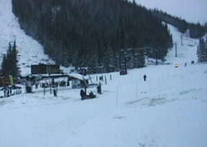
Snow covers Loveland Ski Area this morning as they prepare to open for the first time of the season. (Loveland Ski Area)

Down here along the Front Range we continue waiting for our first snow but in the high country Mother Nature brought white gold in recent days.  The 2010 ski season will kick off this morning as Loveland Ski Area opens and Arapahoe Basin will follow suit tomorrow.

The annual race to be the first ski area in Colorado to open is running a bit behind schedule as warmer than normal weather postponed the openings.  The contest usually comes down to Loveland and A-Basin and for the second year in a row Loveland will be the winner.

Loveland recorded five inches of snow Friday night and more throughout the day Saturday to add to their manmade base.  Overnight Saturday and into Sunday morning snow has continued to fall assuring conditions will be more than adequate for the scheduled 9:00am opening.

On the other side of the Continental Divide in Summit County, A-Basin will open at 9:00am on Monday.  The resort will also be opening with its new Black Mountain Express high speed chairlift.

A series of winter weather systems are forecast to move across the Colorado mountains in the coming days helping to add to the snow totals and pushing other areas closer to their openings.  Winter Storm Warnings have been posted for mountain areas west of the Divide and Winter Storm Watches for the north central mountains on the west side.

On the net:

October 24 to October 30 – This week in Denver weather history

October 17 to October 23 – This week in Denver weather history
October 24 to October 30 - This week in Denver weather history

This year Denver is still waiting for its first snow and we have already passed the average date we see it (October 19).  That however isn’t always the case and October can bring monster snowstorms as we see in our look back at this week in Denver weather history.

From the National Weather Service:

23-24

In 1887…the first measurable snowfall of the season totaled 3.1 inches.  North winds to 20 mph were recorded on the 23rd.  This was the only measurable snow of the month.
 
In 1932…post-frontal snowfall from the late evening of the 23rd continued through the late afternoon of the 24th and totaled 6.2 inches.  Southeast winds were sustained to 25 mph with gusts to 26 mph on the 23rd.  Temperatures cooled from a high of 68 degrees on the 23rd to a low of 25 degrees on the 24th…the coldest reading of the month that year.  Many trees that had not shed their leaves became heavily laden by the wet snow.  Many branches were broken… And a few trees toppled under the weight of the snow.  The landscape became one of rare beauty.

24

In 1956…southwest winds gusted to 56 mph and produced some blowing dust at Stapleton Airport.  A cold front produced a thunderstorm with 1/8 inch hail.  Rain later changed to snow.  Precipitation totaled only 0.11 inch and snowfall only 0.3 inch.
 
In 1973…strong winds raked the eastern foothills…causing damage in Boulder and Jefferson counties.  The heaviest damage occurred in the Boulder area where 20 to 25 mobile homes were hit…some power and telephone lines were blown down…and a store was damaged.  A wind gust to 76 mph was recorded in Boulder at the National Bureau of Standards. Northwest winds gusted to 46 mph at Stapleton International Airport.

24-25

In 1921…rainfall totaled 0.35 inch overnight behind an apparent cold front.  North winds were sustained to 40 mph with gusts to 46 mph on the 25th.  Temperatures plunged from a high of 73 degrees on the 24th to a low of 39 degrees on the 25th.
 
In 1923…rain overnight changed to snow during the morning. The heavy snowfall accumulated to 12.0 inches before ending on the morning of the 25th.  Post-frontal north winds were sustained to 22 mph with gusts to 23 mph on the 24th.
 
In 1997…one of the worst and deadliest blizzards of the decade developed over eastern Colorado as deep east to northeast flow associated with a vigorous upper level low pressure system over the Four Corners…combined with a strong arctic air mass over the central Great Plains. Snowfall totals across metro Denver ranged from 14 to 31 inches.  The heaviest snowfall occurred in the foothills west and southwest of Denver where 2 to 4 feet of snow were measured.  Sustained winds to 40 mph with gusts as high as 60 mph produced zero visibilities and extremely cold wind chill temperatures from 25 below to 40 below zero.  Winds whipped the snow into drifts 4 to 10 feet deep.  Several major and interstate highways were closed as travel became impossible.  Red Cross shelters were set up for hundreds of travelers who became stranded when they had to abandon their vehicles.  Four people died in northeastern Colorado as a result of the blizzard.  None of the deaths were in metro Denver.  At Denver International Airport…4 thousand travelers were stranded when the airport was forced to shut down.  At least 120 cars were abandoned along Pena Blvd….the only arterial leading into and out of DIA.  The blizzard cost air carriers at least 20 million dollars.  Thousands of cattle died in the storm over northeastern Colorado…resulting in losses totaling 1.5 million dollars.  Some of the more impressive snowfall totals included:  51 inches at Coal Creek Canyon; 48 inches at Silver Spruce Ranch…near Ward; 42 inches at Intercanyon…in the foothills southwest of Denver; 37 inches at Sedalia; 35 inches at Aspen Springs and Conifer in the foothills west of Denver; 31 inches at Eldorado Springs… Southeast Aurora…and Englewood; and 30 inches on Table Mesa in Boulder.  Snowfall totaled 21.9 inches at the site of the former Stapleton International Airport…setting a new 24-hour snowfall record of 19.1 inches for the month. Snowfall totaled only 14 inches at Denver International Airport where north winds gusted to 39 mph on the 24th. High temperature of only 21 degrees on the 25th equaled the record low maximum for the date first set in 1873. Low temperature of only 3 degrees on the 26th set a new record minimum for the date.

Continue reading October 24 to October 30 – This week in Denver weather history