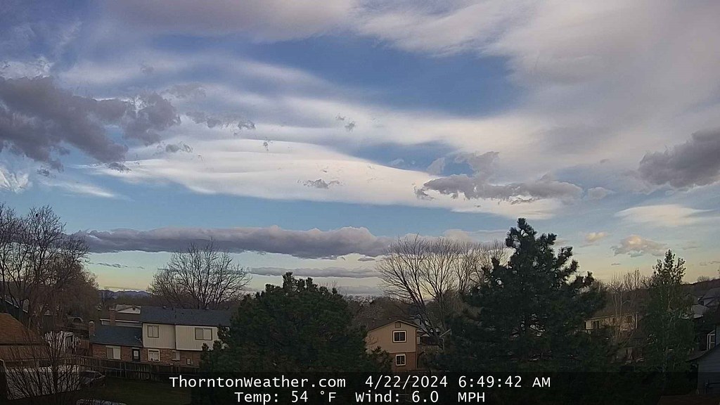
Springtime in Colorado can certainly be pleasant but it can also bring an amazing array of interesting weather. Our look back at this week contains everything from snowstorms and damaging wind to severe thunderstorms with hail and tornadoes.
From the National Weather Service:
10-14
In 1927…post-frontal rain on the 10th changed to snow on the 11th and continued through the 14th. Snowfall totaled 8.5 inches from precipitation of 1.28 inches. North winds were sustained to 26 mph with gusts to 29 mph on the 13th.
12-14
In 1933…heavy snowfall of 5.6 inches occurred in downtown Denver on the 12th and 13th behind a vigorous cold front… Which presented an awe-inspiring spectacle as it approached the station during the late afternoon of the 12th. Brilliant white wind-torn cumulus clouds were sandwiched by a brownish- tan dust cloud at the surface and dark blue cumulus clouds above. The dust cloud storm rapidly enveloped the station with northeast winds sustained to 38 mph and gusts to 44 mph producing much blowing dust…which was accompanied by rapidly falling temperatures and rising pressure. Moist snowfall started in about an hour and continued to midday on the 13th. Record low temperatures of 17 and 15 degrees occurred on the 13th and 14th respectively. The high temperature of only 27 degrees on the 13th was a record low maximum for the date.
12-15
In 1927…snowfall totaled 8.5 inches in downtown Denver. Most of the snow fell on the 14th. Northwest winds were sustained to 27 mph during the storm.
13-14
In 1968…high winds struck Boulder. Sustained winds of 50 mph with gusts as high as 102 mph were recorded at the National Center for Atmospheric Research…while in downtown Boulder winds peaked to 73 mph. The winds damaged a building under construction and some homes in south Boulder. Northwest winds gusted to 35 mph at Stapleton International Airport on the 13th.
In 1996…a potent spring storm strengthened just east of Denver. Blizzard conditions developed over eastern Adams and eastern Arapahoe counties. Strong northerly winds ranging from 25 to 50 mph…cold temperatures…and heavy snowfall combined to create very hazardous conditions. The strong winds whipped snow in drifts 3 to 4 feet high. High winds and heavy wet snow downed power lines and caused traffic accidents. Some roads were closed. Snowfall totaled 15 inches at Strasburg…while only 2.1 inches of snow fell at the site of the former Stapleton International Airport. North winds gusted to 40 mph at Denver International Airport on the 13th.
In 2011…a potent spring snowstorm brought heavy snow to Front Range mountains and foothills. Storm totals included: 16.5 inches near Blackhawk; 16 inches at Nederland; 15.5 inches at Coal Creek Canyon and 5 miles northeast of Ward; 15 inches at Allenspark; 12.5 inches… 5 miles northwest of Idaho Springs; 12 inches at Echo Mountain ski area; and 10.5 inches near Georgetown.
13-15
In 1945…heavy snowfall totaled 9.8 inches in downtown Denver. Most of the snow…4.8 inches…fell on the 14th. Snow fell for a total of 53 consecutive hours. This was the second big snow in less than 2 weeks. The air mass was very cold for April. High temperatures of 21 degrees on the 14th and 32 degrees on the 15th were record low maximums for those dates.
13-17
In 2001…a huge dust storm over southern and Inner Mongolia during April 3rd through the 6th lifted desert dust into the jet stream. This dust cloud moved over metro Denver on the 13th and persisted through the 17th. The cloud created widespread haze…giving the sky a milkish cast due to the scattering of incoming solar radiation.
14
In 1872…high winds damaged buildings in the city. At 9:00 am west winds commenced to blow a perfect gale… Averaging 40 mph sustained until 9:00 pm.
In 1904…west winds sustained to 40 mph with gusts to 48 mph warmed the temperature to a high of 74 degrees.
In 1918…a thunderstorm produced hail that covered the ground to a depth of 1/2 inch. The stones varied in size from small shot to a cherry stone. Rain and melted hail totaled 0.70 inch. There was no reported damage.
In 1935…northeast winds sustained to 30 mph caused a dust storm across the city. The visibility was greatly reduced by blowing dense dust.
In 1970…strong winds caused mostly light but widespread damage to trees…roofs…power lines…and other property across the northeastern Colorado plains. Wind gusts of 45 to 60 mph were common. Southwest wind gusts to 44 mph occurred at Stapleton International Airport.
In 1995…high winds spread from the foothills onto the plains. West winds gusted between 70 and 90 mph in the foothills and 50 to 70 mph on the plains. West winds were clocked to 51 mph at Denver International Airport. Most of the significant wind damage occurred north and east of metro Denver.
14-15
In 1873…north winds blew a gale during the afternoon on both days. Winds were brisk throughout each day.
In 1902…snowfall totaled 6.0 inches in downtown Denver. Most of the snow melted as it fell. Northeast winds were sustained to 20 mph.
In 1910…strong winds occurred on both days. Northeast winds were sustained to 52 mph on the 14th. North winds were sustained to 44 mph on the 15th.
In 1921…heavy snowfall and strong winds produced near- blizzard conditions in the city. Snowfall totaled 10.0 inches. Strong north winds sustained to 48 mph with gusts to 54 mph on the 15th produced drifts to several feet in depth. The heavy wet snow caused extensive damage to trees…utility poles…and buildings. Precipitation from the storm was 1.73 inches. Very heavy snow also fell in the foothills. At silver lake…in the mountains west of Boulder…95 inches of snow fell in 32.5 hours on the 14th and 15th.
In 1935…dense dust…apparently behind a dry cold front… Enveloped the city at 1:00 pm on the 14th and persisted through the night. The dust blew into the city on northeast winds sustained to 30 mph with gusts to 32 mph. By mid-morning on the 15th…the dust had become light and continued as such into the evening. North winds were sustained to only 13 mph on the 15th.
In 1999…a spring storm dumped heavy snow over portions of metro Denver. Nearly 2 feet of snow fell in the foothills with half a foot to a foot over western and southern suburbs. The heavy snow alleviated drought conditions and associated high fire danger that prevailed during much of the winter season. Snowfall totals included: 22 inches in Coal Creek Canyon…20 inches at Wondervu…19 inches at Genesee…17 inches near Evergreen and Nederland and at Idaho Springs and tiny town…14 inches at Georgetown…13 inches at Morrison…10 inches near Sedalia…9 inches in south Boulder… 8 inches at Highlands Ranch and Wheat Ridge…and 7 inches at Littleton and Parker. Only 3.4 inches of snow fell at the site of the former Stapleton International Airport. North- northwest winds gusted to 41 mph on the 15th at Denver International Airport.
15
In 1874…light snow developed around daybreak and became moderate to heavy by mid-morning and continued into the early evening. While most of the snow melted as it fell… Total precipitation from the melted snow was 0.95 inch. This would make the estimated snowfall nearly 10 inches.
In 1963…high winds were widespread across metro Denver. West winds gusted to 63 mph in Denver at Stapleton Airport with sustained winds of 35 mph and gusts to 70 mph in downtown Boulder. The winds caused extensive damage to buildings and other property. Visibility was briefly reduced to 1/2 mile in blowing dust at Stapleton Airport.
In 1998…another spring storm brought heavy snow to the foothills. Thirty to 40 vehicles were involved in accidents along I-70 near Georgetown. The combination of poor visibilities…slick roads…and careless drivers led to the multi-car pileups. Only minor injuries were reported. The accidents forced the closure of all of I-70’s eastbound lanes. Snowfall totals included 12 inches at Genesee and 10 inches at Aspen Springs…Chief Hosa…Georgetown…near Morrison…and on North Turkey Creek. Only 0.1 inch of snow fell at the site of the former Stapleton International Airport. East winds gusted to 30 mph at Denver International Airport.
In 2002…unseasonable warm weather resulted in two records being broken. The high temperature of 84 degrees was a record maximum for the date. The low temperature of 57 degrees was a record high minimum for the date.
15-16
In 1900…heavy rainfall totaled 2.33 inches. A trace of snow was mixed with the rain at times.
In 1950…thunderstorms and heavy rain behind a cold front produced 2.13 inches of rain in 24 hours at Stapleton Airport.
In 2003…a fast moving pacific storm system moved across Colorado allowing strong winds to develop over the eastern foothills and metro Denver. Northwest winds gusted to 59 mph at Denver International Airport late in the evening of the 15th.
In 2016…1.22 inches of precipitation was measured at Denver International Airport which was the greatest daily amount for the month.
In 2020…a potent storm system dropped out of the northern Rockies and produced moderate to heavy snow over portions of the Front Range mountains…foothills and adjacent plains. The heaviest snow fell in and near the foothills north of I-70. In the mountains and foothills…storm totals included: 30 inches near Jamestown…27 inches near Nederland…22 inches near Allenspark…21 inches near St Mary`s Glacier…18 inches in Estes Park…16 inches near Crescent Village and Deer Ridge…15.5 inches near Aspen Springs…and 15 inches near Pinecliffe. In Boulder…16.9 inches of snow helped to establish a new seasonal snowfall record of 151.2 inches. The previous seasonal snowfall record in Boulder was 142.9 inches in 1908-1909. Along the I-25 corridor…storm totals included: 14.5 inches in Niwot…13.5 inches in Frederick…13 inches in Broomfield… 12 inches in Lafayette and near Longmont…10.5 inches in Arvada…10 inches in Erie…Louisville…and Westminster…7 inches in Brighton…6.5 inches in Edgewater and Northglenn…and 5.5 inches in Greeley. Snowfall totaled 1.9 inches at Denver International Airport. In 2021…a storm system produced bands of heavy snow in and near the Front Range Foothills. Storm totals included: 13.8 inches at St. Mary`s Glacier…12.9 inches at Aspen Park…10 inches in Genesee…9.5 inches at Ken Caryl…9 inches in Crescent Village…8.5 inches in Arvada and Westminster…8 inches at Evergreen and Sedalia…with 3 to 7 inches elsewhere. At Denver International Airport… 5.7 inches inches of snowfall was observed.
In 2021…a storm system produced bands of heavy snow in and near the Front Range Foothills. Storm totals included: 13.8 inches at St. Mary`s Glacier…12.9 inches at Aspen Park…10 inches in Genesee…9.5 inches at Ken Caryl…9 inches in Crescent Village…8.5 inches in Arvada and Westminster…8 inches at Evergreen and Sedalia…with 3 to 7 inches elsewhere. At Denver International Airport… 5.7 inches inches of snowfall was observed.
15-17
In 1922…heavy snowfall totaled 9.0 inches in downtown Denver. Most of the snow…6.0 inches…fell on the 16th. This was the third major snow storm in a week. Northwest winds were sustained to 43 mph with gusts to 47 mph on the 15th.
In 2016…a powerful spring snowstorm brought heavy…wet snow to areas in and near the Front Range Foothills and Palmer Divide. Storm totals generally ranged from 2 to 4 feet in the foothills with 1 to 2 feet in the mountain west of Denver and along the Palmer Divide. Along the I-25 Corridor storm totals ranged from 6 to 20 inches…with highest amounts across the western and southern suburbs. Some of those totals included: 16 inches in Aurora and Superior; 15 inches at the National Weather Service Office in Boulder; 14.5 inches in Broomfield; 13.5 inches in Westminster; officially 12.1 inches at Denver International Airport; 12 inches in Louisville; 11.5 inches in Arvada; 11 inches near Englewood; 10.5 inches near Wheat Ridge. At Denver International Airport…there were 852 flight cancellations… most of which occurred on the 16th. The heavy wet snowfall broke trees limbs and caused scattered power outages. Over five thousand customers were without power on the 16th…and over two thousand on the 17th. Xcel Energy brought in extra crews from surrounding states to help restore power and minimize outage times through the storm. Numerous but mostly temporary road closures from 1 to 5 hours occurred throughout the storm. This included portions of I-70 east and west of Denver…Highway 103 from Idaho Springs to Evergreen and Highway 119 through Black Hawk.
16
In 1960…a wind storm struck all of metro Denver. Estimated wind gusts up to 80 mph were registered in Boulder. At Stapleton Airport sustained west-northwest winds over 50 mph with gusts as high as 70 mph produced some blowing dust. The high winds damaged buildings…power and telephone lines…and signs. Five people were injured in metro Denver as a result of the wind storm. Blowing dust reduced visibility at times. The winds were strong and gusty for most of the day.
Continue reading April 14 to April 20: This Week in Denver Weather History →