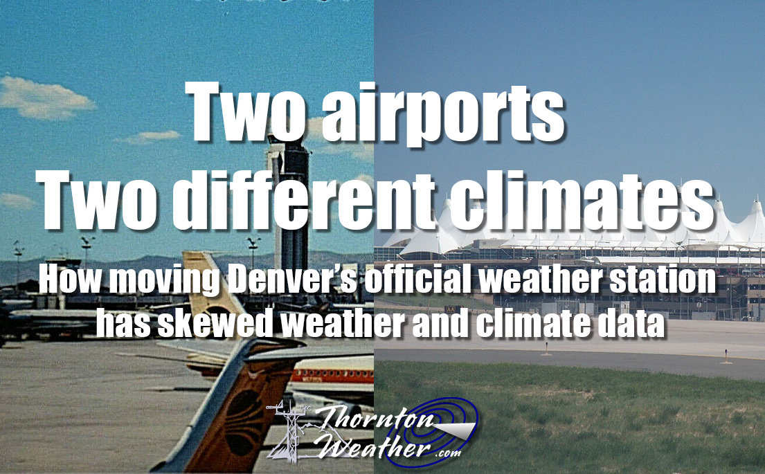
August 2022 top shots: Monthly photo slideshow

The Mile High City on a gorgeous summer day. (Diana Mauzy)

As the calendar turns to August, the summertime heat begins to fade and that makes it easier to get out and enjoy all of the outdoor activities Colorado has to offer.  From a walk in a park to afternoon thunderstorms to an abundance of wildlife, photo opportunities abound as is seen in our slideshow.

Our monsoon season typically arrives about now and that means better chances for moisture.  However with limited instability, the intensity of storms are more sedate.  That doesn’t mean however that the weather is any less photographic.

  • Slideshow updated August 31, 2022

By the end of the month some of our seasonal feathered friends will be looking to leave the state giving our last chance to see them till spring.  Larger mammals are gearing up for the rut (mating season) and that can make for some intense scenes.

Showcasing images captured by ThorntonWeather.com readers as well as some of our own, our monthly slideshow covers the entire gamut of weather and nature related imagery. Sunsets, sunrises, wildlife and of course every type of weather condition are vividly depicted.

To learn more about how to send your photo to us for inclusion in the slideshow, see below the slideshow.

[flickr_set id=”72177720301661701″]

What is missing in the slideshow above?  Your photo!

Our monthly photo slideshow is going to feature images that we have taken but more importantly images that you have captured.  The photos can be of anything even remotely weather-related.

Landscapes, current conditions, wildlife, pets, kids.  Whimsical, newsy, artsy.  Taken at the zoo, some other area attraction, a local park, a national park or your backyard.  You name it, we want to see and share it!

Images can be taken in Thornton, Denver or anywhere across the extraordinary Centennial State.  We’ll even take some from out of state if we can tie it to Colorado somehow.

We’ll keep the criteria very open to interpretation with just about any image eligible to be shown in our slideshows.

What do you win for having your image in our slideshow?  We are just a ‘mom and pop’ outfit and make no money from our site so we really don’t have the means to provide prizes.  However you will have our undying gratitude and the satisfaction that your images are shared on the most popular website in Thornton.

To share you images with us and get them included in the slideshow just email them to us or share them with ThorntonWeather.com on any of the various social media outlets.  Links are provided below.

So come on, get those camera’s rolling!

August 28 to September 3: This Week in Denver Weather History

This Week in Denver Weather History

So who is ready for some snow? Along with many other notable weather events, it was this week in Denver history when we received our earliest snowfall on record!

From the National Weather Service:

19-30

In 1875…grasshoppers appeared in great numbers at 10:00 am on the 19th. Thousands landed on the ground. The streets were literally covered with them. Swarms of grasshoppers were seen on each day. All gardens in the city were devastated…and in the countryside the grasshoppers were very destructive to ripened grain. On the 30th the grasshoppers were so numerous as to almost darken the sun.

27-28

In 2004…a brief chilly spell resulted in three temperature records. The high temperature of 55 degrees on the 27th was a record low maximum for the date. The low temperature of 48 degrees on the 27th equaled the record minimum for the date. The low temperature of 42 degrees on the 28th was a record minimum for the date.

28

In 1887…a dry thunderstorm produced north winds to 48 mph but only a trace of rainfall.

In 1968…one man was seriously injured by lightning while riding on a roller coaster at a Denver amusement park. An airline employee was injured when lightning struck a jetliner he was servicing at Stapleton International Airport. A lightning-caused fire did extensive damage to one house and minor damage to several others in the city of Denver.

In 1970…a microburst wind gust to 53 mph was recorded at Stapleton International Airport.

In 2002…a severe thunderstorm produced 3/4 inch diameter hail near Parker.

In 2005…lightning sparked a small fire near Jamestown. The blaze was quickly contained and consumed less than an acre.

29

In 1876…after the passage of a gentle rain shower to the east during the late evening hours…the moon shone brightly and a remarkably bright lunar rainbow appeared.

In 1910…an apparent cold front produced sustained northeast winds to 40 mph.

In 1946…the high temperature warmed to only 55 degrees…the record low maximum for the month.

In 1989…a spectacular lightning display knocked out power to 300 blocks in southeast Denver. One bolt started a fire in a lumber yard in the northeast part of the city…and the attic of a home in the same area was set ablaze by a lightning bolt.

In 1996…3/4 inch diameter hail was measured in Parker.

In 2000…lightning struck two homes in Thornton. The extent of damage was unknown.

In 2002…two small tornadoes caused damage in southeast metro Denver. The first tornado…associated with a multi-vortex storm…touched down briefly near E-470 and South Jordan Road. Some fences were damaged…and a few trees were blown down. A few of the homes also sustained minor roof damage. Damage from this storm totaled 100 thousand dollars. The second tornado associated with the storm touched down in a subdivision that was under construction at Gartrell and Arapahoe roads. Four large condominiums under construction were destroyed. The most heavily damaged portions of the structures were still in the framing stages. Adjacent sections where enclosed walls were in place were not destroyed. A man suffered 4 broken ribs and several cuts and bruises when the trailer he sought shelter in was flipped three times and torn apart by the twister. Damage from this storm totaled 6 million dollars. A severe thunderstorm produced 1 inch diameter hail near Evergreen.

In 2006…severe thunderstorms produced large hail in the foothills west of Denver. Hail to 1 inch in diameter fell near Blackhawk. Hail as large as 7/8 inch was measured near Idaho Springs…along with 3/4 inch hail near Nederland and conifer.

30

In 1981…60 mph winds were reported in Boulder.

In 2004…a severe thunderstorm produced hail as large as 1 inch in diameter in south Aurora near Cherry Creek.

In 2016…an intense thunderstorm produced very heavy rain and hail in Westminster…where radar estimated up to 3.6 inches of rainfall. Several vehicles were stranded in 2 to 3 feet of moving water at the intersection of 72nd Ave. and Pecos St. Street flooding was also reported on U.S. 36 at Pecos St.

31

In 1951…hail as large as 1 3/4 inches in diameter caused an estimated 300 thousand dollars damage in metro Denver. Hail as large as 1 1/2 inches in diameter was measured at Stapleton Airport.

In 1978…strong thunderstorm winds tore the roof off an apartment building in Aurora…downed trees…and damaged windows in Denver. A microburst wind gust to 58 mph was recorded at Stapleton International Airport.

In 1985…a thunderstorm wind gust to 60 mph was clocked at Buckley Field in Aurora.

In 1997…hail to 1 1/4 inches in diameter was measured in Aurora.

In 2006…a female postal worker was struck and injured by lightning while delivering mail in Westminster.

In 2008…lightning struck a home in Brighton…damaging the roof and a bedroom. The damaged totaled 20 thousand dollars.

In 2020…a worsening drought that started in the spring of 2020…continued through August. The month of August tied with 2011 for the warmest August on record. It also occurred in the middle of the second warmest summer on record. The combination of hot and dry conditions…in addition to critically dry fuels from years of beetle kill…resulted massive wildfires. The Cameron Peak fire…which became the largest wildfire in the state`s history started on August 13th and continued to burn into October. Smoke from this wildfire in addition to several other large wildfires in Colorado and the West resulted in multiple days of extremely poor air quality. In addition…the air quality in Denver and the entire Front Range had deteriorated severely due to the very warm temperatures and high ozone content… which had spiked significantly. In August…26 days in the month equaled or exceeded 90 degrees. Continue reading August 28 to September 3: This Week in Denver Weather History

August 21 to August 27: This week in Denver weather history

This Week in Denver Weather History

Denver’s weather is not often boring. Lightning, hail, tornadoes and even swarms of grasshoppers have made appearances this week in Denver weather history.

From the National Weather Service:

19-30

In 1875…grasshoppers appeared in great numbers at 10:00 am on the 19th. Thousands landed on the ground. The streets were literally covered with them. Swarms of grasshoppers were seen on each day. All gardens in the city were devastated…and in the countryside the grasshoppers were very destructive to ripened grain. On the 30th the grasshoppers were so numerous as to almost darken the sun.

21

In 1876…heavy thunderstorm rain and hail struck the city. Hail stones as large as partridge eggs accumulated to a depth of 1 1/2 feet over eastern portions of the city. The heavy rainfall flooded streets and gutters. However… No significant damage was reported. Rainfall totaled 0.85 inch in central Denver.

In 1903…a thunderstorm produced west winds sustained to 42 mph with gusts to 48 mph.

In 1957…heavy thunderstorm rainfall and hail over the bear creek basin flooded portions of State Highway 8 in and near Morrison. There was also minor property damage in Morrison.

In 1995…a 68-year-old woman was struck by lightning while standing near a tree in Brighton.

In 2006…a severe thunderstorm produced 7/8 inch diameter hail in Franktown.

In 2019…severe thunderstorms produced hail up to 1 inch in diameter in parts of Arapahoe…Denver and Jefferson counties. Heavy rain and flash flooding…close to 2 inches in one hour…also accompanied the nearly stationary storms. In Denver…flash flooding caused several vehicles to be stranded at Martin Luther King Blvd and Dahlia Street. Highway 6 near Federal Blvd also flooded. Standing water up to 3 feet deep occurred in Park Hill. Lastly…water made its way into buildings north of Interstate 70. At Denver International Airport…just a trace of rainfall was recorded.

22

In 1898…an apparent thunderstorm produced southwest sustained winds to 40 mph with gusts to 43 mph.

In 1903…a late afternoon thunderstorm produced rain…hail… And east winds sustained to 40 mph with gusts to 44 mph.

In 1904…the lowest recorded temperature in August…40 degrees…occurred. The same temperature also occurred on three consecutive days…August 24…25…and 26 in 1910.

In 1965…heavy rain and hail caused some damage from flooding over northern Douglas County from Castle Rock to Franktown.

In 1981…thunderstorms moved across metro Denver. At least 5 funnel cloud sightings were reported. Funnel clouds were seen at 96th Ave. and Sheridan Blvd. And at 92nd Ave. and Federal Blvd. in Westminster and 7 miles north of Stapleton International Airport. Lightning injured two people in Boulder. A quarter inch of rain fell in just 5 minutes in Brighton. Up to 3/4 inch of rain doused Parker in 30 minutes.

In 1983…3/4 inch diameter hail was reported at Kittredge… Along with 0.60 inch of rain in 25 minutes.

In 1984…a thunderstorm dumped 4 inches of rain on Brighton in 90 minutes…causing extensive street flooding in the downtown area.

In 1987…over an inch of rain fell in 24 hours throughout most of metro Denver. A public library suffered water damage to the ceiling…carpet…and a few books. Rainfall was 0.76 inch at Stapleton International Airport.

In 1990…lightning knocked out power to about 2500 homes in Lakewood for about an hour.

In 1991…National Weather Service personnel at Stapleton International Airport sighted an apparent tornado briefly on the ground 3 miles west-northwest of the airport. No damage was reported.

In 1995…lightning struck 3 electrical power substations in Louisville. Residences of more than 4500 people were without power from 30 minutes to more than an hour.

In 1996…between 1 and 3 inches of rain fell across metro Denver. As a result…several low lying areas were flooded. A bicyclist was swept into a fast moving creek when he tried to cross a flooded bike path. The man was washed downstream about 15 feet before getting snagged by a tree stump. He and a man who tried to rescue him received minor injuries. The heavy rain caused numerous power outages…false fire alarms…and traffic accidents. In Lakewood…telephone service to around 60 thousand residents was knocked out when a switching center was flooded. Funnel clouds were sighted near Chatfield Reservoir and Highlands Ranch.

In 2000…lightning sparked a blaze which gutted a 10-unit apartment building in Highlands Ranch. Twenty-eight people were left homeless. Damage was estimated at 2 million dollars.

In 2007…severe thunderstorms produced large hail…up to 1 1/4 inches in diameter…in the vicinities of Castle Rock… Elizabeth and Franktown.

In 2013…flash flooding occurred in central Douglas County with numerous road closures reported. One of the closures occurred at the Tomah Road exit along I-25…south of Castle Rock.  The closure backed up all I-25 the way to Castle Rock. At Denver International Airport…1.94 inches of precipitation was recorded…which set a new record rainfall for the date. The old record was 0.75 inches… set back in 1953.

22-24

In 1987…some locations in metro Denver had a total 3-day rainfall of 2 to 4 inches. Rainfall totaled 0.96 inch at Stapleton International Airport.

Continue reading August 21 to August 27: This week in Denver weather history

Thornton Weather’s Facebook page is down – hopefully temporarily

Update, 8/16/22, 4:00pm. Scroll down for the original posting and previous updates. 

A small victory. Once I realized the source of the hack of my Facebook account was likely someone registering a domain name I relinquished six years ago (see below), I started working to get that domain shut down. I contacted the registrar of the domain in Japan, the DNS provider, the company providing the email forwarding for the domain and Google whose Gmail service was the end recipient of the forwarded emails.

I almost immediately had success with the email forwarder. I showed them the domain registration record and how less than one and a half hours after the domain was registered, email from Facebook through their service was used to hack my account. Behind the scenes they stopped the email forwarding.

The domain registrar initially rebuffed me, saying I had no proof and that it was my word against the person that registered the domain. However, I contacted them again providing detailed records including the time of the domain registration and the email headers showing the time the initial email went out right afterwards. They never did reply again, however, today I see the DNS servers have been changed to an “abuse” address leading me to believe I convinced them.

The DNS provider proved to be useless in helping and I have yet to hear from Google about getting the end Gmail address shut down.

At this point I can at least derive some, tiny bit of satisfaction that my efforts appear to have gotten the domain name associated with the hack shut down.

Having said all that, so far, all of that work has not accomplished getting me back on Facebook and my account reinstated. I can clearly demonstrate that my account was hacked by an outsider, how it was hacked and thus that I was not responsible for the postings that occurred. That does me little good, however, because there is no way to communicate all of this to the company.

Yesterday I sent off another batch of snail mail letters to all the officers at Facebook. I continue to tweet at them in the hopes of getting their attention. I even emailed and tweeted at the NPR reporter that did the story a year ago about cases almost exactly like mine.

The silence from Facebook is deafening, maddening and just wrong.

Update, 8/9/22, 4:00am. So frustrating. I have tried everything I can think to regain access to my Facebook account. I’ve emailed every address possible, written letters, tweeted, etc, all to no avail. It really is infuriating to say the least.

A bit of a mea culpa in the interest of being honest. I do think I have figured how the hackers were able to gain access to my account.

Many years ago, I worked on a side project and had registered a domain name and then setup an email address with that domain. While I let the registration for the domain name lapse in 2016, it appears I might have still had that email address listed in my FB profile or somewhere else.

Well, the bad guys registered that domain name for themselves in Japan on Saturday, July 30 and within hours, were hacking into my account. I had received emails saying someone was trying to login with that email address I used long ago but never put two and two together until the other day when I sat down and started hashing through everything that happened.

I’ve since emailed the new registrar of the domain and the DNS provider trying to get it shut down but have not had any luck so far.

One lesson learned that should be passed on is to be sure all your contact info on your social media accounts is accurate. Get rid of any old stuff in there or it may come back to haunt you.

So, it does fall on me for having an old email address listed on my Facebook profile. That, however, does not justify Facebook continuing to lock me out and not giving me the opportunity to correct the issue.

Original post, 8/4/22, 4:00pm. 

Well, no good vacation goes unpunished. I spent much of this past week up in the Colorado high country taking in the sights and critters. I return to find my Facebook account was hacked and they have put it on hold, pending deletion.

First, let me say that I am no computer dummy. I am an IT manager by trade and take all possible precautions to lock down all of my important accounts, including all social media. For Facebook, this included a ridiculously complicated password and two factor authentication.

Last Saturday, I received a notification from the Facebook app that someone was trying to login as me and, with two factor authentication enabled, asked if it was authorized. Naturally I immediately clicked the “no” button.

I then attempted to change my password but due to the limited connectivity where we were camping, I couldn’t complete the process. I wasn’t overly concerned as I had told Facebook to deny the login. Makes sense, right? Nope. Apparently not.

Facebook did indeed let the bad guys in and they in turn started posting what I can only guess is some nasty stuff. Sunday morning I wake up to find my Facebook account was suspended and is pending review due to my violating their Community Standards.

Now, if someone had access to my account and they detected it, I applaud Facebook for disabling it. However, they have taken it too far by preventing me from accessing it again.

I have appealed their decision but now am sitting in limbo, staring at notices counting down the number of days until my account is permanently deleted. Certainly they have the capability to tell there were nefarious actors involved and that I had no part in posting the offending content.

There is literally no way to contact a real person at the company. I have sent emails to the few active email accounts I found and this morning even sent letters via snail mail to all of their executive team.

In my searching, I found many reports of people going through the same ordeal. Major news outlets including NPR have reported on Facebook’s failures to help their users. Many more examples abound including herehere and here.

So, I sit here concerned about losing 10+ years of personal memories not to mention access to my Thornton Weather page that I have spent years cultivating and growing. It just is not right.

Yes, Facebook has a responsibility (and right) to police the content on their site. However, it is simply wrong to essentially “erase” someone through no fault of their own, something they have evidence of!

For you, my friends, this means I won’t be posting to Facebook until this gets resolved. At least I hope it gets resolved. If not, I guess I won’t be found on there again.

In the meantime, please head over to my Twitter account for my postings.  Thank you for your patience.

August 14 to August 20: This week in Denver weather history

This Week in Denver Weather History

Severe weather is a fact of life in Colorado during the summer months and while August is historically relatively calm, that isn’t always the case. In our look back at this week in Denver weather history we see the dangers of lightning, incidents of large hail and flooding rains and even a tornado.

From the National Weather Service:

14

In 1960…a bolt of lightning struck a man in Henderson… Causing serious burns.

In 1962…the temperature climbed to a high of 100 degrees at Stapleton Airport.

In 1968…a young man on a golf course in Denver was injured when lightning struck a tree under which he was standing. Lightning caused minor damage to a house in Denver. Heavy thunderstorm rain caused local street flooding. One inch diameter hail fell at Jefferson County Airport near Broomfield.

In 1973…winds as high as 85 mph damaged 20 aircraft at the Arapahoe County airport…now centennial airport.

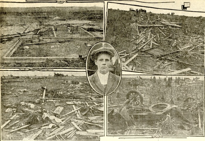
In 1977…three tornadoes were sighted in Bennett. A man suffered a broken leg when hit by a flying board. He was outside his camper home…which was destroyed. All windows were broken in a near-by farmhouse where some shingles were ripped off and a 2 car garage was knocked down. Several vehicles were damaged and a cat…some rabbits…and chickens were killed. A broken oar from a boat was driven into the side of a house. A mobile home was overturned. One old barn was destroyed. Half a dozen homes and several agricultural buildings were damaged just west of State Highway 79.

In 1978…high winds produced much blowing dust…causing many traffic accidents in the Denver-Boulder area. Winds gusts of 70 to 101 mph were recorded. Northwest winds gusted to 44 mph at Stapleton International Airport.

In 1980…lightning hit two power poles in Littleton…causing 400 dollars in damage. Rainfall of 1.23 inches in a short time caused minor flooding…which included damage to a ground floor apartment and partially submerging a few vehicles in water. Thunderstorm rainfall totaled 0.98 inch at Stapleton International Airport.

In 1983…2.10 inches of rain drenched Golden in an hour with similar amounts in Lakewood and Boulder. Over ten thousand dollars worth of plants were washed away at a nursery in Lakewood.

In 1997…twelve motorists were injured in a multi-car accident when strong microburst winds estimated to 50 mph blew blinding dust across I-70 near Bennett.

In 1998…lightning struck a hydro-electric plant in Nederland… Causing a power outage. Residents in the foothills west of Boulder…including Nederland…Ward…Eldora…Jamestown… And Gold Hill…were without power for about an hour.

In 2006…heavy thunderstorm rainfall near Deckers washed away some the banks along State Highway 67 between Deckers and Westcreek. Several driveways on both sides of the highway were also damaged.

15

In 1899…a thunderstorm produced southwest sustained winds to 43 mph with gusts to 46 mph.

In 1972…a pilot reported a funnel cloud briefly touching the ground in open fields…17 miles east-northeast of Stapleton International Airport.

In 1980…thunderstorm winds gusted to 55 mph in Boulder.

In 1982…brief heavy rain and winds estimated as high as 70 mph occurred in the conifer-Evergreen area. No damage was reported.

In 1990…lightning triggered a small attic fire in a house near Sedalia…20 miles south of Denver. A furious lightning storm caused widespread power outages across southern sections of metro Denver. One lightning bolt knocked out an electrical substation…causing a 90-minute blackout in southeast Denver affecting nearly 10 thousand homes and businesses.

In 2007…severe thunderstorms produced large hail…up to 2 inches in diameter…near larkspur. Extensive damage to vehicles in the area was reported.

In Parker…lightning struck a residence. The ensuing fire damaged the attic and top floor; causing $100000 in property damage.

In 2008…at least three homes were hit by lightning during the early morning hours in Arapahoe County. Lightning also struck two homes in Castle Rock…damaging the roofs.

16

In 1902…a thunderstorm produced west winds sustained to 48 mph with gusts to 60 mph…but only a trace of rain.

In 1952…a thunderstorm wind gust to 50 mph was recorded at Stapleton Airport.

In 1960…lightning struck a warehouse in central Denver… Causing 8 thousand dollars in damage to the building and stored electrical equipment.

In 1975…large hail…1 1/2 to 1 3/4 inches in diameter…fell about 4 miles north of Castle Rock. Hail caused some minor damage in Aurora. A funnel cloud was reported 25 miles east of Denver near Bennett.

In 1981…a tornado touched down briefly in open country just to the east of Aurora. No damage was reported.

In 1982…a thunderstorm wind gust to 61 mph was recorded at Buckley Field in Aurora. At the same time almost an inch of rain flooded and closed streets in south Aurora. A women was hit by lightning just north of Denver. A house in the area was also struck.

In 1985…a thunderstorm produced strong wind gusts over southern metro Denver. One strong wind gust hit Cheery Creek Reservoir…capsizing a boat and drowning a man. The wind gusts…clocked as high as 50 mph…also downed a few trees.

In 1989…1 3/4 inch diameter hail fell at Intercanyon in the foothills of Jefferson County.

In 1990…lightning caused minor damage to a south Aurora home. No injuries were reported.

In 1994…strong thunderstorm winds caused damage in southern weld County near Hudson and Fort Lupton. Two mobile homes were destroyed and a few lost their roofs. Up to 20 downed power poles and the destruction of two 115 thousand-volt towers caused widespread power outages. Thunderstorm gust front winds from the north gusted to 48 mph at Stapleton International Airport.

In 2000…lightning ripped most of the roof from a home in southeast Aurora. The bolt sparked a fire which destroyed the residence. Damage was estimated at 250 thousand dollars.

In 2002…the temperature climbed to a maximum of 100 degrees setting a new record high for the date.

In 2003…a teenager was injured when he was struck by lightning while camping at Herman Lake…13 miles northwest of Georgetown. The boy was knocked unconscious and suffered minor injuries.

In 2013…a dry microburst uprooted 30 to 40 large trees across a 12-block area of the Park Hill neighborhood in east central Denver. Several trees were snapped near the base along with numerous branches…8 to 10 inches in diameter. Power poles and lines were also downed with resulted in outages which affected seven hundred residents. One of the downed trees crushed a car`s hood… narrowly missing the driver. At Denver International Airport…a peak wind gust of 22 mph was observed from the southwest. Continue reading August 14 to August 20: This week in Denver weather history

Denver tops record high temperature for August 11

Record High Temperature

We have been having to post way too many high temperature records lately. Here is yet another.

As measured at Denver International Airport, the Mile High City topped out at 98 degrees today. This tops the old record high for August 11 last set in 2020.

Here in Thornton, we matched that with a 98 degree high as well.

Looking ahead, the 90+ degree weather looks to stick with us through the weekend. There are indications however, thankfully, that a cool down arrives for the start of next week.

August 7 to August 13: This week in Denver weather history

This Week in Denver Weather History

As we get further into the month of August severe weather is less common. It can however still strike as we see in our look at this week in Denver weather history. Everything from torrential rains to massive hail and even a tornado have been reported.

From the National Weather Service:

7

In 1948…a brief west moving tornado was sighted 3 miles north-northeast of Stapleton Airport. The white funnel silhouetted against a gray cloud background was very narrow…nearly vertical…and estimated at nearly 5 thousand feet high. A dust cloud formed on the ground around the funnel. No damage was reported.

In 1952…a thunderstorm wind gust to 52 mph was recorded at Stapleton Airport.

In 2014…severe thunderstorms produced large hail across western and southern parts of metro Denver. Near Centennial and Golden…hail up to quarter size was reported. Near Bennett…a peak thunderstorm wind gust to 65 mph was also reported. At Denver International Airport…a peak wind gust to 46 mph was recorded.

In 2018…a severe thunderstorm produced large hail around Denver and vicinity. Hail ranging in size from 1 to 1 3/4
inches fell near Firestone…Ft Lupton…Parker…and Smoky Hill.

8

In 1874…swarms of grasshoppers invaded the city. Millions of them were seen cruising through the air. The insects were apparently picked up by a thunderstorm gust front and carried into the city. The grasshoppers had ravaged crops in surrounding counties for the last month.

In 1878…the highest temperature ever recorded in Denver…105 degrees…occurred at 3:20 pm. This temperature was equaled on July 20th in 2005.

In 1969…the temperature reached 100 degrees at Stapleton International Airport.

In 1976…in Thornton…a 13 year old boy riding a bicycle was struck and killed by lightning.

In 2000…lightning struck three homes in central Arapahoe County east of Denver. Damage was estimated at 47 thousand dollars.

In 2003…hail to 1 inch in diameter pelted Denver. Hail to 7/8 inch was measured in Boulder.

In 2008…heavy rain also caused flash flooding over south Denver and its nearby suburbs. Heavy rain…from 2.5 to 4 inches…fell in less than 90 minutes. Firefighters rescued 20 people as the water quickly rose along creeks…flooded roadways…and stranded motorists. Three people had to be rescued along Cherry Creek when the bike path flooded.

In Evergreen…a man suffered minor injuries when he was struck by lightning. It entered his finger…traveled down his body… And exited his foot.

In 2013…heavy rain caused localized flash flooding in Aurora. An undergound parking garage at an apartment complex was inundated with 3 to 4 feet of water. Flash flooding forced a road closure at East Mississippi Ave. and Alton St. Also… several people had to be rescued when three vehicles stalled in floodwaters at Alameda Ave. and Havana St. The stationary thunderstorms dumped 2.75 inches of rain in less than 45 minutes. In addition…large hail…up to one inch in diameter… was reported north of Roxbourough State Park. At Denver International Airport…just a trace of rainfall was observed.

8-10

In 1979…heavy thunderstorm rains on each of three consecutive days dumped a total of 2.22 inches of rain at Stapleton International Airport. The heaviest rain… 0.95 inches…fell on the 9th. Small hail to 1/8 inch diameter fell on the 8th.

8-13

In 1875…clouds of grasshoppers were seen flying through the air on the prevailing winds during each day.

9

In 1900…a thunderstorm produced west winds sustained to 47 mph with gusts to 55 mph…but only 0.01 inch of rain.

In 1902…a thunderstorm produced no rain and north winds sustained to 52 mph with gusts to 60 mph.

In 1934…heavy cloudbursts in the foothills near Kittredge and at the head of Mount Vernon creek caused flash flooding on both Bear Creek and Mount Vernon Creek at Morrison… Which resulted in 6 deaths and much property damage. The highway in Mount Vernon canyon was destroyed by the flood waters.

In 1981…3/4 inch hail fell at Kittredge near Evergreen in Jefferson County.

In 1987…3/4 inch hail fell in Boulder and 9 miles northwest of Castle Rock.

In 1995…lightning struck a 16-year-old counselor in the back of the head while he and a friend were standing under a tree at the singing river ranch…7 miles west of Evergreen. He stopped breathing…but his friend was able to summon help and they were able to revive him. He was hospitalized for a few days and released.

In 1998…brief…weak tornadoes (f0) were sighted near Bennett and Roggen. No damage was reported. Hail as large as 1 inch diameter fell in Franktown with 3/4 inch diameter hail measured near Castle Rock. Thunderstorm winds gusted to 61 mph near Roggen.

9-10

In 2006…mid and high cloudiness overnight on both days resulted in two temperature records. The low temperature of 71 degrees on the 9th was a record high minimum for the date. The low temperature of 68 degrees on the 10th equaled the record high minimum for the date first set in 1936.

10

In 1924…0.01 inch of rain fell over downtown Denver. This along with the 0.01 inch of rainfall on the 4th was the only rainfall of the month…making this the driest August on record in the city.

In 1962…the high temperature reached 100 degrees at Stapleton Airport.

In 1970…hail stones to 1 inch in diameter were reported in the Fort Lupton area.

In 1972…dry thunderstorm microburst winds gusting to 46 mph briefly reduced the surface visibility to 3/4 mile in blowing dust at Stapleton International Airport.

In 1978…lightning struck two men in Aurora…killing one and injuring the other.

In 1982…a tornado was sighted near Castle Rock and remained on the ground for 10 minutes. Wind gusts to 60 mph were reported in Castle Rock. No damage was reported.

In 1994…heavy thunderstorm rains caused flash flooding on Lena Gulch in west metro Denver. Damage was estimated at 50 thousand dollars. Lightning struck a house in Westminster…causing a small attic fire.

In 1996…strong thunderstorm winds toppled a tent at a company picnic in Westminster. Five people received minor injuries when the tent collapsed. Two cars nearby were also damaged by flying debris. A weak tornado (F0)…first sighted near Denver International Airport…traveled east to near Bennett and Strasburg. No significant damage was reported.

In 1998…heavy rain caused flooding and flash flooding problems over southwest metro Denver. An observer in Lakewood measured 3.26 inches of rainfall in an hour. Several streets were flooded in central Lakewood.

In addition…a trailer park along Lena Gulch in Wheat Ridge was evacuated due to high waters. One inch diameter hail fell near Roggen.

In 1999…thunderstorm-producing tornadoes…damaging straight line winds…heavy rain…and hail hammered metro Denver. In the city…small hail and heavy rainfall…up to 2.50 inches an hour…caused a 20-foot by 50-foot section of the roof to collapse at a furniture warehouse. Damage to the warehouse was estimated at 1 million dollars. Heavy rain also flooded several underpasses with up to 3 feet of water…which resulted in a number of stalled vehicles. In Fort Lupton…a tornado bounced across the area. Spotty damage was reported along a 5-mile path as trees…power poles…and lines were downed. In addition…an empty semi-trailer was overturned onto another vehicle northeast of the town. Thunderstorm winds gusted to 81 mph south of Fort Lupton.

In 2004…severe thunderstorms pummeled metro Denver with large hail. Hail up to 3 inches in diameter was measured 10 miles east of Castle Rock. Two inch diameter hail fell in Louisville…10 miles north of Hudson…and 1 mile east of Brighton. Hail to 1.75 inches was reported in Englewood… 1 mile south of Ft. Lupton…and 8 miles east of Boulder. Hail to 1.50 inches was reported around Boulder…near Broomfield…and in Lafayette…Thornton and greenwood village. Hail from 3/4 to 1 inch in diameter was found in Broomfield… Brighton…Castle Rock…Denver and Thornton…and near Longmont… Northglenn…greenwood village…Morrison…and Wheat Ridge. Severe thunderstorm wind gusts were recorded to 66 mph in Parker and to 60 mph 5 miles northeast of Boulder. There were no damage estimates from the hail or wind.

11 Continue reading August 7 to August 13: This week in Denver weather history

Denver sets record high temperature for August 5

Record High Temperature

Another high temperature record and another 100-degree reading for the Mile High City – and Thornton.

As measured at Denver International Airport, the high temperature in Denver today topped out at 101 degrees. That bested the previous record high for the date of 99 degrees last set way back in 1877.

Here in Thornton, we reached a high of 100 degrees, the 7th time this year we have hit 100 degrees or higher.

July 31 to August 6: This Week in Denver Weather History

This Week in Denver Weather History

How does 42 degrees sound right about now? That mark is one of the highlights of this week in Denver weather history. It was the low temperature recorded twice in our past and the coldest July temperature on record. Many more notable events have also occurred.

From the National Weather Service:

13-5

In 2008…a streak of 24 consecutive days of 90 degrees shattered the previous record of 18 consecutive days established in 1901 and 1874. Ironically…no new single day record high temperatures were set in the month of July. In August however…a record of 104 degrees was set on the 1st…and another record of 103 degrees was set on the 2nd. In addition…a record low min of 70 degrees was set on August 2nd.

18-2

In 1987…a streak of 16 consecutive days of 90 degrees ranked 4th on the list of hot streaks. The record of 24 consecutive days was established in the summer of 2008.

27-31

In 1956…96 percent of the total precipitation for the month of July occurred over the last five days of the month. Heavy thunderstorms produced 4.00 inches of rainfall at Stapleton Airport. This amount of precipitation in 5 days or less had been exceeded only 3 times in previous record. The last time had been in December of 1913 as snow. Considerable property damage occurred across metro Denver from flooding.

31

In 1873…the all-time lowest recorded temperature in July… 42 degrees…occurred. The same temperature also occurred on July 4…1903.

In 1874…during the late afternoon rain and hail fell for 5 minutes followed by brief heavy rain. Pieces of solid ice of irregular shape fell upon the roof of the station. The hail stones measured 1 1/2 inches in diameter. Precipitation (rain and melted hail) was only 0.16 inch.

In 1889…the high temperature climbed to 100 degrees in downtown Denver.

In 1919…heavy thunderstorm rainfall totaled 2.59 inches in downtown Denver during the evening. Rainfall was 1.90 inches in an hour…a new record at that time.

In 1961…over an inch of rain in a short period of time caused flooding of streets and basements in Denver. Rainfall totaled 1.30 inches at 11th and Lincoln in central Denver.

In 1964…the temperature reached 91 degrees in Denver…making this the 27th day of the month that the temperature reached 90 degrees or more. This is the all time record for 90 degree days in a month in Denver.

In 1972…one inch diameter hail fell in Hudson northeast of Denver.

In 1976…during the evening hours extremely heavy thunderstorm rains produced flash flooding in Big Thompson Canyon which killed 144 people between Estes Park and Loveland. No significant weather occurred in metro Denver at the time.

In 1987…1 inch diameter hail fell in Lakewood and 3/4 inch hail fell near Louisville. Southeast Boulder County was drenched with 1.25 inches of rain in just 20 minutes.

In 1993…thunderstorm winds damaged a chimney of a home near Parker.

In 1996…a weak tornado (f0) was sighted 12 miles east of Denver International Airport. No damage was reported.

In 1998…heavy monsoonal thunderstorm rain triggered a mud slide in Blackhawk. The mudslide blocked Main St. and caused an estimated half million dollars in damage to a casino. Heavy thunderstorm rain…up to 3 inches in an hour…caused a flash flood along Buffalo Creek. Portions of County Road 126 just south of the town of Buffalo Creek were washed out. The flood waters nearly washed away the bridge as mud and debris slammed into the structure. Hail to 1 3/4 inches in diameter fell near Idaho Springs.

In 2004…severe thunderstorm winds toppled a 65-foot blue spruce tree in Parker. The tree landed on a home damaging the roof and gutters. The downed tree poked dozens of holes into the shingles.

In 2013…severe thunderstorm winds… with gusts estimated to 80 mph…downed power poles which caused scattered outages in and around Byers…Bennett and Strasburg. Some property damage was also observed. Near Byers…aluminum siding and roofing was peeled off sheds. Large hail…up to one inch in diameter… was reported north of Bennett. At Denver International Airport…a peak wind gust to 40 mph was observed from the northeast.

1

In 1888…heavy rain in the mountains and foothills caused flooding on clear creek in Golden. The high waters also washed away portions of the railroad tracks in the canyon between Idaho Springs and Golden.

In 1901…the temperature reached a high of 100 degrees in the city.

In 1902…the high temperature climbed to 100 degrees in downtown Denver.

In 1914…a thunderstorm produced 1.00 inch of rainfall in just 21 minutes and north winds sustained at 43 mph with gusts to 50 mph. Rainfall totaled 1.17 inches.

In 1938…the temperature climbed to a high of 100 degrees in downtown Denver…which is the record maximum for the date. The temperature was also recorded on this date in previous years.

In 1976…flight operations at Stapleton International Airport were suspended for 90 minutes when the airport tower radar was knocked out and water reached a foot deep on some taxi ramps after 1.50 inches of rain fell in one hour. Heavy rain also caused minor flooding in east Denver and Aurora where lightning damaged the roof of a home and injured the owner. One young man was swept down a flooded ditch…but was rescued by firemen. A number of rafts were floated in flooded streets. Thunderstorm rainfall totaled 1.71 inches at Stapleton International Airport.

In 1978…a tornado damaged a house and broke a power pole 5 miles northwest of Parker. A microburst wind gust to 52 mph briefly reduced visibility to 1 mile in blowing dust at Stapleton International Airport.

In 1985…heavy thunderstorms roared through the southern and western sections of metro Denver…producing large hail and heavy rain. Lightning hit a recreational vehicle trailer causing it to burn. There was a lot of street flooding over western suburbs where rainfall totaled over 2 inches in some areas. One inch diameter hail was reported in Littleton and near Evergreen. Hail piled 4 to 6 inches deep at Tinytown in the foothills southwest of Denver.

In 1990…a small rope-like tornado was spotted in open country 15 miles southeast of centennial airport. No damage was reported from the twister.

In 1992…pilots reported a funnel cloud near the construction site of the new Denver International Airport. A few minutes later…a tornado was reported near Bennett. The tornado remained on the ground for about 18 minutes and was visible from the national weather service office at Stapleton International Airport. Thunderstorm wind gusts to 70 mph were reported near Bennett and Watkins with a wind gust to 60 mph at Brighton. Two men were injured when struck by lightning. A young man sustained serious injuries when struck by lightning while jet skiing on Cheery Creek Reservoir. A man received only minor injuries when struck by lightning while golfing in Westminster.

In 1994…heavy thunderstorm rains in the foothills west of Denver caused the closure of the Virginia Canyon Road north of Idaho Springs by rocks and debris.

In 2001…a 34 year old man on the South Platte River bike path in Denver received minor injuries when lightning struck a nearby tree. Lightning…coupled with strong thunderstorm winds…knocked out electrical power to about 10 thousand homes and businesses in Golden.

In 2006…strong thunderstorms hit southern metro Denver. A severe thunderstorm wind gust estimated to 71 mph knocked down a tree in Aurora near Cherry Creek. Lightning sparked a fire in a home near lone tree and struck a transformer at an RTD light rail station at Interstate 25 and Yosemite Street. Heavy thunderstorm rainfall forced the closure of Arapahoe Road between Holly and Quebec streets due to high water. Flooding was also reported near Park Meadows Mall and Greenwood Village. Heavy rainfall also caused flooding in Highlands Ranch…lone tree…and Parker. Water up to 6 inches deep was reportedly running over the roads.

In 2020…a worsening drought that started in the spring of 2020…continued through August. The month of August tied with 2011 for the warmest August on record. It also occurred in the middle of the second warmest summer on record. The combination of hot and dry conditions…in addition to critically dry fuels from years of beetle kill…resulted massive wildfires. The Cameron Peak fire…which became the largest wildfire in the state`s history started on August 13th and continued to burn into October. Smoke from this wildfire in addition to several other large wildfires in Colorado and the West resulted in multiple days of extremely poor air quality. In addition…the air quality in Denver and the entire Front Range had deteriorated severely due to the very warm temperatures and high ozone content… which had spiked significantly. In August…26 days in the month equaled or exceeded 90 degrees.

Continue reading July 31 to August 6: This Week in Denver Weather History

Weather, natural disasters & climate news and information.