The month of September is typically one of the more pleasant months in Colorado. Temperatures are usually comfortable and there is not normally a lot of weather drama. That however does not mean there aren’t plenty of photo opportunities.
Wildlife is still quite active along the Front Range and flowers will hold on to their petals for at least the first part of the month. Then of course there is the weather which you never know what to expect. Thunderstorms, heavy rain, and even snow are a possibility.
- Slideshow updated September 30, 2015
- To learn more about how to send your photo to us for inclusion in the slideshow, see below the slideshow.
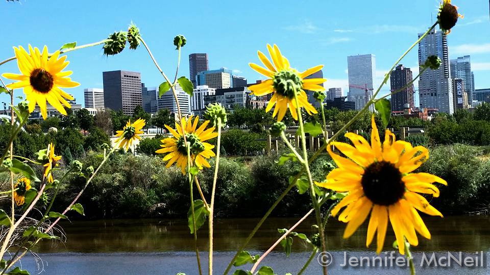
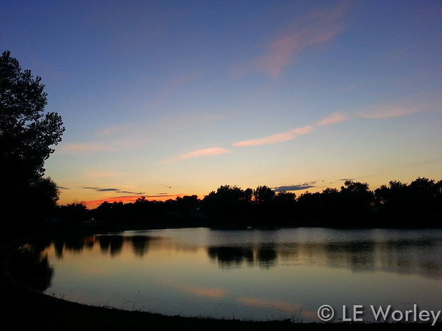
Showcasing images captured by ThorntonWeather.com readers as well as some of our own, our monthly slideshow covers the entire gamut of weather-related imagery.
Sunsets, sunrises, wildlife and of course every type of weather condition are vividly depicted in images captured from yours and our cameras.
| [flickr_set id=”72157657760243740″] |
What is missing in the slideshow above? Your photo!
Our monthly photo slideshow is going to feature images that we have taken but more importantly images that you have captured. The photos can be of anything even remotely weather-related.
Landscapes, current conditions, wildlife, pets, kids. Whimsical, newsy, artsy. Taken at the zoo, some other area attraction, a local park, a national park or your backyard. You name it, we want to see and share it!
Images can be taken in Thornton, Denver or anywhere across the extraordinary Centennial State. We’ll even take some from out of state if we can tie it to Colorado somehow.
We’ll keep the criteria very open to interpretation with just about any image eligible to be shown in our slideshows.
What do you win for having your image in our slideshow? We are just a ‘mom and pop’ outfit and make no money from our site so we really don’t have the means to provide prizes. However you will have our undying gratitude and the satisfaction that your images are shared on the most popular website in Thornton.
To share you images with us and get them included in the slideshow just email them to us or share them with ThorntonWeather.com on any of the various social media outlets. Links are provided below.
So come on, get those camera’s rolling!
- Email: info@ThorntonWeather.com
- Facebook: https://www.facebook.com/ThorntonWeather
- Google+: https://plus.google.com/+Thorntonweather
- Twitter: @ThorntonWeather (https://twitter.com/thorntonweather)


 With only a couple of days left in summer, Mother Nature seems to be indicating the season won’t go down without a fight. Denver broke a high temperature record today that has been on the books for more than a century.
 Following on a drier and slightly warmer than normal August, the month of September arrives and one can’t help but wonder if an early fall lies in wait. The month can bring our first snow of the season but more often than not, it is one of the most pleasant along the Colorado Front Range.

 For the second day in a row, the Mile High City has set or tied a record low temperature. The events certainly bring to mind the quickly approaching fall.