All posts by Thornton Weather

ThorntonWeather.com is your local source for live Thornton, Colorado weather conditions and news!

Weather Channel Founder – Sue Al Gore Over Global Warming Claims

Weather Channel Founder - Sue Al GoreAt the 2008 International Conference on Climate Change on March 3 in New York, Weather Channel founder John Coleman had some interesting words about man made climate and global warming.  Among his comments he proposed suing those who sell ‘carbon credits’ in order to force an open and honest debate about climate change.

Coleman said, “[I] have a feeling this is the opening.  If the lawyers will take the case – sue the people who sell carbon credits. That includes Al Gore. That lawsuit would get so much publicity, so much media attention. And as the experts went to the witness stand and testified, I feel like that could become the vehicle to finally put some light on the fraud of global warming.”

He went on to talk about the Weather Channel and how he hoped they would return to their original mission of talking about the weather rather than being politically involved.  You can read more in the article here

Snow This Morning – Roads Very Slick

Updated 3/5/08 @ 9:12am – The snow has tapered off a bit this morning and the worst of it has subsided.  However, we can expect to have flurries on and off throughout the day and into this evening with maybe an inch total accumulation in Thornton.   Southern and western suburbs can expect up to three inches. 

March 05, 2008 @ 06:07 – A small storm front has moved into the metro area this morning with a bit of snow and wind.  This precipitation coupled with cold temperatures has made the roads quite slick.  As usual, Thornton did a good job prepping their streets but our experience this morning shows other municipalities and CDOT didn’t do as good of a job.  Please be careful out there!

The storm is showing a bit more of an upslope condition so we will see a bit more snow than what was originally expected.  Looks for about an inch of accumulation in Thornton; more as you head further south. 

Snow & Blowing Snow Advisory Issued – Changes Are Here!

Snow on the way!Updated, Sunday, 3/2/08 @ 4:20pm – The storm has pretty much passed to the south of the Thornton area at this time.  The NWS says they will keep the Snow & Blowing Snow Advisory in effect until 8:00pm but there is little cause for concern on our side of town.  Any lingering showers should be confined south of I-76 and I-70.  Look for clearing skies tonight and a cool but decent day tomorrow.  Our next chance for precipitation should be into Wednesday but at this time that doesn’t look like it will amount to much. 

Updated, Sunday, 3/2/08 @ 2:00pm – After a bit of a lull things started picking back up for a while.  Winds continue to blow quite a bit and more snow is falling.  As previously mentioned, it is difficult to measure with how much it is blowing and drifting.  The National Weather Service guidelines say to take an average and pretty much make a “best guess” so that is what we do – call it 4.1″ of snow thus far today. 

Areas south continue to get the worst of the storm, particularly from Park and Jefferson counties east through Douglas and Elbert counties.  Blizzard conditions exist in these areas and do stretch north into eastern Adams county and to Limon.  Travel is not advised in these areas.

Radar does seem to indicate that the storm is slowly moving out and we should start seeing a decrease in intensity on the north side of town in the next couple of hours. 

Speaking of blizzards…  As of yet, this storm has not been classified as an official one – at least in the metro area.  By National Weather Service definition, a blizzard has winds of 35mph or greater and blowing snow that reduces visibilities to 1/4 mile or less for more than 3 hours.  Today, while the wind has been nasty, speeds have  been a bit erratic and we haven’t  had the sustained speeds to meet the definition.  Further, snowfall rates for the most part haven’t caused that severe of visibility issues.   Areas south and east of Denver however do appear to meet the criteria.

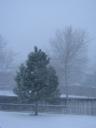
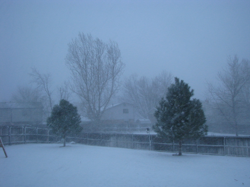
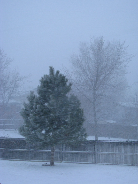
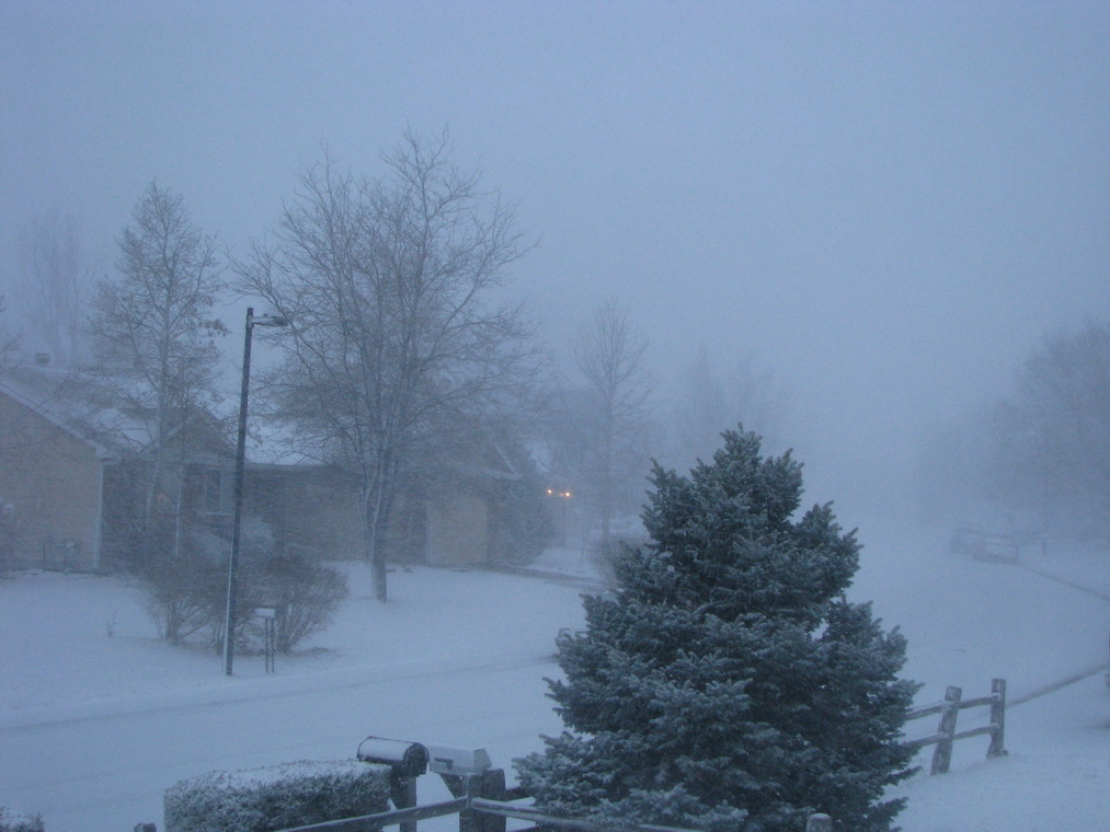
Updated, Sunday, 3/2/08 @ 8:40am – Fast and furious would be a good description of this storm.  The wind is the biggest thing right now causing drifting.  In our area depending on where you measure you can have anywhere from 1/2″ to 5″ which makes it pretty difficult to get an accurate measurement.  Radar does currently show that the worst of the storm has passed us by so it should continue to taper off although the wind will be with us for a while. 

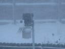
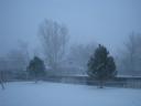
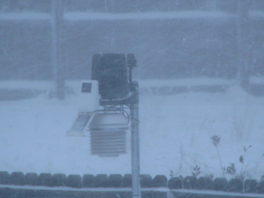
Below are a few pictures we took at around 6:40 this morning as the worst of the snow was falling.

The ThorntonWeather.com sensor suite in the snow.  A view of the ThorntonWeather.com backyard.  A view of the ThorntonWeather.com backyard.  A view of the ThorntonWeather.com street.

Updated, Sunday, 3/2/08 @ 5:25am – The storm is here!  Snow has started falling in the north Thornton area just in the last 15 minutes.  Coupled with it are extremely high and dangerous winds.  The winds started building about an hour ago as the storm approached and reached a crescendo just before 5:00am when we recorded a ThorntonWeather.com record wind gust of 46mph.  This shatters the old record of 40mph.  Current average windspeeds are above 30mph which is quite high.

Radar is showing the front moving south across the area and conditions should continue to deteriorate as we get closer to sunrise and as the morning progresses.  Please rememeber that there is a Snow & Blowing Snow Advisory in effect until 8:00pm tonight.  A snow and blowing snow advisory means that visibilities will be limited due to a combination of falling and blowing snow. Use caution when traveling, especially in open areas.

Saturday, 3/1/08 @ 11:00pm – At 9:51pm tonight the National Weather Service issued a Snow & Blowing Snow Advisory for much of central Colorado and the central and northern mountains.  This goes into effect at 5:00am Sunday through 8:00pm.  Areas affected do include the Denver metro area.  Current models are indicating a stronger than expected upslope with this storm which will help slow it down as it moves through the area. 

Rain and snow showers could start to appear after 2:00am, changing to mostly snow by dawn.  By the end of the day Sunday we could see between three and five inches of snow in Thornton.  However, the ground is pretty warm thanks to the nice weather in recent days so a lot of it won’t stick.  The wind could cause some minor drifting and higher accumulations.   The south metro area and the Palmer Divide could see some significant accumulations and driving conditions will deteriorate quickly so if you are heading that way, please be aware.

This is of course quite a change compared to today (Saturday) when DIA reached a new record high for this date of 74 – the old record was 73.  Up north in Thornton we were a bit warmer with a high of 75.7.  We hope everyone enjoyed the warmth because change is coming!  🙂

ThorntonWeather.com Owner Donates to Veterans Memorial – Issues Challenge

Thornton Veterans MemorialTony Hake, owner and operator of ThorntonWeather.com has made a personal donation of $557.00 to the Thornton Veterans Memorial Foundation and their Vietnam Traveling Memorial Wall event.  Tony is also chairman of the foundation and made the donation as a way to, “put his money where his mouth is.” 

Fundraising for the memorial and the event requires contributions from all area businesses, service organizations and citizens.  As a six year veteran of the United States Navy who served in the Persian Gulf, Tony has a special connection to this project.  Tony said, “It is important that we honor our veterans as well as those who are in uniform today defending this nation on shores far and near.  The Thornton Veterans Memorial will be a small way to say thank you to these brave men and women for their service.”

The WallOf all the war memorials, the Vietnam Veterans Memorial – the Wall – arguably invokes the strongest emotional reaction of any and it is the single most visited memorial in the country. In order to allow more people to experience it, veterans organizations have created 3/5 scale versions that now travel the country making appearances at various events. Just the presence of the wall draws thousands of visitors at every location. It is not merely something that is seen – it is something that is experienced.

It is with this in mind that the Foundation, working in conjunction with the city of Thornton,  has arranged to bring the traveling wall to the city during its annual Independence Day celebration.  The Wall will be available for public viewing 24 hours a day beginning on July 3 through the morning of July 7 at the multipurpose fields at the Margaret W. Carpenter Recreation Center (11151 Colorado Boulevard, Thornton, CO 80233).

Tony is challenging all area businesses and service organizations to match or exceed his own personal contribution to the memorial project and the Wall event.  Tony said, “If we can’t find it in our hearts to honor our veterans, then there is no one worth of honoring.” 

Tony also asks all area citizens to help out in any way they can.  Volunteers are needed for the event for those so inclined.  Donations from citizens in ANY amount are welcome and will help make this memorial possible.  Also remember that the Foundation is a registered non-profit 501(c)(3) organization so your donation is tax deductible! 

Please use the following links to learn more:

The Thornton Veterans Memorial website

Information on the Wall event

Donations can be made online at the memorial’s online store using a credit card. 

Cash donations may be mailed in using the contact information here

March 2008 Weather Preview Now Available

March 2008 PreviewMarch in Denver typically means frequent and rapid weather changes. The days grow longer and we start enjoying more sunshine and sometimes summer-like weather. However, on occasion arctic air masses can still force their way south into Colorado dropping temperatures quickly and markedly.  Occasional thunderstorms do start to happen in March as well.

To see what to expect in the coming month, click here to view our March 2008 Preview.

New features and data added to ThorntonWeather.com

ThorntonWeather.comWe have been busy the last couple of days with some pretty neat enhancements to our website.  The most obvious one being the addition of a “fly-out” menu on the left.  The previous menu was getting quite lengthy as we added new features to the site.  The new menu allows us to group items into main menu categories that when moused over then open a list of related items.  This should make it easier to navigate plus allow you to better see items that you may be interested in. 

Weather is very data oriented and the more you have, the more you know.  To this end we have added a “Historical Statistics” page.  This page draws from data we have submitted to Weather Underground since our inception in October 2006.  Using it, you can view graphs and data for individual days, weeks, months and even full years.  Simply select a date, click View and you receive all the weather data for that day.  Click the week, month or year links and see data for those time periods as well.  There is also a dropdown that allows you to view data from our sister stations in Arvada (arvadawx.com) and Commerce City (reunionweather.com). 

Lastly is an exciting new feature – ThorntonWeather.com’s own NEXRAD radar system.  Using specialized software, we can now generate our own radar images.  That in and of itself is interesting but what really makes this system exciting is the data we can present on it.  Not only radar images but also lightning data, thunderstorm information, and much more.  We are still studying how best to share all of this information with our visitors but it looks to be a pretty neat addition to the site.  At the current time you can view a single static image from the system or a radar loop that displays the last 2 hours of radar returns.  Be sure to look below the radar images too – you will see a table that when a severe thunderstorm appears, will show you critical information about the storm including the chance for hail and even the predicted path of the storm. 

Storms Over Louisiana For a sample of what a severe storm looks like on our computers using this new software, click on the image to the right.  This is a screenshot of a storm as it moved across Louisana last week.  Notice how it plots the radar, lightning strikes, storm cells and a path forecast.

So what do you think?  If you have any comments, questions, suggestions or criticisms about our site please send us an email with anything you might have to say.

Eclipse Turns Out Nicely In Thornton!

Eclipse
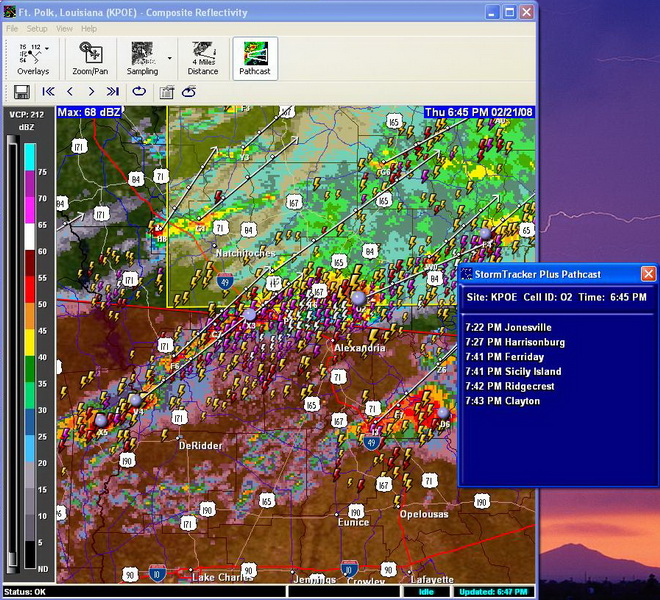
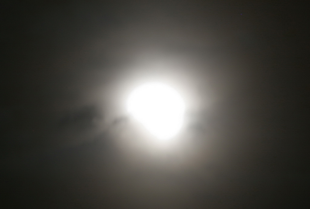
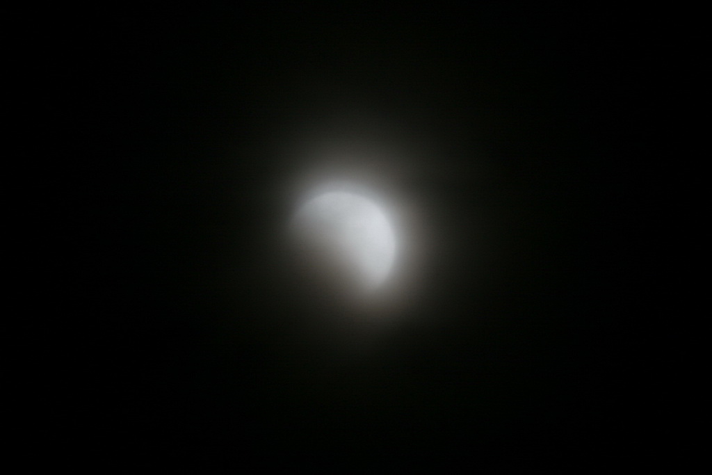
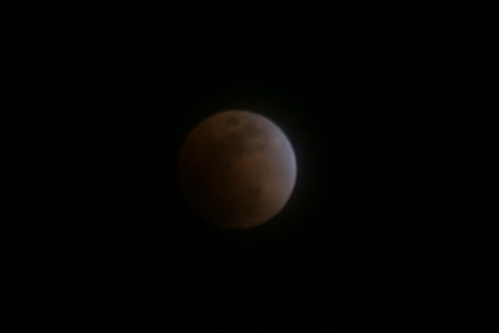
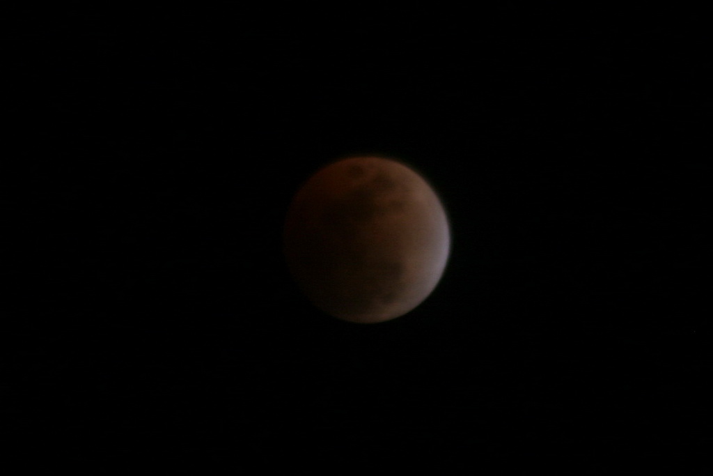
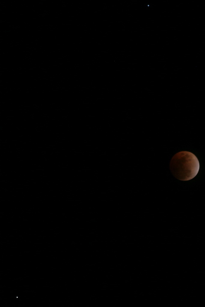
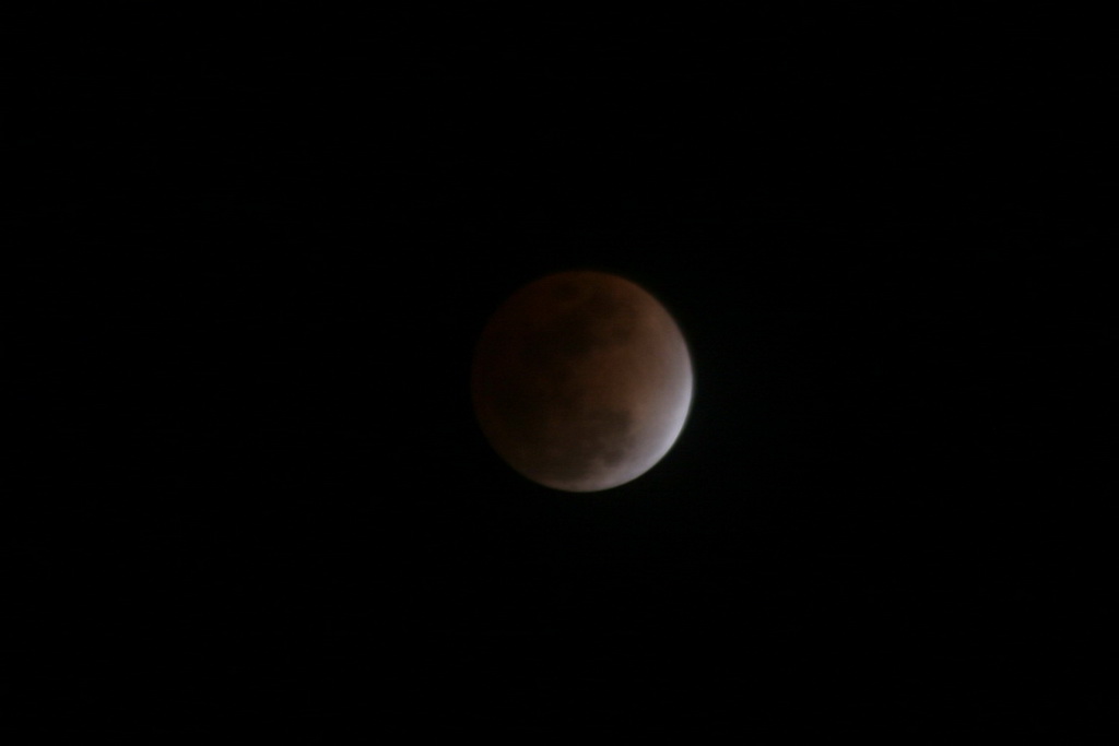
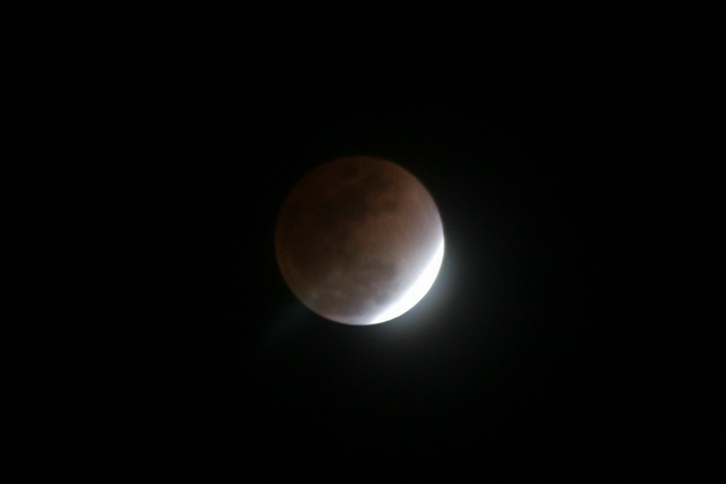
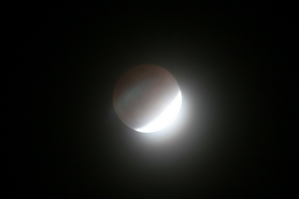
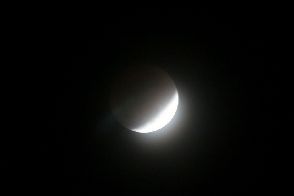
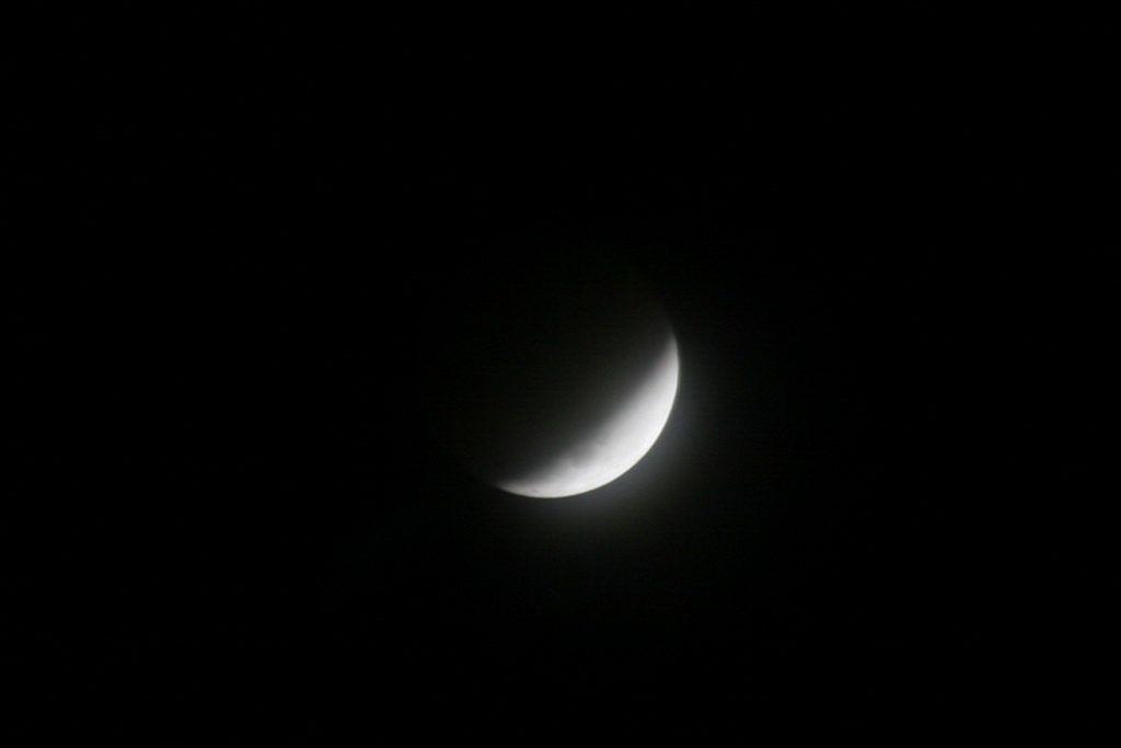
The lunar eclipse last night started out a bit rough with some light cloud cover obscuring the view.  However, a bit before the eclipse was at its maximum, the clouds cleared and we ended up with quite a nice view.  As an added treat, Regulus and Saturn were clearly visible and very bright above and below left of the moon.

Here are some pictures we took last night, in order from the start to finish. 

The start of the eclipse.  The start of the eclipse.  Eclipse  Eclipse

Eclipse  Eclipse  Eclipse  Eclipse 

Eclipse  Eclipse  Eclipse 

Total Lunar Eclipse Wednesday

Lunar eclipseThe Western Hemisphere will be given a bit of an astronomical treat Wednesday with a total lunar eclipse.  A lunar eclipse occurs whenever the moon passes through some portion of the Earth’s shadow – basically when the Earth is between the moon and the sun. 

Best up all for those of us in the Rocky Mountain area, the eclipse will occur at a good time for watching (see below).  For more information, please see the table below for viewing times and the links for more information.

Update, 2/20/08 @ 10:30am – Unfortunately it appears cloud cover in the Denver metro area may inhibit the ability to see the eclipse.  It is worth trying to get a glimpse though.

NASA Website About Tonight’s Eclipse

Wikipedia – Lunar Eclipse

AFP News Story – How an Eclipse Saved Columbus

Total Lunar Eclipse of February 20, 2008
North America Other
Event EST CST MST PST AST GMT
Partial Eclipse Begins: 08:43 pm 07:43 pm 06:43 pm 05:43 pm 04:43 pm 01:43 am*
Total Eclipse Begins: 10:01 pm 09:01 pm 08:01 pm 07:01 pm 06:01 pm 03:01 am*
Mid-Eclipse: 10:26 pm 09:26 pm 08:26 pm 07:26 pm 06:26 pm 03:26 am*
Total Eclipse Ends: 10:51 pm 09:51 pm 08:51 pm 07:51 pm 06:51 pm 03:51 am*
Partial Eclipse Ends: 12:09 am* 11:09 pm 10:09 pm 09:09 pm 08:09 pm 05:09 am*

* Event occurs on morning of February 21, 2008

Add ThorntonWeather.com to Your Website

We’ve completed work on some weather “stickers” that you can now add to your own website.  This is a great service for you and your website visitors and provides the current weather conditions in Thornton at a glance. The conditions displayed are real-time and updated every minute so you know you are seeing the latest!

You can choose from one of four designs – pick whichever best fits your site (a sample of one is below).  To get information on how to easily add these images to your site and see the other choices, please click here.

Square Sticker

Global Cooling the Concern Now?

Global CoolingAn interesting editorial recently in Investor’s Business Daily addresses concerns among many scientists no about global warming – but global cooling.  These scientists of course don’t receive the press that Al Gore and the “man made climate change” groups do but their voice is starting to be heard.  They don’t necessarily dispute that man can have an effect on the climate but they do dispute the amount of effect and they caution that there may be other, greater forces at work – solar activity for one.   From the article:

“Solar activity fluctuates in an 11-year cycle. But so far in this cycle, the sun has been disturbingly quiet. The lack of increased activity could signal the beginning of what is known as a Maunder Minimum, an event which occurs every couple of centuries and can last as long as a century.

Such an event occurred in the 17th century. The observation of sunspots showed extraordinarily low levels of magnetism on the sun, with little or no 11-year cycle.

This solar hibernation corresponded with a period of bitter cold that began around 1650 and lasted, with intermittent spikes of warming, until 1715. Frigid winters and cold summers during that period led to massive crop failures, famine and death in Northern Europe.

Tapping reports no change in the sun’s magnetic field so far this cycle and warns that if the sun remains quiet for another year or two, it may indicate a repeat of that period of drastic cooling of the Earth, bringing massive snowfall and severe weather to the Northern Hemisphere.”

In doing a critical analysis of some of what these people are saying one can’t help but wonder if they just might be correct.  You also begin to realize that the “consensus” that Al Gore and the International Panel on Climate Change (IPCC) insist exists just may not be as strong as they would like people to believe.  There is a growing body of dissenters in the scientific community that are raising the flags and saying we may be all wrong.

Critical thinking dictates that these views be taken into account and that these theories be investigated. 

The editorial:  The Sun Also Sets