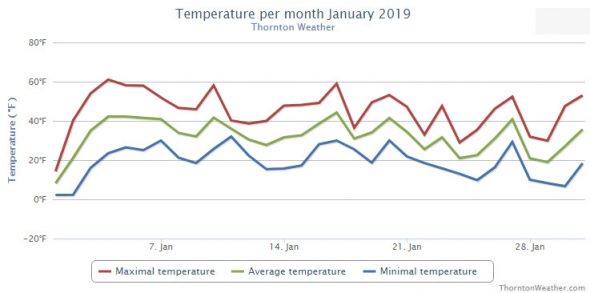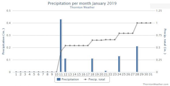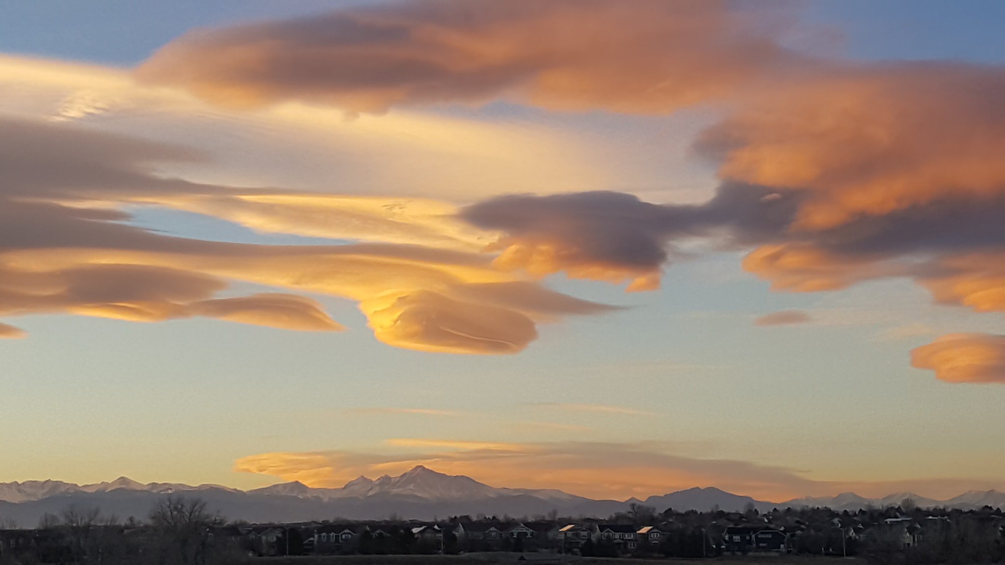
As we continue a dry winter, we look to history to provide some sort of hope. While there have been some significant snow events this week in Denver weather history, more common is bitter cold and damaging winds.
From the National Weather Service:
15-23
In 1962…a protracted cold spell kept metro Denver in the deep freeze for more than a week. From the 15th thru the 23rd…low temperatures were zero or below for 9 consecutive days…but a daily record low was set only on the 22nd when the temperature dipped to 14 degrees below zero. A record low maximum for the date was also set on the 22nd when the temperature climbed to only 11 degrees. The coldest high temperature was 3 degrees above zero on the 21st…which did not break the record. The protracted cold was broken for only a few hours on the afternoon of the 20th when Chinook winds warmed the temperature to a high of 38 degrees before another surge of cold arctic air plunged temperatures back into the deep freeze that evening. The severe cold caused much damage to water systems. A woman was frozen to death at Morrison. There were other deaths attributable to the weather…including traffic deaths and heart attacks from overexertion.
16
In 1911…a trace of rain fell…a rare event in January.
In 1935…rainfall was 0.01 inch during the afternoon…a rare event in January.
In 1989…wind gusts to 80 mph were reported in southwest Boulder. Winds reached 100 mph at Rollinsville in the foothills southwest of Boulder.
In Golden…the wind blew a 25-foot trailer through a fence and flipped it over. West winds gusted to 37 mph at Stapleton International Airport where the Chinook winds warmed the temperature to a high of 49 degrees.
16-17
In 1886…a brief cold spell resulted in two temperature records. High temperatures of zero degrees on the 16th and 2 degrees below zero on the 17th were both record low maximums for the dates. Low temperatures of 8 degrees below zero on the 16th and 16 degrees below zero on the 17th were not records.
In 1930…temperatures plunging well below zero resulted in two records. Low temperatures of 19 degrees below zero on the 16th and 20 degrees below zero on the 17th were record low temperatures for the dates. High temperatures were 4 degrees on the 16th and 15 degrees on the 17th. Light snowfall totaled 4.0 inches. North winds were sustained to 18 mph on the 16th.
In 1964…high winds struck the eastern foothills. Gale velocity winds were recorded in Boulder with gusts to 83 mph measured at Rocky Flats. Several airplanes were damaged at the Jefferson County Airport in Broomfield. Roofs…walls…and parts of buildings were blown away at various locations. Power poles and trees were blown over.
16-18
In 1943…light snowfall totaled 3.2 inches over the 3 days. This was the only measurable snow of the month. North winds were sustained to 20 mph on the 16th.
In 2011…very strong winds associated with an upper level jetstream over Colorado produced blizzard conditions in the mountains above timberline. Peak wind gusts included: 99 mph atop Loveland pass…94 mph…2 miles southwest of Mary Jane…80 mph atop Berthoud Pass and 79 mph atop Niwot Ridge. Storm totals in the ski areas west of Denver ranged from 8 to 14 inches.
5-11
In 1978…the 5th marked the start of a record 7 consecutive days of dense fog at Stapleton International Airport. The heavy fog reduced the visibility to 1/4 mile or less for a period of time on each of these days. Light snow and/or freezing drizzle occurred on most days. Fog reducing visibility to less than 7 miles was recorded at Stapleton International Airport on 11 consecutive days through the 15th. During the period 5-14…the cold thick fog deposited heavy rime ice up to 5 inches thick on power lines and poles over a wide area of eastern Colorado…causing a major electrical power outage disaster.
6-10
In 1933…3:00 pm on the 6th marked the start of a protracted cold period through 8:00 am on the 10th when the temperature was below zero for 86 out of 88 hours. The cold period was interrupted on the 8th at 9:00 am when the temperature was 1 degree above zero and at 10:00 am when the temperature was 8 degrees above zero. Four temperature records were set. High temperatures of 4 degrees below zero on the 7th…8 degrees on the 8th…and 5 degrees below zero on the 9th were record low maximums for those dates. The only record low temperature record was 14 degrees below zero on the 10th. The lowest temperature reached during the period was 16 degrees below zero on both the 7th and 8th…which were not records.
9-10
In 1934…rain changed to heavy snow on the afternoon of the 9th and continued through the day on the 10th. Snowfall totaled 7.4 inches in downtown Denver. North winds were sustained to 24 mph on the 10th.
In 1972…heavy post-frontal snowfall totaled 6.2 inches at Stapleton International Airport where northeast winds gusted to 46 mph on the 9th. Temperatures plunged from a high of 51 degrees on the 9th to a low of 16 on the morning of the 10th.
In 1981…the season’s coldest arctic air mass rolled into metro Denver plunging temperatures from 10 below to 20 degrees below zero. Bitter north winds gusting as high as 36 mph sent wind chill temperatures to 50 below zero. Two to four inches of snow fell over metro Denver with 6 to 12 inches in the foothills. A Boulder man died of hypothermia while cross country skiing in the mountains west of the city. Snowfall totaled only 1.5 inches at Stapleton International Airport where the minimum temperature on the morning of the 10th was 5 degrees below zero. The temperature that day warmed to a high of only 9 degrees.
In 2003…high winds occurred in and near the eastern foothills. The highest wind gusts recorded: Included 80 mph atop Fritz Peak and 73 mph atop Blue Mountain and at the national wind technology center on Rocky Flats south of Boulder. At least 4 multi-car accidents occurred along State Highway 93…between Golden and Boulder when blowing snow caused whiteout conditions. Northwest winds gusted to 36 mph at Denver International Airport on the 10th.
9-11
In 1965…heavy snowfall totaled 6.2 inches at Stapleton International Airport where northeast winds gusted to 25 mph.
In 1993…the same storm that dumped heavy snow in the mountains combined with an arctic cold front to produce heavy snow across metro Denver. Upslope snows of 4 to 8 inches were common with some areas receiving nearly a foot. Ten inches of new snow were measured in Parker and 7 inches in southeast Denver. At Stapleton International Airport… Snowfall totaled 8.1 inches. Strong winds combined with the snowfall to produce near-blizzard conditions over the plains closing many roads east of Denver. North winds gusted to only 18 mph at Stapleton International Airport on the 9th.
10
In 1890…north winds were sustained to 48 mph with gusts as high as 60 mph behind an apparent cold front. Light snow also fell.
In 1932…a large cumulo-nimbus thunderhead was observed in the eastern sky at 4:00 pm. Thunderstorms are relatively rare in February.
In 1990…northwest winds gusted to 52 mph at Stapleton International Airport. The strong Chinook winds warmed the temperature to a high of 56 degrees.
In 1999…a vigorous cold front moved a wall of blowing dust across the plains of northeastern Colorado during the afternoon and early evening hours. While the strongest winds and wind damage were north and east of metro Denver… North to northeast winds did gust to 48 mph at Denver International Airport…reducing the visibility to as low as 3/4 mile in blowing dust. The temperature dropped as much as 15 degrees in 5 minutes and 21 degrees in 30 minutes following the passage of the cold front. Dangerous wind shear conditions at DIA delayed several flights…while others were redirected to Colorado Springs. In the Montbello area of northeast Denver…the strong winds blew the roof off a building. Downed power lines sparked a small brush fire…which burned about 10 acres near the former Fitzsimmons Army Medical Center.
10-11
In 1971…a wind gust to 80 mph was recorded in Boulder at the National Center for Atmospheric Research. A wind gust to 69 mph was measured at the National Bureau of Standards. In downtown Boulder wind gusts to 43 mph were clocked. No damage was reported. North to northwest winds gusted to 39 mph on the 10th and to 41 mph on the 11th at Stapleton International Airport.
In 1999…heavy snow developed over sections of metro Denver during the evening hours. Snowfall totals included: 6 inches at Eaglecrest…6.5 inches at Highlands Ranch…and 8.5 inches about 5 miles south of Sedalia. Only 1.0 inch of snow fell at the site of the former Stapleton International Airport. Strong winds and snow caused near blizzard conditions north of metro Denver.
10-12
In 1958…heavy snow fell across metro Denver. At Stapleton Airport…where northeast winds gusted to 22 mph…6.7 inches of snowfall were measured.
In 1995…cold arctic air brought heavy snow to the foothills and western Denver suburbs. Golden measured 15 inches of snow with 14 inches in south Boulder. Locations in the foothills recorded between 10 and 15 inches of snow. Only 6.1 inches of snow fell at Stapleton International Airport where north winds gusted to 30 mph on the 10th.
10-13
In 1905…an extremely cold arctic air mass moved over the city behind a cold front on the 10th and persisted through the morning of the 13th. North winds were sustained to 25 mph behind the front on the 10th dropping the temperature to a low of 2 degrees below zero…which was also the high reading on the 11th. Light snowfall totaled 3.0 inches overnight of the 10th into the 11th. The low temperature plunged to 19 degrees below zero on the 11th. Records were set on the 12th and 13th. The high temperature of only zero degrees on the 12th was a record low maximum for the date. The low readings of 21 degrees below zero on the 12th and 14 degrees below zero on the 13th were record minimum temperatures for those dates.
11
In 1875…northwest winds were brisk all day. The velocities increased to 30 to 50 mph during the early evening.
In 1957…Chinook winds gusting to 49 mph warmed the temperature to a high of 64 degrees at Stapleton Airport.
In 1971…a rare February thunderstorm produced 1/4 inch diameter hail in southwest Denver.
In 1981…the cold spell of the 10th came to a quick end with strong Chinook winds. Gusts to 84 mph were recorded at Mines Peak and to 80 mph at Wondervu. Gusts in the foothills ranged from 50 to 65 mph. Southwest winds gusted to only 23 mph at Stapleton International Airport.
In 1984…a near-blizzard across eastern Colorado closed I-70 east of Denver and stranded 1200 motorists at Limon. Only 0.9 inch of snow fell at Stapleton International Airport where north winds gusted to 43 mph.
In 1988…wind gusts to 77 mph were measured at Echo Lake. West winds gusted to only 32 mph at Stapleton International Airport.
11-12
In 1899…the temperature plunged to lows of 20 degrees below zero on both days.
In 1900…northwest winds sustained to 52 mph with gusts to 60 mph warmed the temperature to a high of 58 degrees on the 11th. An apparent cold front overnight produced 3.7 inches of snow and northeast winds gusting to 30 mph. The high temperature on the 12th was only 26 degrees.
In 1994…moist upslope winds and an upper level storm system produced heavy snow over western portions of metro Denver. Snowfall amounts totaled 10 inches in Golden and 8 inches at Strontia Springs Reservoir 15 miles southwest of Denver in the South Platte Canyon. Snowfall at Stapleton International Airport totaled only 3.6 inches…but north winds gusting to 35 mph on the 11th produced occasional visibilities as low as 1/4 mile in heavy snowfall and blowing snow.
11-13
In 1903…west to northwest Chinook winds gusting to 34 mph warmed the temperature to a high of 50 degrees on the 11th… Before temperatures rapidly plunged to a low of 14 degrees behind a cold front. Light snow fell through the 13th and totaled 4.2 inches in the city…while temperatures ranged from a high of 14 degrees on the 12th to a low of 5 degrees below zero on the 13th.
12
In 1874…5 inches of snow fell in downtown Denver. Melted snow resulted in 0.31 inch of precipitation.
In 1875…forest fires burned very brightly in the foothills to the west of Denver.
12-13 in 1915…heavy snowfall totaled 7.0 inches over downtown Denver. Northwest winds were sustained to 24 mph on the 13th.
In 1951…heavy snowfall totaled 8.1 inches at Stapleton Airport where northeast winds gusted to 28 mph on the 12th.
In 1968…snowfall totaled 5.6 inches at Stapleton International Airport where northeast winds gusted to 26 mph. Snow fell all day on the 12th and into the morning hours of the 13th.
In 1997…heavy snow fell in the foothills southwest of Denver. Conifer…Evergreen…Morrison…and North Turkey Creek received 6 to 8 inches of new snow overnight. Only 0.2 inch of snow fell at the site of the former Stapleton International Airport. North-northeast winds gusted to 23 mph at Denver International Airport on the 13th.
13
In 1886…northwest winds were sustained to 40 mph during the early morning hours…but winds were strong and gusty all day.
In 1918…west winds were sustained to 42 mph with a measured extreme velocity to 44 mph. The strong Chinook winds warmed the temperature to a high of 58 degrees.
In 1988…high winds raked metro Denver. Boulder reported a wind gust to 67 mph with 63 mph at Lakewood and 49 mph at Stapleton International Airport. The strong winds toppled a tree onto a car in Aurora. Northwest winds gusting to 49 mph at Stapleton International Airport warmed the temperature to a high of 64 degrees.
In 2010…a peak wind gust to 89 mph was recorded in Boulder. North winds gusted to 28 mph at Denver International Airport.
13-14
In 1895…a cold air mass settled over the city. High temperatures of only 4 degrees on the 13th and 8 degrees on the 14th were record low maximum temperatures for each day. Low temperatures were 6 degrees below zero on the 13th and 5 degrees below zero on the 14th…but were not records. Light snow totaled only 0.4 inch. Winds were light.
In 1960…snowfall totaled 6.1 inches and north-northwest winds gusted to 39 mph at Stapleton Airport.
In 1967…high winds were widespread along the foothills where wind gusts of 60 to 90 mph were common. A wind gust to 108 mph was measured at the National Center for Atmospheric Research in Boulder. Sustained winds of 50 to 55 mph with gusts as high as 70 mph were recorded in downtown Boulder. An estimated 3 thousand dollars in damage occurred to mobile homes in Boulder. Power lines were downed over a wide area. At Stapleton International Airport…west winds gusted to 32 mph on the 13th and southwest winds gusted to 48 mph on the 14th.
In 1972…winds gusted to 67 mph at the National Bureau of Standards in Boulder. Wind gusts to 49 mph were measured in downtown Boulder. West winds gusted to 26 mph at Stapleton International Airport.
In 2001…heavy snow fell across metro Denver and in the foothills. Snowfall totals included: 8 inches at Evergreen; 7 inches atop Crow Hill and in Lakewood; 6 inches in Denver…Doubleheader…Eldorado Springs… Morrison…and Pine Junction. Snowfall totaled 4.8 inches at the site of the former Stapleton International Airport. Northeast winds gusted to 33 mph at Denver International Airport on the 13th.
Continue reading February 10 to February 16: This Week in Denver Weather History

 February in Colorado typically brings to an end an extended period when average temperatures are at their lowest. Winter begins to loosen its grip and temperatures get warmer but precipitation is not a particularly common event during the month.

