Change is of course the one constant in Denver’s weather but come July, things actually get pretty consistent.
The standard formula for a day in July is a sunny morning, clouds developing in the late morning and early afternoon. Come mid-afternoon, thunderstorms are rolling off of the foothills and into the metro area and the eastern plains. These storms do occasionally reach severe status containing hail, gusty winds and heavy downpours of rain.
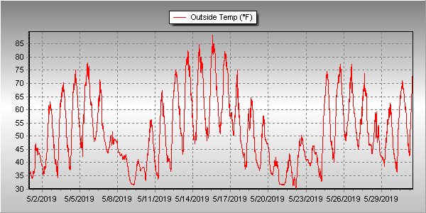
Unsettled would be a good word to sum up Thornton’s weather for June 2019. We experienced a series of troughs and fronts that kept things unsettled and suppressed temperatures. That however did not translate into a great deal of precipitation.
Cooler than normal temperatures were seen across much of the month. Even the later part of June saw some days with high temperatures only in the 60s.
It wasn’t even until the 26th of the month that Denver and Thornton recorded their first 90 degree day of the year. This was in fact the fifth latest occurrence of a 90 degree day in Denver and the latest since 1982.
Thornton’s average temperature for the month came in at 65.7 degrees. This made the month the second coolest June Thornton has recorded in 13 years. Denver saw a virtually identical average of 65.6 degrees. Both readings were below the long term Denver average for June of 67.4 degrees.
Temperatures in Thornton ranged from a high of 98.5 degrees of the 28th of the month down to a low of 40.7 degrees on the morning of the 10th. Denver’s highest reading of 96 degrees came on the 29th and its coolest of 42 degrees on the 10th.
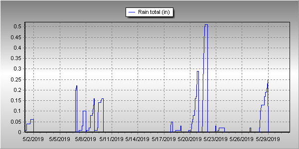
Denver averages 1.98 inches of precipitation during the month of June. This year, Thornton fell short of the mark while Denver exceeded it. Here in Thornton we tallied 1.51 inches while Denver saw 2.24 inches.
Thornton, Colorado’s June 2019 temperature summary. (ThorntonWeather.com)Thornton, Colorado’s June 2019 precipitation summary. (ThorntonWeather.com)
CLIMATE REPORT
NATIONAL WEATHER SERVICE DENVER/BOULDER CO
1129 AM MDT MON JUL 1 2019

...................................

...THE DENVER CO CLIMATE SUMMARY FOR THE MONTH OF JUNE 2019...

CLIMATE NORMAL PERIOD 1981 TO 2010
CLIMATE RECORD PERIOD 1872 TO 2019

WEATHER         OBSERVED          NORMAL  DEPART  LAST YEAR`S
                 VALUE   DATE(S)  VALUE   FROM    VALUE  DATE(S)
                                          NORMAL
................................................................
TEMPERATURE (F)
RECORD
 HIGH             105   06/28/2018
                        06/26/2012
                        06/25/2012
 LOW               30   06/02/1951
HIGHEST            96   06/29       104      -8      105  06/28
                        06/28
LOWEST             42   06/10        30      12       44  06/02
                        06/09
AVG. MAXIMUM     80.1              82.4    -2.3     88.8
AVG. MINIMUM     51.2              52.3    -1.1     56.0
MEAN             65.6              67.4    -1.8     72.4
DAYS MAX >= 90      5               7.9    -2.9       16
DAYS MAX <= 32      0               0.0     0.0        0
DAYS MIN <= 32      0               0.0     0.0        0
DAYS MIN <= 0       0               0.0     0.0        0

PRECIPITATION (INCHES)
RECORD
 MAXIMUM         4.96   1882
 MINIMUM            T   1890
TOTALS           2.24              1.98    0.26     0.43
DAILY AVG.       0.07              0.07    0.00     0.01
DAYS >= .01        12               8.4     3.6        5
DAYS >= .10         6               4.6     1.4        2
DAYS >= .50         1               1.4    -0.4        0
DAYS >= 1.00        0               0.3    -0.3        0
GREATEST
 24 HR. TOTAL    0.97   06/18 TO 06/18

SNOWFALL (INCHES)
RECORDS
 TOTAL             MM   MM
TOTALS            0.0               0.0

DEGREE_DAYS
HEATING TOTAL      62                62       0        9
 SINCE 7/1       6281              6058     223     5410
COOLING TOTAL      87               133     -46      241
 SINCE 1/1         92               155     -63      289

FREEZE DATES
RECORD
 EARLIEST     09/08/1962
 LATEST       06/08/2007
EARLIEST      10/10             10/07
LATEST        05/22             05/05
.................................................................

WIND (MPH)
AVERAGE WIND SPEED              9.7
RESULTANT WIND SPEED/DIRECTION   3/182
HIGHEST WIND SPEED/DIRECTION    43/180    DATE  06/02
HIGHEST GUST SPEED/DIRECTION    56/200    DATE  06/02

SKY COVER
POSSIBLE SUNSHINE (PERCENT)   MM
AVERAGE SKY COVER           0.60
NUMBER OF DAYS FAIR            1
NUMBER OF DAYS PC             26
NUMBER OF DAYS CLOUDY          3

AVERAGE RH (PERCENT)     54

WEATHER CONDITIONS. NUMBER OF DAYS WITH
  0
  5
  0
  1
  0
  0
  1
HAZE                      2

-  INDICATES NEGATIVE NUMBERS.
R  INDICATES RECORD WAS SET OR TIED.
MM INDICATES DATA IS MISSING.
T  INDICATES TRACE AMOUNT.
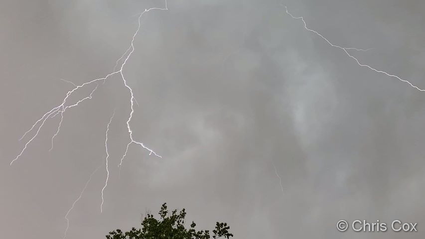
Lightning streaks across the skies over Thornton. (Chris Cox)
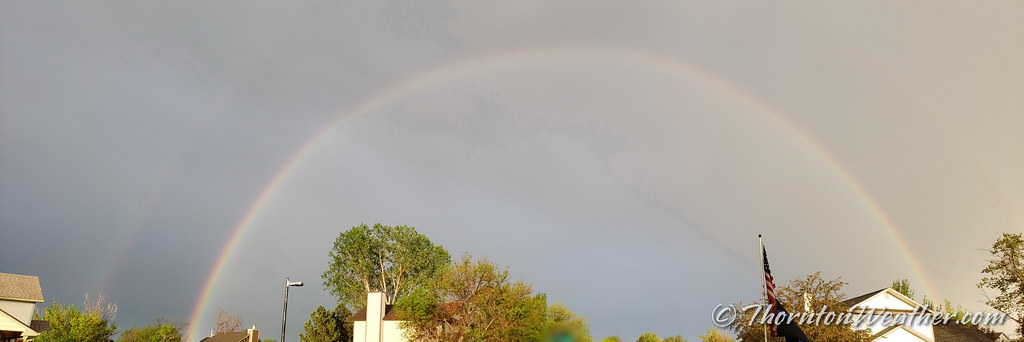
The month of June typically sees springtime severe weather reach its height of activity in northeastern Colorado.
This affords the opportunity to capture extraordinary images of amazing weather phenomena from monstrous supercell thunderstorms to heavy rain, hail and even tornadoes.
Slideshow updated June 30, 2019
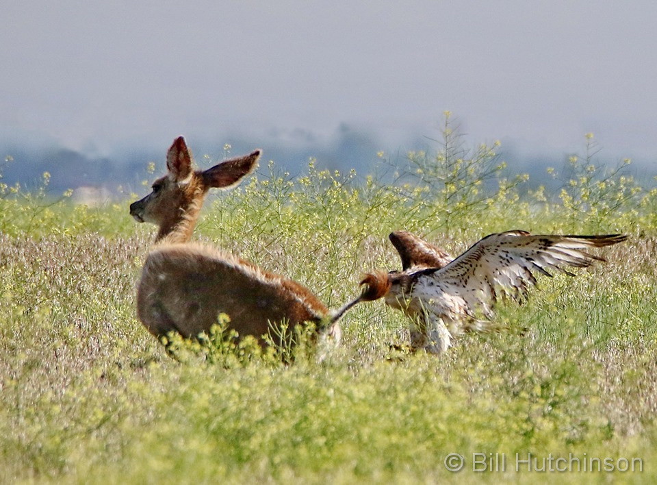
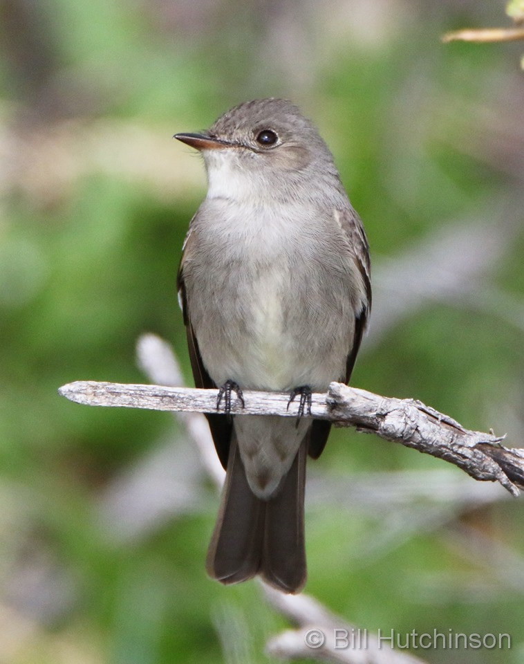
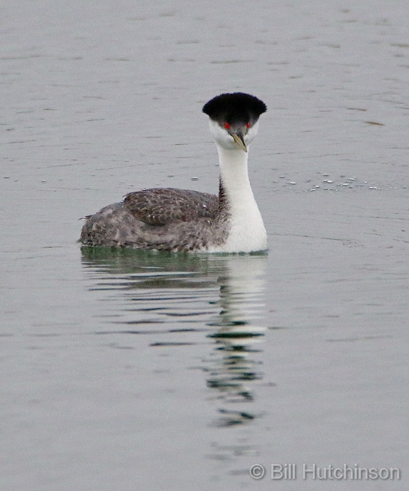
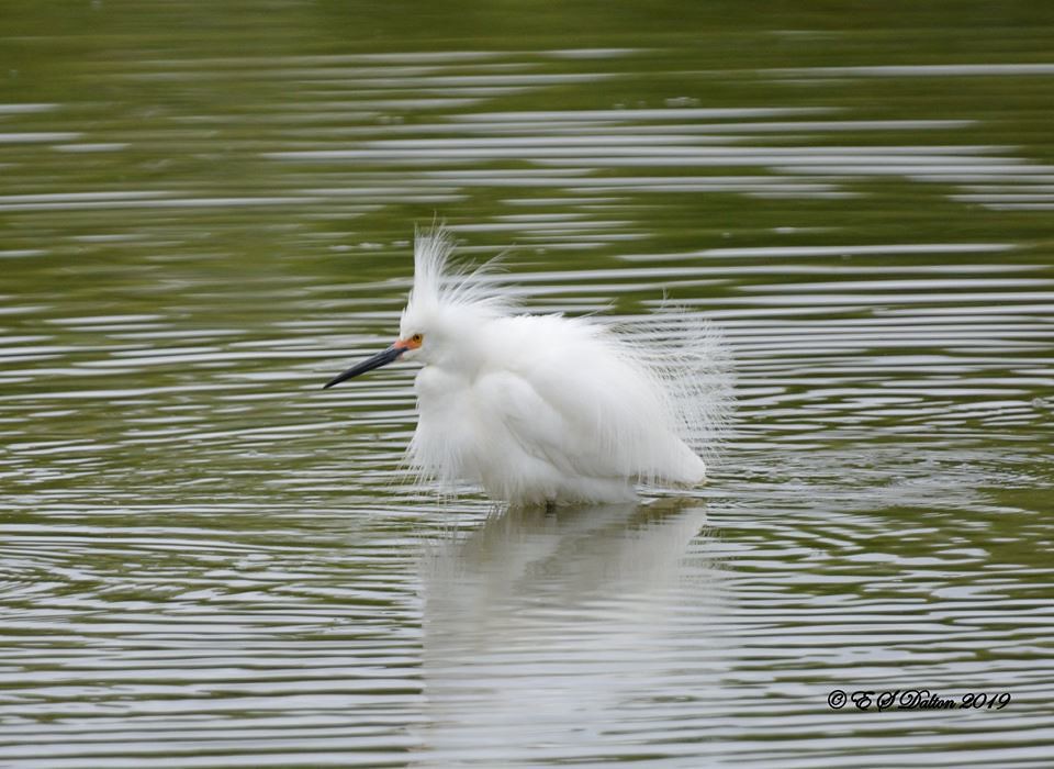
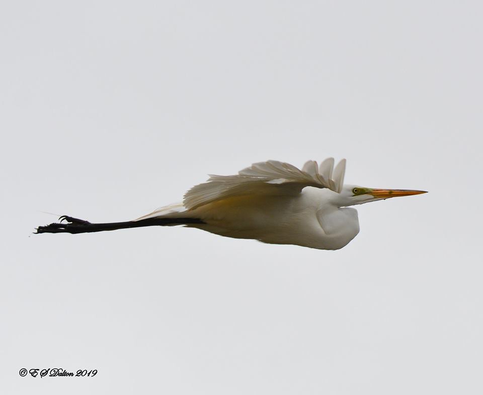
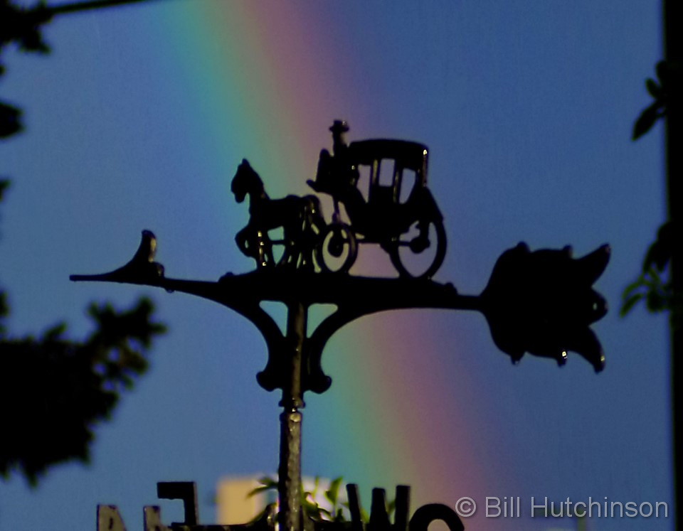
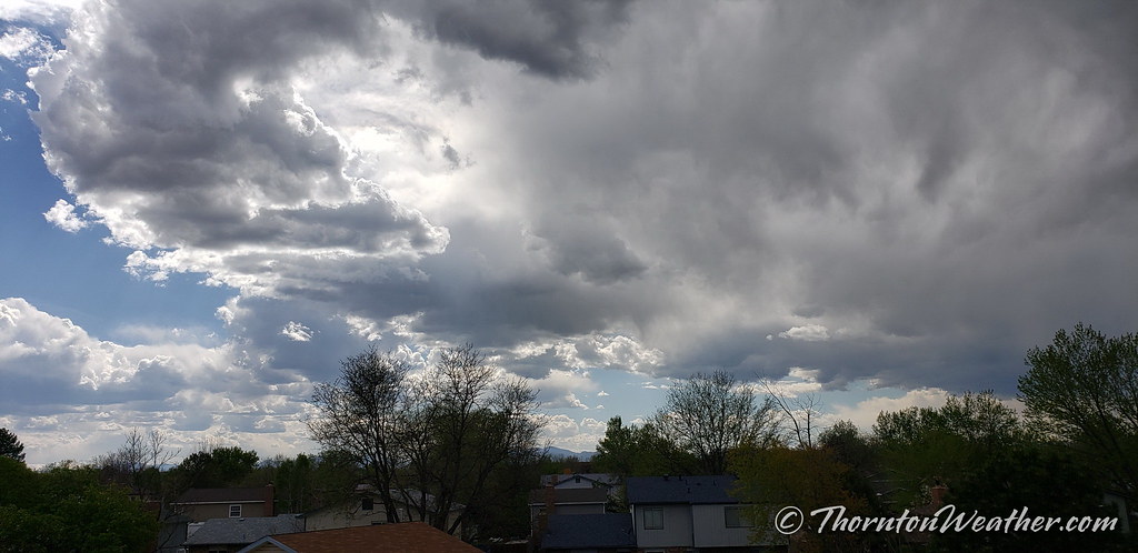
Showcasing images captured by ThorntonWeather.com readers as well as some of our own, our monthly slideshow covers the entire gamut of weather and nature related imagery.
Sunsets, sunrises, wildlife and of course every type of weather condition are vividly depicted. June brings some very dynamic weather and the photos are a great way to see the stunning variety.
To learn more about how to send your photo to us for inclusion in the slideshow, see below the slideshow.
[flickr_set id=”72157708942513328″]
What is missing in the slideshow above? Your photo!
Our monthly photo slideshow is going to feature images that we have taken but more importantly images that you have captured. The photos can be of anything even remotely weather-related.
Landscapes, current conditions, wildlife, pets, kids. Whimsical, newsy, artsy. Taken at the zoo, some other area attraction, a local park, a national park or your backyard. You name it, we want to see and share it!
Images can be taken in Thornton, Denver or anywhere across the extraordinary Centennial State. We’ll even take some from out of state if we can tie it to Colorado somehow.
We’ll keep the criteria very open to interpretation with just about any image eligible to be shown in our slideshows.
What do you win for having your image in our slideshow? We are just a ‘mom and pop’ outfit and make no money from our site so we really don’t have the means to provide prizes. However you will have our undying gratitude and the satisfaction that your images are shared on the most popular website in Thornton.
To share you images with us and get them included in the slideshow just email them to us or share them with ThorntonWeather.com on any of the various social media outlets. Links are provided below.
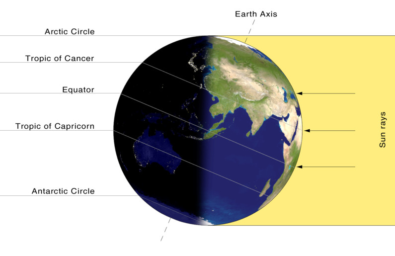
On the June solstice, the Earth’s northern hemisphere is tilted at its maximum toward the sun. The result is the longest day of the year for the northern part of the planet. (NASA)
Astronomical summer will arrive in Thornton this morning and with the solstice we will enjoy our longest day of the year.
Summer officially begins at 9:54am MDT this morning. The Summer Solstice occurs when the North Pole is tilted at it closest to the sun – 23.4 degrees. This results in the longest day of the year in the Northern Hemisphere.
Here in Denver the sun rises at 5:32am today and sets at 8:31pm. This will give us 14 hours, 59 minutes and 14 seconds of daytime.
Tomorrow it will be a bit less than one second shorter than today and each day from now through the Winter Solstice in December will get gradually shorter as well.
At the poles of the globe, the seasonal extremes will be quite notable. Areas north of the Arctic Circle to the North Pole will see 24 hours of daylight and have a midnight sun. On the opposite end of the globe, the South Pole will have no direct sunlight at all as they are in the depths of their winter.
Did you know that there is a difference between the astronomical seasons that we are discussing here and meteorological seasons?
Meteorological seasons differ slightly and are geared toward matching the calendar with the annual temperature cycle. This is done primarily for meteorological observing and forecasting and in many ways it is more logical than the astronomical seasons.
For the Northern Hemisphere, the meteorological spring covers the months of March, April and May. Summer brings the hottest months of the year and so meteorological summer is June, July and August. Meteorological fall then is September, October and November followed by the coldest months of December, January and February as meteorological winter.
There is little doubt that looking back on the month the most notable feature was the cool, sometimes chilly, temperatures. Denver in fact saw one of its coldest on record. Precipitation for Thornton lagged but Denver itself was quite wet.
A seemingly endless series of storm systems impacted the state through the month. Overall, the first week was seasonal and dry. Temperatures then cooled for a couple of days and delivered us a light shot of snow. We rebounded with a series of 80 degree days from the 13th to the 16 before once again chilling out.
From the 18th to the 23rd, temperatures remained below normal and on the 21st we received a respectable 3.3 inches of snow. Temperatures during that period dropped to below freezing three times.
The balance of the month continued the roller coaster with a few mild days followed by cooler ones.
Thornton’s overall average monthly temperature for May came in at 51.9 degrees. This made it the coldest May since ThorntonWeather.com came online 13 years ago.
Out at DIA where Denver’s official measurements are taken, the month was comparable with a 51.6 degree average. That made May 2019 the seventh coldest May on record and the coldest since 1995.
Highs ranged in Thornton from a maximum of 89 degrees on the 15th down to a lowest reading of 29.8 degrees on the 22nd. Denver’s highest reading of 83 degrees and its coldest of 30 degrees came on the same dates.
Three temperature records were officially set in Denver. The record low for May 21st of 31 degrees was tied. Also on that day, a record low maximum of 39 degrees was set. The old record was 40 degrees set in 1891. Lastly, the low on the 22nd of 30 degrees broke the record low reading for the date of 32 degrees set in 1930.
In terms of precipitation, Denver averages 2.12 inches during the month. Thornton came close to matching that with 2.03 inches. Out at the airport, it was wetter with 3.23 inches being recorded.
Thornton saw a total of 4.1 inches of snow for the month while Denver saw a bit less at 3.9 inches. Both were well above the May average of 1.1 inches.
May 2019 temperature summary for Thornton, Colorado.May 2019 precipitation summary for Thornton, Colorado.
CLIMATE REPORT
NATIONAL WEATHER SERVICE DENVER/BOULDER CO
753 AM MDT SAT JUN 1 2019

...................................

...THE DENVER CO CLIMATE SUMMARY FOR THE MONTH OF MAY 2019...

CLIMATE NORMAL PERIOD 1981 TO 2010
CLIMATE RECORD PERIOD 1872 TO 2019

WEATHER         OBSERVED          NORMAL  DEPART  LAST YEAR`S
                 VALUE   DATE(S)  VALUE   FROM    VALUE  DATE(S)
                                          NORMAL
................................................................
TEMPERATURE (F)
RECORD
 HIGH              95   05/26/1942
 LOW               19   05/02/2013
                        05/03/1907
HIGHEST            83   05/15
LOWEST             30   05/22
                        05/01

AVG. MAXIMUM     63.9              71.5    -7.6     75.4
AVG. MINIMUM     39.2              42.7    -3.5     47.5
MEAN             51.6              57.1    -5.5     61.4
DAYS MAX >= 90      0               0.8    -0.8        4
DAYS MAX <= 32      0               0.0     0.0        0
DAYS MIN <= 32      7               1.9     5.1        0
DAYS MIN <= 0 0 0.0 0.0 0 PRECIPITATION (INCHES) RECORD MAXIMUM 8.57 1876 MINIMUM 0.06 1974 TOTALS 3.23 2.12 1.11 1.86 DAILY AVG. 0.10 0.07 0.03 0.06 DAYS >= .01        14               9.4     4.6        8
DAYS >= .10         7               4.8     2.2        5
DAYS >= .50         3               1.2     1.8        0
DAYS >= 1.00        1               0.2     0.8        0
GREATEST
 24 HR. TOTAL    1.07   05/20 TO 05/20

SNOWFALL (INCHES)
TOTALS            3.9   2019        1.1 (NCEI 1981-2018 AVG)
RECORD           15.5   1898

DEGREE_DAYS
HEATING TOTAL     414               265     149      151
 SINCE 7/1       6219              5996     223     5401
COOLING TOTAL       5                21     -16       46
 SINCE 1/1          5                22     -17       48

FREEZE DATES
RECORD
 EARLIEST     09/08/1962
 LATEST       06/08/2007
EARLIEST                        10/07
LATEST                          05/05
.................................................................

WIND (MPH)
AVERAGE WIND SPEED              10.0
RESULTANT WIND SPEED/DIRECTION   1/090
HIGHEST WIND SPEED/DIRECTION    35/310    DATE  05/17
HIGHEST GUST SPEED/DIRECTION    50/310    DATE  05/17

SKY COVER
POSSIBLE SUNSHINE (PERCENT)   MM
AVERAGE SKY COVER           0.60
NUMBER OF DAYS FAIR            3
NUMBER OF DAYS PC             16
NUMBER OF DAYS CLOUDY         12

AVERAGE RH (PERCENT)     64

-  INDICATES NEGATIVE NUMBERS.
R  INDICATES RECORD WAS SET OR TIED.
MM INDICATES DATA IS MISSING.
T  INDICATES TRACE AMOUNT.
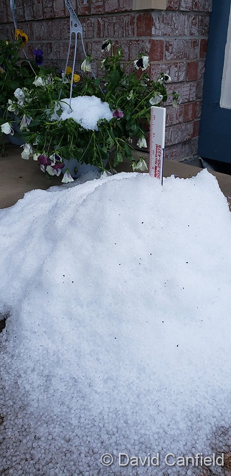
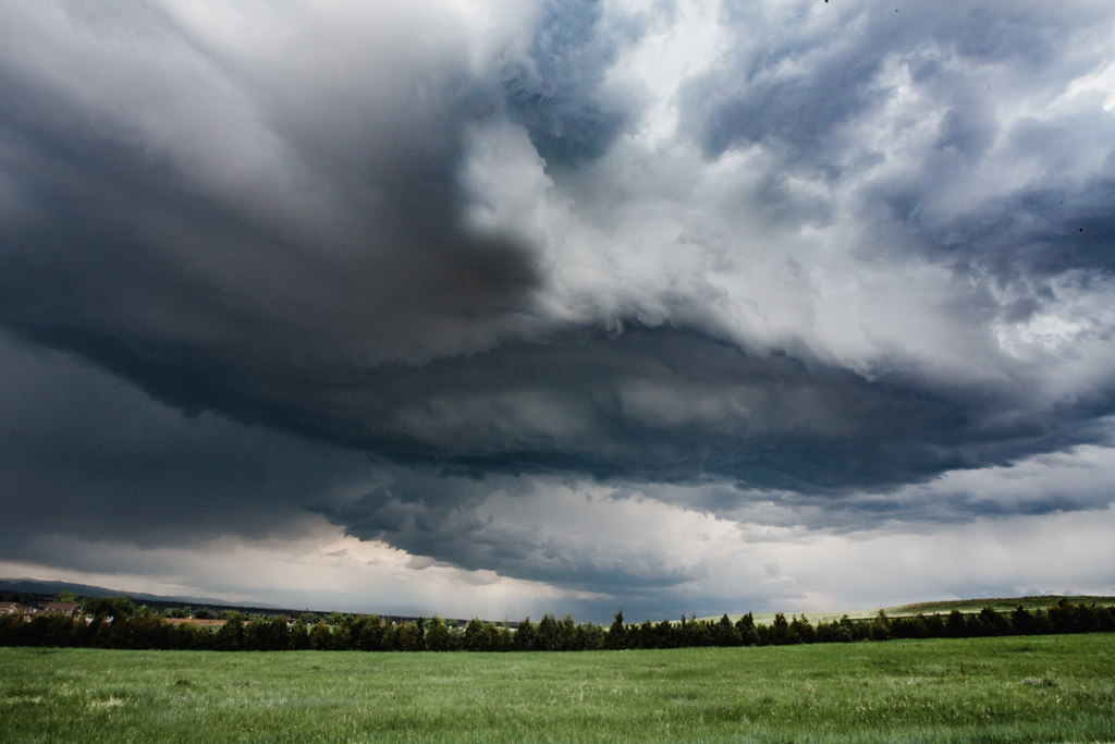
Extreme weather can occur during in month in Colorado we well know. June however is when traditional spring severe weather arrives in the state oftentimes with hail, damaging wind and tornadoes.
Over 40 percent of the tornadoes that occur in Colorado happen during the month of June. Far more common are thunderstorms with hail and wind, each responsible for extensive damage each year.
While severe weather is common, so too are brilliantly sunny and mild days as we close out spring and enter summer. If you are looking for cold, it isn’t likely but it is possible as the Denver area has seen freezing temperatures and yes, even snow, during the month.
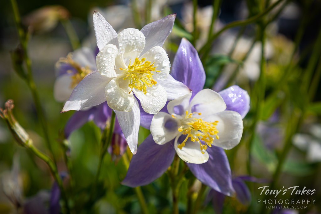
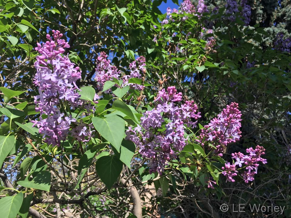
Beautiful blooms in Thornton start off the month of May. (Lalania Worley)
Colorado’s famously highly variable weather seems to showcase itself during the month of May when a variety of weather conditions can be seen. This provides a prime opportunity for photos of everything weather to flora to fauna.
The month of May can bring extremes. Snow is not entirely uncommon during the month but more common is severe weather, particularly in the latter half of the month. Thunderstorms become more frequent and their associated hazards – lightning, wind, hail and tornadoes – are usual visitors. Providing additional subjects for pictures are the emerging spring flowers and our abundant wildlife.
Slideshow updated May 27, 2019. To learn more about how to send your photo to us for inclusion in the slideshow, see below the slideshow.
Showcasing images captured by ThorntonWeather.com readers as well as some of our own, our monthly slideshow covers the entire gamut of weather-related imagery.
Sunsets, sunrises, wildlife and of course every type of weather condition are vividly depicted in images captured from yours and our cameras.
What is missing in the slideshow above? Your photo!
Our monthly photo slideshow is going to feature images that we have taken but more importantly images that you have captured. The photos can be of anything even remotely weather-related.
Landscapes, current conditions, wildlife, pets, kids. Whimsical, newsy, artsy. Taken at the zoo, some other area attraction, a local park, a national park or your backyard. You name it, we want to see and share it!
Images can be taken in Thornton, Denver or anywhere across the extraordinary Centennial State. We’ll even take some from out of state if we can tie it to Colorado somehow.
We’ll keep the criteria very open to interpretation with just about any image eligible to be shown in our slideshows.
What do you win for having your image in our slideshow? We are just a ‘mom and pop’ outfit and make no money from our site so we really don’t have the means to provide prizes. However you will have our undying gratitude and the satisfaction that your images are shared on the most popular website in Thornton.
To share you images with us and get them included in the slideshow just email them to us or share them with ThorntonWeather.com on any of the various social media outlets. Links are provided below.
The calendar says spring but the temperature would make you think otherwise as cold temperatures set a record this morning.
The National Weather Service reported that Denver’s temperature dropped to 30 degrees at 2:55am. The broke the record low for the date of 32 degrees last set in 1930.
Thornton matched the reading at DIA with a low of 30 degrees as well.
Brrr! Just a bit chilly out there and one for the record books as a result.
As measured at Denver International Airport, the low temperature today dipped to 31 degrees. This ties the record low for the date set in 2001.
Additionally, the high temperature today only topped out at 39 degrees. This sets a record for the coldest high temperature for the date, besting the old record of 40 degrees set in 1891.
Here in Thornton, we also saw a low of 31 degrees but did warm up more than the airport with a high of 44 degrees.
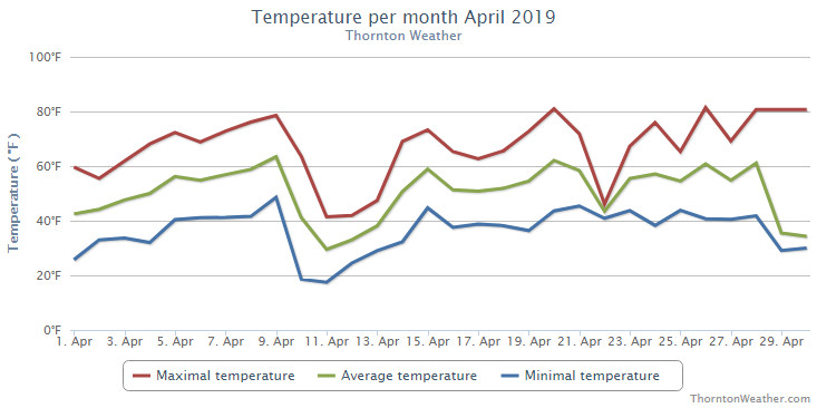
The month of April had the usual, inconsistent weather conditions we expect from the month. Thornton enjoyed everything from spring-like days with mild temperatures to a healthy round of snow and cold.
The month started out mild with seven of the first nine days of the month seeing above normal temperatures and pleasant conditions. A cold front and storm system moved in on the 10th though and brought about significant changes for a few days and our first snow of the month.
Warmer weather returned though and on the 20th we recorded our first 80 degree day of the year. Showers and thunderstorms on the 21st brought some much-needed rain then we dried back out for the next six days. We saw a couple more 80+ degree days then the final two days chilled things out and delivered a bit more snow.
Thornton’s overall average temperature for the month came in at 49.6 degrees. This was a good bit above Denver’s long-term April average of 47.4 degrees. Out at DIA where the Mile High City’s official measurements are kept, the average temperature was similar with 49.1 degrees.
Temperatures in Thornton ranged from a high of 81.4 degrees on the 26th down to a low of 17.5 degrees on the 11th. Denver saw a high reading of 80 degrees on the 20th and a low of 17 on the 11th.
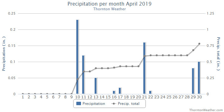
In terms of precipitation, Denver averages 1.71 inches during April. Both Thornton and Denver fell short of that mark with 0.78 inches and 1.25 inches in their rain buckets respectively.
Snowfall in Thornton was respectable with 8.1 inches of the white stuff. Denver was well short of that with 3.5 inches. April averages 6.8 inches so while Thornton was above that, Denver was below.
Thornton, Colorado’s April 2019 temperature summary. (ThorntonWeather.com)Thornton, Colorado’s April 2019 precipitation summary. (ThorntonWeather.com)
CLIMATE REPORT
NATIONAL WEATHER SERVICE DENVER/BOULDER CO
913 AM MDT WED MAY 1 2019

...................................

...THE DENVER CO CLIMATE SUMMARY FOR THE MONTH OF APRIL 2019...

CLIMATE NORMAL PERIOD 1981 TO 2010
CLIMATE RECORD PERIOD 1872 TO 2019

WEATHER         OBSERVED          NORMAL  DEPART  LAST YEAR`S
                 VALUE   DATE(S)  VALUE   FROM    VALUE  DATE(S)
                                          NORMAL
................................................................
TEMPERATURE (F)
RECORD
 HIGH              90   04/30/1992
 LOW               -2   04/02/1975
HIGHEST            80   04/20                         83  04/29
LOWEST             17   04/11                         21  04/06
                        04/10
AVG. MAXIMUM     62.7              61.5     1.2     63.2
AVG. MINIMUM     35.6              33.3     2.3     32.5
MEAN             49.1              47.4     1.7     47.8
DAYS MAX >= 90      0               0.0     0.0        0
DAYS MAX <= 32      0               0.3    -0.3        0
DAYS MIN <= 32     10              13.0    -3.0       16
DAYS MIN <= 0       0               0.0     0.0        0

PRECIPITATION (INCHES)
RECORD
 MAXIMUM         8.24   1900
 MINIMUM         0.03   1963
TOTALS           1.25              1.71   -0.46     0.86
DAILY AVG.       0.04              0.06   -0.02     0.03
DAYS >= .01         9               9.1    -0.1        8
DAYS >= .10         2               4.5    -2.5        4
DAYS >= .50         1               0.9     0.1        0
DAYS >= 1.00        0               0.5    -0.5        0
GREATEST
 24 HR. TOTAL    0.82   04/21 TO 04/21           04/21 TO 04/21

SNOWFALL (INCHES)
RECORDS
 TOTAL            3.5               6.8
RECORD APRIL     33.8    1933

DEGREE_DAYS
HEATING TOTAL     469               529     -60      509
 SINCE 7/1       5805              5731      74     5250
COOLING TOTAL       0                 1      -1        2
 SINCE 1/1          0                 1      -1        2

FREEZE DATES
RECORD
 EARLIEST     09/08/1962
 LATEST       06/08/2007
EARLIEST                        10/07
LATEST                          05/05
.................................................................

WIND (MPH)
AVERAGE WIND SPEED              10.3
RESULTANT WIND SPEED/DIRECTION   0/078
HIGHEST WIND SPEED/DIRECTION    44/310    DATE  04/21
HIGHEST GUST SPEED/DIRECTION    55/280    DATE  04/28

SKY COVER
POSSIBLE SUNSHINE (PERCENT)   MM
AVERAGE SKY COVER           0.60
NUMBER OF DAYS FAIR            2
NUMBER OF DAYS PC             19
NUMBER OF DAYS CLOUDY          9

AVERAGE RH (PERCENT)     56

-  INDICATES NEGATIVE NUMBERS.
R  INDICATES RECORD WAS SET OR TIED.
MM INDICATES DATA IS MISSING.
T  INDICATES TRACE AMOUNT.
Weather, natural disasters & climate news and information.

 Extreme weather can occur during in month in Colorado we well know. June however is when traditional spring severe weather arrives in the state oftentimes with hail, damaging wind and tornadoes.