Colorado’s famously highly variable weather seems to showcase itself during the month of May when a variety of weather conditions can be seen.
The month can certainly bring extremes.
Snow is not entirely uncommon during the month, occurring in about 50% of Mays. When it does, it has the potential to cause damage to newly bloomed trees.
More common however is severe weather, particularly in the latter half of the month. Thunderstorms become more frequent and their associated hazards – lightning, wind, hail and tornadoes – are usual visitors.
April can be a tricky month weather-wise with everything from mild temperatures to snow to severe weather being possible. The good thing about that is that it provides plenty of chances for great photos!
April marks a transition between winter and summer for most of the country but for Denver it is especially true as we can see a stunning variety of weather.
The proverbial April showers are certainly a possibility for Denver. Snow? Tornadoes? Thunderstorms? You bet – all can happen!
Throw in our usual wildlife plus the wide variety of birds that return to the Centennial State for the spring and summer and there is a lot going on.
Slideshow updated April 20, 2025.
To learn more about how to send your photo to us for inclusion in the slideshow, see below the slideshow.
Showcasing images captured by ThorntonWeather.com readers as well as some of our own, our monthly slideshow covers the entire gamut of weather-related imagery.
Sunsets, sunrises, wildlife and of course every type of weather condition are vividly depicted in images captured from yours and our cameras.
What is missing in the slideshow above? Your photo!
Our monthly photo slideshow is going to feature images that we have taken but more importantly images that you have captured. The photos can be of anything even remotely weather-related.
Landscapes, current conditions, wildlife, pets, kids. Whimsical, newsy, artsy. Taken at the zoo, some other area attraction, a local park, a national park or your backyard. You name it, we want to see and share it!
Images can be taken in Thornton, Denver or anywhere across the extraordinary Centennial State. We’ll even take some from out of state if we can tie it to Colorado somehow.
We’ll keep the criteria very open to interpretation with just about any image eligible to be shown in our slideshows.
What do you win for having your image in our slideshow? We are just a ‘mom and pop’ outfit and make no money from our site so we really don’t have the means to provide prizes. However you will have our undying gratitude and the satisfaction that your images are shared on the most popular website in Thornton.
To share you images with us and get them included in the slideshow just email them to us or share them with ThorntonWeather.com on any of the various social media outlets. Links are provided below.
Thornton, Colorado’s March 2025 Temperature Summary. (ThorntonWeather.com)
Heading into the last few days of the month, Thornton had seen a March with very warm temperatures and little moisture, so much so that the month was likely going to be in the warmest and driest. Then, in the last few days of the month, Mother Nature opened the spigot and finally delivered some much-needed precipitation, saving the month from at least one of those marks.
We started out the month with three mild days and temperatures well above normal. We then cooled down and the seventh was chilly with a high of only 33 degrees. Two the first seven days did also bring some light precipitation.
After that, we settled in for a long haul of dry weather with 21 days straight of no precipitation. Temperatures during those three weeks were largely above average with many days seeing highs of 65 degrees or warmer and a few 70+ degree readings.
Late in the day of the 28th, things began to change, at least for precipitation. The 29th brought over an inch of rain and more came on the 30th. Were it not for that, the month would have been one of the driest Marches on record. We did also receive our one and only snowfall during that period although it was quite minimal.
Temperatures never did really chill out and the month came in with average readings far above normal for March.
Overall, March 2025 came in with an average temperature of 47.2 degrees in Thornton. This was well above Thornton’s running 18-year average for March of 42.3 degrees. It put the month into the books as the third warmest March during that period. Temperatures ranged from a high of 79.4 degrees on the 28th down to a low of 20.0 degrees on the 8th.
For Denver, as recorded at Denver International Airport, the month saw an average temperature of 45.8 degrees. This too was well above the Mile High City’s long-term March average of 41.6 degrees. The airport saw a maximum temperature of 77 degrees on the 28th and its coldest reading of 17 degrees on the 5th.
In terms of precipitation, Thornton ended the month with 1.56 inches in the bucket. As noted, the vast majority of that fell in the final days of the month. This allowed the month to come in with a total above the 1.31-inch average for March.
Out at the airport, Denver recorded 1.26 inches of precipitation. This was a good bit above the city’s 0.86 inches average for March.
March normally is one of our snowiest months but that was certainly not the case in 2025. Thornton saw a mere 0.80 inches of the white stuff. This was far below the 10.7 inch average for March over the past 18 years. It was our third least-snowiest March during the period.
Denver fared slightly better than us with 2.0 inches of snow recorded. This was far below the Mile High City’s long-term average for March of 11.4 inches.
April marks a transition between winter and summer for most of the country but for Denver it is especially true as we can see a stunning variety of weather.
The proverbial April showers are certainly a possibility for Denver. Snow? Tornadoes? Thunderstorms? You bet – all can happen!
For good measure throw in a chance for hail and even dust storms and April gives every type of weather condition you could like – or hate.
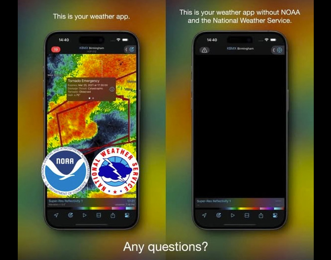
Your favorite weather app or weather website without NOAA and the NWS. (Justin Berk, Meteorologist)
The new administration is set on making cuts to the federal government budget, but I am concerned that they are going about it rather haphazardly and in a way that endangers lives.
The National Oceanic and Atmospheric Administration (NOAA), the parent of the National Weather Service (NWS), is not to be spared from DOGE. Last week it came out that at least 800 workers were to be cut within NOAA, many from local NWS offices.
The cuts to the NWS are troubling as the agency was already known to be understaffed. Local NWS offices are absolutely critical to providing timely, life-saving information, particularly when severe weather strikes. Only the personnel in these local offices have the in-depth knowledge of their specific geographical locations to accurately understand the complicated weather patterns that impact them.
Here at Thornton Weather, we rely heavily on the NWS for the information we provide not only in terms of forecasts, but many of the features on our website. These cuts threaten all of that.
More troubling is the storm on the horizon with rumors about a privatization of many of the services the National Weather Service provides. AccuWeather and other for-profit organizations have long cast a wishful eye for this to happen to enhance their balance sheets.
Free forecasts? Gone. Free live radar? Gone. Life-saving weather alerts? Only if you pay. Much of the data on ThorntonWeather.com? Bye bye. That is what privatization would bring. To be blunt, lives will be lost as a result.
I am further concerned about cuts to other critical agencies, most notably the Department of Veterans Affairs and many of the agencies of the Department of the Interior like the National Park Service, U.S. Forest Service, Bureau of Land Management and the U.S. Fish and Wildlife Service.
Let me clear, there is no doubt that our federal government needs to be trimmed in terms of size and budget. The bureaucrats have lived high on the hog at our expense, ridiculous programs are funded and many agencies have become extraordinarily bloated. I am certain that even within those I mention, there are plenty of cuts that could be made with minimal pain.
However, the way this is happening is wrong. This is taking a chainsaw to something that needs a knife. Smart, directed cuts could have massive benefits, lower costs and result in a smaller, leaner, more efficient government.
We won’t get there with the approach the administration is taking now. What we will get is crucial agencies that service, help and protect American citizens destroyed and unable to perform the missions they have been charged with.
That is unsatisfactory.
If you concur, I would urge you to reach out to your federal elected representatives and let them know, in a respectful way, that this can be done better.
I never delve into politics on this page and while this is politics-related, I will be keeping it generic in nature and what is written here is no indication of my personal beliefs on politics and I don’t care about yours. Any replies should be respectful and on topic. Those that are not will be deleted.
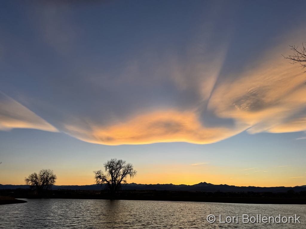
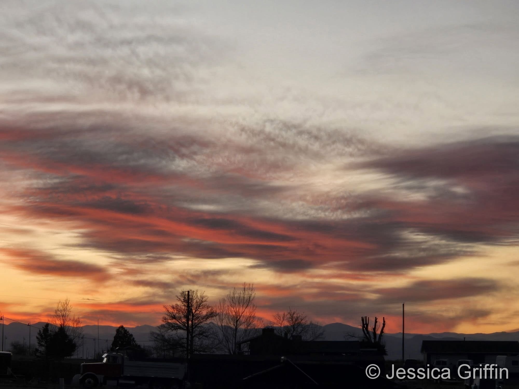
A gorgeous sunrise starts the day. (Lori Bollendonk)
The month of March is the start of meteorological spring and while conditions do begin warming, winter weather is certainly out of the question. From hot to cold, snow to rain, the conditions can be very conducive to great pictures as we see in our slideshow.
March in Denver typically means frequent and rapid weather changes. The days grow longer and we start enjoying more sunshine and sometimes summer-like weather. However, on occasion arctic air masses can still force their way south into Colorado dropping temperatures quickly and markedly.
With the active wildlife, increased outdoor activities by us humans, and of course the weather, March imagery contains a wide variety of subjects and extremes.
Slideshow updated March 29, 2025. To learn more about how to send your photo to us for inclusion in the slideshow, see below the slideshow.
Showcasing images captured by ThorntonWeather.com readers as well as some of our own, our monthly slideshow covers the entire gamut of weather-related imagery.
Sunsets, sunrises, wildlife and of course every type of weather condition are vividly depicted in images captured from yours and our cameras.
What is missing in the slideshow above? Your photo!
Our monthly photo slideshow is going to feature images that we have taken but more importantly images that you have captured. The photos can be of anything even remotely weather-related.
Landscapes, current conditions, wildlife, pets, kids. Whimsical, newsy, artsy. Taken at the zoo, some other area attraction, a local park, a national park or your backyard. You name it, we want to see and share it!
Images can be taken in Thornton, Denver or anywhere across the extraordinary Centennial State. We’ll even take some from out of state if we can tie it to Colorado somehow.
We’ll keep the criteria very open to interpretation with just about any image eligible to be shown in our slideshows.
What do you win for having your image in our slideshow? We are just a ‘mom and pop’ outfit and make no money from our site so we really don’t have the means to provide prizes. However you will have our undying gratitude and the satisfaction that your images are shared on the most popular website in Thornton.
To share you images with us and get them included in the slideshow just email them to us or share them with ThorntonWeather.com on any of the various social media outlets. Links are provided below.
Thornton, Colorado’s February 2025 Temperature Summary. (ThorntonWeather.com)
The month of February might have seemed unusually cold and while we did see a very chilly middle of the month, it was bookended by a warm start and finish. Also, while we received a good bit of snow, it was relatively dry giving little measurable precipitation.
The month started out with above normal temperatures dominating six of the first seven days of the month. Things then turned toward the colder side for the next two weeks with below average temperatures on all but one day during the period. We then saw things turn warmer and Mother Nature gave us a hint of spring.
We only saw four days with snowfall, none of which were significant events. All of them were relatively ‘dry snow’ and didn’t do much in terms of liquid precipitation. The greatest snowfall came out the 15th of the month with 3.9 inches.
Overall, Thornton’s average temperature came in at 31.8 degrees. That is right at the running 18-year average for the month.
Our warmest temperature reading of 69.7 degrees came on the 25th of the month. Our coldest, -1 degrees, was recorded on the morning of the 19th.
Out at Denver International Airport where the Mile High City’s official records are kept, it was slightly colder. The site saw an average temperature for the month of 31.2 degrees. This was well below their long-term average for February of 32.7 degrees.
Precipitation for the month was rather meager, despite the snow we received. Thornton saw a mere 0.10 inches in its bucket. This was well below the running average for February of 0.64 inches. It also put February 2025 into the books as the second driest February of the past 18 years.
At DIA, Denver fared better with 0.22 inches recorded. This was just more than half of the long-term February average for the Mile High City of 0.41 inches.
In terms of snowfall, Thornton recorded 6.3 inches. That is a respectable amount but well below our February average of 11.3 inches.
DIA saw less snow than us with 5.5 inches recorded. This was a good bit below their long-term February average of 7.6 inches.
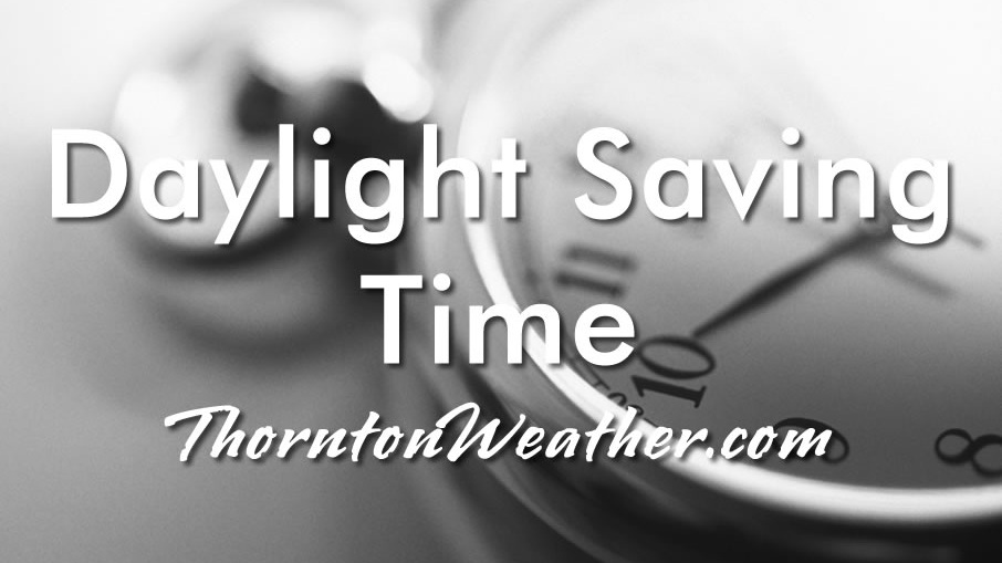
The United States returns to Daylight Saving Time at 2:00am Sunday as Standard Time comes to an end.
The biannual ritual of changing our clocks to adjust for Daylight Saving Time occurs this Saturday night providing yet another signal of the changing of seasons. The United States will ‘spring forward’ one hour at 2:00am Sunday morning as we begin Daylight Saving Time.
The ritual of changing our clocks twice a year can be met with some resistance as some people struggle to adjust their body’s internal clock. The start of Daylight Saving Time can be particularly problematic given the one hour less sleep people receive on the night of the change.
However, longer days as we head into the milder months are a very real benefit and for many worth the inconvenience of a lost hour of sleep. The time change definitely has big effects on how much daylight we enjoy during our normal waking hours.
On Saturday, prior to the change, sunset will occur at 5:59pm but on Sunday the sun won’t disappear over the horizon until 7:01pm. This affords folks more time in the evening to get started on those spring-time chores and allows us to get outside and enjoy the warming weather.
Similarly, sunrise on Saturday is at 6:21am but shifts to 7:20am on Sunday.
The March Equinox is also on the horizon. Spring officially begins at 3:01am on Thursday, March 20.
This year Daylight Savings Time will come to an end on November 2.
Some of the recent history of Daylight Savings Time (from Wikipedia):
Daylight saving time in the United States was first observed in 1918. Most areas of the United States currently observe daylight saving time, with the exceptions being the states of Arizona and Hawaii along with the territories of Puerto Rico, American Samoa, Guam, and the Northern Mariana Islands.
From 1987 to 2006, daylight saving time in the United States began on the first Sunday of April and ended on the last Sunday of October. The time was adjusted at 2:00 AM (0200) local time (as it still is done now).
Since 2007, daylight saving time starts on the second Sunday of March and ends on the first Sunday of November, with all time changes taking place at 2:00 AM (0200) local time.
The month of March in Denver is usually one that is welcomed heartily by residents. We begin to shake off the cold of winter with warmer temperatures and calmer conditions. That does not mean we are done with snow and cold by any means.
March usually offers healthy snowfall giving us an opportunity to add to our seasonal totals. While there is good snow potential in March, the month also typically brings much warmer temperatures.
March is historically Denver’s snowiest month and brings about 20% of our annual snowfall. Heavy, wet spring snow storms can oftentimes bring the entire month’s snowfall total in one monstrous snow.
We also start the transition to spring and severe weather season and the month typically brings our first thunderstorms of the year. Temperatures climb throughout the month and by the end our average daytime highs are near 60 degrees.
February 6, 2025 – A beautiful way to end the day. (Jessica Griffin)
February signifies the start of the climb toward warmer temperatures for the year. Cold and snow though do intrude but, coupled with milder conditions, there are lots of photo opportunities as can be seen in our monthly slideshow.
The month is one of our least snowiest of the year but it isn’t unusual to see the landscape blanketed in white. Warming temperatures through the month can bring the onset of spring fever and gives residents the opportunity to enjoy some prolonged time outdoors on the mild days.
Cold or mild, snowy or dry, our scenery is almost always gorgeous – and photo worthy.
Slideshow updated February 23, 2025
To learn more about how to send your photo to us for inclusion in the slideshow, see below the slideshow.
Showcasing images captured by ThorntonWeather.com readers as well as some of our own, our monthly slideshow covers the entire gamut of weather-related imagery.
Sunsets, sunrises, wildlife and of course every type of weather condition are vividly depicted in images captured from yours and our cameras.
What is missing in the slideshow above? Your photo!
Our monthly photo slideshow is going to feature images that we have taken but more importantly images that you have captured. The photos can be of anything even remotely weather-related.
Landscapes, current conditions, wildlife, pets, kids. Whimsical, newsy, artsy. Taken at the zoo, some other area attraction, a local park, a national park or your backyard. You name it, we want to see and share it!
Images can be taken in Thornton, Denver or anywhere across the extraordinary Centennial State. We’ll even take some from out of state if we can tie it to Colorado somehow.
We’ll keep the criteria very open to interpretation with just about any image eligible to be shown in our slideshows.
What do you win for having your image in our slideshow? We are just a ‘mom and pop’ outfit and make no money from our site so we really don’t have the means to provide prizes. However you will have our undying gratitude and the satisfaction that your images are shared on the most popular website in Thornton.
To share you images with us and get them included in the slideshow just email them to us or share them with ThorntonWeather.com on any of the various social media outlets. Links are provided below.