Extreme weather can occur during in month in Colorado we well know. June however is when traditional spring severe weather arrives in the state oftentimes with hail, damaging wind and tornadoes.
Over 40 percent of the tornadoes that occur in Colorado happen during the month of June. Far more common are thunderstorms with hail and wind, each responsible for extensive damage each year.
While severe weather is common, so too are brilliantly sunny and mild days as we close out spring and enter summer. If you are looking for cold, it isn’t likely but it is possible as the Denver area has seen freezing temperatures and yes, even snow, during the month.
Colorado’s famously highly variable weather seems to showcase itself during the month of May when a variety of weather conditions can be seen.
Winter-like temperatures and snow are possible as are mid-summer like temperatures or the more typical spring severe weather.
As the month starts out in 2022 we are going to enjoy some much-needed precipitation. Long range forecasts however portend a potentially drier than normal month.
The month can certainly bring extremes. Snow is not entirely uncommon during the month, oftentimes causing damage to newly bloomed trees. More common however is severe weather, particularly in the latter half of the month. Thunderstorms become more frequent and their associated hazards – lightning, wind, hail and tornadoes – are usual visitors.
We knew it was going to be extraordinarily warm and blustery today, particularly for April. The numbers bear it out as Denver set a record high temperature for the date, one that also tied for the second warmest April reading on record.
As measured at Denver International Airport, the Mile High City topped out at 89 degrees. That bests the previous record high for April 22nd of 88 degrees set in 1989. The reading was also the second warmest April temperature recorded in Denver history coming in second to a 90 degree reading on April 30, 1992.
Here in Thornton we were just a hair cooler with a high of 88 degrees.
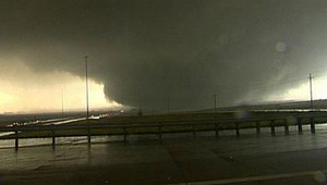
The 2008 Windsor Tornado highlights the very real danger twisters present in Colorado. Do you know when to do when one strikes?
One fact that may surprise those new to Colorado is that we are actually on the western edge of the infamous Tornado Alley. This large swath of land comprises much of the nation’s midsection and is a unique place as the United States sees more tornadoes than any other place on earth. In fact, tornadoes have been recorded in all 50 states including Alaska and Hawaii.
Closer to home, Colorado sees our share of these storms. In fact, one metro area county – Weld County – holds the distinction of being the “tornado capital of the world.” With 252 tornados from 1950-2011, no single county in the nation has had more tornadoes! Adams County is number two in the state and isn’t far behind with 156 over that same period. Granted these numbers are skewed a bit simply due to the sheer size of those counties, but it does serve to highlight the real danger that tornadoes present.
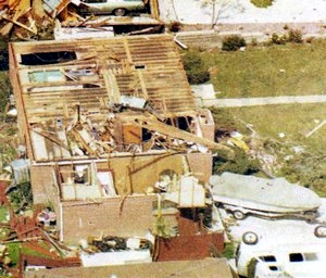
One common myth is that tornadoes don’t strike metropolitan areas. This has been disproved many times including here in Colorado in 1981 when an F2 tornado struck Thornton. Image courtesy the City of Thornton archives.
The most well known tornado outbreak in the metro area occurred on June 15, 1988. Five tornadoes resulted in seven injuries and damage in excess of $15 million.
The greatest threat for tornadoes occurs during late spring and early summer when you have a combination of heat and moisture in the lower atmosphere. Here in Colorado, tornadoes are frequent from May through August with June being the most active month.
Colorado ranks 10th in terms of the number of tornadoes with 1,911 events from 1950-2011. One good thing is that our high altitude and drier air do make it harder for the monster supercells that spawn the biggest tornadoes to form. Most of our tornadoes are small and short lived. Further, thanks to the wide open spaces of the eastern half of our state, many strike sparsely populated areas. This is reflected in the fact that we rank 38th for tornado related deaths.
April marks a transition between winter and summer for most of the country but for Denver it is especially true as we can see a stunning variety of weather.
The proverbial April showers are certainly a possibility for Denver. Snow? Tornadoes? Thunderstorms? You bet – all can happen!
For good measure throw in a chance for hail and even dust storms and April gives every type of weather condition you could like – or hate.
Old Man Winter isn’t done with the Mile High City just yet as evidenced by the bone-chilling cold this morning.
As measured at Denver International Airport, Denver’s low temperature plummeted to -7 degrees this morning. That easily bests the previous record low for March 10th of -3 degrees set in 1932.
Additionally, it puts March 10, 2022 into the books as being one of the top 10 coldest March temperatures on record and is the Mile High City’s coldest March reading since 1960.
Here in Thornton, we managed to escape getting quite that cold. We saw a low of 0 degrees at 4:12am.
Well, our Arctic blast is now in the record books.
As measured at Denver International Airport, the low temperature in the Mile High City dropped to -7 degrees this morning. That pretty easily bests the previous record low for February 23 of -4 degrees set in 1899.
Here in Thornton we stayed just a bit warmer with a low of -4 degrees.
February in Colorado typically brings to an end an extended period when average temperatures are at their lowest. Winter begins to loosen its grip and temperatures get warmer but precipitation is not a particularly common event during the month.
Thus far, our snow season has been a bit of a disappointment although January did help and the start of February offers some relief. February is only our sixth snowiest month so we can’t count on much else.
Temperatures however do usually see a nice rebound during the month. Average high temperatures climb from an average of 44 degrees at the start to 50 degrees by the end of February.
As we begin the new year the winter chill begins to set in. While January can see its share of extremes, the month historically sees stable temperatures and is usually relatively dry.
January ranks as the second coldest month in Denver next to December with average temperatures remaining virtually the same from the start to the end of the month.
In terms of snowfall, the month only ranks as the sixth snowiest and it is not uncommon for it to be quite dry.
What does January 2022 hold for us? Follow the link to find out.

 Extreme weather can occur during in month in Colorado we well know. June however is when traditional spring severe weather arrives in the state oftentimes with hail, damaging wind and tornadoes.
 February in Colorado typically brings to an end an extended period when average temperatures are at their lowest. Winter begins to loosen its grip and temperatures get warmer but precipitation is not a particularly common event during the month.
 As we begin the new year the winter chill begins to set in. While January can see its share of extremes, the month historically sees stable temperatures and is usually relatively dry.