All posts by Thornton Weather

ThorntonWeather.com is your local source for live Thornton, Colorado weather conditions and news!

October 26 to November 1: This Week in Denver Weather History

This Week in Denver Weather History
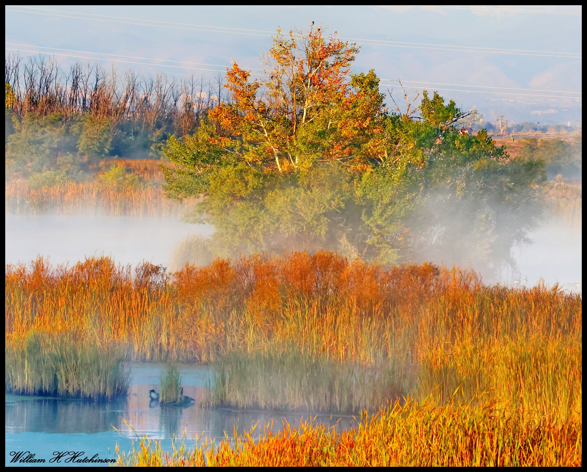
Wind can be one of the most frustrating weather conditions to experience and our look back at this week in Denver weather history shows the period has seen more than its fair share. Also notable are many significant snow events that have occurred in the Mile High City over the seven day period.

From the National Weather Service:

25-27

In 2021…the minimum temperature at Denver International Airport dropped into the single digits for three consecutive mornings: 8 degrees…4 degrees and 8 degrees respectively.

26

In 2010…very strong winds during the day knocked down power lines in parts of Boulder. The downed electrical lines sparked a small brush fire near Columbine Elementary School. Strong wind gusts also damaged the tennis bubble at the Millennium Harvest House. In Northglenn, a tree was knocked down and caused minor damage to a mini-van parked nearby. Peak wind gusts included: 70 mph at Berthoud…67 mph at Rocky Mountain Metropolitan Airport in Broomfield… 63 mph at the Rocky Flats National Wind Technology Center and 59 mph at the NCAR Mesa Laboratory…3 miles southwest of Boulder. West winds gusted to 43 mph at Denver International Airport.

In 2011…a powerful early season storm brought heavy snow to the Front Range and adjacent plains. The heavy…wet snow caused extensive downed large branches and in some cases…entire trees. Massive power outages occurred from Fort Collins and Greeley south to Denver and the surrounding metro area. Most of the trees still had their leaves…which helped to catch snow and down trees under the weight of the moisture laden snow. Nearly two hundred thousand utility customers along the Front Range were without heat and electricity for several hours. The Red Cross opened four temporary shelters overnight until the power could be restored. The outages also forced the closure of the Boulder Criminal Justice Center the following day. The fallen trees and branches also caused extensive property damage to roofs and automobiles. In the Front Range mountains and foothills…storm totals included 19.8 inches…3 miles west of Jamestown; 18 inches…5 miles west of copper; 13 inches…3 miles north of Blackhawk and 3 miles south of Evergreen…4 miles east-northeast of Nederland and Lake Eldora; 12 inches at Berthoud SNOTEL. Across the urban corridor storm totals included: 11.5 inches in Boulder; 9.5 inches at the national weather service in Boulder; 9 inches…1 mile southwest of Westminster; 8.5 inches in Broomfield… Denver International Airport…Frederick and Louisville; 8 inches in Aurora…7 inches in Watkins; with 6 inches in Arvada.

25-26

In 1996…4 to 6 inches of snow fell in the foothills west of Denver. Only 1.5 inches of snowfall were measured at the site of the former Stapleton International Airport on the 26th. This was the only measurable snow of the month at the site. The snowfall produced icy and snowpacked highways…which resulted in a 50-to 60-car pileup on I-25 south of metro Denver. West winds gusted to 33 mph at Denver International Airport.

In 2006…a winter storm brought heavy snowfall to metro Denver and the eastern foothills. Total snowfall ranged from 12 to 22 inches over the higher terrain and 6 to 12 inches across metro Denver. Northerly winds at sustained speeds of 20 to 30 mph with gusts as high as 47 mph at Denver International Airport whipped the snow into drifts 3 to 4 feet deep. Many tree limbs snapped under the weight of the heavy…wet snow which also downed power lines… Leaving thousands of residents without power. Storm total snowfall included: 25 inches near Aspen Springs…Conifer… And Evergreen; 23.5 inches near Rollinsville; 23 inches in Idaho Springs; 22.5 inches near Blackhawk; 21.5 inches near Bailey; 19 inches near Bergen Park; 18 inches near Aspen Springs…Genesee…and Jamestown; 17 inches southwest of Boulder; 16 inches in Evergreen; and 15 inches near Georgetown and Perry Park. Snowfall totaled 5.3 inches in the Denver Stapleton area. At Denver International Aiport…rain…including a thunderstorm…changed to snow on the evening of the 25th after a high temperature of 70 degrees.

In 2010…a storm system brought heavy snow to the mountains west of Denver. Storm totals included: 24 inches at the Eisenhower Tunnel…18 inches at Loveland Ski Area; with 16 inches at Arapahoe basin.

25-27

In 1897…a major storm dumped 13.5 inches of snowfall over downtown Denver. Rain changed to snow during the evening of the 25th and continued through mid-morning of the 27th. Most of the snow…12.0 inches…fell on the 26th when north winds were sustained to 36 mph and gusts were as high as 46 mph. Temperatures during the storm were in the 20’s and lower 30’s. Precipitation (rain and melted snow) totaled 1.21 inches.

Continue reading October 26 to November 1: This Week in Denver Weather History

October 2025 top shots: Monthly photo slideshow

October 9, 2025 - A beautiful fall scene. (Bill Hutchinson)
October 9, 2025 – A beautiful fall scene. (Bill Hutchinson)

October in Thornton can bring a wide variety of weather conditions, perfect for the photographer in all of us.

The month brings the changing of the colors at Colorado’s lower elevations and it is also is typically when we see our first freeze and first snow.

Couple those facts with our usual widely varying landscapes and wildlife and we have a month that is sure to bring in plenty of photo opportunities.

  • Slideshow updated October 26, 2025
  • To learn more about how to send your photo to us for inclusion in the slideshow, see below the slideshow.

Showcasing images captured by ThorntonWeather.com readers as well as some of our own, our monthly slideshow covers the entire gamut of weather-related imagery.

Sunsets, sunrises, wildlife and of course every type of weather condition are vividly depicted in images captured from yours and our cameras.

What is missing in the slideshow above?  Your photo!

Our monthly photo slideshow is going to feature images that we have taken but more importantly images that you have captured.  The photos can be of anything even remotely weather-related.

Landscapes, current conditions, wildlife, pets, kids.  Whimsical, newsy, artsy.  Taken at the zoo, some other area attraction, a local park, a national park or your backyard.  You name it, we want to see and share it!

Images can be taken in Thornton, Denver or anywhere across the extraordinary Centennial State.  We’ll even take some from out of state if we can tie it to Colorado somehow.

We’ll keep the criteria very open to interpretation with just about any image eligible to be shown in our slideshows.

What do you win for having your image in our slideshow?  We are just a ‘mom and pop’ outfit and make no money from our site so we really don’t have the means to provide prizes.  However you will have our undying gratitude and the satisfaction that your images are shared on the most popular website in Thornton.

To share you images with us and get them included in the slideshow just email them to us or share them with ThorntonWeather.com on any of the various social media outlets.  Links are provided below.

So come on, get those camera’s rolling!

ThorntonWeather.com enters its 20th year of operation

ThorntonWeather.com enters its 20th year of operation. (AI image generated with CoPilot)

From a random anniversary gift to becoming Colorado’s longest running independent source for weather news and data. Crazy, eh?

It was 19 years ago on October 25, 2006, that ThorntonWeather.com went live and the first bits of live weather data from our weather station were fed to the Internet.

My wife had gotten me a home weather station for our anniversary a few months earlier. It was fun to be able to see what the weather conditions were right where we lived in Thornton – not DIA or downtown Denver where conditions can be dramatically different.

It didn’t take long though and I soon desired more. I wanted to be able to monitor that weather station from anywhere and thus, with the help of the home weather station community, created the first version of the website.

  • Did you know ThorntonWeather.com is a completely non-profit venture run by a Thornton resident?  We are self-funded but do occasionally receive help from members of the community, something which allows us to keep things up and running. Learn more about how you can help here.

Word soon got out among residents of the north Denver metro area and traffic to the site boomed. Stories in print media helped spread the word.

We are proud to have become a valuable resource for the community providing real time weather data, forecasts, historical climate information, satellite imagery, webcams and so much more.

We’re just ‘weather geeks’ that love the weather and love our community.  Running ThorntonWeather.com can be a bit expensive and it is time consuming to maintain and operate it but it is worth it.

We’d like to thank all of our visitors for your support in the past and we look forward to continuing to be the best, truly local source for Thornton weather.

October 19 to October 25: This Week in Denver Weather History

This Week in Denver Weather History

As we enter the latter half of October, wintry weather stands a better chance of occurring. Our look back at this week in Denver weather history shows many snowy events including a record-setting storm in 1997 that dumped nearly 22 inches on the Mile High City.

From the National Weather Service:

17-19

In 1908…a moist…heavy…wet snowfall totaled 13.0 inches in downtown Denver over the 3 days. Rain from early morning on the 17th changed to snow by late afternoon and continued through the late morning of the 19th. Due to temperatures in the 30’s and melting…the most snow on the ground was only 5.0 inches at 6:00 pm on the 18th. Northwest to northeast winds were sustained between 12 and 20 mph during the storm. Precipitation totaled 1.82 inches.

18-23

In 2003…an extended warm spell resulted in 5 new temperature records. The high temperature of 84 degrees on the 18th equaled the record high for the date. High temperatures of 86 degrees on the 19th…83 degrees on the 21st…and 84 degrees on the 22nd were record highs for the dates. Low temperature of 49 degrees on the 23rd was a record high minimum for the date. Low temperatures during the period were in the 40’s and lower 50’s.

19

In 1887…northwest winds sustained to 42 mph were recorded in the city.

In 1982…3 to 6 inches of snow fell over northwest metro Denver…including Boulder. Only 1.2 inches of snowfall were recorded at Stapleton International Airport where north winds gusted to 35 mph. This was the first measurable snowfall of the season.

19-20

In 1990…an early winter storm dumped heavy snow across metro Denver. Snowfall amounts ranged from 4 to 8 inches in the foothills above 6500 feet elevation…4 to 7 inches in the Castle Rock area…and 2 to 5 inches across most of metro Denver and Boulder. Snowfall totaled 3.6 inches at Stapleton International Airport where northwest winds gusting to 48 mph kicked up some blowing dust shortly after a cold frontal passage on the 19th. However… Temperatures were warm enough to keep most roadways wet and slushy at lower elevations.

19-23

In 1906…heavy snowfall totaled 22.7 inches in the city over the 5 days. Rain changed to snow on the evening of the 19th…and snow continued through the late afternoon of the 23rd. The heaviest amount of snowfall…16.0 inches…fell from 8:00 pm on the 20th to 8:00 pm on the 22nd. The most snow on the ground was 13.3 inches on the evening of the 23rd. This was the first snow of the season and the only snow of the month. Winds during the storm were from the north at sustained speeds of 20 to 30 mph each day. Temperatures during the storm were generally in the 20’s.

20

In 1878…between 3:00 pm and 4:00 pm wind speeds averaged 48 mph with a maximum 1 minute sustained velocity to 96 mph at both 3:27 pm and 3:48 pm in downtown Denver. This is the highest sustained wind speed ever recorded in the city.

In 1986…a rare late October thunderstorm produced 3/4 inch diameter hail at Centennial Airport. Hail piled up 2 1/2 inches deep…causing some street flooding in south metro Denver.

In 2019…strong bora winds swept across the foothills and adjacent plains. Peak gusts included: 82 mph…3 miles southwest of Rocky Flats; 78 mph near White Ranch Open Space; 75 mph near Genesee and Georgetown; with 63 mph at Firestone. At Denver International Airport…a peak gust of 49 mph was observed from the west.

20-21

In 2007…a storm system brought heavy snow to the southern Denver suburbs as well as the Palmer Divide south of Denver. Storm totals included: 7.5 inches near Castle Rock…Lone Tree and Greenwood Village…with 6.5 inches at Elizabeth. Snow drifts up to 2 feet deep were observed 6 miles south-southwest of Elizabeth. In the Denver Stapleton area…2.0 inches of snow was observed.

In 2009…heavy snow developed along the palmer divide south and southeast of Denver as a storm system tracked across southern Colorado and northern New Mexico. Storm totals included: 15 inches…15 miles north of Elizabeth…9 inches…5 miles south-southwest of Arapahoe Park; 8 inches in Highlands Ranch…5 miles south- southeast of Sedalia; 6.5 inches…8 miles southwest of Bennett and 6 inches in Parker. At Denver International… Only 1.5 inches of snowfall was observed.

Continue reading October 19 to October 25: This Week in Denver Weather History

October 12 to October 18: This Week in Denver Weather History

This Week in Denver Weather History

Like any month, October can bring a wide variety of weather conditions and our look back at this week in Denver weather history shows it has been a particularly active one. The week has seen everything from monstrous snowstorms including the infamous ‘Bronco Blizzard’ to damaging hail and even tornadoes.

From the National Weather Service:

10-12

In 1969…the second heavy snowstorm in less than a week dumped nearly a foot of snow across metro Denver and plunged the area into extremely cold temperatures for so early in the season. Snowfall totaled 11.0 inches at Stapleton International Airport. North winds gusting to 26 mph produced drifts up to 2 feet deep. Temperatures dipped from a high of 52 degrees on the 10th to a record low for the date of 10 degrees on the 12th. There was additional damage to trees and power and telephone lines from heavy snow accumulations and icing. Travel was restricted or blocked by drifting snow in both the mountains and on the plains east of Denver.

11-12

In 1901…an apparent cold front produced northeast winds sustained to 42 mph with gusts to 48 mph on the 11th. General rain changed to snow overnight and totaled 2.0 inches. This was the first snowfall of the season. Total precipitation was 0.32 inch.

11-13

In 1892…apparent post-frontal rainfall totaled 3.33 inches in downtown Denver over the 3 days. A trace of snow on the 12th melted as it fell. Rainfall of 2.58 inches on the 12th into the 13th was the greatest 24-hour precipitation ever recorded during the month of October. Northwest winds were sustained to 48 mph with gusts as high as 55 mph on the 12th.

12

In 1873…smoke from several very large forest fires was sighted along the mountains.

In 1923…post-frontal rain changed to snow and totaled 4.0 inches. North winds were sustained to 14 mph.

In 1978…northeast winds gusting to 35 mph with a strong cold front briefly reduced visibility to 2 miles in blowing dust at Stapleton International Airport.

12-13

In 2001…overnight peak wind gusts to 82 mph and 70 mph were measured atop Niwot Ridge and Squaw Mountain… Respectively.

12-14

In 1969…record breaking extremely cold temperatures for so early in the season occurred. The high temperature of 26 degrees on the 13th was two degrees lower than the previous record minimum temperature of 28 degrees for the date set in 1885. The high temperature of 24 degrees on the 12th exceeded the record low temperature (22 degrees set in 1885) for the date by only 2 degrees. In addition… 3 new record low temperatures for the dates were set. The low temperature dipped to 10 degrees on the 12th breaking the old record (22 degrees in 1885) by 12 degrees. On the 13th the mercury plunged to a low of 3 degrees breaking the old record (28 degrees in 1885) by 25 degrees. On the 14th the temperature reached a minimum of 4 degrees breaking the old record (25 degrees in 1966) by 21 degrees.

13

In 1990…strong downslope winds stirred up clouds of dust and gravel…rattled windows…and stripped autumn-colored leaves from trees in Boulder. A wind gust to 78 mph was clocked in southwest Boulder…while a 96 mph gust was recorded in northwest Boulder. West winds gusted to only 36 mph at Stapleton International Airport.

Continue reading October 12 to October 18: This Week in Denver Weather History

Throwback Thursday: Images of the June 15, 1988, tornado outbreak in Denver.

June 15, 1988 - Tornadoes strike Denver, Colorado. (ThorntonWeather.com)
June 15, 1988 – Tornadoes strike Denver, Colorado. (ThorntonWeather.com)

This was a fun find! I was going through old family photos and came across these images of a famous – and destructive – Denver weather event.

At that time, I was staying with my sister at her house on Fox Street near 96th Ave in Thornton. The weather was clearly getting spicy and where she lived provided clear views to the south and southeast.

We were amazed to watch multiple twisters strike in and around the city, me grabbing pictures with my old 35mm Canon AE-1 Program.

The National Weather Service history for the event describes “several” tornadoes. The most powerful was an F3 that struck in south Denver and was on the ground for 25 minutes. That twister alone damaged 85 buildings and many vehicles. Miraculously, no serious injuries or deaths were reported.

Below see more pictures I took that day and you can read the official account from the NWS and watch some archived news stories from the day.

From the National Weather Service:

In 1988…several tornadoes developed across metro Denver. One tornado touched down just northeast of the rocky mountain arsenal. The twister moved very slowly and did no damage…except to demolish a small electrical substation… Even though it was on the ground for nearly 30 minutes. Later…another tornado was sighted east of Brighton about 2 miles north of Barr Lake. An f2 tornado cut a swath through northeast Denver. The main path went through a thickly wooded area for about 6 blocks and uprooted about 500 city owned trees…many of them large elms 75 to 100 years old. Hundreds of privately owned trees were also sucked from the ground by the slow moving twister…which was filmed by a news team in a helicopter as it uprooted trees. The replacement cost to the city owned trees was estimated at 1.5 million dollars. The twister did little damage to buildings. Some homes suffered roof and chimney damage…a gas main was ruptured…and some cars were damaged by falling trees. The uprooted trees also caused curb and sidewalk damage and cut some electrical wires. The funnel cloud passed close to Stapleton International Airport. Aircraft operations were shut down…and the tower was evacuated. The tornado was on the ground for almost 25 minutes. An f3 tornado cut an erratic path through south Denver for about 25 minutes…causing extensive damage in at least 3 areas. The twister damaged about 85 buildings… 20 severely; the total loss was estimated at 5 to 10 million dollars. Many cars were severely damaged; at least 15 vehicles were overturned. One trailer was lifted onto the top of a building that had just been unroofed; numerous antique cars inside the building were damaged. A Ford Bronco was blown over a church…and landed 100 yards away. A metal storage shed was deposited far above the ground in some power lines. The tornado uprooted many trees on a golf course. No one was seriously hurt…although seven people suffered minor injuries from flying debris. A golfer was thrown 40 feet…but was not hurt; a man clinging to a telephone pole was unscathed…but lost both shoes…a sock…and buttons off his shirt. A woman holding a baby was sucked through a broken convenience store window… But was unhurt. A dog…tethered to the ground by its leash… Was suspended in the air by the twister. Uprooted trees crushed cars and damaged curbs and sidewalks. People in downtown Denver could see three tornadoes occurring simultaneously. Hail as large as 1 3/8 inches in diameter fell in extreme southeast Aurora.

October 5 to October 11: This Week in Denver Weather History

This Week in Denver Weather History

Fall in Colorado is typically calm but that is not always the case. Our look back at this week in Denver weather history showcases many high wind events as well as early fall snowfalls.

From the National Weather Service:

3-5

In 1984…the remnants of Pacific Hurricane Polo produced heavy rain over northeastern Colorado. Most locations received between 1.00 to 2.50 inches of rain…but 3.45 inches fell in Littleton. Rainfall totaled 1.73 inches at Stapleton International Airport…where north winds gusted to 24 mph.

4-5

In 1997…unusually warm weather resulted in two temperature records. High temperature of 87 degrees on the 4th exceeded the old record set in 1922 by one degree. High temperature of 86 degrees on the 5th equaled the record set in 1990 and previous years.

5

In 1962…unusually severe thunderstorms for this late in the season affected areas from Boulder northward. Hail up to golf ball size and strong gusty winds did much damage to roofs…windows…and signs in Boulder. Heavy rainfall caused local flooding.

In 1994…lightning caused a power outage to over 2400 homes for a few hours in and around Nederland in the foothills southwest of Boulder. Very strong winds accompanied the thunderstorm. Thunderstorm winds gusted to 60 mph and hail to 1/2 inch diameter fell in Lafayette. Strong microburst winds gusting to 69 mph near Strasburg caused an oil rig to topple onto two vehicles…injuring one person. The strong winds in the area also downed a few power poles… But caused power outages to only a few homes.

In 1995…strong winds spread from the foothills onto the plains. Wind gusts to 77 mph were reported atop Squaw Mountain west of Denver. On the plains…winds gusted to 60 mph at Kennesburg and to 62 mph near Strasburg. North winds gusted to 41 mph at Denver International Airport.

6

In 1900…northwest winds were sustained to 40 mph with gusts as high as 50 mph in downtown Denver.

In 1903…northwest winds were sustained to 40 mph with gusts to 50 mph. The strong winds warmed the temperature to a high of 71 degrees in the city. The low reading was only 46 degrees.

In 1910…light smoke from forest fires drifted over the city.

In 1976…an arctic cold front brought light snow over the foothills above 6 thousand feet. Traffic was snarled at many locations. Only a trace of snow fell at Stapleton International Airport where rainfall totaled 0.20 inch and northeast winds gusted to 41 mph.

In 1991…the brilliant orange sunset was apparently the result of an extensive volcanic smoke layer in the upper atmosphere.

In 1994…strong west to northwest winds developed in the foothills above 9500 feet. A wind gust to 78 mph was recorded atop Squaw Mountain west of Denver and to 72 mph at Ward northwest of Boulder. Northwest winds gusted to 35 mph at Stapleton International Airport.

In 2011…strong winds developed in and around the Denver area ahead of an approaching storm system. At the National Wind Technology Center…peak wind gusts ranged from 79 to 92 mph during the early morning hours. Across metro Denver…the strong winds toppled a few trees and damaged patio furniture. The wind caused a few flight delays at Denver International Airport due to a partial ground stoppage of incoming flights. Peak wind reports also included: 66 mph at cedar point…63 mph at Denver International Airport…60 mph at Buckley Air Force Base; 59 mph at Highlands Ranch; 58 mph at Deer Trail and Rocky Mountain Metro Airport in Broomfield; 55 mph at Bennett…Centennial Airport and City Park in Denver.

7

In 1903…north winds were sustained to 40 mph with gusts to 48 mph.

In 1917…post-frontal northwest winds were sustained to 45 mph with gusts to 52 mph. Rain was mixed with a trace of snow…the first of the season. Precipitation totaled 0.22 inch and included the occurrence of hail… Even though no thunder was heard.

In 1950…strong winds caused a power outage in Boulder. This was the heaviest windstorm since January. Damage was minor. Northwest winds gusted to only 35 mph at Stapleton Airport.

In 1985…strong Chinook winds buffeted the Front Range foothills. Wind gusts between 60 and 70 mph were reported in Boulder and atop Squaw Mountain west of Denver. Southwest winds gusted to 41 mph at Stapleton International Airport.

7-8

In 1990…the season’s first snow occurred. Snowfall amounts varied from 3 to 7 inches across metro Denver. Snowfall totaled 4.0 inches at Stapleton International Airport where north winds gusted to 29 mph.

8

In 1923…southeast winds were sustained to 44 mph with gusts to 47 mph. The strong winds persisted through the afternoon. The high temperature of 77 degrees was the warmest of the month that year.

In 1975…a wind gust to near 100 mph was recorded in Boulder. Frequent wind gusts to 60 mph were reported along the foothills causing only minor damage. West winds gusted to 45 mph at Stapleton International Airport.

8-9

In 2017…an early season snowstorm produced heavy wet snow which broke branches and downed power lines. About ninety-eight thousand outages occurred in Denver and the surrounding metro area. Almost half the outages were very short…while 54210 were sustained outages that lasted longer than five minutes. Some however lasted for several hours. Snow amounts varied greatly along the Interstate 25 Corridor. West of I-25…storm totals included: 7.5 inches in Arvada…7 inches in Broomfield…6 inches Boulder and Louisville…with 5 inches at Ralston Reservoir. East of I-25…storm totals ranged from a trace to 4 inches. In the mountains and foothills…storm totals included: 12.5 inches near Genesee…10 inches at Eldorado Springs… Idledale and Nederland…with 8.5 inches near Jamestown.

9

In 1910…light smoke from forest fires in the mountains was sighted over the city.

In 1982…northwest winds gusted to 49 mph at Stapleton International Airport.

Continue reading October 5 to October 11: This Week in Denver Weather History

September 2025 Weather Recap: Temps near normal, precipitation well above average

Thornton, Colorado's September 2025 temperature summary. (ThorntonWeather.com)
Thornton, Colorado’s September 2025 temperature summary. (ThorntonWeather.com)

Thornton was finally able to break out of the hot, dry weather pattern of recent months and see things get a bit more normal. September historically is one of our most pleasant months and 2025 largely held true to that.

We did start out pretty mild and precipitation was meager for the first half of the month. Finally, on the 13th, we began to see things cool down and then on the 16th got a nice shot of rain (0.61”).

The rest of the month offered mild but comfortable temperatures. A strong trough on the 23rd cooled us considerably with that day offering high temperatures nearly 20 degrees below normal. It also brought a very healthy shot of rain (1.21″).

In the end, the average temperature for the month of September ended up very close to average. Thornton’s average for the month was 64.6 degrees. This was just a hair higher than our 19 year running average for the month of 64.3 degrees. Our maximum temperature for the month was 92 degrees and came on the 10th. Our coolest reading of 42.3 degrees was on the 25th.

For Denver, at Denver International Airport where the Mile High City’s official measurements are taken, temperatures were on par with ours. They reported an average for the month of 64.7 degrees. This was close to their long term average for September of 64.8 degrees.

In terms of precipitation, Thornton saw a notable 2.09 inches for the month. This was far above our 19-year running average of 1.51 inches for September. This was the fourth wettest September over that period.

The Mile High City was quite a bit drier with 1.35 inches recorded in their rain bucket. It was, however, above their long term average for the month of 1.09 inches.

No snow was recorded in Thornton or Denver for the month.

Click here to view Thornton’s complete September 2025 climate summary report.

Thornton, Colorado's September 2025 precipitation summary. (ThorntonWeather.com)
Thornton, Colorado’s September 2025 precipitation summary. (ThorntonWeather.com)

Thornton’s October 2025 preview: Generally calm conditions with our first freeze and snow

The month of October.

With the first full month of fall here, October usually brings one of the quietest weather months in the Denver area with plenty of mild, sunny days and clear, cool nights.

October is historically the second sunniest month and conditions are generally calm.

However we also will usually see our first taste of winter during the month with the first freeze and first snowfall of the season.  Temperatures as well will start to drop and by the end of the month the average nighttime lows are below freezing.

For complete details on our historical October weather and what we can expect in the coming month, read our complete October weather preview here.

  • Don’t miss a thing when it comes to our ever-changing weather! Be sure to ‘like’ us on Facebook and follow us on Twitter.