Tag Archives: September Weather

September 26 to October 2: This week in Denver weather history

This Week in Denver Weather History

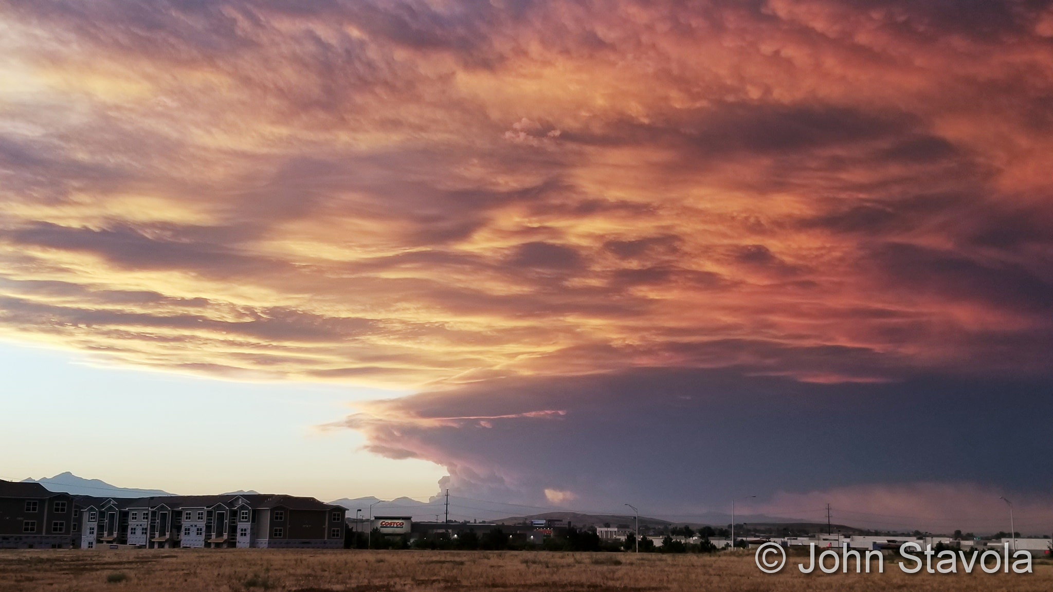
Denver has been graced with an unusually mild September this year.  That however is not always the case and in fact the weather can be downright winterish as we see in our look back at this week in Denver weather history.

25-26

In 1908…apparent post-frontal rain changed to snow overnight and totaled 6.5 inches in downtown Denver.  This was the first snow of the season.  Precipitation totaled 0.76 inch. North winds were sustained to 39 mph on the 25th.

25-27

In 1996…an early season snowstorm brought heavy snow to the Front Range eastern foothills.  Snowfall totals included:  8 to 12 inches around conifer…7 inches on Floyd Hill…and 6 inches at both Bailey and Chief Hosa. Snowfall totaled only 4.7 inches at the site of the former Stapleton International Airport.  This was the first measurable snow of the season.  After the passage of a strong cold front…north winds gusted to 38 mph at Denver International Airport on the 25th.

26

In 1907…a late afternoon thunderstorm produced hail…0.23 inch of precipitation…and north winds sustained to 24 mph.

In 1927…snowfall of 1.7 inches…mixed at times with sleet… Was the first measurable snowfall of the season.

In 2012…a man was seriously injured when he was struck by lightning outside the Hebrew Educational Alliance as he and his family were getting in their car. The victim stopped breathing but was saved when his wife performed cardiopulmonary resuscitation on him immediately following the lightning strike. He suffered burns to 15 percent of his body which included his legs…chest… abdomen and neck. Lightning also caused 48 outages in Denver which affected 6582 Xcel Energy customers.

26-28

In 1936…the heaviest snowfall ever recorded in September and the heaviest snowfall ever recorded so early in the season dumped a total of 16.5 inches of snow on downtown Denver and 21.3 inches at Denver municipal airport.  The 15.0 inches of snow measured from 6:00 pm on the 27th to 6:00 pm on the 28th is the greatest 24 hour snowfall ever recorded in September.  This was the first snow of the season.  The snow was intermittent through the 26th…but continuous from early afternoon on the 27th to around midnight on the 28th…except for a period of rain during the afternoon of the 28th which contributed to a loss of depth on the ground.  The greatest snow depth on the ground downtown was 13 inches with 8 inches at Denver municipal airport.  There were no high winds with the storm and traffic was interrupted for only a short period.  The storm produced property damage estimated at 7 million dollars.  With trees and shrubs in full foliage…the leaves caught and held the heavy water-laden snow…until the branches snapped from the weight.  More than 3000 workmen were called to remove the debris and snow from the city.  The city firemen who were off duty…as well as all the reserves… Were asked to report to their stations.  All schools in the city remained open…but attendance was only 50 percent of normal.  Grade school students were sent home at noon on the 28th.  The early storm caught stockmen with many cattle still in higher ranges.  Warm weather followed the snow…which had all melted by the end of the month…except for a few inches in sheltered places.

27

In 1877…smoke from heavy forest fires in the mountains spread over the city on upper wind currents.

In 1935…the first snow of the season was 2.8 inches in downtown Denver.  The low temperature dipped to 31 degrees for the first freeze of the season.

27-28

In 1984…heavy snow fell over the plains and foothills. Snowfall amounts ranged from 2 to 5 inches on the plains with up to a foot at higher elevations in the foothills. The main problem caused by the storm was thousands of power outages caused by snow-laden tree limbs snapping and falling onto power lines.  Over 15 thousand homes lost power in metro Denver.  Some cars were damaged by falling trees and limbs.  The snow also caused some flight delays at Stapleton International Airport where 5.1 inches of snow fell and northeast winds gusted to 29 mph.  Maximum snow depth on the ground was 3 inches due to melting.  The high temperature of only 34 degrees on the 28th was a record low maximum for the date and equaled the all-time record for the month at that time.

28

In 1877…heavy dense smoke from mountain forest fires spread over the city.  The smoke was so dense that it obscured the sun at times.

In 1921…post-frontal northeast winds were sustained to 44 mph.

In 1953…a pacific cold front produced a west wind gust to 59 mph at Stapleton Airport where the visibility was briefly reduced to 3/4 miles in blowing dust.  Strong winds were also widespread over Boulder during the afternoon.

In 1960…strong…gusty winds tore the roof from 6 units of a motel on west Colfax Avenue in Denver.  The roofing sailed over the building and crashed down on a truck…wrecking it. The strong winds were the result of an apparent microburst.

In 1999…snow fell in the foothills west of metro Denver and over the plains.  Snowfall totals included 7 inches at conifer.  At the site of the former Stapleton International Airport…3.1 inches of snow were measured.  This was the first snow of the season.  The heavy wet snow snapped branches from fully leafed trees…downing power lines and causing scattered outages.

In 2004…severe thunderstorms produced hail to 3/4 inch in diameter in Littleton and in Douglas County 14 miles northwest of Castle Rock.

In 2012…a weak tornado (EF-0) tornado touched down near Strasburg. No damage was reported.

Continue reading September 26 to October 2: This week in Denver weather history

September 19 to September 25: This week in Denver weather history

This Week in Denver Weather History

This time of year many folks would consider “snow” a bad four-letter word but living in the Mile High City we can’t rule it out even with it technically still being summer.  In fact, it was only 15 short years ago that we received a significant snowstorm that brought up to 8 inches of snow in the metro area and caused millions of dollars in damage.

From the National Weather Service:

15-19

In 1906…rain on 5 consecutive days totaled 1.61 inches. A thunderstorm occurred on the 17th.  High temperatures ranged from 48 degrees on the 16th to 65 degrees on the 15th.  Low temperatures were in the lower to mid 40’s.

16-19

In 1971…a record breaking early fall snow storm caused extensive damage to trees and utility lines.  The heavy wet snow occurred with little wind…but caused record breaking cold temperatures for so early in the season.  Snowfall totaled 15.6 inches at Stapleton International Airport with most of the snowfall…12.0 inches…occurring on the 17th.  This was the heaviest first snow of the season. The maximum snow depth on the ground was 13 inches. Record low temperatures were set on three consecutive days: 31 degrees on the 17th…23 degrees on the 18th…and 20 degrees on the 19th…which was also a new all-time record minimum for the month at that time.  Record low maximum temperatures were set on 4 consecutive days:  48 degrees on the 16th…35 degrees on the 17th…40 degrees on the 18th… And 42 degrees on the 19th.

18-19

In 1955…heavy rains caused flash flooding across portions of metro Denver.  Rainfall totaled 1.71 inches at Stapleton Airport.

19

In 1955…hail stones to 2 1/2 inches in diameter were reported north of Denver.  The large stones broke many automobile windshields.

In 1963…hail to 3/4 inch in diameter fell in Westminster.

In 1983…an unusually strong cold front roared through metro Denver during the afternoon hours.  At Stapleton International Airport…the temperature dropped 51 degrees… From a sunny 86 degrees to a snowy 35 degrees…in just 7 hours.  Strong winds and a wall of blowing dust followed the front.  Northeast winds gusting to 36 mph briefly reduced the surface visibility to 1 mile in blowing dust at Stapleton International Airport where only a trace of snow fell later.

In 1996…high winds gusting to 84 mph were measured at Golden Gate Canyon in the foothills west of Denver. West winds gusted to only 25 mph at Denver International Airport.

20

In 1921…an apparent Bora produced northwest winds sustained to 44 mph with gusts to 64 mph.

In 1955…hail stones 1/2 to 3/4 inch in diameter were reported across parts of the city of Denver.

In 1992…weather observers at Buckley Air National Guard base sighted two tornados southeast of the base.  The tornados were short-lived and caused no injuries or damage.

20-21 in 1963…heavy rain and hail caused local flooding in southeast Denver.  Thunderstorm rainfall was only 0.60 inch at Stapleton Airport on the 20th.

In 1983…the cold front on the 19th brought an unusually cold air mass into metro Denver for so early in the season.  The temperature dipped to a daily record minimum of 28 degrees on both days.

In 1995…a vigorous late summer storm brought the season’s first heavy snow to portions of metro Denver.  Millions of trees were damaged and power lines downed as 4 to 8 inches of heavy wet snow settled on fully leafed trees in the Boulder and Denver areas.  Branches snapped and trees split under the weight of heavy snow…downing power lines. Firefighters responded to numerous transformer fires. Around 100 thousand people were left without electricity in Boulder and Denver areas alone.  It took over a week to fully restore power to some areas.  Insurance claims were estimated to be around 6 million dollars to homes in metro Denver and about 500 thousand dollars in damage to automobiles.  It was estimated that about 80 percent of 125 million dollars worth of city owned trees in Denver were damaged.  Snowfall totaled 7.4 inches at the site of the former Stapleton International Airport where the greatest depth of snow on the ground was only 4 inches due to melting.  Temperature records were set on the 21st when the thermometer dipped to a record low reading of 27 degrees and climbed to a high of only 36 degrees… Setting a record low maximum for the date.  North winds gusted to 29 mph at Denver International Airport on the 20th.

Continue reading September 19 to September 25: This week in Denver weather history

September 12 to September 18: This week in Denver weather history

This Week in Denver Weather History

Normally one doesn’t associate tornadoes with September weather in Denver but they can and do happen as we see in our look back in Denver weather history for the week.  We have a couple of occasions of twisters and of a funnel cloud.  Other severe weather like hail, damaging wind and flooding rains have also occurred.   Oh, and should we mention the dreaded “S” word – snow?

5-13

In 2010…the Fourmile Canyon Wildfire…northwest of Boulder… broke out on the morning of the 5th. It originated from an unattended fire pit at a local residence. The wildfire quickly consumed 5 1/2 square miles or 3500 acres the first day…and forced the evacuation of over three thousand residents. Erratic 45-mph gusts sent the fire in two directions at times. Very dry weather conditions preceded the fire. The combination of strong winds…low relative humidities and dry fuels allowed the wildfire spread rapidly through the steep…heavily forested terrain. The flames were reportedly 20 to 50 feet in length. Towns within the burn area included Salina…Wallstreet and Gold Hill. The dry conditions coupled with gusty winds ranging from 45 to 64 mph persisted for several more days. Fire managers used as many as 700 firefighters and support personnel from 35 agencies and seven air tankers to battle the wildfire. A total of 6181 square acres or approximately 10 square miles were burned. The Fourmile Canyon Wildfire was the most destructive fire in Colorado history in terms of the damage to personal property. It destroyed 171 homes with an estimated cost of 217 million dollars.

11-16

In 2013…a deep southerly flow over Colorado… Ahead of a nearly stationary low pressure system over the great basin… Pumped copious amounts of monsoonal moisture into the area. In addition…a weak stationary front stretched along the Front Range foothills and Palmer Divide.  This resulted in a prolonged period of moderate to heavy rain across the Front Range foothills…Palmer Divide…urban corridor. By the 14th…storm totals ranged from 6 to 18 inches… Highest in the foothills of Boulder County. The headwaters then moved down the South Platte River and caused widespread flooding with record flood stages at several locations as it made its way downstream.  The record high flood stages resulted in widespread flooding along the South Platte River basin. The flood damage encompassed 4500 square miles of the Front Range…left 7 dead… Forced thousands to evacuate…and destroyed thousands of homes and farms. Record amounts of rainfall generated flash floods that tore up roads and lines of communication… Leaving many stranded. Nearly 19000 homes were damaged… And over 1500 destroyed. Colorado department of transportation estimated at least 30 state highway bridges were destroyed and an additional 20 seriously damaged. Preliminary assessments of the state`s infrastructure showed damage of $40 million to roads and $112 million to bridges. Repair costs for state and county roads ran into the hundreds of millions of dollars. Miles of freight and passenger rail lines were washed out or submerged… Including a section servicing Amtrak`s iconic California Zephyr. The town of Lyons was isolated by the flooding of St. Vrain creek…and several earth dams along the Front Range burst or were over-topped. Floodwaters swept through Estes Park; damaged hundreds of buildings and destroyed large sections of U.S. 34 from Loveland and U.S. 36 from Lyons to Boulder. U.S. 34 suffered the most damage… With 85 percent of its roadway and bridges destroyed. In Weld County…about nearly two thousand gas wells were damaged and had to be closed off as the floodwaters inundated entire communities. Sewage treatment plants and other utilities were knocked out in a number of towns. Governor Hickenlooper declared a disaster emergency on September 13th…in 11 counties across northeast Colorado including:  Adams…Arapahoe…Broomfield…Boulder…Denver…  Jefferson…Larimer…Logan…Morgan… Washington and Weld. By the 15th…federal emergency declarations covered those counties as well as Clear Creek County. Projected losses from the flooding statewide was nearly two billion dollars in property damage…according to Eqecat… A catastrophe modeling firm.  The damage was most severe in and around Lyons and Boulder.  More than 11 thousand people were evacuated…reportedly the largest since Hurricane Katrina. President Obama declared a state of emergency for Boulder and Larimer counties.  An additional 10 counties were added on the 16th and included: Adams… Arapahoe…Broomfield…Clear Creek…Denver…Jefferson…  Morgan…Logan… Washington and Weld counties. The president also declared a major disaster specifically for Boulder County.  There were six fatalities directly attributed to flash flooding. Two 19-yr old teenagers died on the 11th…after they were swept away by floodwaters after abandoning their car on Lindon Drive in Boulder. In Jamestown…a 72-yr old man was killed when the building he was in collapsed. An 80-yr old Lyons resident died in the early morning hours of the 12th…when his truck was swept into the St. Vrain River near his home. Later on the 12th…a 79-yr old Larimer County resident was killed when she was swept away while trying to climb to safety from her home in Cedar Point. A 61-yr old cedar point resident died when her home was swept down the Big Thompson River by the floodwaters. An 80-yr old Idaho Springs resident drowned in Clear Creek when the embankment he was standing on collapsed. In Boulder…some of the monthly records broken included: one-day all-time record: 9.08 inches which shattered the previous wettest day of 4.8 inches set on July 31… 1919; one-month record of 18.16 inches…which broke the previous all-time monthly record of 9.59 inches set in May of 1995; wettest September on record which broke the previous record of 5.5 inches set in September of 1940; one-year record of 34.15 inches broke the previous wettest year of 29.93 inches set in 1995. At Denver International Airport…the total precipitation for the month of September was 5.61 inches…which was 4.65 inches above the normal of 0.96 inches. This is the most precipitation ever recorded in Denver for the month of September. Daily precipitation records included 1.11 inches on the 12th and 2.01 inches on the 14th.

11-12

In 1974…post-frontal rain changed to snow overnight for the first snow of the season.  Snowfall totaled only 1.8 inches at Stapleton International Airport where north winds gusted to 40 mph on the 11th.  High temperature of only 46 degrees on the 12th set a new record low maximum for the date.

12

In 1887…west winds to 42 mph were recorded in the city.

In 1952…a thunderstorm outflow produced strong southeast winds gusting to 52 mph.  Surface visibility at Stapleton Airport was briefly reduced to 2 miles in blowing dust.

In 1963…a nearly stationary…white tornado near Bennett was sighted from Denver.  No damage was reported.

In 1989…an early snowfall and the first of the season brought 2 to 3 inches of slush to metro Denver.  More snow whitened the foothills west of Denver where 6 inches were measured at Evergreen.  The snow fell on leaf laden trees… And sagging branches onto power lines caused outages.  Much of Denver’s snow fell during the evening rush hour…creating traffic chaos.  Snowfall totaled 2.3 inches at Stapleton International Airport where the maximum snow depth on the ground was only 1 inch due to melting.

In 1994…thunderstorm microburst winds gusted to 67 mph in Boulder.  No damage was reported.

In 2002…a severe thunderstorm produced hail as large as 1 inch in diameter near Castle Rock.

13

In 1899…west winds were sustained to 43 mph with gusts to 46 mph.

In 1928…northwest winds were sustained to 41 mph with gusts to 45 mph.

In 1937…an apparent dry microburst produced brief north winds sustained to 31 mph with gusts to 41 mph.  There was a trace of rain.

In 1982…torrential rains drenched both the foothills and plains from Denver north.  While the heaviest rain occurred north of Denver…just east of Denver 2 1/3 inches of rain fell in 5 hours along with hail that caused minor damage to a few airplanes.  Thunderstorm rainfall totaled 0.83 inch at Stapleton International Airport.

In 1993…an upper level system combined with a cold and moist upslope flow to bring the heaviest snowfall to metro Denver for so early in the season.  Snowfall from the storm totaled 5.4 inches at Stapleton International Airport; however…most of the snow melted as it fell leaving a maximum of one inch on the ground at any one time.  North winds gusted to 21 mph at Stapleton International Airport where a record low temperature of 33 degrees for the date was observed.

In 2002…Friday the 13th proved to be bad luck for several motorists when heavy thunderstorm rainfall caused flooding on I-25 in central Denver.  Water rose several feet under the Logan Street overpass…inundating several vehicles. Some motorists were rescued…while others simply waited atop their cars for the flood water to recede.  The highway had to be closed in both directions for about 3 hours.  The flooding was exacerbated by poor drainage due to the construction along the highway.  A 12-foot drainage pipe had not yet been installed beneath the underpass.  The deluge also flooded several businesses along Broadway.

Continue reading September 12 to September 18: This week in Denver weather history

September 5 to September 11: This week in Denver weather history

This Week in Denver Weather History

September is typically one of our quietest weather months and in fact it is our sunniest.  That doesn’t however mean we can’t experience weather extremes.  This week in Denver weather history we see everything from scorching heat and severe thunderstorms to snow and damaging wind.  For more about September’s weather, check out our September weather preview.

1-5

In 1995…record breaking heat occurred on the first 5 days of the month when the temperature climbed into the 90’s on each day.  Record high temperatures of 97 degrees on both the 1st and 4th equaled the all-time record maximum for the month.  High temperature of 95 degrees on the 3rd was a record for the date.  High temperatures of 94 degrees on both the 2nd and the 5th were not records.  The low temperature of 64 degrees on the 4th equaled the record high minimum for the date.

1-7

In 1978…the temperature reached 90 degrees or more on seven consecutive days with the highest temperature…94 degrees… Recorded on both the 4th and 6th.

3-6

In 1909…rainfall for the 4 days accumulated to 3.97 inches in Boulder…while in Denver rainfall totaled 2.45 inches on the 4th…5th…and 6th.

5

In 1899…the highest recorded temperature in September…97 degrees…occurred.  The same temperature was also reached on September 4…1960…and September 1 and 4…1995.

In 1940…a severe wind and hail storm confined mostly to the west and north parts of the city occurred shortly after 4:30 pm.  Hail stones ranged in size from 1/4 to 1/2 inch in diameter. In north Denver…hail piled to a depth of 4 inches.  Flooding occurred in one underpass…which stalled 2 cars.  One girl was injured when the weight of the hail flattened a porch on which she stood. Northeast winds were sustained to 29 mph with gusts to 32 mph in downtown Denver.

In 1987…a thunderstorm complex produced hail as large as 1 3/8 inches in diameter…2 miles east of Buckley Field in Aurora.  No damage was reported.

5-9

In 1988…layers of smoke aloft from large forest fires in Yellowstone National Park completely obliterated the sun at times.  At Stapleton International Airport…surface visibility was reduced at times to 5 and 6 miles in smoke.

5-13

In 2010…the Fourmile Canyon Wildfire…northwest of Boulder… broke out on the morning of the 5th. It originated from an unattended fire pit at a local residence. The wildfire quickly consumed 5 1/2 square miles or 3500 acres the first day…and forced the evacuation of over three thousand residents. Erratic 45-mph gusts sent the fire in two directions at times. Very dry weather conditions preceded the fire. The combination of strong winds…low relative humidities and dry fuels allowed the wildfire spread rapidly through the steep…heavily forested terrain. The flames were reportedly 20 to 50 feet in length. Towns within the burn area included Salina…Wallstreet and Gold Hill. The dry conditions coupled with gusty winds ranging from 45 to 64 mph persisted for several more days. Fire managers used as many as 700 firefighters and support personnel from 35 agencies and seven air tankers to battle the wildfire. A total of 6181 square acres or approximately 10 square miles were burned. The Fourmile Canyon Wildfire was the most destructive fire in Colorado history in terms of the damage to personal property. It destroyed 171 homes with an estimated cost of 217 million dollars.

6

In 1940…a thunderstorm pelted the city with small hail. The storm produced some lightning damage.  One woman was stunned by a bolt which struck near her.  Heavy rain from the storm raised the level of Cherry Creek by more than 3 feet during the height of the storm.  Rainfall downtown was only 0.26 inch.

In 1988…strong winds blew down two houses that were under construction in Castle Rock.  Northwest winds gusted to 44 mph at Stapleton International Airport.

In 1993…a man was struck and killed by lightning while standing outside his home in unincorporated Arapahoe County 11 miles south of Denver.  Lightning also struck a cabin in Marshdale…20 miles southwest of Denver…which started a fire and damaged one room and a portion of the roof.

In 1995…hail as large as 3/4 inch in diameter fell in Coal Creek Canyon in northern Jefferson County.

In 2001…a thunderstorm dropped 3/4 inch diameter hail in Aurora near Cherry Creek.

7

In 1875…the creeks were running dangerously high during the night from heavy rains in the mountains.

In 1885…a thunderstorm produced very white hail of irregular shape and about the size of beans.  Precipitation was only 0.10 inch.

In 1971…a vigorous cold front accompanied by a thunderstorm produced wind gusts to 48 mph at Stapleton International Airport and much upslope cloudiness and light rain across metro Denver.

In 1989…widespread thunderstorms produced lightning strikes that knocked out power to about 13 thousand homes in Boulder County. In a rugged area stripped of vegetation by a forest fire earlier in July…heavy rain triggered mud slides that destroyed one home and severely damaged another in Boulder canyon 10 miles west of Boulder. In one home…the mud caved in an exterior wall and poured into the residence only seconds after 2 people had evacuated the premises. Rainfall totaled 1 to 3 inches.  Hail 1 3/4 inches in diameter fell in Nederland…Idaho Springs…and Golden Gate Canyon.  Hail 1 inch in diameter was measured 10 miles north of Golden.

In 1993…thunderstorm winds toppled an overhead sign onto the intersection of I-70 and I-25 in Denver…causing considerable damage to 4 vehicles.  The winds also caused a police car to be blown off the road northeast of Denver. Thunderstorm winds gusting to 66 mph damaged the siding of a residence southeast of Brighton.  A thunderstorm wind gust to 53 mph was recorded at Stapleton International Airport.  Hail to 7/8 inch in diameter fell at Kittredge in the foothills of Jefferson County.

In 1994…lightning severely damaged a public television transmitter atop Squaw Mountain west of Denver.

7-8

In 1884…a windstorm from mid-afternoon until the early morning hours of the 8th produced south winds sustained to 48 mph.  The strong winds toppled several trees in the city.

In 1892…there was a trace of rainfall each day.  This together with a trace of rain on both the 2nd and 3rd was the only rainfall of the month…making the month the driest on record.  The record was equaled in 1944.

Continue reading September 5 to September 11: This week in Denver weather history

Thornton’s September 2021 weather preview

Following an August that was unseasonably warm and dry, we find ourselves heading into September hoping for relief.  The month can bring plenty of rain and even our first snow of the season but more often than not, it is one of the most pleasant along the Colorado Front Range.

As temperatures start to drop, September usually reminds us that summer is at an end and fall is now here. Sunshine is predominant though as the month actually has the highest percentage of sun out of any month. Sunny days and clear, cool nights are the standard weather pattern for the month.

The month can bring extremes however.  We will of course forever remember 2013’s devastating floods brought on by record-setting rain.  Longtime residents might remember September 1971 which brought over 17 inches of snowfall.

Get a complete look at September’s weather and more details as to what we can expect this year here.

August 29 to September 4: This week in Denver weather history

This Week in Denver Weather History

Certainly this time of year we start to see temperatures drop and the conditions moderate.  This is usually one of Denver’s most pleasant times of years when the heat of summer fades and the snow and cold of winter is still far away.  That however wasn’t the case when the most notable event in Denver weather history this week occurred.  It was in 1961 on the 3rd of September that Denver received its earliest measurable snowfall – 4.2 inches!

19-30

In 1875…grasshoppers appeared in great numbers at 10:00 am on the 19th.  Thousands landed on the ground.  The streets were literally covered with them.  Swarms of grasshoppers were seen on each day.  All gardens in the city were devastated…and in the countryside the grasshoppers were very destructive to ripened grain.  On the 30th the grasshoppers were so numerous as to almost darken the sun.

29

In 1876…after the passage of a gentle rain shower to the east during the late evening hours…the moon shone brightly and a remarkably bright lunar rainbow appeared.

In 1910…an apparent cold front produced sustained northeast winds to 40 mph.

In 1946…the high temperature warmed to only 55 degrees…the record low maximum for the month.

In 1989…a spectacular lightning display knocked out power to 300 blocks in southeast Denver.  One bolt started a fire in a lumber yard in the northeast part of the city…and the attic of a home in the same area was set ablaze by a lightning bolt.

In 1996…3/4 inch diameter hail was measured in Parker.

In 2000…lightning struck two homes in Thornton.  The extent of damage was unknown.

In 2002…two small tornadoes caused damage in southeast metro Denver.  The first tornado…associated with a multi-vortex storm…touched down briefly near E-470 and South Jordan Road.  Some fences were damaged…and a few trees were blown down.  A few of the homes also sustained minor roof damage. Damage from this storm totaled 100 thousand dollars.  The second tornado associated with the storm touched down in a subdivision that was under construction at Gartrell and Arapahoe roads.  Four large condominiums under construction were destroyed.  The most heavily damaged portions of the structures were still in the framing stages.  Adjacent sections where enclosed walls were in place were not destroyed.  A man suffered 4 broken ribs and several cuts and bruises when the trailer he sought shelter in was flipped three times and torn apart by the twister.  Damage from this storm totaled 6 million dollars. A severe thunderstorm produced 1 inch diameter hail near Evergreen.

In 2006…severe thunderstorms produced large hail in the foothills west of Denver.  Hail to 1 inch in diameter fell near Blackhawk.  Hail as large as 7/8 inch was measured near Idaho Springs…along with 3/4 inch hail near Nederland and Conifer.

30

In 1981…60 mph winds were reported in Boulder.

In 2004…a severe thunderstorm produced hail as large as 1 inch in diameter in south Aurora near Cherry Creek.

31

In 1951…hail as large as 1 3/4 inches in diameter caused an estimated 300 thousand dollars damage in metro Denver. Hail as large as 1 1/2 inches in diameter was measured at Stapleton Airport.

In 1978…strong thunderstorm winds tore the roof off an apartment building in Aurora…downed trees…and damaged windows in Denver.  A microburst wind gust to 58 mph was recorded at Stapleton International Airport.

In 1985…a thunderstorm wind gust to 60 mph was clocked at Buckley Field in Aurora.

In 1997…hail to 1 1/4 inches in diameter was measured in Aurora.

In 2006…a female postal worker was struck and injured by lightning while delivering mail in Westminster.

In 2008…lightning struck a home in Brighton…damaging the roof and a bedroom.  The damaged totaled 20 thousand dollars.

1

In 1951…large hail pounded Boulder…causing thousands of dollars in damage to roofs and automobiles.  Heavy thunderstorm rainfall flooded basements and produced widespread street flooding.

In 1966…severe thunderstorms caused local flooding in areas from Denver to the north and east.  There was scattered damage from hail and lightning.  Streets were flooded in Boulder…and streets and basements were flooded in several areas of metro Denver.  The public reported 1 inch diameter hail in Aurora and near Cheery Creek Reservoir. Thunderstorm rainfall totaled only 0.39 inch at Stapleton International Airport.

In 1985…severe thunderstorms dumped heavy rain and hail at many locations along the Front Range from Denver south. The southern and eastern suburbs of metro Denver were especially hard hit.  Rainfall from 1 1/2 to 3 inches caused extensive street flooding in Aurora where two creeks rose out of their banks.  Two homes in the city suffered minor lightning damage.  Almost 4 inches of rain fell in the Parker area.  Hail up to ping-pong ball size piled up to a foot deep and closed a road in Evergreen. Hail as large as 1 3/4 inches in diameter was reported 8 miles northeast of Deckers.  Wind gusts to 65 mph were estimated in southeast Aurora.

In 1990…marble size hail piled up to 2 inches deep in the foothills community of Kittredge…18 miles southwest of Denver.  As much as half an inch of rain fell in just 15 minutes and caused minor road and small stream flooding. A thunderstorm dropped pea to marble size hail and brief heavy rain near Ward road and 64th avenue in Arvada. Minor street and small stream flooding was reported in the area.

In 1995…a strong thunderstorm microburst with only a few drops of rain produced a recorded wind gust to 85 mph at the site of the former Stapleton International Airport. The wind gust occurred at 8:30 pm MDT.  The all-time highest recorded temperature in September…97 degrees…occurred.  The same temperature also occurred on September 5…1899…September 4…1960…and September 4… 1995.
1-5

In 1995…record breaking heat occurred on the first 5 days of the month when the temperature climbed into the 90’s on each day.  Record high temperatures of 97 degrees on both the 1st and 4th equaled the all-time record maximum for the month.  High temperature of 95 degrees on the 3rd was a record for the date.  High temperatures of 94 degrees on both the 2nd and the 5th were not records.  The low temperature of 64 degrees on the 4th equaled the record high minimum for the date.

1-7

In 1978…the temperature reached 90 degrees or more on seven consecutive days with the highest temperature…94 degrees… Recorded on both the 4th and 6th.

2

In 1938…heavy cloudbursts in the foothills near the top of Genesee mountain caused flash flooding on bear creek at Morrison.  Nearly 8 inches of rain fell just north of Morrison in 6 hours and drowned 6 people in a car between Morrison and Kittredge.  Damage was estimated at nearly a half million dollars.  Flash flooding also occurred on South Boulder Creek in Eldorado Springs. Rainfall totaled 4.42 inches in Eldorado Springs…and rainfall was estimated to more than 6 inches in the foothills west of the town.  Many buildings and residences were damaged in Eldorado Springs…and bridges were swept away.  The high waters forced residents from their homes as far downstream as Erie.  This was the flood of record on south Boulder creek.

In 1973…hail to 3/4 inch diameter was reported in Boulder.

In 1987…lightning struck two men who were standing under a tree in downtown Denver.  Both were seriously injured and hospitalized.

In 1996…lightning sparked a brush fire in the south buffer zone of the Rocky Flats Environmental Test Facility.  No structures were damaged…but the fire burned about 100 acres of grassland before being contained.

2-3

In 1892…there was a trace of rainfall each day.  This… Together with a trace of rain on both the 7th and 8th…was the only rainfall of the month…making the month the driest on record.  The monthly record was equaled in 1944.

3

In 1901…a thunderstorm produced rain…hail of unknown size… And south winds sustained to 40 mph with gusts to 43 mph.

In 1961…Labor Day snow storm is the earliest date of the first snow…trace and measurable…of the season.  The heavy wet snow broke many limbs from trees that were still in full foliage.  The storm produced 4.2 inches of snowfall at Stapleton Airport with nearly a foot of snow in western suburbs and in the foothills.  Minimum temperature of 33 degrees was a record for the date and the coldest ever recorded so early in the season.

In 1999…severe thunderstorms dumped large hail across metro Denver.  Hail as large as 1 inch in diameter was measured near Cherry Creek in Aurora and near Bennett.  Hail to 3/4 inch in diameter fell in the city of Denver.

In 2002…a thunderstorm produced a wind gust to 51 mph at Denver International Airport.

In 2003…very heavy thunderstorm rain washed out parts of the Virginia Canyon Road above Idaho Springs.  Up to 4 feet of mud reportedly washed down the road during the storm.  Several vehicles were trapped on the road.  In Idaho Springs…several streets…including the main street… Were also buried in mud and gravel.  Some buildings in town experienced minor flooding…including the basement of the town library and the police station.

3-6

In 1909…rainfall for the 4 days accumulated to 3.97 inches in Boulder…while in Denver rainfall totaled 2.45 inches on the 4th…5th…and 6th.

Continue reading August 29 to September 4: This week in Denver weather history

September 2020 top shots: Monthly photo slideshow

Smoke from the Cameron Peak Fire makes for a beautiful sunset. (John Stavola)

The month of September is typically one of the more pleasant months in Colorado.  Temperatures are usually comfortable and there is not normally a lot of weather drama.  That however does not mean there aren’t plenty of photo opportunities.

Wildlife is still quite active along the Front Range and flowers will hold on to their petals for at least the first part of the month.  Then of course there is the weather which you never know what to expect.  Thunderstorms, heavy rain, and even snow are a possibility.

  • Slideshow updated October 1, 2020
  • To learn more about how to send your photo to us for inclusion in the slideshow, see below the slideshow.

Showcasing images captured by ThorntonWeather.com readers as well as some of our own, our monthly slideshow covers the entire gamut of weather-related imagery.

Sunsets, sunrises, wildlife and of course every type of weather condition are vividly depicted in images captured from yours and our cameras.

[flickr_set id=”72157715893432902″]

What is missing in the slideshow above?  Your photo!

Our monthly photo slideshow is going to feature images that we have taken but more importantly images that you have captured.  The photos can be of anything even remotely weather-related.

Landscapes, current conditions, wildlife, pets, kids.  Whimsical, newsy, artsy.  Taken at the zoo, some other area attraction, a local park, a national park or your backyard.  You name it, we want to see and share it!

Images can be taken in Thornton, Denver or anywhere across the extraordinary Centennial State.  We’ll even take some from out of state if we can tie it to Colorado somehow.

We’ll keep the criteria very open to interpretation with just about any image eligible to be shown in our slideshows.

What do you win for having your image in our slideshow?  We are just a ‘mom and pop’ outfit and make no money from our site so we really don’t have the means to provide prizes.  However you will have our undying gratitude and the satisfaction that your images are shared on the most popular website in Thornton.

To share you images with us and get them included in the slideshow just email them to us or share them with ThorntonWeather.com on any of the various social media outlets.  Links are provided below.

So come on, get those camera’s rolling!

Fall colors 2020: When and where to go for leaf peeping

Rocky Mountain National Park is a prime spot for viewing the fall foliage. (Tony's Takes)
Rocky Mountain National Park is a prime spot for viewing the fall foliage. (Tony’s Takes)

This time of year many folks start thinking about heading to the hills west of Denver in search of gold – fall foliage gold.

Where to go?  Below are five of ThorntonWeather.com’s favorite ones near Denver – plus a few further out and some bonus ideas.  After that, we will tell you where you can find a great website that provides regular updates on viewing conditions.

I-70 Corridor – If you’re looking for the easiest route, then this one is for you.  Simply head west on I-70 about 110 miles to Avon.  Between Vail and Avon, both sides of I-70 are lined beautifully with aspen.

Rocky Mountain National Park – One of the most popular summer destinations in the state is of course also a prime spot to view aspen in all their glory.  Once in the park head toward Bear Lake.  Glacier Gorge Junction provides a beautiful spot and you of course also get to enjoy all the splendor that Rocky Mountain National Park has to offer.  Extend your viewing by taking Trail Ridge Road all the way through to the west side of the park and the Grand Lake and Granby area.

Peak to Peak Highway – This little road trip can be a dual purpose trip – gambling and fall foliage viewing!  Take U.S. 6 through Clear Creek Canyon and then 119 through Blackhawk and Central City.  You can of course stop there if your wallet is fat enough and donate some money to the casinos.  From there continue on 119 toward Nederland.  Take highway 72 toward Ward and Allenspark.  There you will find more golden aspen than you can imagine, all with the Continental Divide nearby.

Colorado Fall Foliage - Average Date of Peak Aspen Colors. Click for larger view. (ThorntonWeather.com)
Colorado Fall Foliage – Average Date of Peak Aspen Colors. Click for larger view. (ThorntonWeather.com)

Poudre Valley Canyon –  Heading north on I-25 take Colorado 14 west and into Poudre Canyon and Roosevelt National Forest.  As you continue west you will come very near timberline as you come to Cameron Pass.  Amazing views abound!

Guanella Pass – This is a nice, relatively short drive from Denver.  From C470 take 85 through Bailey and Conifer, a nice drive unto itself.  When you come to the town of Grant, take the Guanella Pass Scenic and Historic Byway north to Georgetown.  The air is pretty thin along the way as you climb in excess of 11,500 views through the Pike and Arapahoe National Forests.

A couple other possibilities further from the Front Range:

Leadville / Aspen – From Denver take I-70 west to Copper Mountain and then Colorado 91 south over Freemont Pass to Leadville. Along the way there are plenty of viewing opportunities and Leadville is a nice little town to make a stop. From here you can take Highway 24 north back through Minturn and Vail. To extend the drive, take Highway 24 south to Colorado 82 and head toward Aspen. You can stop by the Maroon Bells in White River National Forest to view some of the most photographed mountains in Colorado.

Cottonwood Pass – From Denver take Highway 285 to Buena Vista. Head west on Main Street for seven miles then west on County Road 344 / Colorado 82. From there you start the climb up Cottonwood Pass with absolutely stunning views from the top. If you are up for it, you can continue down the west side of the pass into the Taylor Park area.

Honorable mentions worth considering:

  • Boreas Pass between Breckenridge and Como (County Road 10)
  • Kenosha Pass on Highway 285 between Bailey and Fairplay
  • Independence Pass (Colorado 82 between Aspen and Twin Lakes)
  • Colorado 103 from Evergreen to Echo Lake. Throw in a drive up Mount Evans for a bonus.

If you do head out, be sure to send us your pictures for inclusion in our monthly photo slideshows!

For more information:

September 27 to October 3: This week in Denver weather history

This Week in Denver Weather History

With the end of summer and the arrival of fall, looking back at Denver weather history we start to see more mentions of snow.  It is of course not the only notable weather event this time of year.  We still have received severe thunderstorms, damaging winds, and 90 degree plus heat.

From the National Weather Service:

From the 25th to the 27th:

in 1996…an early season snowstorm brought heavy snow to the Front Range eastern foothills.  Snowfall totals included:  8 to 12 inches around Conifer…7 inches on Floyd Hill…and 6 inches at both bailey and Chief Hosa. Snowfall totaled only 4.7 inches at the site of the former Stapleton International Airport.  This was the first measurable snow of the season.  After the passage of a strong cold front…north winds gusted to 38 mph at Denver International Airport on the 25th.

From the 26th to the 28th:

In 1936…the heaviest snowfall ever recorded in September and the heaviest snowfall ever recorded so early in the season dumped a total of 16.5 inches of snow on downtown Denver and 21.3 inches at Denver municipal airport.  The 15.0 inches of snow measured from 6:00 pm on the 27th to 6:00 pm on the 28th is the greatest 24 hour snowfall ever recorded in September.  This was the first snow of the season.  The snow was intermittent through the 26th…but continuous from early afternoon on the 27th to around midnight on the 28th…except for a period of rain during the afternoon of the 28th which contributed to a loss of depth on the ground.  The greatest snow depth on the ground downtown was 13 inches with 8 inches at Denver municipal airport.  There were no high winds with the storm and traffic was interrupted for only a short period.  The storm produced property damage estimated at 7 million dollars.  With trees and shrubs in full foliage…the leaves caught and held the heavy water-laden snow…until the branches snapped from the weight.  More than 3000 workmen were called to remove the debris and snow from the city.  The city firemen who were off duty…as well as all the reserves… Were asked to report to their stations.  All schools in the city remained open…but attendance was only 50 percent of normal.  Grade school students were sent home at noon on the 28th.  The early storm caught stockmen with many cattle still in higher ranges.  Warm weather followed the snow…which had all melted by the end of the month…except for a few inches in sheltered places.

On the 27th:

In 1877…smoke from heavy forest fires in the mountains spread over the city on upper wind currents.

In 1935…the first snow of the season was 2.8 inches in downtown Denver.  The low temperature dipped to 31 degrees for the first freeze of the season.

From the 27th to the 28th:

In 1984…heavy snow fell over the plains and foothills. Snowfall amounts ranged from 2 to 5 inches on the plains with up to a foot at higher elevations in the foothills. The main problem caused by the storm was thousands of power outages caused by snow-laden tree limbs snapping and falling onto power lines.  Over 15 thousand homes lost power in metro Denver.  Some cars were damaged by falling trees and limbs.  The snow also caused some flight delays at Stapleton International Airport where 5.1 inches of snow fell and northeast winds gusted to 29 mph.  Maximum snow depth on the ground was 3 inches due to melting.  The high temperature of only 34 degrees on the 28th was a record low maximum for the date and equaled the all-time record for the month at that time.

On the 28th:

In 1877…heavy dense smoke from mountain forest fires spread over the city.  The smoke was so dense that it obscured the sun at times.

In 1921…post-frontal northeast winds were sustained to 44 mph.

In 1953…a pacific cold front produced a west wind gust to 59 mph at Stapleton Airport where the visibility was briefly reduced to 3/4 miles in blowing dust.  Strong winds were also widespread over Boulder during the afternoon.

In 1960…strong…gusty winds tore the roof from 6 units of a motel on west Colfax Avenue in Denver.  The roofing sailed over the building and crashed down on a truck…wrecking it. The strong winds were the result of an apparent microburst.

In 1999…snow fell in the foothills west of metro Denver and over the plains.  Snowfall totals included 7 inches at Conifer.  At the site of the former Stapleton International Airport…3.1 inches of snow were measured.  This was the first snow of the season.  The heavy wet snow snapped branches from fully leafed trees…downing power lines and causing scattered outages.

In 2004…severe thunderstorms produced hail to 3/4 inch in diameter in Littleton and in Douglas County 14 miles northwest of Castle Rock.

In 2012…a weak tornado (ef-0) tornado touched down near Strasburg. No damage was reported.

From the 28th to the 29th:

In 1959…one of the heaviest September snow storms of record began as rain and changed to heavy wet snow.  The storm caused heavy damage to trees and shrubbery…which were still in full leaf.  The storm dumped 10.6 inches of snow at Stapleton Airport…the third heaviest September snow amount to date.  Falling trees and limbs disrupted traffic…broke power and communication lines…and damaged buildings and cars.  One man was killed in Denver by a falling tree limb…and four others died of heart attacks while shoveling snow or trying to move heavy tree limbs.  Direct costs of the storm for cleaning up debris…repairing utility lines…and damage to buildings and other property across all of eastern Colorado were estimated to be over a half million dollars.  The value of trees destroyed or damaged was estimated to exceed five million dollars.  North-northeast winds gusted to 32 mph at Stapleton Airport on the 28th.

In 1985…an unusually cold air mass for this time of year settled over the area.  Metro Denver received 8 to 12 inches of powdery snow.  The 8.7 inches of snow that fell at Stapleton International Airport was the first measurable snow of the season and the city’s heaviest September snowfall since 1971.  The snow caused flight delays of over 2 hours at Stapleton International Airport. I-70 was closed for a time west of Denver.  Snow-laden tree limbs snapped over all of metro Denver…causing widespread power outages.  Ten thousand people were without electricity for a time in Boulder.  The morning of the 29th saw mid-winter temperatures along the Front Range.  The temperature dipped to 17 degrees…the lowest temperature ever recorded in September in Denver.  The high temperature of only 29 degrees on the 29th was a new record low maximum for the date and lowest ever recorded during the month of September.  The low temperature of 21 degrees on the evening of the 28th set a new record low for the date.  The cold weather persisted through the 1st with record minimum temperatures of 25 degrees set on the 30th and 27 degrees set on October 1st.

On the 29th:

In 1966…a vigorous cold front moved thru metro Denver. North winds gusting to 51 mph kicked up billows of blowing dust…which briefly reduced the visibility to 1 mile at Stapleton International Airport.  The cold air caused temperatures to drop rapidly from a high of 86 degrees to a low of 46 degrees by days end.

In 1985…the lowest temperature ever recorded in September… 17 degrees…occurred.  The high temperature warmed to only 29 degrees…the all-time record low maximum for the month.

In 1994…the temperature reached a high of 91 degrees at Stapleton International Airport.  This was the 60th day of the year that the temperature had reached 90 degrees or more…establishing a new record at that time.  The previous record of 52 “90 degree days” occurred in 1978. Only 43 “90 degree days” were recorded at Denver International Airport during 1994.

In 1995…lightning struck a couple in Aurora as they were walking in the rain.  The bolt struck the umbrella the man was carrying…injuring both the man and his wife.

In 2000…late afternoon thunderstorms produced strong wind gusts to 76 mph in Westminster…to 69 mph near Boulder…and to 60 mph at Jefferson County airport near Broomfield.  No damage was reported.

In 2014…a storm system that moved through the area produced large hail and street flooding in parts of metro Denver and then spread east into the plains. The storm also caused multiple accidents. A semi became detached from a trailer… Blocking traffic on westbound Interstate 70 west of Tower Road. Downed power poles blocked a roadway on CO 79 near Bennett…at mile marker 10. In addition to the damaging winds…the storms produced large hail… From nickel to golfball size across southern and eastern portions of metro Denver. The hailstorm was the most damaging of the 2014 summer season…with insured losses that topped 213 million dollars. Insurance claims included 29297 automobile claims worth more than 87.2 million dollars and 14287 property claims for 126 million dollars…ranking the storm as the eighth most expensive to hit the state. At Denver International Airport…1.01 inches of rainfall was recorded which was the greatest 24-hr rainfall for the date. In addition…a peak wind gust to 38 mph was observed at the airport.

In 2015…severe thunderstorms developed over the foothills of Boulder County and Jefferson Counties…then moved south along the western suburbs of Denver. Areas north of Golden… around Lakewood and into northern Douglas County saw the heaviest rain and hail. The hail ranged in size from nickel to ping pong size.

On the 30th: Continue reading September 27 to October 3: This week in Denver weather history

September 20 to September 26: This week in Denver weather history

This Week in Denver Weather History

Looking back at this week in Denver history we start to see more of the signs that summer is coming to an end and fall and winter are right around the corner.  Summer-like severe weather can still occur but we also start to see more cold temperatures and occasions with snow become more prevalent.

From the National Weather Service:

20

In 1921…an apparent Bora produced northwest winds sustained to 44 mph with gusts to 64 mph.

In 1955…hail stones 1/2 to 3/4 inch in diameter were reported across parts of the city of Denver.

In 1992…weather observers at Buckley Air National Guard base sighted two tornados southeast of the base.  The tornados were short-lived and caused no injuries or damage.

20-21

In 1963…heavy rain and hail caused local flooding in southeast Denver.  Thunderstorm rainfall was only 0.60 inch at Stapleton Airport on the 20th.

In 1983…the cold front on the 19th brought an unusually cold air mass into metro Denver for so early in the season.  The temperature dipped to a daily record minimum of 28 degrees on both days.

In 1995…a vigorous late summer storm brought the season’s first heavy snow to portions of metro Denver.  Millions of trees were damaged and power lines downed as 4 to 8 inches of heavy wet snow settled on fully leafed trees in the Boulder and Denver areas.  Branches snapped and trees split under the weight of heavy snow…downing power lines. Firefighters responded to numerous transformer fires. Around 100 thousand people were left without electricity in Boulder and Denver areas alone.  It took over a week to fully restore power to some areas.  Insurance claims were estimated to be around 6 million dollars to homes in metro Denver and about 500 thousand dollars in damage to automobiles.  It was estimated that about 80 percent of 125 million dollars worth of city owned trees in Denver were damaged.  Snowfall totaled 7.4 inches at the site of the former Stapleton International Airport where the greatest depth of snow on the ground was only 4 inches due to melting.  Temperature records were set on the 21st when the thermometer dipped to a record low reading of 27 degrees and climbed to a high of only 36 degrees… Setting a record low maximum for the date.  North winds gusted to 29 mph at Denver International Airport on the 20th.

20-22

In 1902…a thunderstorm on the 20th…in advance of an apparent cold front…produced rain…hail…and northwest winds to 40 mph with gusts to 48 mph.  Widespread rain developed behind the cold front and totaled 3.21 inches from the evening of the 20th through the early afternoon of the 22nd.  The 2.70 inches of precipitation recorded from 800 pm on the 20th to 800 pm on the 21st is the greatest 24 hour precipitation ever recorded in the month of September.  The temperature dipped from a high of 80 degrees on the 20th to a high of only 51 degrees on the 21st.

21

In 1951…4.2 inches of snow fell at Stapleton Airport… Where northeast winds gusted to 27 mph.  This was the first snowfall of the season in Denver…marking the end of the second shortest snow-free period on record…109 days…from June 4th through September 20th.  A trace of snow fell on June 3rd.

In 1984…thunderstorm winds gusted to 56 mph at Stapleton Airport.

In 1992…the only precipitation of the month at Stapleton International Airport…0.01 inch of rain…fell from a brief shower around daybreak.
21-22 in 1870…strong winds occurred in the foothills and in Boulder and Denver.

In 1895…rain changed to snow overnight and totaled 11.4 inches in downtown Denver.  This was the first snowfall of the season and the second heaviest first snowfall of the season on record.  North winds were sustained to 27 mph with gusts to 30 mph on the 21st.

In 2009…an early season storm brought moderate to heavy snow to the foothills of clear creek…Jefferson and Park counties…west and southwest of Denver. A trained spotter…4 miles west-northwest of Conifer… Was the big winner with 14 inches of snow. Storm totals elsewhere generally ranged from 5 to 10 inches.

22

In 1913…a thunderstorm produced northwest winds sustained to 40 mph with gusts to 44 mph.

In 1946…a trace of snow fell in downtown Denver.  This marked the start of the longest snow season on record… 263 days through June 11…1947…when a trace of snow also fell.

Continue reading September 20 to September 26: This week in Denver weather history