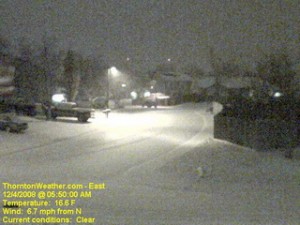
The snow arrived overnight and as of 5:00am ThorntonWeather.com had measured 1.3” and it was still coming down pretty good. Due to the extreme cold – 17 degrees and a windchill of 5 degrees as of this writing – the roads are quite slick. This morning we found residential streets to be the worst of course but main arterials like 120th Ave were not in too good of shape either. Please allow plenty of time to get the kids to school and yourselves to work, allow plenty of distance between you and other cars and just take your time.
A surge of cold air from the north is expected to intensify the snowfall in the coming hours and a bit of upslope will keep the flakes falling for most of the day. Accumulations though won’t be all that great – look for 2 to 4 inches overall. Snow will taper off this evening from the north to the south and completely end in the metro area around midnight.
Friday and this weekend are shaping up great but that could be short lived. We are watching a cold front coming from Montana that could bring more cold and snow toward the first part of next week.
