Snowmaking operations began last night for the 2013-2014 season at Araphoe Basin and Loveland ski areas. (Arapahoe Basin)
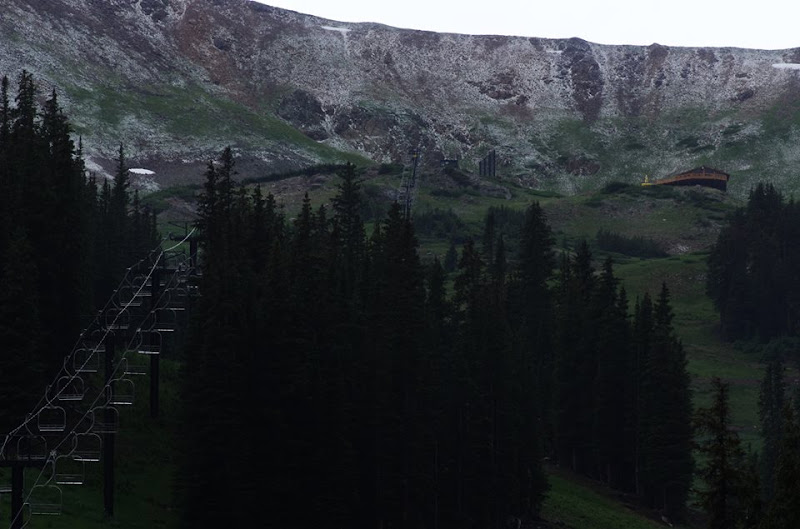
A marked turn toward colder weather and a few light snowfalls has Colorado ski areas raring to get the 2013 – 2014 season underway. Last night both Loveland and Arapahoe Basin fired up their snowmaking gear.
Neither ski area has announced an official opening date but with snowmaking underway, it won’t be far off. Both began operations last night as temperatures were dropping below freezing.
Loveland and Arapahoe Basin stand at elevations approaching 11,000 feet which gives them a jump on other Colorado ski areas. The two are always in a race to see which can open first with A-Basin usually holding the edge.
The earliest A-Basin has opened is October 10, 2007. Two years later, Loveland bested that mark when it opened on October 7, 2009.
Don’t miss a thing when it comes to our ever-changing weather! Be sure to ‘like’ us on Facebook, follow us on Twitter and add us to your Google+ circles.
This morning’s satellite imagery runs are showing some interesting white cover on Colorado’s landscape and it isn’t clouds. In fact, we see virtually entirely cloudless skies across the state.
That white stuff is in fact snow, the first covering of the season at higher elevations. Some locations Sunday night / Monday morning received up to six inches of the white stuff.
Satellite imagery clearly shows the snow in parts of the San Juan Mountains to the southwest as well as the Elk and Sawatch ranges, the Flat Tops and even the western parts of the Front Range mountain areas.
It likely won’t be long before the Front Range sees its own snowfall. Denver’s first freeze on average occurs on October 7th. Its first snowfall on October 19th.
July 18, 2013 – Loveland Ski Area received a dusting of snow. While a bit unusual in mid-summer, certainly not unheard of given an altitude at the base of 10,800 feet. (Loveland Ski Area)
At an altitude of 10,800 feet, Loveland Ski Area is certainly in some rarified air. Yesterday the resort saw a dusting of snow while Colorado residents below in the Mile High City simmered in 90+ degree temperatures.
Snowfall can occur in Colorado’s high country any time of year, even in mid-summer, and yesterday’s event was not particularly unusual.
Here in Denver however there has never officially been snow in July. The key word though is ‘officially.’
Unofficially there has been snow in the Mile High City in July – almost exactly one year ago today in fact.
Check out this tidbit from the National Weather Service archives:
“On July 17, 1872…the U.S. Army Signal Service weather observer recorded snowfall during the early morning hours in the hand written daily weather journal: “rain commenced at 1:30 a.m. changing about 3 a.m. to snow & in about half an hour to rain again; it continued until 6 a.m.” This is the only recorded occurrence of snowfall in Denver in July…but this report is not included in the “official” station snowfall records…which did not begin in Denver until January 1…1882. The low temperature on this morning was 45 degrees…which is sufficiently cold for the occurrence of light stratiform snowfall.”
Snow covers the streets with Thornton's March 4, 2013 snowstorm. Within a couple of hours the sun was out and the streets were clear. (ThorntonWeather.com)
March is historically the Denver area’s snowiest month and only four days into it Mother Nature delivered a nice, wet shot of the white stuff. The storm moved through quickly Monday afternoon and now we focus on a potentially significant storm this coming weekend.
Today Thornton recorded 2.4 inches of snow and a very welcome 0.15” of liquid precipitation from it. Similar totals, many a bit less, were seen in other locations of the Denver metro area.
This brings Thornton’s seasonal snow total to 28.9 inches. That is still well below normal but given the progress made in recent weeks, we are hoping these storms continue to arrive.
As we discussed in this morning’s forecast, models are pointing toward a far more significant storm arriving as early as late Friday and lasting well into the weekend.
One model, the European ECMWF, has been relatively consistent with its projection of a powerful storm with a hefty shot of snow. Other models have been less optimistic but on later runs today they are starting to come in line with the same thinking.
Northeastern Colorado received a much needed wallop of snow and the accompanying precipitation.
The heaviest snowfall was in the southern and western suburbs and foothills. In Thornton the storm was less generous but nevertheless welcome.
Pinecliffe west of Golden was the prize winner with nearly 22 inches of snow. Further to the south Conifer received 15 inches. In the metro area most snowfall totals were in the 6 to 10 inch range with the higher amounts to the south.
The interactive map below shows snowfall reports from National Weather Service storm spotters. You can double-click to zoom in or use the + / – buttons. Click and hold and then drag to pan the map around. Click on any ‘dot’ to see the report for that location.
The recent storm was certainly far less than impressive in reality. Thornton recorded a mere 3.6″ of snow and our seasonal snowfall totals continue to lag well below average.
However, when you take 24 hours of pictures taken at one minute intervals and combine them all into a single video you end up with a pretty neat 48 second time lapse. Below are videos from each of our webcams covering the period from noon on Wednesday, February 20 to noon on Wednesday, February 21.
Trail Ridge Road will be unable to open before Memorial Day as Rocky Mountain National Park has received more snow this year than in any of the past 20 years. View a slideshow of the piled up snow below. (RMNP / NPS)
Historically the highest continuous road in the United States, Trail Ridge Road, opens right before the Memorial Day weekend. That won’t be the case this year as with snow falling as recently as just a couple of days ago, the snow is just too deep.
The Denver Weather Examiner has a story about the mountains of snow up in Rocky Mountain National Park. The snow up there approaches levels not seen in the past 20 years.
Just last week a winter storm dumped snow across the northern Colorado mountains and along the Continental Divide. On the east side of Rocky Mountain National Park, snow drifts reached 17 feet high above Rainbow Curve.
The heavy snow accumulation, snow drifts and rock slides are hampering efforts to open the road this season. Snowplow operators said they were battling the most snow this late in the season in the past 30 years.
The central and northern Colorado mountains have seen an extraordinary amount of snowfall this year with the snowpack approaching record levels. In stark contrast, Denver is likely to finish the snow season with the second least amount of snow on record.
To date Denver has officially recorded a paltry 22.8 inches of the white stuff. Here in Thornton we have fared worse with only 21.8 inches. Recent rains have helped to ease the drought but we will need to keep moisture coming to prevent a bad fire season this summer.
Denver's snow season thus far is the second worst in the past 122 years. Click the image for a larger view. (Denver Weather Examiner)
Conditions have been tinder dry across the Colorado Front Range in recent months and certainly one of the biggest factors has been the lack of snowfall. Denver is in fact seeing its second least snowiest snow season on record likely setting the stage for a dangerous fire season ahead.
Through April 30, a mere 21.8 inches of snow has been recorded at Denver’s official monitoring site at Denver International Airport. This is an astonishing 38.6 inches below normal to this point in the season. At the end of March the season ranked as the third worst but after receiving only 1.2 inches of snow in April, the situation looks even more dismal.
For all the latest Thornton weather news, follow us on Twitter and ‘like’ us on Facebook.
Here in Thornton we have fared slightly poorer. ThorntonWeather.com has recorded 21.2 inches, by far the lowest we have seen at this point in the season since we came into operation nearly five years ago.
Only one other season has seen lower snow totals through the end of April. That occurred 122 years ago during the 1888 to 1889 season when 21.3 inches was recorded. That also ended up being that season’s final total as only a trace was recorded for the rest of the season.
While the plains of Colorado have seen little snow, that hasn’t been the case in the high country. The Colorado Rocky Mountains have been inundated with six of the eight basins reporting from 112 to 165 percent of normal snow water equivalent.
Severe drought conditions have settled in on the eastern half of Colorado with the far southeastern corner of the state event reaching extreme drought levels. NOAA’s drought outlook for the period through July predicts that the drought will continue or intensify.
This situation is cause for alarm for anyone on the plains or in the Colorado mountains east of the Continental Divide. There have already been several significant fires in the foothills and on the far eastern plains. Without some significant precipitation, Colorado may find itself seeing a very dangerous and damaging fire season ahead.
Denver is having a pitiful snow season - the third worst in the city's history. (Denver Weather Examiner)
March 31 was the last day of what is historically Denver’s snowiest month but like every other month this season, it fell dismally short in terms of the amount of snowfall. In fact, as it stands now, the Mile High City and Thornton area experiencing their third worst season of snow since record keeping began.
In a normal snow season, through the end of March, Denver historically averages 51.3 inches of snow – a healthy total needed for water supplies, irrigation and to help keep the wildfire danger down.
For the 2010 to 2011 season we are far behind that mark. As of yesterday Denver has recorded a paltry 20.6 inches of snow this season at DIA; a total more than 30 inches below normal. Only two other seasons have seen lower snow totals at this point in the season since record keeping began in 1882 – and those were more than 125 years ago.
For the season Thornton has fared worse than the official Denver totals as we have recorded a mere 19.7 inches (click here for the latest totals). Stapleton has recorded 22.8 and Denver City Park has fared the best with 26.8.
Only one month in this snow season has Denver seen at or above normal snowfall. That occurred in January when we recorded 8.0 inches of snow versus the average for the month of 7.7 inches.
By comparison, the Mile High City’s two snowiest months – March and November respectively – saw very little snowfall. In March a mere 2.5 inches fell in contrast to 11.7 inches on average. November 2010 saw only 1.5 inches of snow versus the November average of 10.7 inches.
The long range climate forecasts from the National Weather Service predict continued drier and warmer than normal weather for the month. April is however historically our third snowiest month so there may be hope, especially given the history of the two seasons on record that were worse than this one.
During the 1883 to 1884 season, April brought 18 inches of snow and the 1884 to 1885 season saw an astounding 32 inches of snowfall in the month. While both snow seasons finished below average, they made up a lot of ground in 30 days.
We can only hope that this season follows suit or we will be in for a very dry – and dangerous – summer.
NASA satellite imagery reveals that at one point in January 2011 the nation saw its fifth largest snow cover extent. Click the image for a larger view. (NASA)
How much snow has fallen this season in Colorado all depends on where you are. The high country has continued to see snowfall far in excess of normal while here on the Plains we remain mostly dry. For the nation, a new NASA satellite image reveals that 71 percent of it was covered in snow at one point last month.
The new image (right), taken by NASA’s Terra satellite using its Moderate Resolution Imaging Spectroradiometer (MODIS), reveals a snow covered contiguous United States in January.
The image uses false colors to show the snow extent and the length of time it was on the ground. White areas were completely covered with snow for most of the month whereas the pale green areas had snow for part of the month or were only partly snowy.
On January 12, 71 percent was covered in snow – the fifth largest amount of snow cover in the past 45 years. In fact, 49 of the 50 states had snow thanks to a significant winter storm that pummeled the Gulf Coast states with Florida being the only hold out.
Despite the expansive snow cover, the National Climatic Data Center said that January 2011 was the ninth-driest January in the United States since 1894. Further, while snow reached the Gulf Coast states, the southern half of the nation has been very dry with a large area from stretching Arizona to Virginia considered in various stages of drought.
Eastern Colorado is now seeing areas of moderate to severe drought as the lack of snowfall we have seen takes its toll. In Denver we have recorded only 18.1 inches of snow so far this season – 21.5 inches below what we would normally see through the end of February. Thornton has barely fared better recording 18.5 inches so far.


")
 Northeastern Colorado received a much needed wallop of snow and the accompanying precipitation.
")


")
