|
Tag Archives: Antarctica
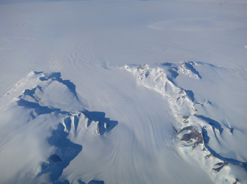
NASA Study: Mass Gains of Antarctic Ice Sheet Greater than Losses
Interesting. NASA study conflicts directly with much of the climate change narrative about ice in Antarctica.
A new NASA study says that an increase in Antarctic snow accumulation that began 10,000 years ago is currently adding enough ice to the continent to outweigh the increased losses from its thinning glaciers.
The research challenges the conclusions of other studies, including the Intergovernmental Panel on Climate Change’s (IPCC) 2013 report, which says that Antarctica is overall losing land ice.
According to the new analysis of satellite data, the Antarctic ice sheet showed a net gain of 112 billion tons of ice a year from 1992 to 2001. That net gain slowed to 82 billion tons of ice per year between 2003 and 2008.
“We’re essentially in agreement with other studies that show an increase in ice discharge in the Antarctic Peninsula and the Thwaites and Pine Island region of West Antarctica,” said Jay Zwally, a glaciologist with NASA Goddard Space Flight Center in Greenbelt, Maryland, and lead author of the study, which was published on Oct. 30 in the Journal of Glaciology. “Our main disagreement is for East Antarctica and the interior of West Antarctica – there, we see an ice gain that exceeds the losses in the other areas.” Zwally added that his team “measured small height changes over large areas, as well as the large changes observed over smaller areas.”
Scientists calculate how much the ice sheet is growing or shrinking from the changes in surface height that are measured by the satellite altimeters. In locations where the amount of new snowfall accumulating on an ice sheet is not equal to the ice flow downward and outward to the ocean, the surface height changes and the ice-sheet mass grows or shrinks.
But it might only take a few decades for Antarctica’s growth to reverse, according to Zwally. “If the losses of the Antarctic Peninsula and parts of West Antarctica continue to increase at the same rate they’ve been increasing for the last two decades, the losses will catch up with the long-term gain in East Antarctica in 20 or 30 years — I don’t think there will be enough snowfall increase to offset these losses.”
The study analyzed changes in the surface height of the Antarctic ice sheet measured by radar altimeters on two European Space Agency European Remote Sensing (ERS) satellites, spanning from 1992 to 2001, and by the laser altimeter on NASA’s Ice, Cloud, and land Elevation Satellite (ICESat) from 2003 to 2008.
Zwally said that while other scientists have assumed that the gains in elevation seen in East Antarctica are due to recent increases in snow accumulation, his team used meteorological data beginning in 1979 to show that the snowfall in East Antarctica actually decreased by 11 billion tons per year during both the ERS and ICESat periods. They also used information on snow accumulation for tens of thousands of years, derived by other scientists from ice cores, to conclude that East Antarctica has been thickening for a very long time.
“At the end of the last Ice Age, the air became warmer and carried more moisture across the continent, doubling the amount of snow dropped on the ice sheet,” Zwally said.
The extra snowfall that began 10,000 years ago has been slowly accumulating on the ice sheet and compacting into solid ice over millennia, thickening the ice in East Antarctica and the interior of West Antarctica by an average of 0.7 inches (1.7 centimeters) per year. This small thickening, sustained over thousands of years and spread over the vast expanse of these sectors of Antarctica, corresponds to a very large gain of ice – enough to outweigh the losses from fast-flowing glaciers in other parts of the continent and reduce global sea level rise.
Zwally’s team calculated that the mass gain from the thickening of East Antarctica remained steady from 1992 to 2008 at 200 billion tons per year, while the ice losses from the coastal regions of West Antarctica and the Antarctic Peninsula increased by 65 billion tons per year.
“The good news is that Antarctica is not currently contributing to sea level rise, but is taking 0.23 millimeters per year away,” Zwally said. “But this is also bad news. If the 0.27 millimeters per year of sea level rise attributed to Antarctica in the IPCC report is not really coming from Antarctica, there must be some other contribution to sea level rise that is not accounted for.”
“The new study highlights the difficulties of measuring the small changes in ice height happening in East Antarctica,” said Ben Smith, a glaciologist with the University of Washington in Seattle who was not involved in Zwally’s study.
“Doing altimetry accurately for very large areas is extraordinarily difficult, and there are measurements of snow accumulation that need to be done independently to understand what’s happening in these places,” Smith said.
To help accurately measure changes in Antarctica, NASA is developing the successor to the ICESat mission, ICESat-2, which is scheduled to launch in 2018. “ICESat-2 will measure changes in the ice sheet within the thickness of a No. 2 pencil,” said Tom Neumann, a glaciologist at Goddard and deputy project scientist for ICESat-2. “It will contribute to solving the problem of Antarctica’s mass balance by providing a long-term record of elevation changes.”
Antarctic researchers stranded after icebreaker vessel runs aground
|
Sydney (dpa) – More than 30 researchers were stranded in the Antarctic on Thursday after an Australian ship scheduled to pick them up ran aground in a blizzard. The Aurora Australis icebreaker ran aground in a Wednesday storm and suffered a breach in its hull, Australian Antarctic Division (AAD) said. The scientists waiting to be taken… Continue reading Antarctic researchers stranded after icebreaker vessel runs aground |
U.S. Coast Guard deployed to rescue global warming expedition and its rescuers

A Russian research ship stuck in expanding Antarctic ice and a Chinese ice breaker sent to help have put out calls for further assistance and the U.S. Coast Guard is responding.
The Akadmik Shokalskiy became stuck in the ice on December 24. Tourists, scientists and journalists were on board the Russian ship conducting global warming research.
Chinese icebreaker Xue Long was dispatched to rescue the trapped researchers. Using its helicopters it was able to airlift dozens of passengers to a second rescue ship, the Aurora Australis, on Thursday. However, the Xue Long soon found itself stuck in the expanding ice.
Last week the Australian government asked the United States for assistance in clearing the way for the two ships and yesterday it was announced the U.S. Coast Guard would dispatch one of its largest ships to help.
Read more about the rescue mission – with video – on Examiner.com
Arctic sea ice reaches lowest extent on record while Antarctic ice grows
Scientists announced yesterday that Arctic sea ice had completed its summer melt and in the end reached the lowest extent since satellite measurements began. At the other end of the globe Antarctica was seeing the exact opposite as the ice at the South Pole grows to record levels. Read the rest of this story on Examiner.com. Be sure to check out the video of the early August storm that tore the Arctic ice to shreds.
. (NASA)")
Satellites capture images of Antarctica ice shelf breaking apart from Japanese tsunami
 and after (right) photos of the Sulzberger Ice Shelf illustrate the calving event associated with the Japan earthquake and resulting tsunami that occurred on March 11, 2011. The icebergs have just begun to separate in the left image.")
Nearly 8,000 miles away the power of the tsunami caused by the March 11, 2011 Tohoku earthquake was felt in a resounding fashion. New satellite imagery released by NASA shows 50 square miles of ice from the Sulzberger Ice Shelf on the coast of Antarctica being broken off due to the waves.
Scientists have speculated that a tsunami could cause flexing of ice and result in pieces breaking off. The quake and resultant tsunami in Japan have now proven that theory.
NASA researchers utilized imagery from the European Space Agency’s Envisat satellite. The before and after pictures clearly show numerous icebergs having been calved from the shelf.
- In pictures: View before and after imagery of the Sulzberger Ice Shelf (Examiner.com)
- Watch: NASA video explains how the tsunami affected the ice in Antarctica (Examiner.com)
18 hours after the quake, the tsunami reached Antarctica. Imagery taken just prior to the waves reaching the Sulzberger Ice Shelf show it complete intact. Five days later, imagery shows massive icebergs floating away from the shelf.
The tsunami is estimated to have been only one foot high when it reached the Earth’s southernmost continent. However the stress was enough to break apart the 260 foot thick shelf and calve an area of ice equal to the size of Manhattan Island in New York.
Douglas MacAyeal of the University of Chicago and one of the researchers who made the discovery said the event shows how connected the planet’s systems are.
“This is an example not only of the way in which events are connected across great ranges of oceanic distance, but also how events in one kind of Earth system, i.e., the plate tectonic system, can connect with another kind of seemingly unrelated event: the calving of icebergs from Antarctica’s ice sheet,” MacAyeal said in a statement.
Satellite imagery from governments and private industry has been useful to scientists and the public in analyzing the disaster. NASA has trained its eyes in the sky on the disaster struck region and Google has released stunning imagery from its partners.
This story was originally posted on Examiner.com for the Natural Disasters Examiner. Be sure to check there for the latest natural disasters news.