Denver sets record high minimum for October 1

Record High Temperature

Our mild days of late have helped keep the nights relatively warm and last night we saw our warmest night for the date.

As measured at Denver International Airport, the Mile High City saw a low of 58 degrees. This sets a new record high minimum for October 1, besting the previous mark of 57 degrees set in 2005.

Here in Thornton, the breezy winds kept us even warmer with a low of 60.6 degrees.

October 1 to October 7: This week in Denver weather history

This Week in Denver Weather History

October is usually a relatively calm weather month in Denver but can see some interesting events. In our look back at this week in Denver weather history we see tornadoes, damaging wind and of course snow.

From the National Weather Service:

30-1

In 1959…heavy snowfall totaled 5.9 inches at Stapleton Airport. Winds were light.

1

In 1892…the highest temperature ever recorded in October… 90 degrees…occurred. This is also the latest 90 degree reading of the season.

In 1898…southwest winds were sustained to 40 mph with gusts to 49 mph in the city.

In 1927…a trace of snow was the only snow of the month… Ranking the year…amongst several other years…the second least snowiest on record.

In 1971…a wind gust to 90 mph was recorded at Buckley Field in Aurora. The severe winds caused damage in northeast metro Denver. A brick wall of a bowling alley was blown down…the roof was blown off a garage…and some business signs were damaged. A man in the bowling alley was injured by flying glass. Northwest winds gusted to 43 mph at Stapleton International Airport.

In 1994…unusually strong thunderstorms for so late in the season pummeled metro Denver with large hail. The largest hail…2 inches in diameter…fell at Buckley Field. Hail 1 3/4 inches in diameter fell 7 miles northeast of Boulder and at Niwot. Hail 3/4 to 1 1/2 inches in diameter fell in Boulder…Arvada…Wheat Ridge…Edgewater…capitol hill and northwest Denver…Bennett…and Strasburg. Hail of unknown size damaged a Boeing 737 aircraft and injured both pilots at Stapleton International Airport when the windshield was broken out on takeoff. Half inch diameter hail fell at Stapleton International Airport where northwest winds gusted to 40 mph and rainfall totaled 0.82 inch.

In 2014…severe thunderstorms produced wind gusts to 60 mph across parts of Arapahoe and Denver Counties.  The intense wind gusts downed trees and power lines which caused a power outage near the Denver Technology Center.  At Denver International Airport…a peak wind gust to 37 mph was measured from the northwest.

1

In 2020…extreme drought conditions continued in October. The first half of the month remained unseasonably warm… dry and windy. These conditions allowed the fires to the west and northwest of Denver to explode and double in size. The Cameron Peak wildfire become the largest in the state`s history. The Calwood wildfire in Boulder County started near Jamestown…and consumed 8788 acres within a 24-hr period on the 17th. It consumed a total of 10105 acres by the end of the month. The Calwood wildfire also became the largest wildfire in Boulder County history. The fire damaged or destroyed a total of 26 homes with preliminary damage estimates of nearly 37 million dollars. Extremely poor air quality continued to plague Denver and the entire Front Range.

2

In 1903…southwest winds were sustained to 42 mph with gusts as high as 60 mph. The strong Chinook winds warmed the temperature to a high of 78 degrees.

In 1910…an apparent dry microburst produced sustained northeast winds to 43 mph.

In 1934…a trace of rain was the only precipitation of the month. This was the driest October on record.

3

In 1875…very dense haze hid the mountains from view as observed from the city.

In 1933…rainfall of just 0.01 inch was the only precipitation of the month. This was the second driest October on record.

In 1954…the low temperature cooled to only 60 degrees…the all-time record high minimum for the month October.

3-4

In 1969…the first snowfall of the season totaled 16.0 inches at Stapleton International Airport. There was a thunder snow shower on the evening of the 3rd…but otherwise little wind with the storm. The greatest snow depth on the ground was 8 inches due to melting. Heavy wet snow accumulated on trees…which were still in full leaf…and caused widespread damage from broken limbs and downed utility lines.

3-5

In 1984…the remnants of pacific hurricane Polo produced heavy rain over northeastern Colorado. Most locations received between 1.00 to 2.50 inches of rain…but 3.45 inches fell in Littleton. Rainfall totaled 1.73 inches at Stapleton International Airport…where north winds gusted to 24 mph.

4

In 1912…sustained south winds to 55 mph with gusts to 60 mph raised the temperature to a high of 83 degrees… The warmest temperature of the month that year.

In 1924…west winds were sustained to 46 mph with gusts to 50 mph in the city. The apparent Bora winds cooled the temperature to a high of 57 degrees from a high of 70 degrees on the 3rd.

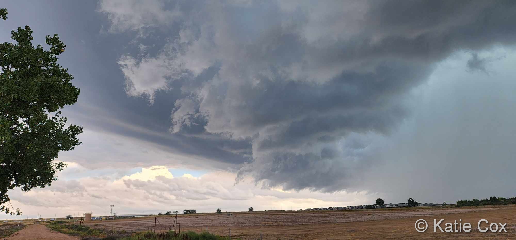
In 2004…several small tornadoes touched down near Brighton… Barr lake…and Hudson in Adams and southern Weld counties. Most of these caused no damage. However…a small tornado 5 miles southeast of Brighton caused extensive damage to a recreational vehicle and severely damaged a barn. The barn was torn from its foundation…and the roof was thrown 100 feet. Four llamas in the barn were injured when it collapsed.

4-5

In 1997…unusually warm weather resulted in two temperature records. High temperature of 87 degrees on the 4th exceeded the old record set in 1922 by one degree. High temperature of 86 degrees on the 5th equaled the record set in 1990 and previous years.

5

In 1962…unusually severe thunderstorms for this late in the season affected areas from Boulder northward. Hail up to golf ball size and strong gusty winds did much damage to roofs…windows…and signs in Boulder. Heavy rainfall caused local flooding.

In 1994…lightning caused a power outage to over 2400 homes for a few hours in and around Nederland in the foothills southwest of Boulder. Very strong winds accompanied the thunderstorm. Thunderstorm winds gusted to 60 mph and hail to 1/2 inch diameter fell in Lafayette. Strong microburst winds gusting to 69 mph near Strasburg caused an oil rig to topple onto two vehicles…injuring one person. The strong winds in the area also downed a few power poles… But caused power outages to only a few homes.

In 1995…strong winds spread from the foothills onto the plains. Wind gusts to 77 mph were reported atop Squaw Mountain west of Denver. On the plains…winds gusted to 60 mph at Kennesburg and to 62 mph near Strasburg. North winds gusted to 41 mph at Denver International Airport.

6

In 1900…northwest winds were sustained to 40 mph with gusts as high as 50 mph in downtown Denver.

In 1903…northwest winds were sustained to 40 mph with gusts to 50 mph. The strong winds warmed the temperature to a high of 71 degrees in the city. The low reading was only 46 degrees.

In 1910…light smoke from forest fires drifted over the city.

In 1976…an arctic cold front brought light snow over the foothills above 6 thousand feet. Traffic was snarled at many locations. Only a trace of snow fell at Stapleton International Airport where rainfall totaled 0.20 inch and northeast winds gusted to 41 mph.

In 1991…the brilliant orange sunset was apparently the result of an extensive volcanic smoke layer in the upper atmosphere.

In 1994…strong west to northwest winds developed in the foothills above 9500 feet. A wind gust to 78 mph was recorded atop squaw mountain west of Denver and to 72 mph at Ward northwest of Boulder. Northwest winds gusted to 35 mph at Stapleton International Airport.

In 2011… Strong winds developed in and around the Denver area ahead of an approaching storm system. At the National Wind Technology Center, peak wind gusts ranged from 79 to 92 mph during the early morning hours. Across metro Denver, the strong winds toppled a few trees and damaged patio furniture. The wind caused a few flight delays at Denver International Airport due to a partial ground stoppage of incoming flights. Peak wind reports also included: 66 mph at Cedar Point, 63 mph at Denver International Airport, 60 mph at Buckley Air Force Base; 59 mph at Highlands Ranch; 58 mph at Deer Trail and Rocky Mountain Metro Airport in Broomfield; 55 mph at Bennett, Centenniel Airport and City Park in Denver.

7

In 1903…north winds were sustained to 40 mph with gusts to 48 mph.

In 1917…post-frontal northwest winds were sustained to 45 mph with gusts to 52 mph. Rain was mixed with a trace of snow…the first of the season. Precipitation totaled 0.22 inch and included the occurrence of hail… Even though no thunder was heard.

In 1950…strong winds caused a power outage in Boulder. This was the heaviest windstorm since January. Damage was minor. Northwest winds gusted to only 35 mph at Stapleton Airport.

In 1985…strong Chinook winds buffeted the Front Range foothills. Wind gusts between 60 and 70 mph were reported in Boulder and atop Squaw Mountain west of Denver. Southwest winds gusted to 41 mph at Stapleton International Airport.

7-8

In 1990…the season’s first snow occurred. Snowfall amounts varied from 3 to 7 inches across metro Denver. Snowfall totaled 4.0 inches at Stapleton International Airport where north winds gusted to 29 mph.

Denver sets record high temperature for September 30

Record High Temperature

We have enjoyed much warmer than normal temperatures this past week and today, we were warm enough to set a record high.

As measured at Denver International Airport, the Mile High City topped out at 91 degrees. This bests the previous record high temperature for September 30th of 90 degrees set in 1980. This also is the hottest temperature seen this late in the year since record-keeping began in 1872.

Here in Thornton we were actually a bit cooler with a high of 89.3 degrees.

September 2023 top shots: Monthly photo slideshow

An impressive storm cell moves through Thornton on September 14, 2023. (Katie Cox)

The month of September is typically one of the more pleasant months in Colorado.  Temperatures are usually comfortable and there is not normally a lot of weather drama.  That however does not mean there aren’t plenty of photo opportunities.

Wildlife is still quite active along the Front Range and flowers will hold on to their petals for at least the first part of the month.  Then of course there is the weather which you never know what to expect.  Thunderstorms, heavy rain, and even snow are a possibility.

  • Slideshow updated September 30, 2023
  • To learn more about how to send your photo to us for inclusion in the slideshow, see below the slideshow.

Showcasing images captured by ThorntonWeather.com readers as well as some of our own, our monthly slideshow covers the entire gamut of weather-related imagery.

Sunsets, sunrises, wildlife and of course every type of weather condition are vividly depicted in images captured from yours and our cameras.

[flickr_set id=”72177720311209631″]

What is missing in the slideshow above?  Your photo!

Our monthly photo slideshow is going to feature images that we have taken but more importantly images that you have captured.  The photos can be of anything even remotely weather-related.

Landscapes, current conditions, wildlife, pets, kids.  Whimsical, newsy, artsy.  Taken at the zoo, some other area attraction, a local park, a national park or your backyard.  You name it, we want to see and share it!

Images can be taken in Thornton, Denver or anywhere across the extraordinary Centennial State.  We’ll even take some from out of state if we can tie it to Colorado somehow.

We’ll keep the criteria very open to interpretation with just about any image eligible to be shown in our slideshows.

What do you win for having your image in our slideshow?  We are just a ‘mom and pop’ outfit and make no money from our site so we really don’t have the means to provide prizes.  However you will have our undying gratitude and the satisfaction that your images are shared on the most popular website in Thornton.

To share you images with us and get them included in the slideshow just email them to us or share them with ThorntonWeather.com on any of the various social media outlets.  Links are provided below.

So come on, get those camera’s rolling!

September 24 to September 30: This week in Denver weather history

This Week in Denver Weather History

Colorado’s famously inconsistent weather can be seen in our look back at this week in Denver weather history. Not only do we see damaging thunderstorms and winds but even major snowstorms that deposited more than a foot of the white stuff on the city.

From the National Weather Service:

23-24

In 2000…the first snowstorm of the season brought heavy snow to areas in and near the foothills. While the heaviest snow fell north of metro Denver…6 inches were measured in Boulder…4 inches at both Castle Rock and Morrison…but only 0.2 inch at the site of the former Stapleton International Airport where most of the precipitation fell as rain. At Denver International Airport where drizzle and rain fell on the 23rd… Snowfall during the early morning of the 24th was estimated at 2.1 inches due to melting. The foothills west of Denver received more snow with 10 inches measured at conifer…9 inches 11 miles southwest of Morrison… 8 inches atop Crow Hill…7 inches at Chief Hosa…and 5 inches at Ralston Reservoir.

24

In 1901…northwest winds were sustained to 50 mph with gusts as high as 57 mph in the city.

In 1932…thunderstorm rainfall of only 0.11 inch was the only measurable precipitation for the month that year in the city.

In 1986…a very strong wind storm roared across metro Denver. Boulder was hit hardest. Winds peaked to 131 mph at the National Center for Atmospheric Research. This is thought to be the highest wind gust ever recorded in Boulder during September. A wind gust to 118 mph was clocked on Davidson Mesa and to 92 mph near Niwot. Gusts of 70 to 80 mph were common over all of Boulder where an estimated 70 to 90 large trees were uprooted. About a dozen of them hit cars. Two walls of a building under construction were toppled and solar panels were blown off a house. Traffic lights and power lines were downed. Damage to power equipment alone was estimated at 100 thousand dollars. Wind gusts to 87 mph at Jefferson County Airport damaged two planes. A woman was seriously injured in Boulder. She suffered a fractured skull when struck by a falling tree limb. Trees were also downed in Louisville and Lafayette. West wind gusts to 45 mph were recorded at Stapleton International Airport.

25

In 1873…a fire was sighted in the woods near Platte Canyon… Probably caused by high winds blowing sparks among the timber.

In 1896…an apparent cold front produced northeast sustained winds to 40 mph with gusts to 48 mph.

In 1910…a thunderstorm produced sustained north winds to 51 mph. This was the highest recorded wind speed in the city in September at the time.

In 1936…a vigorous cold front produced a deadly dust storm in the city. North winds sustained to 36 mph with gusts to 38 mph produced much blowing dense dust…greatly restricting the visibility. The temperature plunged from a high of 84 degrees to a low of 38 degrees by midnight. The weather observer described the event with the following. “at 6:00 pm the temperature was 82 degrees and the wind velocity was only 4 mph; but with the wind shifting to the north and the barometer rising quite rapidly…the temperature fell sharply. By 6:30 pm…the wind velocity increased rapidly and by 7:00 pm had reached a maximum sustained velocity of 36 mph…bringing with it clouds of dust which had been picked up by gale force winds in southern Wyoming and northern Colorado…covering the city. The visibility was generally reduced to about 1/4 mile; however…the whirling of the dust down the streets and alleys…the visibility was at times somewhat less. Airplanes were grounded…traffic was halted at times…and homes filled with dust. The strong winds damaged electric power and telephone lines…leaving homes in darkness for a few hours in the city and for 18 hours in suburban towns and putting 2500 telephones out of service because of broken lines. An electric lineman was killed while repairing damage by the high winds. The dust storm was followed by rain that began falling at 10:55 pm…which turned to snow during the early morning hours of the 26th. A major snow storm followed on the 27th through the 29th.”

In 1999…high winds developed in the foothills of Boulder County. Winds gusted to 90 mph at Wondervu.

25-26

In 1908…apparent post-frontal rain changed to snow overnight and totaled 6.5 inches in downtown Denver. This was the first snow of the season. Precipitation totaled 0.76 inch. North winds were sustained to 39 mph on the 25th.

25-27

In 1996…an early season snowstorm brought heavy snow to the Front Range eastern foothills. Snowfall totals included: 8 to 12 inches around conifer…7 inches on Floyd Hill…and 6 inches at both Bailey and Chief Hosa. Snowfall totaled only 4.7 inches at the site of the former Stapleton International Airport. This was the first measurable snow of the season. After the passage of a strong cold front…north winds gusted to 38 mph at Denver International Airport on the 25th.

26

In 1907…a late afternoon thunderstorm produced hail…0.23 inch of precipitation…and north winds sustained to 24 mph.

In 1927…snowfall of 1.7 inches…mixed at times with sleet… Was the first measurable snowfall of the season.

In 2012…a man was seriously injured when he was struck by lightning outside the Hebrew Educational Alliance as he and his family were getting in their car. The victim stopped breathing but was saved when his wife performed cardiopulmonary resuscitation on him immediately.

26-28

In 1936…the heaviest snowfall ever recorded in September and the heaviest snowfall ever recorded so early in the season dumped a total of 16.5 inches of snow on downtown Denver and 21.3 inches at Denver Municipal Airport. The 15.0 inches of snow measured from 6:00 pm on the 27th to 6:00 pm on the 28th is the greatest 24 hour snowfall ever recorded in September. This was the first snow of the season. The snow was intermittent through the 26th…but continuous from early afternoon on the 27th to around midnight on the 28th…except for a period of rain during the afternoon of the 28th which contributed to a loss of depth on the ground. The greatest snow depth on the ground downtown was 13 inches with 8 inches at Denver Municipal Airport. There were no high winds with the storm and traffic was interrupted for only a short period. The storm produced property damage estimated at 7 million dollars. With trees and shrubs in full foliage…the leaves caught and held the heavy water-laden snow…until the branches snapped from the weight. More than 3000 workmen were called to remove the debris and snow from the city. The city firemen who were off duty…as well as all the reserves… were asked to report to their stations. All schools in the city remained open…but attendance was only 50 percent of normal. Grade school students were sent home at noon on the 28th. The early storm caught stockmen with many cattle still in higher ranges. Warm weather followed the snow…which had all melted by the end of the month…except for a few inches in sheltered places. Continue reading September 24 to September 30: This week in Denver weather history

September 17 to September 23: This week in Denver weather history

This Week in Denver Weather History

The calendar may still say it is summer for a few more days but our look back at this week in Denver weather history shows that Old Man Winter can still make an appearance.

From the National Weather Service:

10-18

In 2018…the high temperature equaled or exceeded 90 degrees for 9 consecutive days; marking the first time such an occurrence has taken place in the month of September. It also brought September of 2018 into a 4-way tie for most 90 degree + days in the month. Previous years included 2017…2005 and 1895. During the streak…4 record high temperatures were either tied or broken…and one record high minimum temperatures was broken.

15-17

In 2000…unusually hot weather for so late in the season occurred when temperatures climbed into the 90’s setting daily record maximum temperatures on each of the 3 days. The high temperature was 92 degrees on the 15th and 95 degrees on both the 16th and 17th.

15-19

In 1906…rain on 5 consecutive days totaled 1.61 inches. A thunderstorm occurred on the 17th. High temperatures ranged from 48 degrees on the 16th to 65 degrees on the 15th. Low temperatures were in the lower to mid 40’s.

16-19

In 1971…a record breaking early fall snow storm caused extensive damage to trees and utility lines. The heavy wet snow occurred with little wind…but caused record breaking cold temperatures for so early in the season. Snowfall totaled 15.6 inches at Stapleton International Airport with most of the snowfall…12.0 inches…occurring on the 17th. This was the heaviest first snow of the season. The maximum snow depth on the ground was 13 inches. Record low temperatures were set on three consecutive days: 31 degrees on the 17th…23 degrees on the 18th…and 20 degrees on the 19th…which was also a new all-time record minimum for the month at that time. Record low maximum temperatures were set on 4 consecutive days: 48 degrees on the 16th…35 degrees on the 17th…40 degrees on the 18th… And 42 degrees on the 19th.

17

In 1873…brisk west to northwest winds at different times during the day…generally in sudden gusts…spread a good deal of dust into the city.

In 1953…strong winds caused thousands of dollars in damage to Boulder. The winds blew for most of the day with great gustiness…and a freak twister was reported during the afternoon. Damage was minor. A thunderstorm wind gust to 40 mph caused some blowing dust at Stapleton Airport.

In 1992…a tornado touched down briefly near Bennett. No damage was reported.

In 1993…severe thunderstorms rumbled across northern portions of metro Denver. Hail as large as 1 3/4 inches in diameter fell in Brighton. Dime size hail damaged several roofs of residences in Lafayette.

In 2000…for the second day in a row…the high temperature of 95 degrees at Denver International Airport broke three record temperature extremes: the high temperature broke the previous record for the day of 94 degrees set in 1895; it marked the warmest it has been for so late in the season; it also marked the 61st day in the year that the temperature had equaled or exceeded 90 degrees…eclipsing the record equaled the previous day and first set on September 29… 1994.

18

In 1901…northeast winds were sustained to 42 mph with gusts to 50 mph behind an apparent cold front.

In 1948…the low temperature cooled to only 69 degrees…the all-time record high minimum for the month.

In 1988…a strong cold front blasted metro Denver with high winds. Gusts reached 82 mph in Longmont and 81 mph at Jefferson County Airport near Broomfield where the winds flipped over and destroyed a small airplane. Wind gusts to 60 mph were recorded in Boulder and Wheat Ridge. West wind gusts to 54 mph were clocked at Stapleton International Airport. The strong winds downed trees and power lines and damaged homes and cars. A Longmont man was slightly injured…when a tree fell on top of his car.

In 1990…a slow moving thunderstorm over southwest metro Denver spawned an ominous looking funnel cloud near the intersection of Sheridan Blvd. and U.S. Highway 285. The funnel cloud nearly touched down a few times before lifting back into the main cloud. No damage was reported. Pea to marble size hail and 3/4 inch of rain fell over central and northeast Denver. Numerous streets and underpasses became flooded on Denver’s south side when the heavy runoff backed up storm sewers. Thunderstorm rainfall totaled 1.02 inches at Stapleton International Airport.

In 1993…a severe thunderstorm rolled through southeast metro Denver. Dime size hail was reported in many areas. Straight-line winds from the thunderstorm…measured by a weather spotter at 70 mph…tore the roof off 6 apartments of an apartment complex in Aurora. Heavy rain which accompanied the winds caused major damage to the apartments as well as the contents. Many trees…fences… And power poles were knocked down by the strong winds. Heavy rain flooded roadways in Denver and Aurora. Thunderstorm rainfall totaled 1.08 inches and north winds gusted to 44 mph at Stapleton International Airport where the visibility was briefly reduced to as low as 1/4 mile in heavy rain.

In 1996…a late summer snowstorm struck the northern mountains and Front Range eastern foothills. Golden Gate Canyon received 6 inches of new snow with 5 inches reported at both Nederland and Blackhawk. Thunderstorms produced heavy rain across metro Denver…which was mixed with snow by late evening. Rainfall totaled 0.83 inch at the site of the former Stapleton International Airport and 1.22 inches at Denver International Airport where northwest winds gusted to 39 mph. Continue reading September 17 to September 23: This week in Denver weather history

September 10 to September 16: This week in Denver weather history

This Week in Denver Weather History

Severe weather is less common as we enter the fall season but it is not entirely unheard of. As we see in our look back at this week in Denver weather history, we have seen everything ranging from torrential rains to tornadoes and even heavy snow.

1-30

In 2020…a worsening drought that started in the spring and continued through September. Outside of an early season snow on the 8th…the month of September was another unseasonably warm and dry period. The combination of hot…mostly dry conditions…and critically dry fuels… resulted in a continuation and rapid expansion of several massive wildfires. The Cameron Peak fire…which became the largest in the state`s history started on August 13th…and continued through September. As a result…very poor air quality continued to impact Denver and the entire Front Range. Denver recorded the most days ever with a high temperature of 90 degrees or better; 75 days. The last of which was 91 degrees on the 24th. The previous record was 73 days set in 2012.

5-13

In 2010…the Fourmile Canyon Wildfire…northwest of Boulder…broke out on the morning of the 5th. It originated from an unattended fire pit at a local residence. The wildfire quickly consumed 5 1/2 square miles or 3500 acres the first day…and forced the evacuation of over three thousand residents. Erratic 45-mph gusts sent the fire in two directions at times. Very dry weather conditions preceded the fire. The combination of strong winds…low relative humidities and dry fuels allowed the wildfire spread rapidly through the steep…heavily forested terrain. The flames were reportedly 20 to 50 feet in length. Towns within the burn area included Salina…Wallstreet and Gold Hill. The dry conditions coupled with gusty winds ranging from 45 to 64 mph persisted for several more days. Fire managers used as many as 700 firefighters and support personnel from 35 agencies and seven air tankers to battle the wildfire. A total of 6181 square acres or approximately 10 square miles were burned. The Fourmile Canyon Wildfire was the most destructive fire in Colorado history in terms of the damage to personal property. It destroyed 171 homes with an estimated cost of 217 million dollars.

9-10

In 1933…heavy rain over the Cherry Creek…Plum Creek…Big Dry Creek…and Little Dry Creek watersheds caused flooding on the South Platte River in Denver overnight. Nearly an inch of rain…0.98 inch…fell in the city.

In 1944…a trace of rain fell on each day. This together with a trace of rain on the 4th and 30th was the only precipitation for the month. The total of a trace of precipitation for the month equaled the driest September on record first set in 1892.

In 1994…unusually very warm weather resulted in three temperature records being equaled. High temperatures of 94 degrees on the 9th and 93 degrees on the 10th equaled record maximums for the dates. Low temperature of 63 degrees on the 9th equaled the record high minimum for the date.

10

In 1985…golf ball size hail was reported just east of Parker.

In 1989…3/4 inch diameter hail fell in Littleton. Heavy rain produced local flooding in Lakewood. The heavy rain caused the wall of a house to collapse.

In 1993…thunderstorm winds downed power lines…which caused a power outage in Castle Rock.

10-17

In 2018…the high temperature equaled or exceeded 90 degrees for 8 consecutive days; breaking the previous streak of 7 consecutive days in the month of September.

10-18

In 2018…the high temperature equaled or exceeded 90 degrees for 9 consecutive days; marking the first time such an occurrence has taken place in the month of September. It also brought September of 2018 into a 4-way tie for most 90 degree + days in the month. Previous years included 2017…2005 and 1895. During the streak…4 record high temperatures were either tied or broken…and one record high minimum temperatures was broken.

11

In 1910…west winds were sustained to 42 mph.

In 1951…a vigorous Canadian cold front produced a dust storm across metro Denver. Northeast wind gusts to 43 mph reduced the visibility at Stapleton Airport to as low as 1 1/2 miles for nearly 5 hours. The temperature dropped 47 degrees in 8 hours…from a high of 92 degrees to a low of 45 degrees.

In 1967…a microburst wind gust to 52 mph produced blowing dust and briefly reduced the visibility to 1/2 mile at Stapleton International Airport.

In 1974…a trace of snow…the first of the season…ended the shortest period without snow…94 days from June 9th through September 10th. A trace of snow also fell on June 8th.

In 1995…strong post-frontal winds associated with a fast moving pacific cold front knocked down power poles and trees as it moved through metro Denver. Numerous power outages affected nearly one thousand people in Denver and Jefferson counties. West winds gusted to 34 mph at Denver International Airport.

11-16

In 2013…a deep southerly flow over Colorado… Ahead of a nearly stationary low pressure system over the great basin… Pumped copious amounts of monsoonal moisture into the area. In addition…a weak stationary front stretched along the Front Range foothills and Palmer Divide.  This resulted in a prolonged period of moderate to heavy rain across the Front Range foothills…Palmer Divide…urban corridor. By the 14th…storm totals ranged from 6 to 18 inches… Highest in the foothills of Boulder County. The headwaters then moved down the South Platte River and caused widespread flooding with record flood stages at several locations as it made its way downstream.  The record high flood stages resulted in widespread flooding along the South Platte River basin. The flood damage encompassed 4500 square miles of the Front Range…left 7 dead… Forced thousands to evacuate…and destroyed thousands of homes and farms. Record amounts of rainfall generated flash floods that tore up roads and lines of communication… Leaving many stranded. Nearly 19000 homes were damaged… And over 1500 destroyed. Colorado department of transportation estimated at least 30 state highway bridges were destroyed and an additional 20 seriously damaged. Preliminary assessments of the state`s infrastructure showed damage of $40 million to roads and $112 million to bridges. Repair costs for state and county roads ran into the hundreds of millions of dollars. Miles of freight and passenger rail lines were washed out or submerged… Including a section servicing Amtrak`s iconic California Zephyr. The town of Lyons was isolated by the flooding of St. Vrain creek…and several earth dams along the Front Range burst or were over-topped. Floodwaters swept through Estes Park; damaged hundreds of buildings and destroyed large sections of U.S. 34 from Loveland and U.S. 36 from Lyons to Boulder. U.S. 34 suffered the most damage… With 85 percent of its roadway and bridges destroyed. In Weld County…about nearly two thousand gas wells were damaged and had to be closed off as the floodwaters inundated entire communities. Sewage treatment plants and other utilities were knocked out in a number of towns. Governor Hickenlooper declared a disaster emergency on September 13th…in 11 counties across northeast Colorado including:  Adams…Arapahoe…Broomfield…Boulder…Denver…  Jefferson…Larimer…Logan…Morgan… Washington and Weld. By the 15th…federal emergency declarations covered those counties as well as Clear Creek County. Projected losses from the flooding statewide was nearly two billion dollars in property damage…according to Eqecat… A catastrophe modeling firm.  The damage was most severe in and around Lyons and Boulder.  More than 11 thousand people were evacuated…reportedly the largest since Hurricane Katrina. President Obama declared a state of emergency for Boulder and Larimer counties.  An additional 10 counties were added on the 16th and included: Adams… Arapahoe…Broomfield…Clear Creek…Denver…Jefferson…  Morgan…Logan… Washington and Weld counties. The president also declared a major disaster specifically for Boulder County.  There were six fatalities directly attributed to flash flooding. Two 19-yr old teenagers died on the 11th…after they were swept away by floodwaters after abandoning their car on Lindon Drive in Boulder. In Jamestown…a 72-yr old man was killed when the building he was in collapsed. An 80-yr old Lyons resident died in the early morning hours of the 12th…when his truck was swept into the St. Vrain River near his home. Later on the 12th…a 79-yr old Larimer County resident was killed when she was swept away while trying to climb to safety from her home in Cedar Point. A 61-yr old cedar point resident died when her home was swept down the Big Thompson River by the floodwaters. An 80-yr old Idaho Springs resident drowned in Clear Creek when the embankment he was standing on collapsed. In Boulder…some of the monthly records broken included: one-day all-time record: 9.08 inches which shattered the previous wettest day of 4.8 inches set on July 31… 1919; one-month record of 18.16 inches…which broke the previous all-time monthly record of 9.59 inches set in May of 1995; wettest September on record which broke the previous record of 5.5 inches set in September of 1940; one-year record of 34.15 inches broke the previous wettest year of 29.93 inches set in 1995. At Denver International Airport…the total precipitation for the month of September was 5.61 inches…which was 4.65 inches above the normal of 0.96 inches. This is the most precipitation ever recorded in Denver for the month of September. Daily precipitation records included 1.11 inches on the 12th and 2.01 inches on the 14th.

11-12

In 1974…post-frontal rain changed to snow overnight for the first snow of the season. Snowfall totaled only 1.8 inches at Stapleton International Airport where north winds gusted to 40 mph on the 11th. High temperature of only 46 degrees on the 12th set a new record low maximum for the date. Continue reading September 10 to September 16: This week in Denver weather history

Thornton’s September 2023 preview: Usually one of the most pleasant months of the year

Following an August that was unseasonably warm, we find ourselves heading into September hoping for relief.  The month can bring plenty of rain and even our first snow of the season but more often than not, it is one of the most pleasant along the Colorado Front Range.

As temperatures start to drop, September usually reminds us that summer is at an end and fall is now here. Sunshine is predominant though as the month actually has the highest percentage of sun out of any month. Sunny days and clear, cool nights are the standard weather pattern for the month.

The month can bring extremes however.  We will of course forever remember 2013’s devastating floods brought on by record-setting rain.  Longtime residents might remember September 1971 which brought over 17 inches of snowfall.

Get a complete look at September’s weather and more details as to what we can expect this year here.

September 3 to September 9: This week in Denver weather history

This Week in Denver Weather History

The first full week of September sees us start one of the most pleasant times of year in Denver. While less common this time year, severe weather can and does occur. Our look back at this week in Denver weather history includes hail, damaging wind and even smoke from wildfires hundreds of miles away.

From the National Weather Service

1-5

In 1995…record breaking heat occurred on the first 5 days of the month when the temperature climbed into the 90’s on each day. Record high temperatures of 97 degrees on both the 1st and 4th equaled the all-time record maximum for the month. High temperature of 95 degrees on the 3rd was a record for the date. High temperatures of 94 degrees on both the 2nd and the 5th were not records. The low temperature of 64 degrees on the 4th equaled the record high minimum for the date.

1-7

In 1978…the temperature reached 90 degrees or more on seven consecutive days with the highest temperature…94 degrees… Recorded on both the 4th and 6th.

1-30

In 2020…a worsening drought that started in the spring and continued through September. Outside of an early season snow on the 8th…the month of September was another unseasonably warm and dry period. The combination of hot…mostly dry conditions…and critically dry fuels… resulted in a continuation and rapid expansion of several massive wildfires. The Cameron Peak fire…which became the largest in the state`s history started on August 13th…and continued through September. As a result…very poor air quality continued to impact Denver and the entire Front Range. Denver recorded the most days ever with a high temperature of 90 degrees or better; 75 days. The last of which was 91 degrees on the 24th. The previous record was 73 days set in 2012.

2-3

In 1892…there was a trace of rainfall each day. This… Together with a trace of rain on both the 7th and 8th…was the only rainfall of the month…making the month the driest on record. The monthly record was equaled in 1944.

3

In 1901…a thunderstorm produced rain…hail of unknown size… And south winds sustained to 40 mph with gusts to 43 mph.

In 1961…Labor Day snow storm is the earliest date of the first snow…trace and measurable…of the season. The heavy wet snow broke many limbs from trees that were still in full foliage. The storm produced 4.2 inches of snowfall at Stapleton Airport with nearly a foot of snow in western suburbs and in the foothills. Minimum temperature of 33 degrees was a record for the date and the coldest ever recorded so early in the season.

In 1999…severe thunderstorms dumped large hail across metro Denver. Hail as large as 1 inch in diameter was measured near Cherry Creek in Aurora and near Bennett. Hail to 3/4 inch in diameter fell in the city of Denver.

In 2002…a thunderstorm produced a wind gust to 51 mph at Denver International Airport.

In 2003…very heavy thunderstorm rain washed out parts of the Virginia Canyon Road above Idaho Springs. Up to 4 feet of mud reportedly washed down the road during the storm. Several vehicles were trapped on the road.

In Idaho Springs…several streets…including the main street… Were also buried in mud and gravel. Some buildings in town experienced minor flooding…including the basement of the town library and the police station.

3-6

In 1909…rainfall for the 4 days accumulated to 3.97 inches in Boulder…while in Denver rainfall totaled 2.45 inches on the 4th…5th…and 6th.

4

In 1909…apparent post-frontal heavy rainfall totaled 1.94 inches in downtown Denver. North winds were sustained to 19 mph.

In 1944…a trace of rain fell. This together with a trace of rain on the 9th…10th…and 30th was the only precipitation for the month. The total of a trace of precipitation for the month equaled the driest September on record first set in 1892.

In 1960…the highest recorded temperature in September…97 degrees…occurred. The same temperature also occurred on September 5…1899…September 1…1995…and September 4… 1995.

In 1989…a strong thunderstorm wind gust flipped a plane taxiing on a private runway in Adams County east of Denver. Two people were slightly injured and the plane was heavily damaged.

In 1992…strong winds developed across metro Denver behind a pacific cold front. Sustained winds above 40 mph with gusts as high as 60 mph were recorded mainly in and near the foothills. Pre-frontal south winds gusted to 37 mph at Stapleton International Airport.

In 1995…two people were injured when lightning struck their home in Lakewood. The lightning entered the attic where it started a small fire. It then traveled through the walls… Exploding a mirror and spraying glass on the residents. Lightning also sparked small grass fires near Aurora…Denver International Airport…and Bennett. The highest recorded temperature in September…97 degrees…occurred. The same temperature also occurred on September 5…1899…September 4…1960…and September 1…1995.

In 2000…thunderstorm winds gusted to 64 mph in Castle Rock.

5

In 1899…the highest recorded temperature in September…97 degrees…occurred. The same temperature was also reached on September 4…1960…and September 1 and 4…1995.

In 1940…a severe wind and hail storm confined mostly to the west and north parts of the city occurred shortly after 4:30 pm. Hail stones ranged in size from 1/4 to 1/2 inch in diameter. In north Denver…hail piled to a depth of 4 inches. Flooding occurred in one underpass…which stalled 2 cars. One girl was injured when the weight of the hail flattened a porch on which she stood. Northeast winds were sustained to 29 mph with gusts to 32 mph in downtown Denver.

In 1987…a thunderstorm complex produced hail as large as 1 3/8 inches in diameter…2 miles east of Buckley Field in Aurora. No damage was reported.

5-8

In 2020…a strong upper level low brought an end to record heat to the Front Range urban corridor…and provided Denver its second earliest measurable snowfall on record. Numerous heat records were set leading up to the snowfall…and several new snowfall and cold records were also broken in this abrupt bout with winter. Denver set its all time record high for September…reaching 101 degrees during the afternoon. This was also the latest date a 100 degree reading has ever been observed in Denver. Another daily record high was then tied on September 6th when Denver hit 97 degrees. September 7th was the last day of heat when Denver`s high temperature reached 93 degrees. That tied Denver for the record for the number of 90 degree days for a year at 73…and was also the warmest temperature ever recorded before a day of measurable snowfall. By the evening of September 7th…a series of cold fronts progressed southward from Wyoming into Colorado… dropping the temperature into the low 30s by the early morning hours of September 8th. Snow developed across the Front Range mountains and foothills overnight… while a mix of rain and snow developed along the I-25 corridor. A few locations picked up light snowfall accumulations in the morning. Accumulating snow was mostly confined to the higher elevations much of the day…before spreading across the plains during the late afternoon and evening. Storm totals ranged from 4 to 10 inches in the mountains…with 3 to 6 inches near the foothills. A total of 5.6 inches of snow was measured at the NWS Boulder office…while at Denver International Airport…the official measurement was 1.0 inch. Continue reading September 3 to September 9: This week in Denver weather history

Denver ties record high minimum for September 2

Record High Temperature

Following on yesterday’s record high temperature, today’s low end did not get particularly cool and, in fact, tied a record.

As measured at Denver International Airport, the Mile High City’s low temperature for September 2 came in at 67 degrees. This tied the record for warmest low temperature for the date last set in 1939.

Here in Thornton, we cooled down to far more normal levels. Our low for the date was 61.7 degrees.

Weather, natural disasters & climate news and information.