Two powerful winter storms are set to collide over the northeastern United States today in what could be a record-breaking weather event. Many locations including Boston and New York City will see blizzard conditions in what some are calling a potentially historic event.
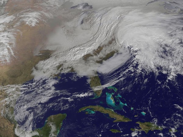
Parts of New England will be measuring snow in feet when this storm is finished and it is possible many locations will see their biggest snows on record. NASA satellites captured an amazing image this morning of the region as the storms begin to arrive – see below.
NASA says, “The satellite image, captured at 9:01 a.m. EST, shows clouds associated with the western frontal system stretching from Canada through the Ohio and Tennessee valleys, into the Gulf of Mexico. The comma-shaped low pressure system located over the Atlantic, east of Virginia, is forecast to merge with the front and create a powerful nor’easter. The National Weather Service expects the merged storm to move northeast and drop between two to three feet of snow in parts of New England.”
Related:

