Category Archives: Colorado Weather

Front brings snow to Colorado’s high country, Mt Evans road closed

August 27, 2014 - Dawn reveals fresh snow on top of Mount Evans. (DU)
August 27, 2014 – Dawn reveals fresh snow on top of Mount Evans. (DU)

Snow at the Centennial State’s elevations can occur any time of year and last night Mother Nature delivered a white reminder that fall and winter are not far behind.

On Monday, the Colorado Department of Transportation closed the road to the top of Mount Evans due to the potential for snowfall.  That potential was realized overnight last night as the observatory webcam this morning  showed a couple of inches of snow on the ground.

This morning CDOT’s website reports the road is, “Closed from Summit Lake to top of Mount Evans due to adverse conditions. There is no estimated time of opening.”

The highest paved road in North America, the road to the summit of Mount Evans usually remains open until the first weekend of October when conditions prevent it from being maintained.  It doesn’t reopen until the Friday before Memorial Day.

Other areas of the high country saw light doses of snow last night.

At 8:20pm last night the National Weather Service reported that 13,495 foot high Berthoud Pass was reporting 34 degrees.  Moderate snow was falling and visibility had been reduced to 1/2 mile.

Snowfall above timberline will be possible tonight with potential accumulations of 1 to 2 inches in some locations.

  • Stay up to date with the dynamic weather: Be sure to ‘like’ us on Facebook, follow us on Twitter and add us to your Google+ circles.

Two tornadoes touch down in north Denver metro area, minor damage seen

July 28, 2014 - Image of the tornado at the Rocky Mountain Arsenal. (Ed Dalton)  Click for a larger view.
July 28, 2014 – Image of the tornado at the Rocky Mountain Arsenal. (Ed Dalton) Click for a larger view.

Monday’s forecast called for a chance for thunderstorms but Mother Nature threw in a couple of wildcards in the form of two tornadoes in the area.  The landspout tornadoes caused minor damage in north Denver and were widely seen across much of the area.

The first tornado was reported at 3:53pm just across the Adams County line in Weld County near Fort Lupton.  The twister was the better defined of the two but appears to have struck farmland with no damage reported.

At 4:09pm a second tornado was reported near the Rocky Mountain Arsenal National Wildlife Refuge in Adams County.  A diesel repair shop near 51st and Havana had one of its garage doors ripped off and some material thrown about.

Denver International Airport sent travelers to shelters for a period of time and warning sirens were sounded in Brighton, Commerce City and other nearby locations.

Three people on a small boat on Barr Lake were overturned by the strong thunderstorm winds.  The trio managed to swim to shore and were not injured.

Tuesday’s weather is not expected to contain quite as much excitement as yesterday’s.  However, heavy rain will be possible and a Flash Flood Watch has been issued.

Drive into the mountains brings stark reminders of Colorado’s September 2013 floods

We went for a drive through Estes Park and into Rocky Mountain National Park yesterday.  Always beautiful but now, a bit more dramatic for other reasons.  

The devastation from last year’s floods are still very visible and while much has done rebuilding, much more needs to be done.  Here you can see what is left of a car after being caught in the flood on Highway 34.  In the background, the collapsed hillside is seen and two construction vehicles work to rebuild the riverbank.

Piles of debris and rubble as still visible as you climb up the canyon.  While some houses have been rebuilt, others remain in pieces.

Remnants of Colorado's September 2013 floods. (Tony's Takes Photography)
Remnants of Colorado’s September 2013 floods. (Tony’s Takes Photography)

Video: NASA showcases weather and climate events of 2013 as seen from space

A scene from a new NASA video shows Colorado’s West Fork Fire in June 2013 among other area weather and climate events. (NASA / YouTube)

A stunning video released by NASA this week provides a bird’s eye view of some of the Earth’s most significant weather and climate events of last year.

Using images and movies from satellites and the International Space Station, scenes from across the globe are shown in the video titled “Earth from Orbit 2013.”

Colorado and surrounding states however will draw the most attention from many locally.

From their perch high above, imagery of Colorado’s West Fork Fire in June 2013 is seen as well as the effects of the September floods.

To our south, the drought in New Mexico is seen having taken its toll on Elephant Butte Reservoir in New Mexico.  The veritable explosion of storm cells that lea to devastation in Oklahoma during a May tornado outbreak are also shown.

Below the video you will find a description of each scene and links to more imagery.

From NASA – Published on Apr 21, 2014:

A fleet of orbiting satellites monitors Earth constantly. The satellites from NASA and other space agencies give us a fresh, wide perspective on things that we can see from the ground — and things that we can’t.

A look back at Earth in 2013 from the viewpoint of orbit reveals the kind of data gathering and technical achievement that are the reason NASA puts Earth-observing satellites in space. A visualization of satellite and computer model data shows how a cloud of dust from the Chelyabinsk meteor moved around the world. NASA satellites measured the intensity of wildfires, the salinity of the oceans and rainfall around the globe — whether it was too little or too much.
To learn more about NASA’s Earth science in 2014, please visit: www.nasa.gov/earthrightnow

Imagery used in this video, in order:
Views of a Distant Earth
http://earthobservatory.nasa.gov/IOTD…

Earth and Moon
http://svs.gsfc.nasa.gov/vis/a000000/…

Current Earth Observing Fleet
http://svs.gsfc.nasa.gov/vis/a030000/…

Term3_ISS From Night to Day to Night Again
http://eol.jsc.nasa.gov/Videos/CrewEa…

Astronaut View of Fires in Colorado
http://earthobservatory.nasa.gov/Natu…

Extensive Ice Fractures in the Beaufort Sea
http://earthobservatory.nasa.gov/IOTD…

Dune Movement Around Aorounga
http://earthobservatory.nasa.gov/IOTD…

San Francisco Region at Night
http://earthobservatory.nasa.gov/IOTD…

Whiting Event, Lake Ontario
http://earth.jsc.nasa.gov/debrief/ISS…

Dust Plumes over the Mediterranean
http://earthobservatory.nasa.gov/Natu…

Mt. St. Helens
http://earthobservatory.nasa.gov/IOTD…

El Paso
http://earthobservatory.nasa.gov/IOTD…

Close-Up of Flooding in Mozambique
http://earthobservatory.nasa.gov/IOTD…

Drought Dries Elephant Butte Reservoir
http://earthobservatory.nasa.gov/IOTD…

Oklahoma Tornadoes
http://earthobservatory.nasa.gov/Natu…

Floods in Colorado
http://earthobservatory.nasa.gov/Natu…

Pavlof Volcano
http://earthobservatory.nasa.gov/Natu…

Swirling Sediment Reveals Erosive Power of New England Storm
http://earthobservatory.nasa.gov/IOTD…

Never at Rest: The Air over Los Angeles
http://svs.gsfc.nasa.gov/vis/a000000/…

Measuring Soil Moisture from Space
http://svs.gsfc.nasa.gov/vis/a030000/…

Antarctic Bedrock
http://svs.gsfc.nasa.gov/vis/a000000/…

Seeing Photosynthesis from Space
http://svs.gsfc.nasa.gov/vis/a010000/…

Greenland’s Mega Canyon
http://svs.gsfc.nasa.gov/vis/a000000/…

Chelyabinsk Bolide Plume as seen by NPP and NASA Models
http://svs.gsfc.nasa.gov/vis/a000000/…

Narrated Distributed Water Balance of the Nile Basin
http://svs.gsfc.nasa.gov/vis/a010000/…

NEO Observations (various)
http://svs.gsfc.nasa.gov/cgi-bin/advs…

National Weather Service announces storm spotter training dates for 2014

On June 3, 1981 a tornado struck Thornton in what is the worst twister to have struck the Denver metro area. Are you ready should disaster strike again? Image courtesy the City of Thornton archives.

Severe weather is a fact of life in Colorado – from blizzards to tornadoes we can and do see it all.  Each year the weather is responsible for claiming lives in our state and across the nation and the threat is very real.  Storm spotter training allows you to learn how to protect yourself and your family while providing a public service.

Education is key to knowing how to protect you and your family.  Whether you want to be an official storm spotter or maybe just want to learn more about severe weather, storm spotter training can provide you an incredible opportunity to learn.

The National Weather Service Denver / Boulder office has announced a series of Skywarn storm spotter training dates for Colorado for the 2013 season.

The storm spotter program is a nationwide program with more than 280,000 trained spotters.  These volunteers report weather hazards to their local National Weather Service office providing vital information when severe strikes.  Data from spotters include severe wind, rain, snow measurements, thunderstorms and hail and of course tornadoes.

Storm spotters are part of the ranks of citizens who form the Nation’s first line of defense against severe weather. There can be no finer reward than to know that their efforts have given communities the precious gift of time–seconds and minutes that can help save lives.

By completing one of these training classes you can become an official storm spotter.  When severe weather strikes, you can report it by calling a special toll free number or submit your report via the National Weather Service’s website.

These are great sessions for anyone wanting to learn more about the severe weather we experience in Colorado, whether you want to be an official spotter or not.  All training is free.  Topics include:

  • Basics of thunderstorm development
  • Fundamentals of storm structure
  • Identifying potential severe weather features
  • Information to report
  • How to report information
  • Basic severe weather safety

To learn more about the program, see here: http://www.crh.noaa.gov/bou/awebphp/spotter.php

Below are the dates, times and locations announced thus far with the first occurring on Sunday, February 16.  We will try to keep this updated but you can click here for any new dates on the National Weather Service website.

Schedule updated 4/6/14:

April, 2014 – Upcoming
Day City, State Time Location
07 Loveland, CO
(Larimer County)
9:00am MDT The Rialto Theater 228 E. Fourth Street Loveland, Colorado 80537
Contact Information: mialyp@ci.loveland.co.us
07 Fort Collins, CO
(Larimer County)
6:30pm MDT Fort Collins Police Services Building, Community Service Room 2221 S. Timberline Drive Fort Collins Colorado
Contact Information: migavin@poudre-fire.org
10 New Raymer , CO
(Weld County)
6:30pm MDT New Raymer Community Building 25 Shirley Ave. New Raymer, CO
Contact Information: dustin@dustinpricephotography.com
12 Kiowa, CO
(Elbert County)
9:00am MDT Old County Courthouse Second floor, 215 Comanche Street, Kiowa, CO 80117
Contact Information: brandon.lenderink@elbertcounty-co.gov
14 Akron, CO
(Washington County)
6:30pm MDT Washington County Fairgrounds Event Center 551 E. Second Street, Akron, CO
Contact Information: mmccaleb@co.washington.co.us
15 Greeley, CO
(Weld County)
6:30pm MDT Weld County Administration Building, 1150 O Street, Greeley, CO
Contact Information: gmarquez@co.weld.co.us
19 Commerce City, CO
(Adams County)
10:00am MDT Sheriff’s Substation Conference Room, 4201 E. 72nd Ave., Commerce City, CO 80022
Contact Information: r1@rampartsar.com
21 Centennial, CO
(Arapahoe County)
6:30pm MDT Arapahoe County Sheriff, 13101 East Broncoes Parkway, Centennial, CO
Contact Information: awallin@arapahoegov.com
24 Aurora, CO
(Arapahoe County)
6:00pm MDT Aurora Central Library 14949 E Alameda Pkwy, Aurora, CO 80012.
Contact Information: acox@auroragov.org
26 Strasburg, CO
(Adams County)
10:00am MDT Strasburg Fire Department Conference Room, 56281 E. Colfax Ave., Strasburg, CO 80136
Contact Information: tmccall@svfd8.org
28 Parker, CO
(Douglas County)
6:30pm MDT Parker Police 18600 Lincoln Meadows Pkwy Parker, CO 80134
Contact Information: khenry@parkeronline.org
29 Littleton, CO
(Jefferson County)
10:00am MDT Foothills Park and Recreation District 6612 S. Ward Street, Littleton, CO 80127.
Contact Information: lisan@fhprd.org
29 Denver, CO
(Denver County)
7:00pm MDT Red Cross facility 444 Sherman St., Denver Co
Contact Information: kc0mht@msn.com
May, 2014 – Upcoming
Day City, State Time Location
01 Hugo, CO
(Lincoln County)
2:00pm MDT Lincoln County Courthouse 103 3rd Street, Hugo, CO 80821
Contact Information: lclanduse@lincolncountyco.us
01 Hugo, CO
(Lincoln County)
6:30pm MDT Lincoln County Courthouse 103 3rd Street, Hugo, CO 80821
Contact Information: lclanduse@lincolncountyco.us
06 Boulder, CO
(Boulder County)
6:30pm MDT SHHQ TrainingRoom 5600 Flatiron Parkway, Boulder
Contact Information: fgonzales@bouldercounty.org
08 Thornton, CO
(Adams County)
6:00pm MDT Thornton City Hall 1st Floor Training Room, 9500 Civic Center Drive, Thornton, CO 80229
Contact Information: gene.putman@cityofthornton.net

Video: Dust devil strikes during controlled burn at Rocky Mountain Arsenal

A prescribed burn at the Rocky Mountain Arsenal quickly got out of control when swirling winds struck.
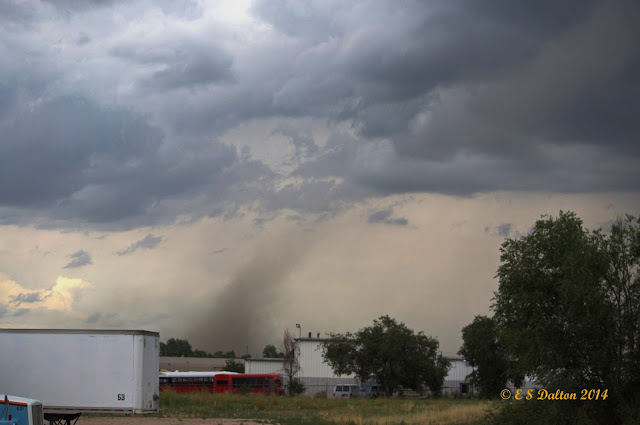
Performing prescribed burns is an important way to clear brush and renew wildland and are often done without any excitement. Mother Nature had other plans last week however as whirling winds propelled a fire beyond its containment lines at the Rocky Mountain Arsenal National Wildlife Refuge.

The amazing video of the event on March 14 was taken by a firefighter from South Metro Fire and showcases how quickly weather conditions can change and how even when well-planned, fires can quickly get out of control.

The fire is seen burning through the grasslands of the refuge when swirling wind develops – a common phenomenon caused by the heat quickly rising from the fire. Soon the fire begins to rage and tumbleweeds and burning debris are sent flying in a circular path.

Thomas Rogers, the man behind the camera, said on YouTube the fire burned an additional acre as crews backed off to gain the upper hand.

Refuge Manager David Lucas said on Facebook, “What we saw and how we reacted is exactly what we want out of our fire crews — well planned with plenty of on-site resources to manage contingencies, safety first, and well trained folks who got after it quickly.”

Time lapse video captures mountain wave clouds, sunset

Screenshot of an amazing time lapse video showing mountain wave clouds. (YouTube / BasehuntersChasing)

Watching clouds in real time can be fascinating however it is when they are sped up via time lapse that we can oftentimes truly see the subtle motions that we otherwise miss. A time lapse video released by some local storm chasers provide a stunning visual of wave clouds near Boulder.

Posted to YouTube today by Basehunters Chasing, the video showcases scenes captured over a couple of days along the Front Range.

Rolling mountain wave clouds serve as a backdrop to cows in a field.  Watching closely, snow can be seen falling on the highest mountain peaks.  Zoomed in views of a wave cloud follow showing the amazing motion.

Lastly a sunset is seen with the clouds starting pastel orange, then turning brilliant bright orange before fading away.

The video is set to a very soothing flute-type instrumental.  Check it out below.

Massive 104 car pileup on icy roads in Denver kills one, injures dozens

An accident on icy roads south of Colorado Springs resulted in a vehicle rollover and was one of three significant multi-vehicle accidents on I-25.
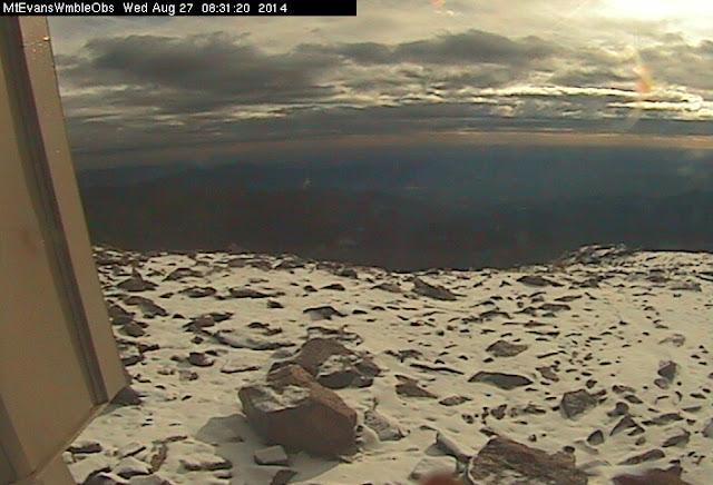
Icy roads Saturday morning led to a massive 104 car pileup on Interstate 25 through central Denver killing one person and injuring 30.

The chain reaction accident began just before 11:00 a.m. near University and Downing on the northbound side of the interstate. Cars, unable to stop on the ice and snow covered highway, began piling up.

One woman was killed in the accident. Her name is currently being withheld. The woman’s vehicle struck the back of a semitrailer, peeling the roof back as it lodged under the trailer.

Thirty people were injured and transported to area hospitals including Denver Health, St. Anthony’s and Swedish Medical Center. Among the injured were adults and children.

Read more about his incredible accident and check out the photos and video on Examiner.com

Video captures chain reaction multi-car crash on I-25 near Colorado Springs

A screen capture shows the moment of impact during one of a series of accidents on I-25 Saturday, January 4, 2014.
A screen capture shows the moment of impact during one of a series of accidents on I-25 Saturday, January 4, 2014. (YouTube / coach tone)

As temperatures dropped and the snow fell Saturday across Colorado, roads became ice-coated and driving conditions worsened. Video captured near Colorado Springs captured a harrowing multi-car pileup on Interstate 25 that highlighted the dangerous road conditions.

Posted by a user Anthony Salazar to KOAA-5 television’s Facebook page, the video is taken from an overpass in the Colorado Springs area on Saturday, January 4.

Showing I-25 southbound, some drivers are shown exercising appropriate caution on the icy roads and proceeding slowly. Calamity ensues when others are less aware of the conditions.

Read the rest of this story and check out the amazing video on Examiner.com